Figure 1. Proposed track
| Aircraft Commander | Mark Nelson |
| Co-pilot | Cathy Martin |
| Co-pilot | Mark Sweeney |
| Navigator | Chris Sloan |
| Flight Engineer | Joe Klippel |
| Flight Director | Ian Sears |
| Data Technician | Terry Lynch |
| Data Technician | Jeff Newnam |
| AVAPS | Jeff Smith |
| Electronics Technician | Bobby Peek |
| Lead Scientist | Rob Rogers (HRD) |
| Radar Scientist | John Gamache (HRD) |
| Observer | Jennifer Collins (USF) |
| Observer | John Rossi (AOC) |
| Guest | Brooks Garner (WFLA-8) |
| Guest | Anthony Alfred (WFLA-8) |
Mission Plan :
Fly TDR mission (Fig. 1) into Hurricane Sandy, a Category 2 hurricane that has emerged off the north coast of Cuba. Sandy underwent RI prior to hitting Cuba, and now is much less organized with a ragged eye at best. A recent recon fix of 963 hPa was up from a minimum of 954 hPa the previous night. The storm is encountering SW shear (Fig. 2) in association with an upper-level low to the west of the system. Middle and upper-level dry air is also impacting the southwest side of the system, but there are good outflow channels on the northwest and northeast sides. There was a burst of convection in the north eyewall at the time of departure, as depicted by visible, infrared, and microwave imagery (Figs. 3-4).
|
(a) |
(b) |
The mission will be a rotating figure-4, with an IP on the west and final point on the northeast. This pattern was shifted from the original pattern depicted in Fig. 1 because of the need to avoid flying over south Florida with a full load of external AXBT's. The aircraft will fly at 8000 ft altitude. Drop sondes at all endpoints, midpoints, and the RMW, plus the first and last pass. Drop AXBT's at mid- and RMW points for the first figure-4, and the end- and mid-points for the second figure-4.
Mission Summary :
| Take off | Landing
| MacDill AFB, FL | 20:11 UTC
| MacDill AFB, FL | 04:12 UTC
| Penetrations
| 5
| | ||||
|
(a) |
(b) |
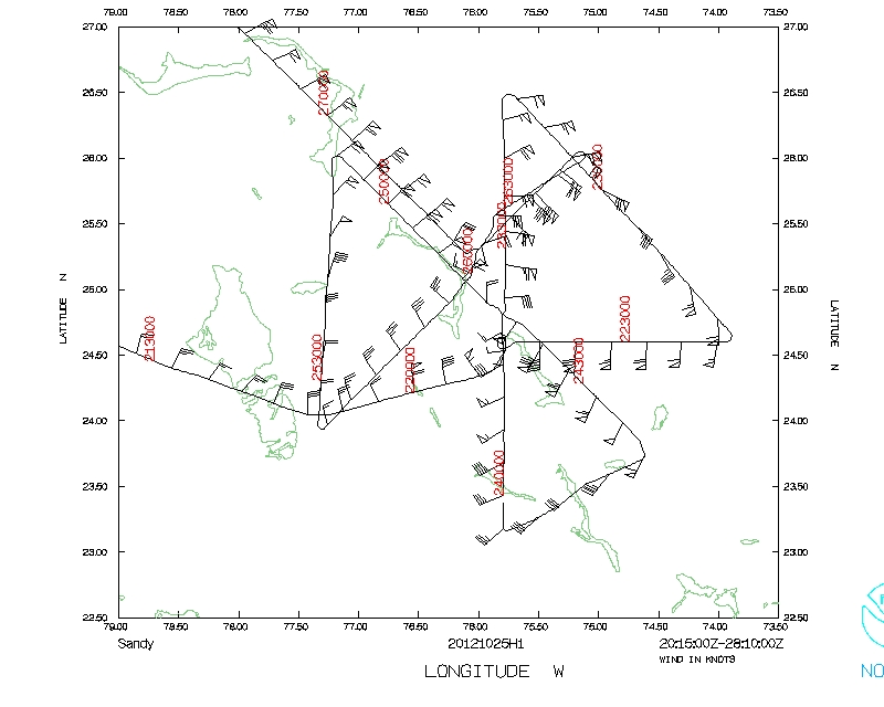
The pattern was flown generally as planned (Fig. 5). Take-off was at 2012 UTC. We had to shorten the leg on the NE side because of military activity in the vicinity. We turned and did a fifth penetration, inbound from the NE and outbound to the NW. The storm was highly complex, indicative of SW shear interation, with strong PBL inflow on the east and north side, outflow on the west side, weak inflow on the S side, and vertical cross sections of wind speed in the N-S plane clearly showing vortex tilting toward the N with height. Horizontal cross-sections also bear this out (Fig. 6).
|
(a) |
(b) |
|
(c) | |
The aircraft completed its mission and landed at MacDill AFB at 0413 UTC.
Mission Evaluation:
The mission did meet its objectives. The radar generally worked well, with decent coverage on the N and E sides. Twenty-seven sondes were dropped and 18 BT's, all of which were paired with a sonde, were dropped. Almost all sondes worked, and about 75% of the BT's. It is an interesting case being sampled, with a TC interacting with an upper-level cutoff low and undergoing significant structural evolution.
Problems :
No major problems except for some failures in the BT's (about 25%). A total of 27 GPS sondes and 18 AXBT's were dropped.
Rob Rogers
Nov. 1, 2012
Mission Data :
 Flight track |
 Temperature and Moisture |
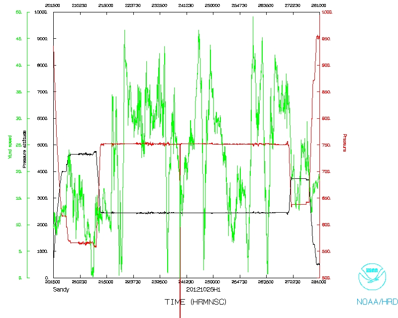 Wind and Atlitude |
SFMR data | NetCDF file | 1 second data