Mission Data :
Flight Data | ||
 Flight track |
 Temperature and Moisture |
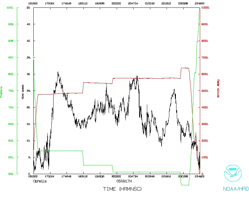 Wind and Atlitude |
| Phil Kennedy | Pilot |
| Tom Strong | Pilot |
| Tom Shepherd | Flight Director |
| Greg Bast | Flight Engineer |
| Tim Gallagher | Navigator |
| Sean McMillan | Electrical Technician |
| Beth Kerr | Electrical Technician |
| Bill Olney | Electrical Technician |
| Sim Aberson | LPS |
| Krystal Valde | Dropsonde |
| Paul Leighton | Radar Workstation |
| Jim Abraham (Environment Canada) | Observer |
| Tracy Prysiazniuk (ATV/CTV Moncton, NB) | Observer |
Mission Plan :
Extratropical transition experiment. Depart Portsmouth International Airport, NH and perform initial pass through storm. Then sample the region downstream with dropwindsondes, and return and perform a Figure-4. Drop at center, radius of maximum winds, and endpoints on each pass. Drop BTs in the region of the storm. Will recover at Portsmouth, NH at 6:00 PM EDT.
Mission Summary :
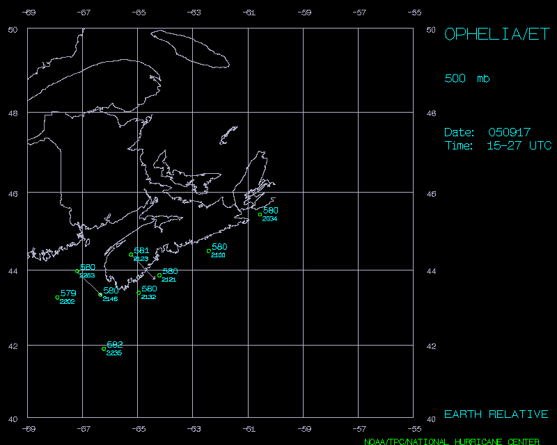
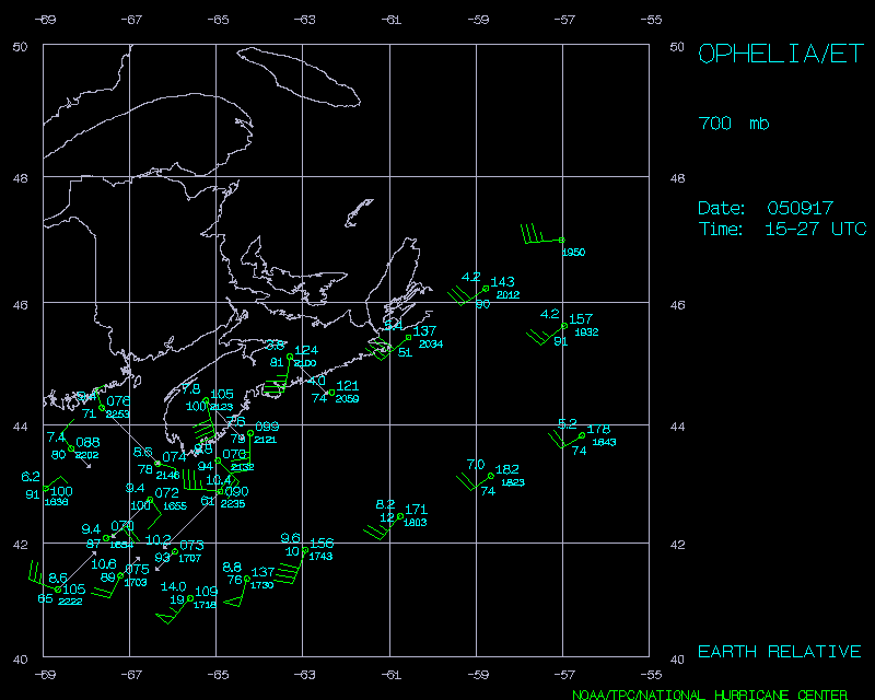
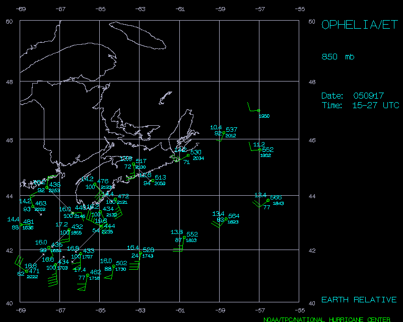
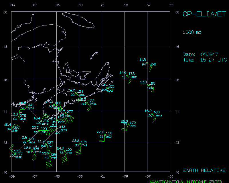
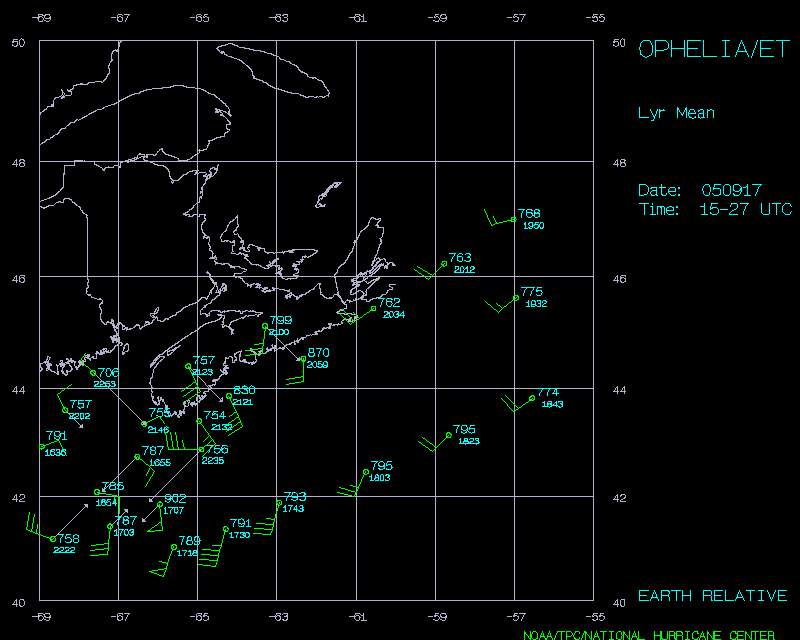
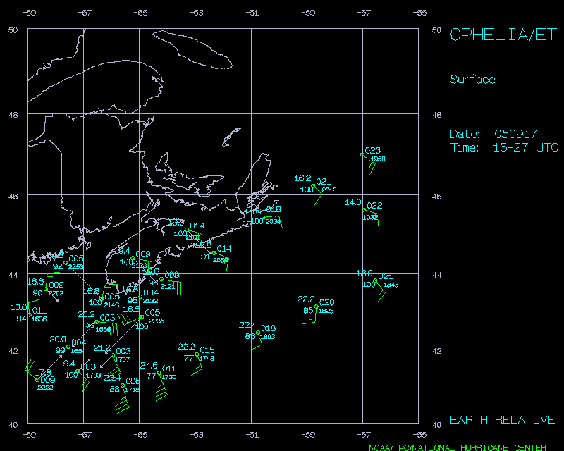
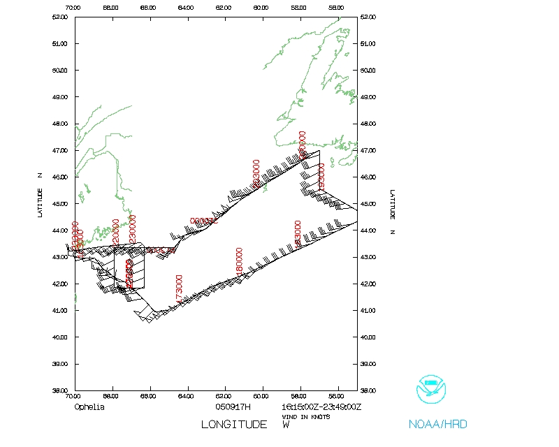
Took off from Portsmouth after delay due to late landing previous night and slow fueling at 1611 UTC. Reached the IP at 1636, and passed through the center. This time, the radar software provided a shallow analysis of winds that looked reasonable and were sent off the plane. System was very asymmetric with low flight-level and surface (SFMR) winds on northwest side, and very broad wind maximum (more than 120 nmi) on southeast and east side. Convection was dissipating rapidly at the time. Winds at flight-level barely rose above 45 kt, and surface winds were lower, but winds up to 65 kt were seen just above the top of the boundary layer in the dropwindsonde data.
Synoptic sondes followed showing a very broad wind field out to the east and northeast of the center. The interesting data here was the wind shift in the boundary layer in the southern run of sondes over the Gulf Stream showing the impact of the warm water there. Drop number 16 was interesting in that it showed three different air masses in three layers of the sounding. More work will have to be done to find the origins of these layers.
By the return to the storm, only one convective cell remained on satellite and radar, well ahead of the low-level center. AXBTs showed SSTs of 16.5°C and 10°C in this region. The latter temperature was measured at a shoal, so no mixed-layer depth could be reported. Dropwindsondes were released at the approximate location of the center as seen on satellite. These two sondes showed the tile of the center, with no winds at 700 hPa, and the center tilted SE to NW with height.
The mission was cut slightly short because of an engine malfunction in Engines 2 and 3. No major data loss was encountered because of this since most of the mission was completed.
Problems :
Engines 2 and 3.
Data :
500 mb plot of drops
700 mb plot of drops
850 mb plot of drops
925 mb plot of drops
1000 mb plot of drops
Deep Layer Mean plot of drops
Surface plot of drops
Mission Data :
Flight Data | ||
Flight track |
Temperature and Moisture |
Wind and Atlitude |