Mission Summary
20151004N1 Aircraft 49RF
Ferry/Synoptic Surveillance flight
Aircraft Crew (49RF)
| Aircraft Commander | Ron Moyers
|
| Co-pilot | Doug MacIntyre
|
| Co-pilot | Kristie Twining
|
| Flight Director | Mike Holmes
|
| Flight Director | Rich Henning
|
| Elec. Technician | Gabe Defeo
|
| Dropsonde Operator | Jeff Newnam
|
| Dropsonde Operator | Jeff Hartberger
|
Scientific Crew (49RF)
| None
|
Mission Plan :
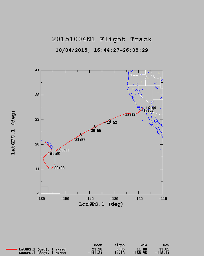
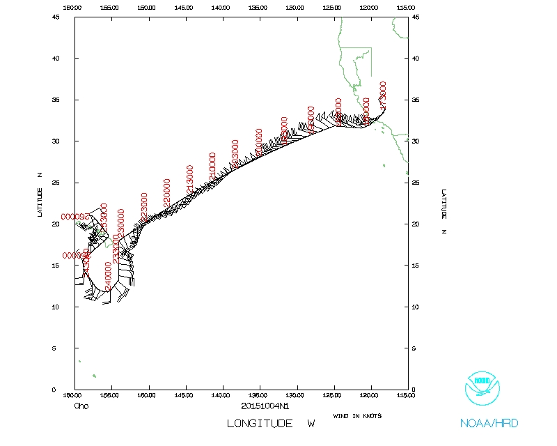
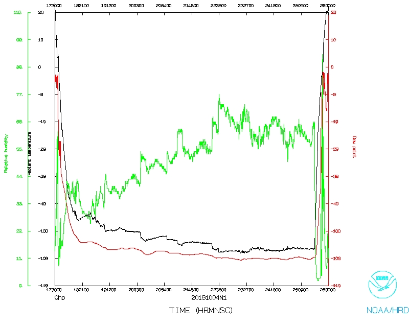
NOAA 49RF will continue its ferry, from Long Beach, CA to Honolulu, HI
while carrying out a CPHC-tasked Synoptic Surveillance mission around
Tropical Storm Oho south of Hawaii.
Synoptic Suveillance MISSION PLAN: Oho
Prepared by the National Hurricane Center
October 03, 2015 4:20:18 PM
Aircraft: N49RF
Proposed takeoff: 04/1730Z
|
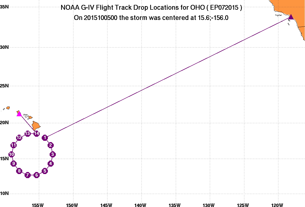
DROP LOCATION TABLE
|
| #
| LAT
| LON
| Time
|
|
| deg min
| deg min
| hr:min
| | 1 | 17 57 | -154 08 | 5:08
| | 2 | 16 54 | -153 18 | 5:19
| | 3 | 15 36 | -153 00 | 5:30
| | 4 | 14 18 | -153 18 | 5:41
| | 5 | 13 15 | -154 08 | 5:51
| | 6 | 12 41 | -155 20 | 6:02
| | 7 | 12 41 | -156 40 | 6:13
| | 8 | 13 15 | -157 52 | 6:24
| | 9 | 14 18 | -158 42 | 6:35
| | 10 | 15 36 | -159 00 | 6:46
| | 11 | 16 54 | -158 42 | 6:57
| | 12 | 17 57 | -157 52 | 7:07
| | 13 | 18 31 | -156 40 | 7:18
| | 14 | 18 31 | -155 20 | 7:29
| |
Mission Summary :
| Take off
| Landing
| Long Beach, CA | 17:30 UTC
| Honolulu, HI | 02:03 UTC
| |
14 dropsondes deployed, all 14 were good and sent.
Problems :
Mission Data :
Flight Director's log |
Flight Director's manifest |
NetCDF data |
One second data |
serial data
Page last updated Feb. 8, 2016
Return to Mission page.