Mission Summary
20031205I1 Aircraft 43RF
Extratropical Transition Experiment (ET)
into Odette 2003
Scientific Crew
| Lead Scientist | Peter Dodge
|
| Doppler Scientist | Matt Eastin
|
| Dropsonde Scientist | Neal Dorst
|
| AXBT Scientist | Joe Cione
|
| Observers | Sharan Majumdar
Dave Kofron
(UMiami)
|
Aircraft Crew
| Pilots | CDR Phil Kennedy
LT Mike Silah
|
| Navigator | LT Devin Brakob
|
| Flight Director | Barry Damiano
|
| Flight Engineer | Steve Wade
|
| Engineer | Jeff Smith
|
| Technicians | Terry Lynch
Ray Tong
Damon SansSouci
|
Mission Plan :
The ET flight will leave MacDill AFB, FL at 10:00 AM EST and
recover at 7:30 PM EST at MacDill AFB.
Mission Summary :
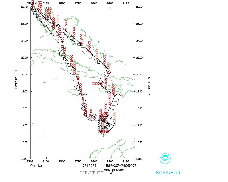
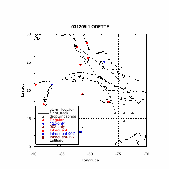
NOAA 43 left Tampa at 1512 UTC, 5 December 2003, and reached our
first drop point at 1652. After drop at point 3 we dropped a sequence
of AXBTs to Point 4 and then dropped 2 more BTs as we headed SW to
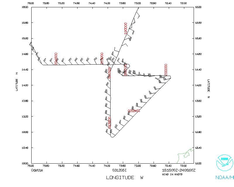
the center of Odette. Between 1830 and 2030 we flew an inner core
pattern, dropping sondes at 90, 60, 30 and 15 nmi intervals from
the center. However there was not a center apparent at our flight
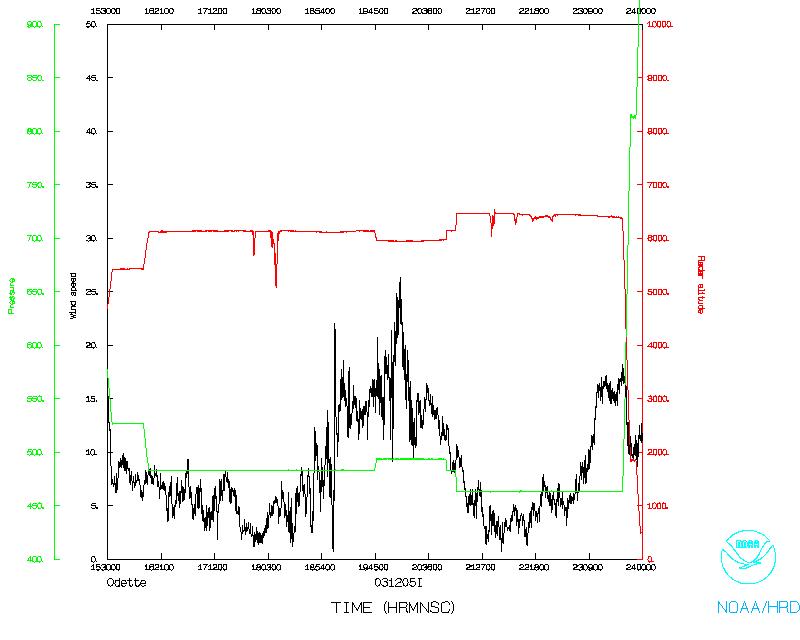
level and flight level winds were 35 kts when we passed over the
possible center at 1914. At 2016 we noticed that crescent shaped
area of convection had formed on the NE side of the storm. We turned
back and headed towards that area to see if we could get a wind shift
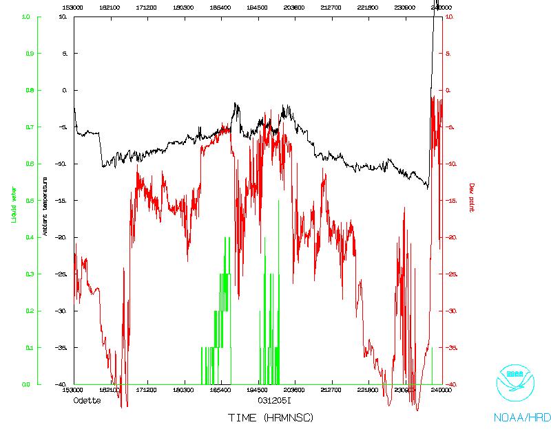
or pressure drop, but we did not see much, although flight-level temp
did go up to -2.1 °C. Looking at the sonde plots, there was
circulation up to 850 mb, with some remnant at 700 mb, but none
apparent at 500 mb.
After dropping the remaining sondes in the pattern, we returned to
Tampa, arriving at MacDill at 0005 UTC.
Evaluation:
The mission went well, even if Odette was not the strong tropical
storm we had hoped for.
Acknowledgments:
Barry Damiano, Devin Brakob and the flight crew were very helpful in
both planning and executing the flight. Especially appreciated were
the modifications to the flight plan to better place the AXBTs ahead
of the storm.
Problems :
- There were some problems getting the revised flight track
to AOC on Friday morning.
- A problem with engine #2 delayed take off by 15 minutes.
- The TEMPDROP messages did not have the right header
in the sonde messages, so this caused some problems in CARCAH,
but the specialists eventually saw our data.
Peter Dodge
Lead Scientist
Mission Data
One minute listing
Table 1
GPS Sondes
| Launch | # ID
| Time (UTC) | Lat | Lon
| RA | Comments
|
|
1 | 021925269 | 16:52:54.6 | 23.01250 | -75.98810 | 6122.7 m |
|
|
2 | 020215319 | 17:38:11.0 | 20.49630 | -73.13280 | 6124.7 m |
|
|
3 | 021925271 | 18:01:54.6 | 18.93410 | -74.00270 | 6118.2 m |
|
|
4 | 024125205 | 18:30:10.0 | 17.36130 | -72.58820 | 6117.6 m | No Launch Detect
|
|
5 | 021925172 | 18:31:38.7 | 17.36130 | -72.58820 | 6117.6 m | AVAPS system down
|
|
6 | 021925179 | 18:54:58.1 | 15.67910 | -73.34830 | 6102.2 m |
|
|
7 | 024125183 | 19:01:23.5 | 15.21360 | -73.55670 | 6096.1 m | winds 2 minutes late
|
|
8 | 021925178 | 19:07:25.1 | 14.75410 | -73.74860 | 6092.9 m |
|
|
9 | 022625110 | 19:10:53.1 | 14.49640 | -73.87210 | 6096.9 m |
|
|
10 | 011335025 | 19:14:51.0 | 14.17060 | -73.93090 | 6094.8 m |
|
|
11 | 011378045 | 19:17:43.5 | 13.92060 | -73.93100 | 6102.7 m |
|
|
12 | 011378044 | 19:20:28.9 | 13.67990 | -73.92780 | 6110.6 m | No winds
|
|
13 | 011378036 | 19:26:12.2 | 13.18900 | -73.92750 | 6117.4 m |
|
|
14 | 011335016 | 19:33:38.1 | 12.67170 | -73.82860 | 6121.3 m |
|
|
15 | 011378061 | 19:46:39.6 | 13.46090 | -73.06560 | 5942.1 m | SE of center
|
|
16 | 011345065 | 19:59:47.2 | 14.24080 | -72.43910 | 5930.4 m | E of center
|
|
17 | 011378059 | 20:04:47.8 | 14.24770 | -72.80690 | 5929.4 m | E of center
|
|
18 | 011378239 | 20:12:23.6 | 14.24570 | -73.32710 | 5920.4 m | Near "eye"
|
|
19 | 022928016 | 20:39:43.4 | 14.51710 | -74.90040 | 5944.4 m | W of center
|
|
20 | 011378042 | 20:50:16.3 | 14.54530 | -75.73440 | 5951.4 m | W of center
|
|
21 | 011335033 | 21:46:56.9 | 19.00300 | -77.02050 | 6445.1 m | No winds
|
|
22 | 021925273 | 21:51:49.5 | 19.41180 | -77.11960 | 6443.2 m |
|
Note: These times and locations are from the Launch records
in the raw GPS files, comments are from the dropsonde scientist logs.
Table 2
AXBT
| Launch | (UTC)
| Lat | Lon | SST (°C)
|
|
1 | 181910 | 18.00 | -73.21 | 27.9
|
|
2 | 182421 | 17.75 | -73.84 | 27.4
|
|
3 | 183000 | 17.48 | -72.5 | 27.9
|
|
4 | 183647 | 16.99 | -72.75 | 27.5
|
|
5 | 184346 | 16.49 | -72.97 | 27.5
|
|
6 | 185335 | 15.77 | -73.31 | 27.5
|
|
7 | 191040 | 14.50 | -73.88 | 27.9
|
|
8 | 191724 | 13.92 | -73.91 | 27.6
|
|
9 | 203941 | 14.52 | -74.91 | 28.0
|
|
10 | 205012 | 14.55 | -75.74 | 27.6
|
Information from AXBT scientist logs.
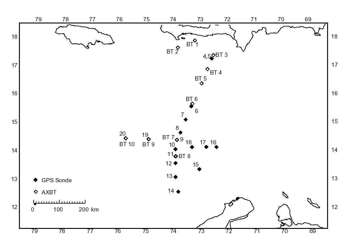
Map showing Sonde and AXBT Launch locations. Numbers are keyed to
the tables above.
Dropsonde plots at various levels
500 mb
700 mb
850 mb
925 mb
1000 mb
surface
Return to Mission page.

