Mission Summary
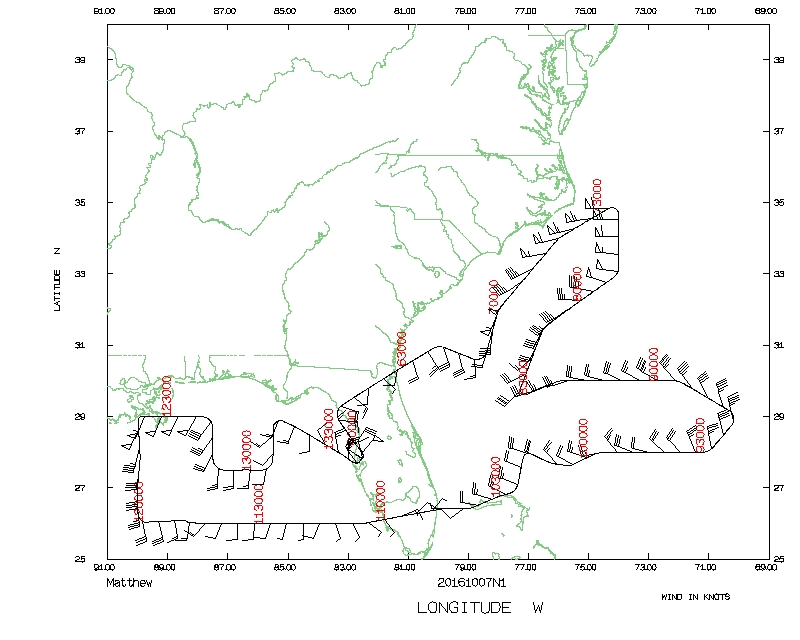
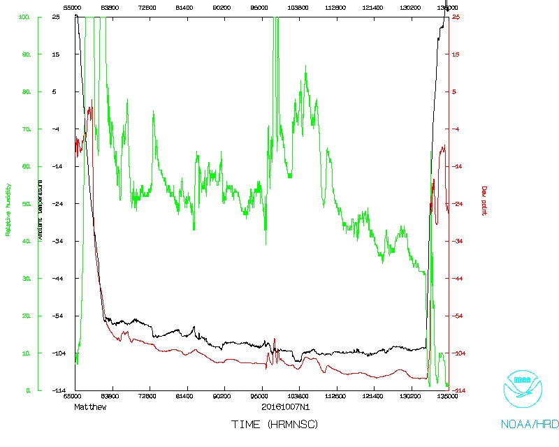
20161007N1 Aircraft 49RF
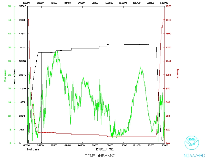
Hurricane Matthew
Aircraft Crew (49RF)
| Aircraft Commander | Doug MacIntyre
|
| Co-pilot | Brad Fritzler
|
| Co-pilot | Kris Twining
|
| Flight Director | Rich Henning
|
| Flight Director | Brian Belson
|
| Data Technician | Joe Greene
|
| Dropsonde Operator | Gabe Defeo
|
| Dropsonde Operator | Jeff Newnam
|
| Dropsonde Operator | Leonard Miller
|
Mission Plan :
NOAA 49RF will conduct NHC-tasked Synoptic Surveillance mission on Hurricane
Matthew in the southern Bahamas.
MISSION PLAN: MATTHEW
Prepared by National Hurricane Center
October 05, 2016 5:47:52 PM
Aircraft: N49RF
Proposed takeoff: 07/0530Z
|
|
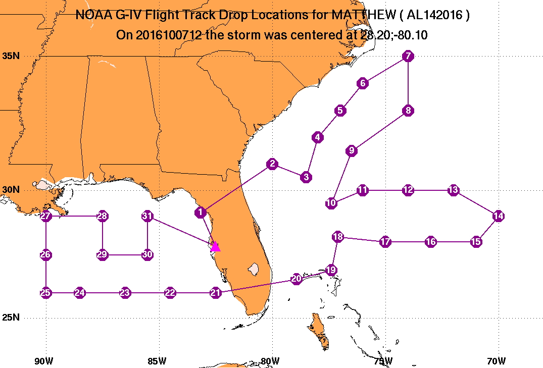
DROP LOCATION TABLE
|
| #
| LAT
| LON
| Time
|
|
| deg min
| deg min
| hr:min
|
| 1 | 29 09 | -83 10 | 0:12
|
| 2 | 31 00 | -80 00 | 0:40
|
| 3 | 30 30 | -78 30 | 0:52
|
| 4 | 32 00 | -78 00 | 1:05
|
| 5 | 33 00 | -77 00 | 1:16
|
| 6 | 34 00 | -76 00 | 1:27
|
| 7 | 35 00 | -74 00 | 1:44
|
| 8 | 33 00 | -74 00 | 2:01
|
| 9 | 31 30 | -76 30 | 2:23
|
| 10 | 29 30 | -77 24 | 2:41
|
| 11 | 30 00 | -76 00 | 2:52
|
| 12 | 30 00 | -74 00 | 3:08
|
| 13 | 30 00 | -72 00 | 3:23
|
| 14 | 29 00 | -70 00 | 3:40
|
| 15 | 28 00 | -71 00 | 3:51
|
| 16 | 28 00 | -73 00 | 4:07
|
| 17 | 28 00 | -75 00 | 4:22
|
| 18 | 28 12 | -77 06 | 4:38
|
| 19 | 26 54 | -77 24 | 4:49
|
| 20 | 26 33 | -78 55 | 5:01
|
| 21 | 26 00 | -82 30 | 5:29
|
| 22 | 26 00 | -84 30 | 5:45
|
| 23 | 26 00 | -86 30 | 6:00
|
| 24 | 26 00 | -88 30 | 6:16
|
| 25 | 26 00 | -90 00 | 6:28
|
| 26 | 27 30 | -90 00 | 6:40
|
| 27 | 29 00 | -90 00 | 6:52
|
| 28 | 29 00 | -87 30 | 7:11
|
| 29 | 27 30 | -87 30 | 7:23
|
| 30 | 27 30 | -85 30 | 7:39
|
| 31 | 29 00 | -85 30 | 7:51
|
Mission Summary :
| Take off
| Landing
| MacDill AFB, FL
| 05:53 UTC
| MacDill AFB, FL
| 13:45 UTC
| |
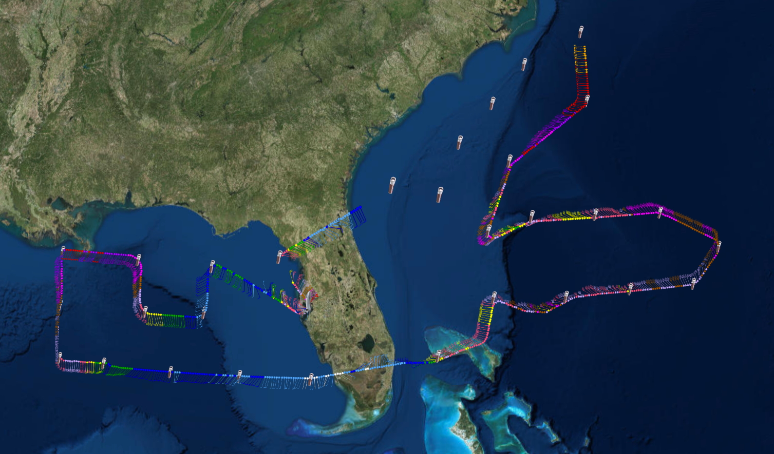
32 dropsondes released, all good but only 31 sent.
Mission Data :
NetCDF |
One second |
serial |
Flight Director's log |
Flight Director's manifest
Page last updated May 1, 2017
Return to Mission page.