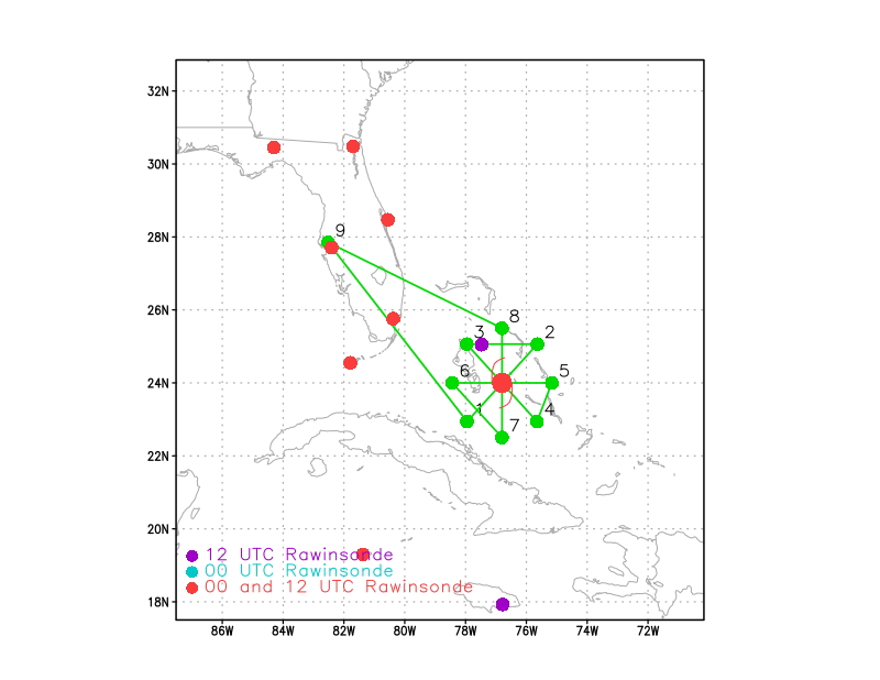
 Proposed flight track |
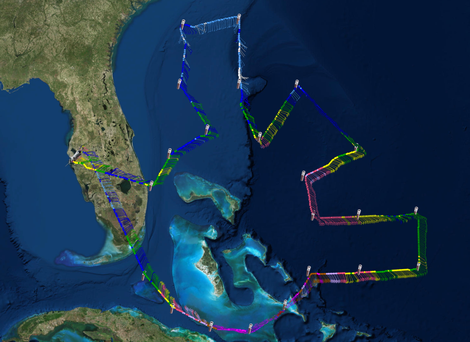 Final flight track |
| Aircraft Commander | Scott Price |
| Co-pilot | Pat Didier |
| Co-pilot | Danny Rees |
| Co-pilot | Jacob Blaauboer |
| Flight Engineer | Paul Darby |
| Flight Engineer | Heystek |
| Navigator | Pete Siegel |
| Navigator | Randy Mitchell |
| Flight Director | Ian Sears |
| Flight Director | Brian Belson |
| Data Technician | Terry Lynch |
| Data Technician | Dale Carpenter |
| Dropsonde Operator | Mike Mascaro |
| Dropsonde Operator | Todd Richards |
| LPS | Lisa Bucci | (HRD) |
| Radar | Hui Christophersen | (HRD) |
| Radar | Gus Alaka | (HRD) |
| Drops | Heather Holback | (HRD) |
| Photo | Nick Komisarjevsky | (AOML) |
Mission Plan :
|
Proposed flight track |
Final flight track |
NOAA43 will fly a NHC-tasked Synoptic Surveillance mission into Hurricane Matthew to cover for G-IV which is down for repairs.
|
Prepared by Hurricane Research Division Prepared by the National Hurricane Center October 04, 2016 3:55:20 PM Aircraft: N43RF Proposed takeoff: 5/0600Z | |||||||
| DROP LOCATION TABLE | |||||||
| # | LAT | LON | Time | ||||
| deg min | deg min | hr:min | |||||
| 1 | 26 54 | -79 55 | 0:22 | ||||
| 2 | 27 57 | -79 16 | 0:32 | ||||
| 3 | 28 39 | -78 00 | 0:43 | ||||
| 4 | 30 00 | -79 00 | 0:56 | ||||
| 5 | 32 00 | -79 00 | 1:13 | ||||
| 6 | 32 00 | -77 00 | 1:28 | ||||
| 7 | 30 00 | -77 00 | 1:44 | ||||
| 8 | 28 24 | -76 15 | 1:59 | ||||
| 9 | 30 00 | -75 00 | 2:15 | ||||
| 10 | 32 00 | -75 00 | 2:31 | ||||
| 11 | 34 00 | -75 00 | 2:48 | ||||
| 12 | 34 00 | -73 00 | 3:02 | ||||
| 13 | 34 00 | -71 00 | 3:17 | ||||
| 14 | 32 00 | -71 00 | 3:34 | ||||
| 15 | 32 00 | -73 00 | 3:49 | ||||
| 16 | 30 00 | -73 00 | 4:05 | ||||
| 17 | 30 00 | -71 00 | 4:20 | ||||
| 18 | 30 00 | -69 00 | 4:36 | ||||
| 19 | 28 00 | -69 00 | 4:52 | ||||
| 20 | 28 00 | -71 00 | 5:07 | ||||
| 21 | 28 00 | -73 00 | 5:23 | ||||
| 22 | 27 12 | -75 00 | 5:39 | ||||
| 23 | 26 00 | -74 42 | 5:50 | ||||
| 24 | 26 00 | -73 00 | 6:03 | ||||
| 25 | 26 00 | -71 00 | 6:18 | ||||
| 26 | 24 18 | -71 00 | 6:32 | ||||
| 27 | 24 18 | -73 00 | 6:48 | ||||
| 28 | 24 18 | -74 42 | 7:01 | ||||
| 29 | 23 15 | -75 32 | 7:12 | ||||
| 30 | 22 41 | -76 44 | 7:22 | ||||
| 31 | 22 43 | -78 02 | 7:33 | ||||
| 32 | 23 21 | -79 13 | 7:43 | ||||
| 33 | 24 18 | -80 06 | 7:54 | ||||
| Take off | Landing
| MacDill AFB, FL
| 05:36 UTC
| MacDill AFB, FL
| 13:27 UTC
| | ||
Problems :
|
Final flight track |
||
Plot of raw High Density Obs |

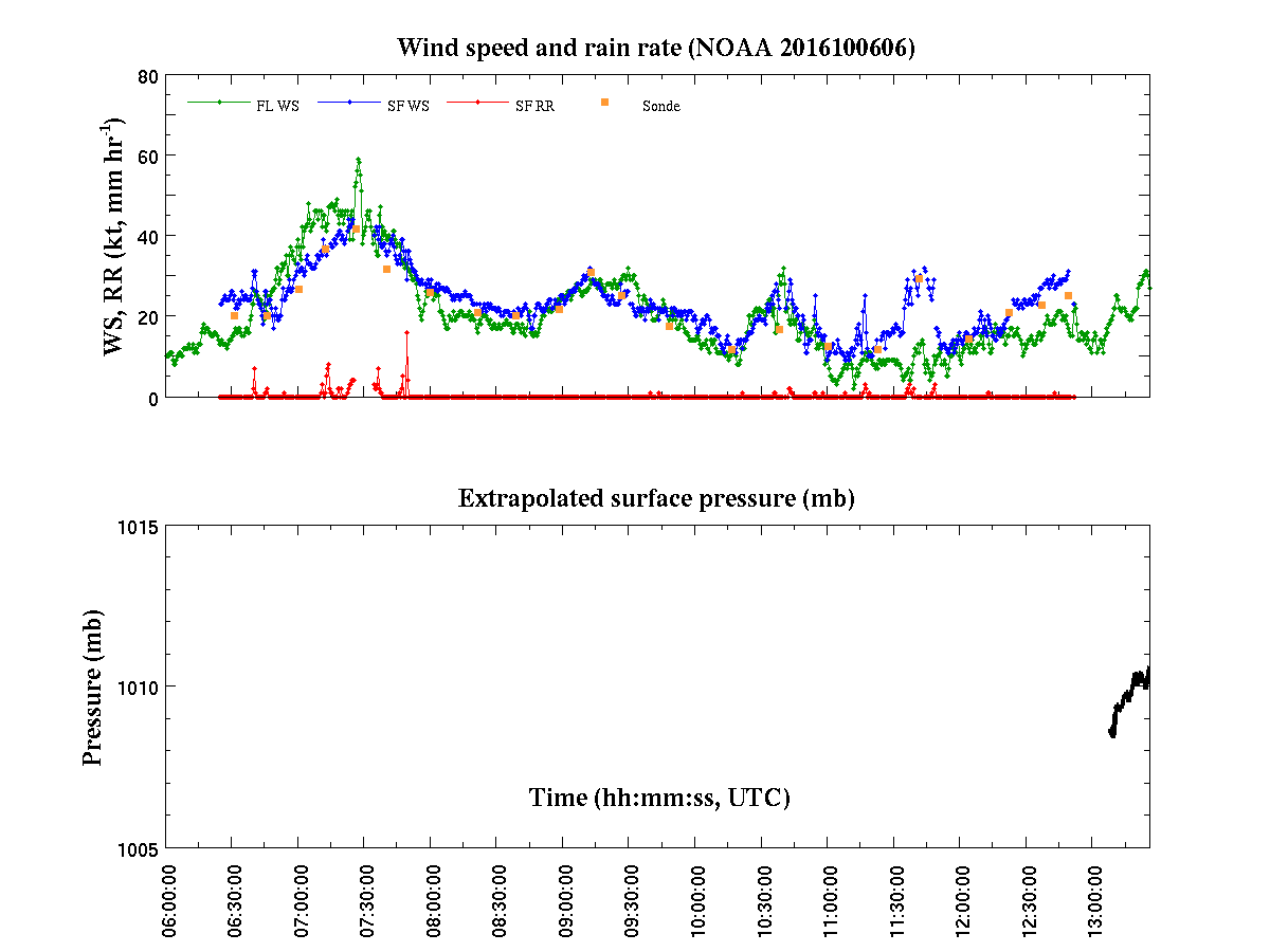
Plot of raw Flight Level winds |
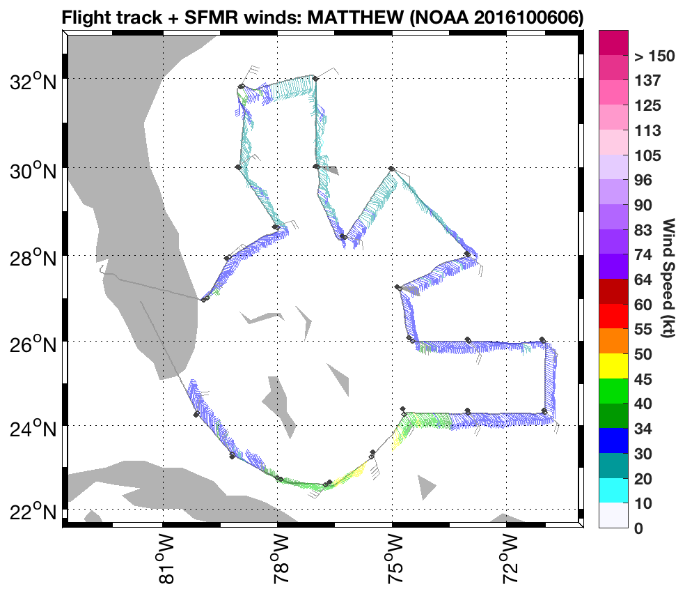
Plot of raw SFMR winds |
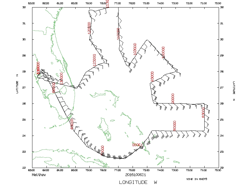 Flight track |
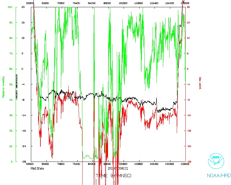 Temperature and Moisture |
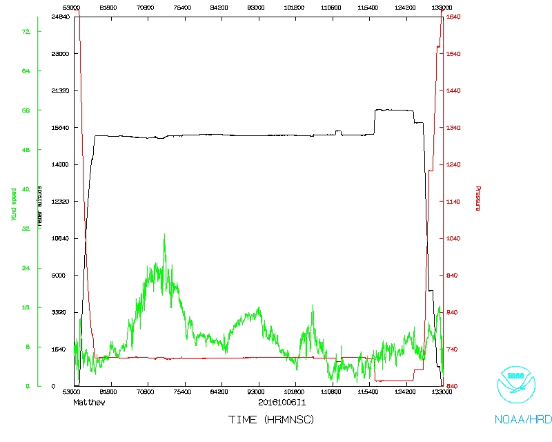 Wind and Atlitude |
Flight Director's log |
Flight Director's manifest |
NetCDF data
1 second data |
SFMR data |
serial data