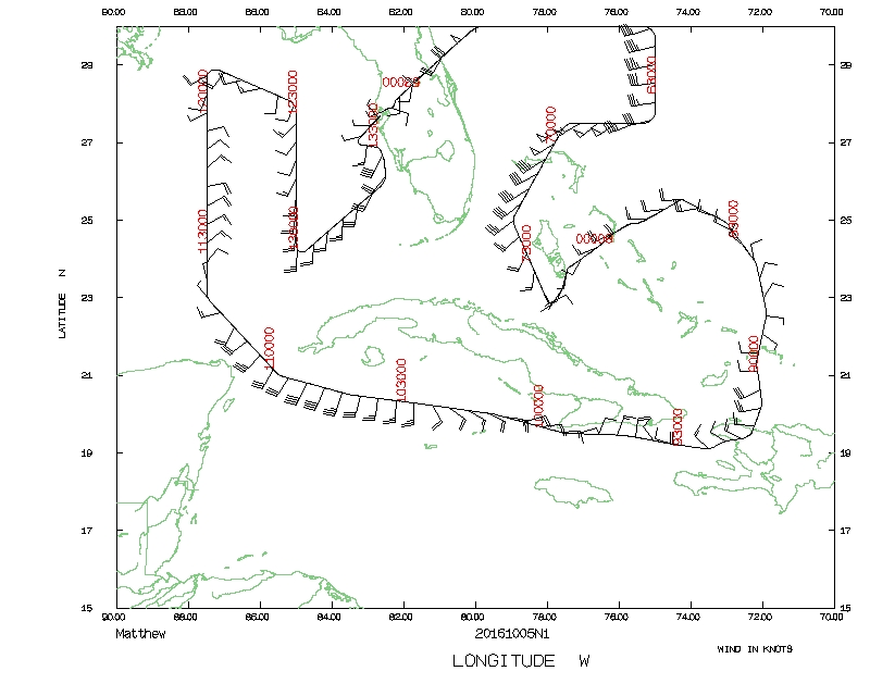
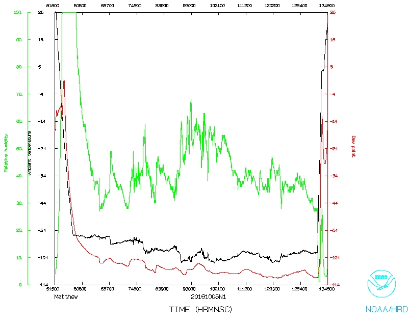
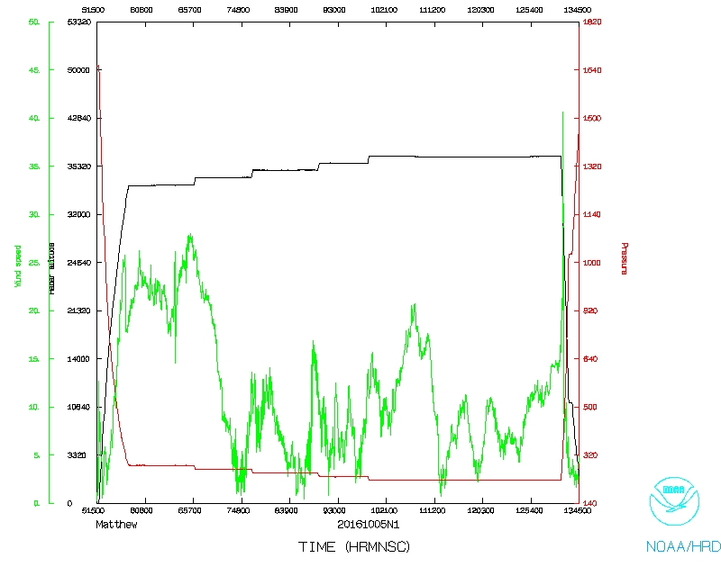
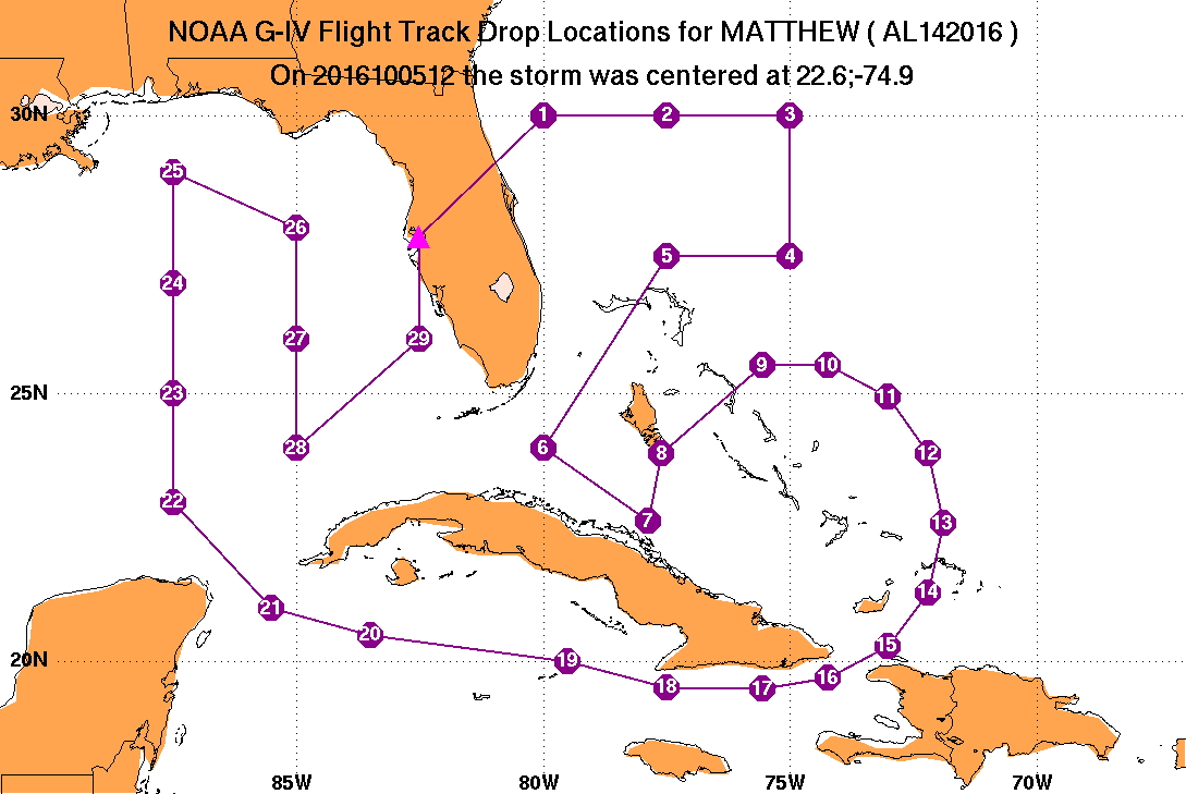
Aircraft Commander | Doug MacIntyre |
Co-pilot | Brad Fritzler |
Co-pilot | Kris Twining |
Flight Director | Rich Henning |
Flight Director | Brian Belson |
Data Technician | Joe Greene |
Dropsonde Operator | Gabe Defeo |
Dropsonde Operator | Jeff Newnam |
Dropsonde Operator | Leonard Miller |
Dropsonde | Heather Holbach | (HRD) |
![]() Proposed NOAA 49 track |
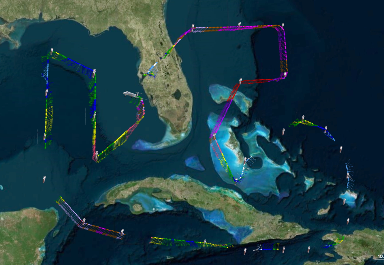
![]() Final NOAA 49 track |
Mission Plan :
NOAA 49RF will conduct NHC-tasked Synoptic Surveillance mission on Hurricane Matthew in the southern Bahamas.
Prepared by National Hurricane Center October 03, 2016 3:16:01 PM Aircraft: N49RF Proposed takeoff: 05/0530Z | |||||||
DROP LOCATION TABLE | |||||||
# | LAT | LON | Time | ||||
deg min | deg min | hr:min | |||||
1 | 30 00 | -80 00 | 0:26 | ||||
2 | 30 00 | -77 30 | 0:45 | ||||
3 | 30 00 | -75 00 | 1:04 | ||||
4 | 27 30 | -75 00 | 1:25 | ||||
5 | 27 30 | -77 30 | 1:44 | ||||
6 | 24 00 | -80 00 | 2:18 | ||||
7 | 22 38 | -77 53 | 2:39 | ||||
8 | 23 54 | -77 36 | 2:49 | ||||
9 | 25 31 | -75 34 | 3:10 | ||||
10 | 25 31 | -74 14 | 3:20 | ||||
11 | 24 57 | -73 02 | 3:31 | ||||
12 | 23 54 | -72 12 | 3:41 | ||||
13 | 22 36 | -71 54 | 3:52 | ||||
14 | 21 18 | -72 12 | 4:03 | ||||
15 | 20 17 | -73 02 | 4:14 | ||||
16 | 19 41 | -74 14 | 4:25 | ||||
17 | 19 28 | -75 34 | 4:35 | ||||
18 | 19 30 | -77 30 | 4:51 | ||||
19 | 20 00 | -79 30 | 5:07 | ||||
20 | 20 30 | -83 30 | 5:39 | ||||
21 | 21 00 | -85 30 | 5:55 | ||||
22 | 23 00 | -87 30 | 6:18 | ||||
23 | 25 00 | -87 30 | 6:34 | ||||
24 | 27 00 | -87 30 | 6:51 | ||||
25 | 29 00 | -87 30 | 7:07 | ||||
26 | 28 00 | -85 00 | 7:28 | ||||
27 | 26 00 | -85 00 | 7:44 | ||||
28 | 24 00 | -85 00 | 8:01 | ||||
29 | 26 00 | -82 30 | 8:26 |
Take off | Landing
MacDill AFB, FL
| 05:17 UTC
| MacDill AFB, FL
| 13:49 UTC
| |
Mission Data :
![]() Flight track |
![]() Temperature and Moisture |
![]() Wind and Atlitude |