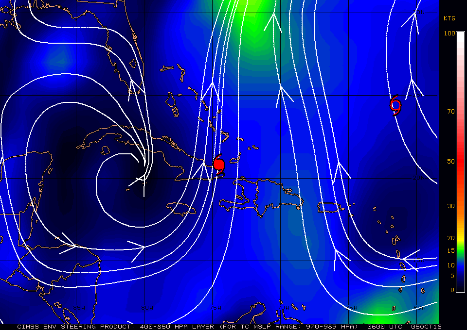
 06Z Steering currents |
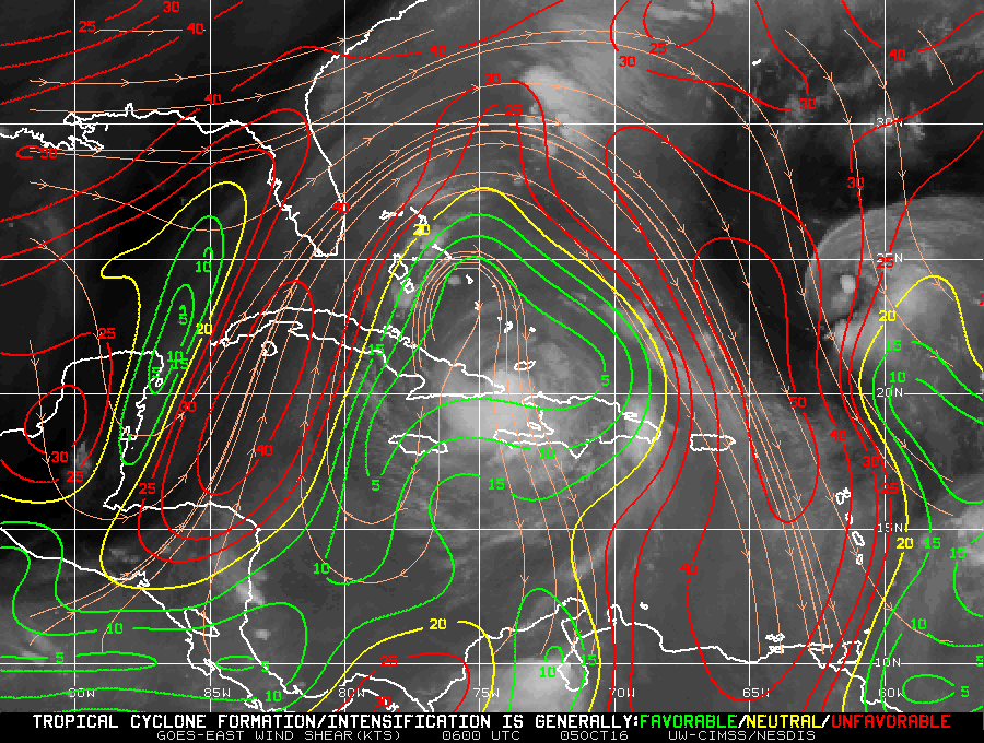 06Z Wind shear analysis |
| Aircraft Commander | Scott Price |
| Co-pilot | Danny Rees |
| Co-pilot | Adam Abitbol |
| Co-pilot | Pat Dider |
| Navigator | Pete Siegel |
| Flight Engineer | Ken Heystek |
| Flight Engineer | Ken Darby |
| Flight Director | Ian Sears |
| Data Technician | Terry Lynch |
| Dropsonde Operator | Todd Richards |
| Dropsonde Operator | Mike Mascaro |
| Electroinics Tech | Dale Carpenter |
| Radio Operator | Damen San Souci |
| LPS/DWL | Lisa Bucci | HRD |
| Radar | Hui Christophersen | HRD |
| Drops | Gus Alaka | HRD |
| Observer | Nadine Shittko | HRD |
| Observer | Nick Komisarjensk | AOML |
| Ocean Winds | Paul Chang | NESDIS |
| Guest | Paul Hoffman | unk |
| Radar | John Gamache | HRD |
Mission Plan :
|
06Z Steering currents |
06Z Wind shear analysis |
The mission is to conduct a TDR experiment into Hurricane Matthew. The category 3 hurricane was located just north of the SE tip of Cuba. It is moving NNW at about 7 knots (Figure 1) under low shear (5-10 knots, Figure 2). After interacting with the Haiti and Cuban landmasses, the circulation has been disrupted by the mountainous terrain of the islands. Based on radar, the eastern eyewall remains intact, however the western portion of the storm currently lacks deep convection. Track guidance show Matthew approaching the coast of Florida and curving to follow the coasts of Florida, Georgia, South Carolina and North Carolina (Figure 3) staying just offshore. Intensity guidance initializes Matthew at a strong category 3 hurricane and maintains this intensity (possibly slightly strengthening to a weak category 4) for 60 hours until slowly weakening it as Matthew travels farther north (Figure 4).
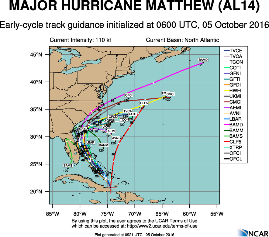 06Z Track forecasts |
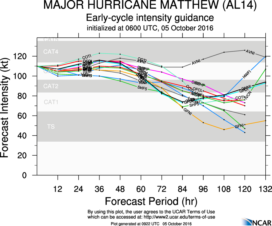 06Z Intensity forecasts |
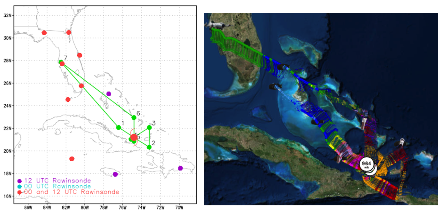
Given the storm's proximity to land, the plan calls for a truncated butterfly pattern with the southern legs shortened to avoid Cuban air space (Figure 5a). Flight altitude is at 7000 feet radar with drops at the end points to conserve resources. A possible Ocean Winds module may be conducted during this flight with additional drops. Upon completion of the mission, the plane will return to MacDill AFB.
|
Prepared by Hurricane Research Division Prepared by the Hurricane Research Division File: current1.ftk October 05, 2016 10:00:00 AM Aircraft: N43RF Proposed takeoff: 5/0600Z | |||||||
| DROP LOCATION TABLE | |||||||
| # | LAT | LON | RAD/AZM | Time | |||
| deg min | deg min | n mi/deg | hr:min | ||||
| 1S | 22 05 | 76 26 | 105/300 | 2:53 | |||
| 2S | 20 20 | 73 11 | 105/120 | 3:49 | |||
| 3S | 22 05 | 73 10 | 105/060 | 4:18 | |||
| 4S | 21 02 | 75 07 | 20/240 | 4:52 | |||
| 5S | 20 52 | 74 48 | 20/180 | 4:58 | |||
| 6S | 22 57 | 74 48 | 105/000 | 5:32 | |||
| Take off | Landing
| MacDill AFB, FL
| 07:02 UTC
| MacDill AFB, FL
| 13:52 UTC
| | ||
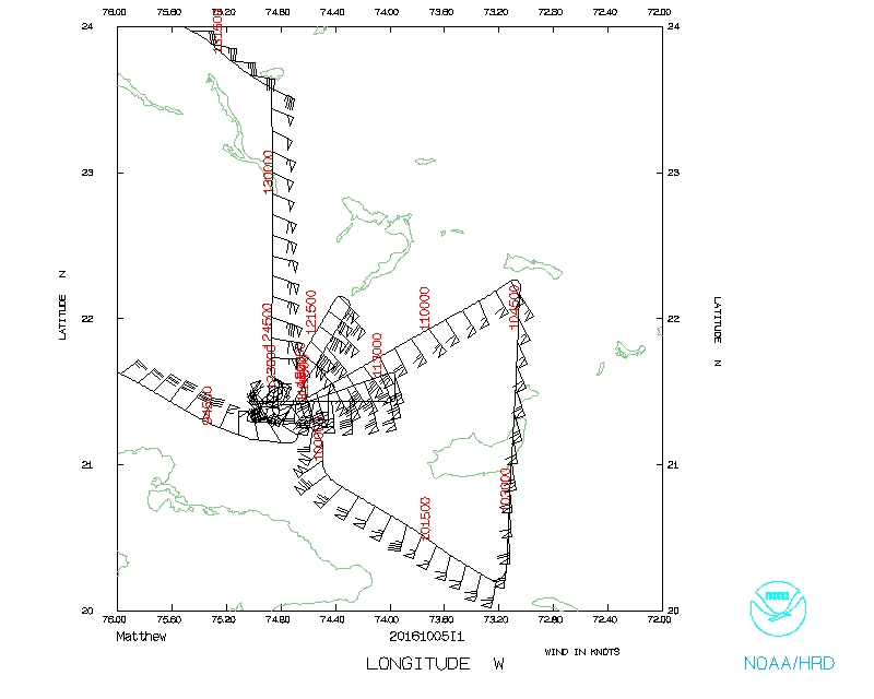
 Proposed and Actual flight tracks |
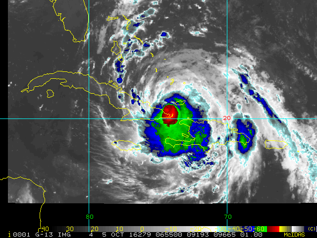
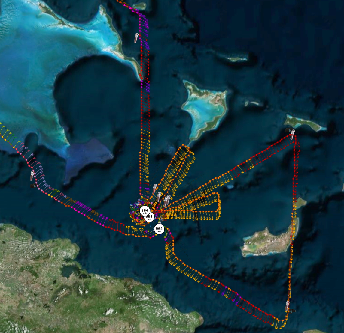
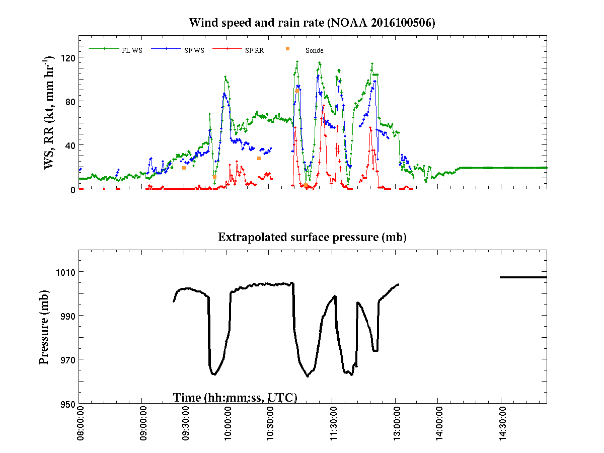
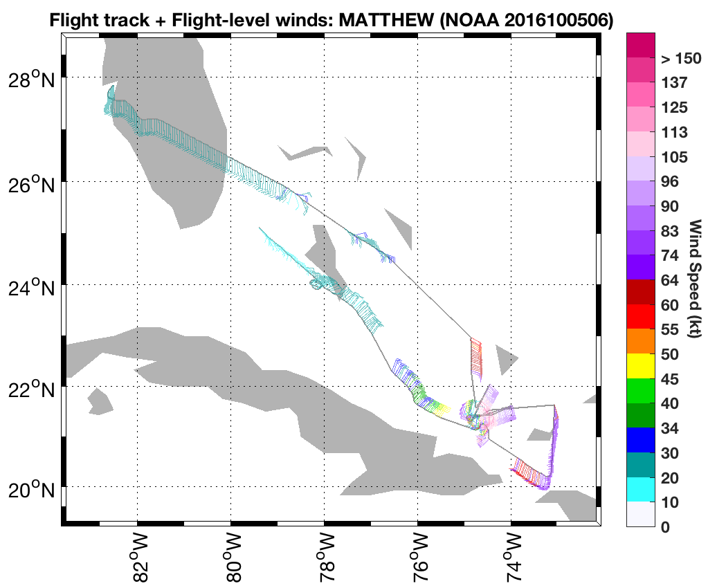
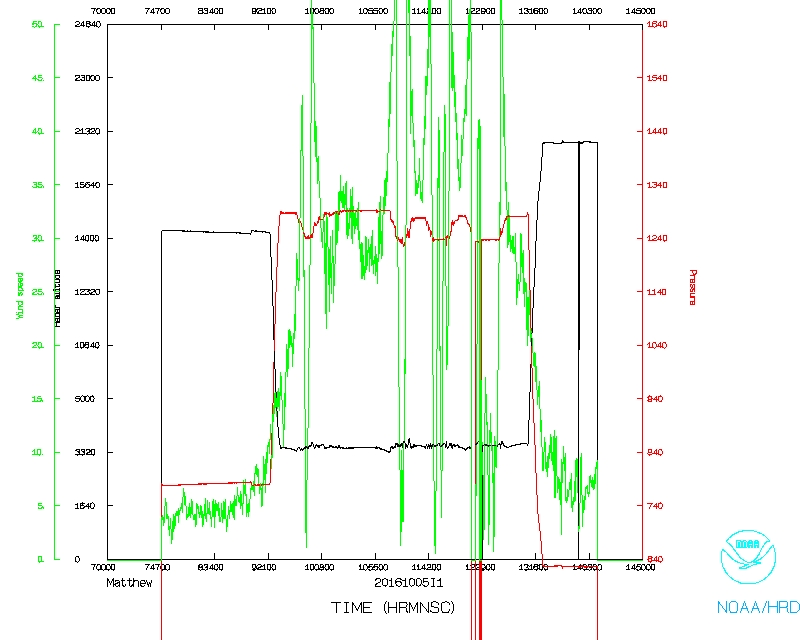
The butterfly pattern was flown, however the southern points of the pattern were removed due to the center's proximity to land (Figure 5b). Ocean Wind radials were performed after the completion of the second inbound in the NE quadrant since the plane was located in the area of the highest surface winds. As Matthew distanced itself from the coast of Cuban the eastern eyewall began to wrap around the storm. Radar composites show the western portion still had not completely filled in by the end of the second inbound (Figure 7). A satellite animation showed the cold cloud tops associated with the reforming eyewall wrapping around to the west as the mission progressed (Figure 6). This reformation of the eyewall structure could indicate possible strengthening of Matthew as indicated by some of the intensity guidance. Peak flight level winds were 113 knots. SFMR reached 103 knots while the strongest surface winds from a dropsonde were found on drop 9 with 90 knots.
 IR satellite loop |
 Radar analyses |
A total of 10 sondes were dropped (4 HRD, 6 Ocean Winds) and 1 radar analyses were completed.
Mission Evaluation:
This TDR mission was successfully and captured 1 analyses of Hurricane Matthew as it reemerged off the coast of Cuba. However the insertion of the Ocean Winds module caused difficulty with the second TDR analysis, therefore it is recommended to complete a TDR pattern prior to performing any additional modules. Additionally the series of delays prior to the arrival of the P3 to Matthew did not allow for additional TDR patterns to be completed. Problems :
Engine 4 did not start during takeoff sequence causing about an hour delay at the beginning of the flight. On the transit to Matthew, there was a fire of unknown origin that was traced to the flight director’s workstation. This caused another hour delay while the plane, but the mission was still continued after the problem was believed to be isolated. During the time in the storm there were 2 frequency converter glitches, causing all the workstations to lose power and reset. This made completing radar analyses difficult. On the transit home a second fire of unknown origin occurred and was also traced back to the flight director’s workstation.

Final flight track |
Detail Final flight track |
|
Plot of raw High Density Obs |
Plot of raw Flight Level winds |
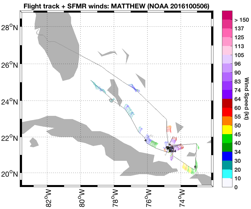
Plot of raw SFMR winds |
 Flight track |
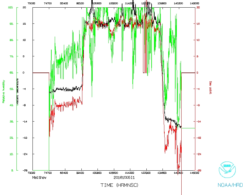 Temperature and Moisture |
 Wind and Atlitude |
LPS's log | Radar Scientist's log | Dropsonde Scientist's log |
Flight Director's log |
Flight Director's manifest |
SFMR data |
serial data |
1 second data |
NetCDF data