
Proposed flight track for 20170926H2 |
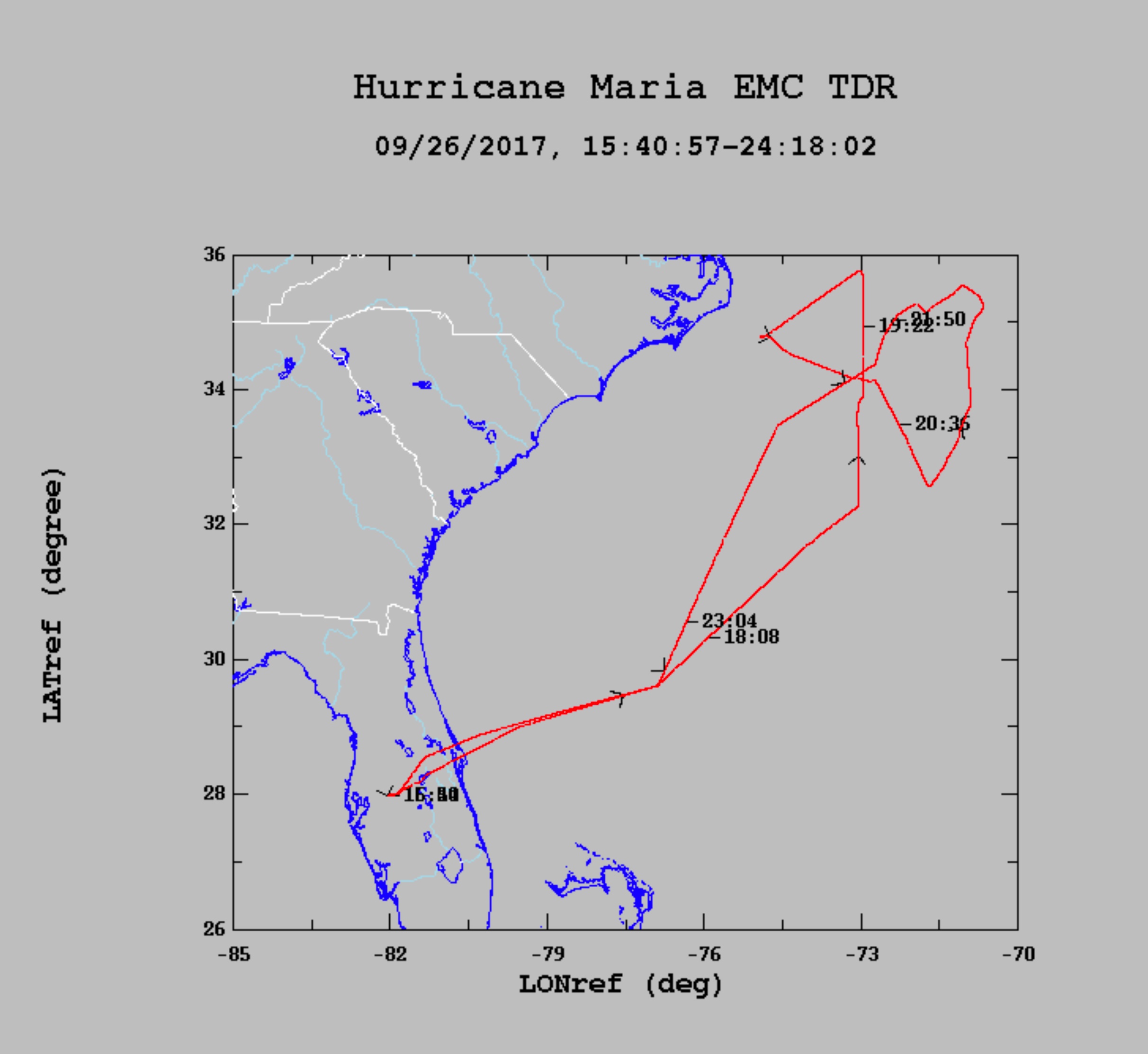
Final flight track for 20170926H2 |
| Aircraft Commander | Scott Price |
| Co-pilot | Kahn |
| Co-pilot | Rossi |
| Flight Engineer | Ken Heystek |
| Flight Engineer | Mike Sanchez |
| Navigator | Freeman |
| Flight Director | Jess Williams |
| Flight Director | Rich Henning |
| System Engineer | Paul |
| Data Technician | Marc Mascaro |
| Dropsonde Operator | McAllister |
| Guest | Matthew Badolato | unk |
| Guest | Timothy Miller | unk |
| Radar Scientist | John Gamache | HRD |
Mission Plan :
NOAA 42RF (N42) will perform an HRD-tasked Doppler Winds LIDAR and COYOTE mission into Hurricane Maria.
|
Proposed flight track for 20170926H2 |
Final flight track for 20170926H2 |
|
Prepared by the Hurricane Research Division September 25, 2017 Aircraft: N42RF Proposed takeoff: 26/1700Z
DROP LOCATION TABLE
| #
| LAT
| LON
| RAD/AZM
| Time
|
| deg min
| deg min
| n mi/deg
| hr:min
| 1S | 31 45 | 73 18 | 105/180 | 1:34
| 2S | 35 15 | 73 18 | 105/000 | 2:27
| 3S | 34 23 | 75 08 | 105/300 | 2:54
| 4S | 32 38 | 71 30 | 105/120 | 3:47
| 5S | 34 23 | 71 28 | 105/060 | 4:14
| 6S | 32 38 | 75 06 | 105/240 | 5:07
| | ||||||||||||||
Mission Summary :
| Take off | Landing
| Linder-Lakeland, FL
| 16:58 UTC
| Linder-Lakeland, FL
| 00:17 UTC
| Penetration
| 2
| | ||||
Expendables:6 dropsondes, all good.
Mission Evaluation:
Problems :
| NetCDF SFMR data | |
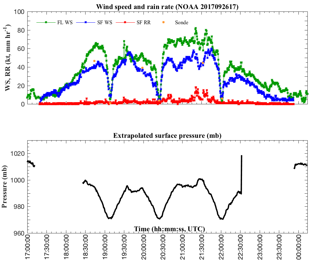
Timeseries wind, rain rate, and pressure plots |
|
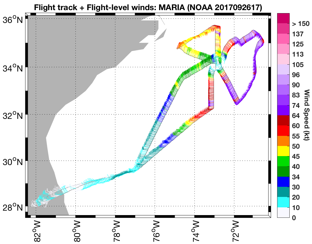
Flight level wind plots full flight |
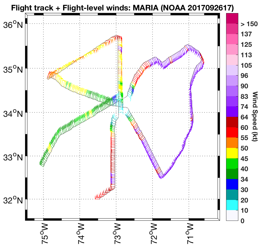
Flight level wind plots in storm |
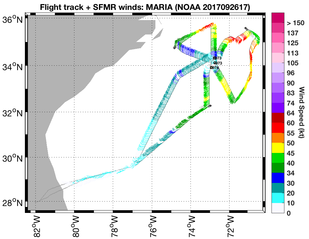
SFMR wind plots full flight |
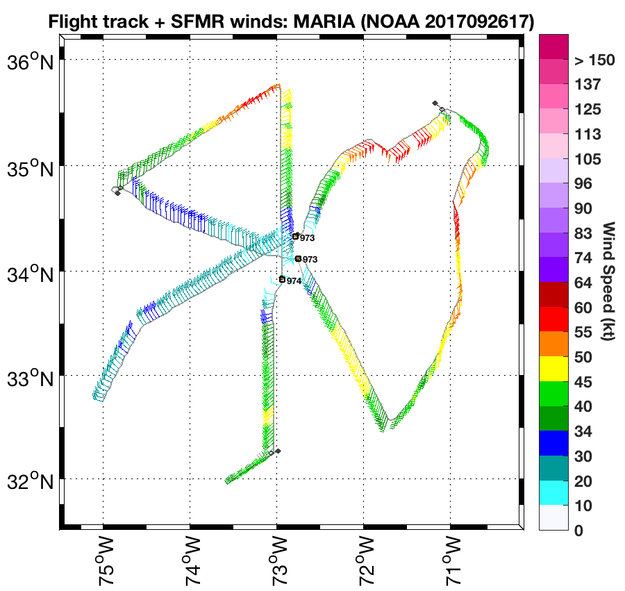
SFMR wind plots in storm |
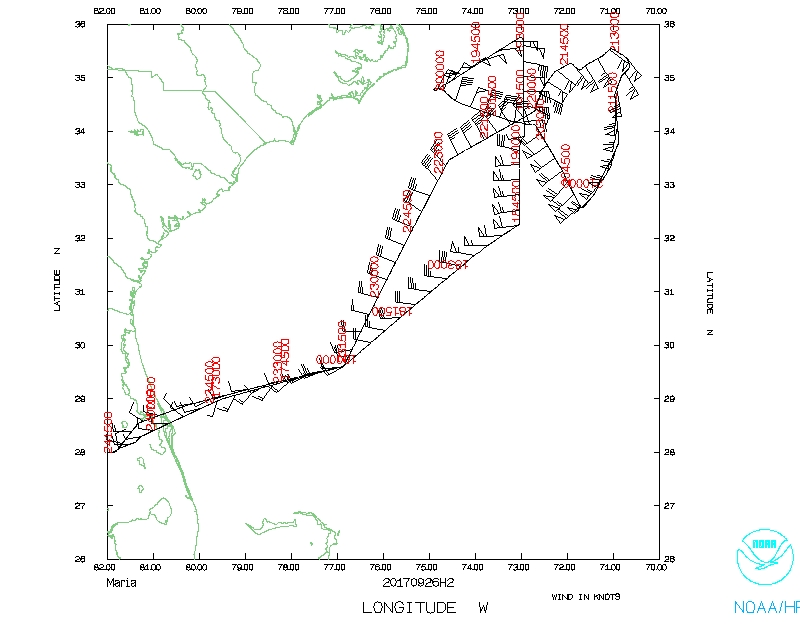 Flight track |
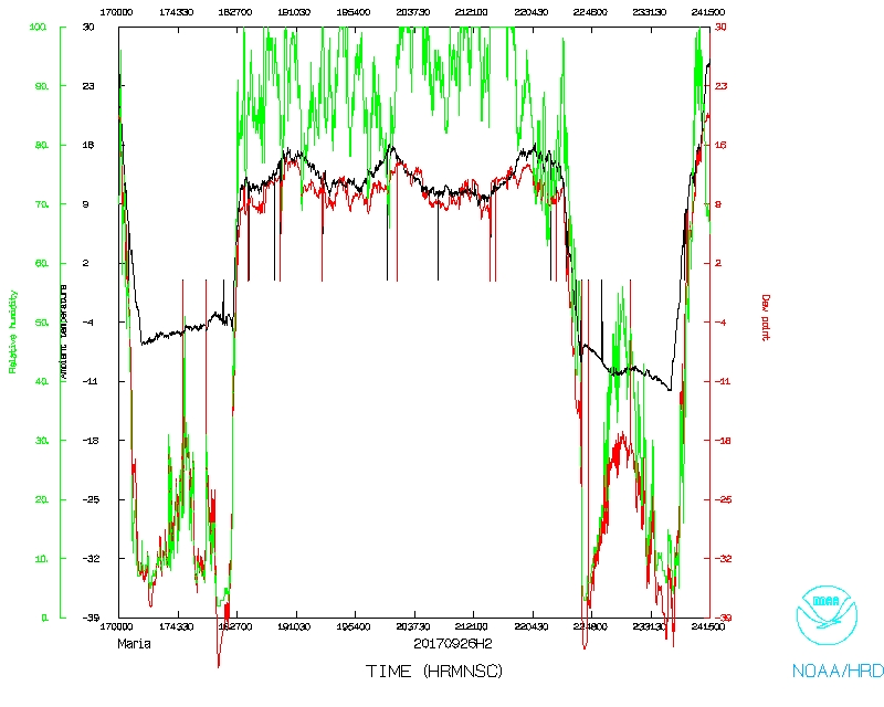 Temperature and Moisture |
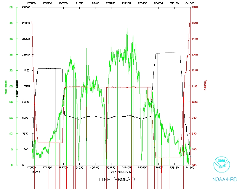 Wind and Atlitude |
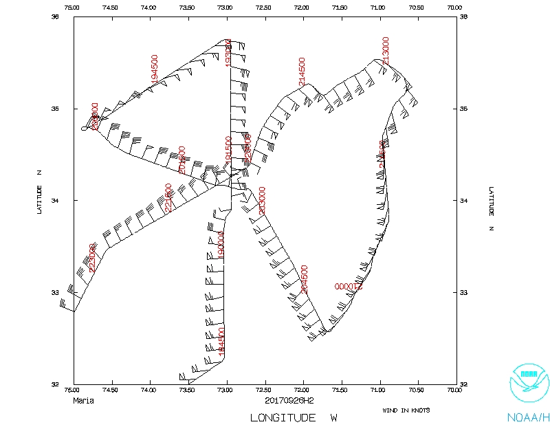 Flight track detail |
SFMR data |
Flight Director's log |
Drop log |
Flight Director's manifest
NetCDF data |
serial data |
1 second data