| Aircraft Commander | Doug MacIntyre |
| Co-pilot | Fritzler |
| Flight Director | Rich Henning |
| Flight Director | Brian Belson |
| System Engineer | Joe Greene |
| Data Technician | Gabe Defeo |
| Dropsonde Operator | Underwood |
| Dropsonde Operator | James Warnecke |
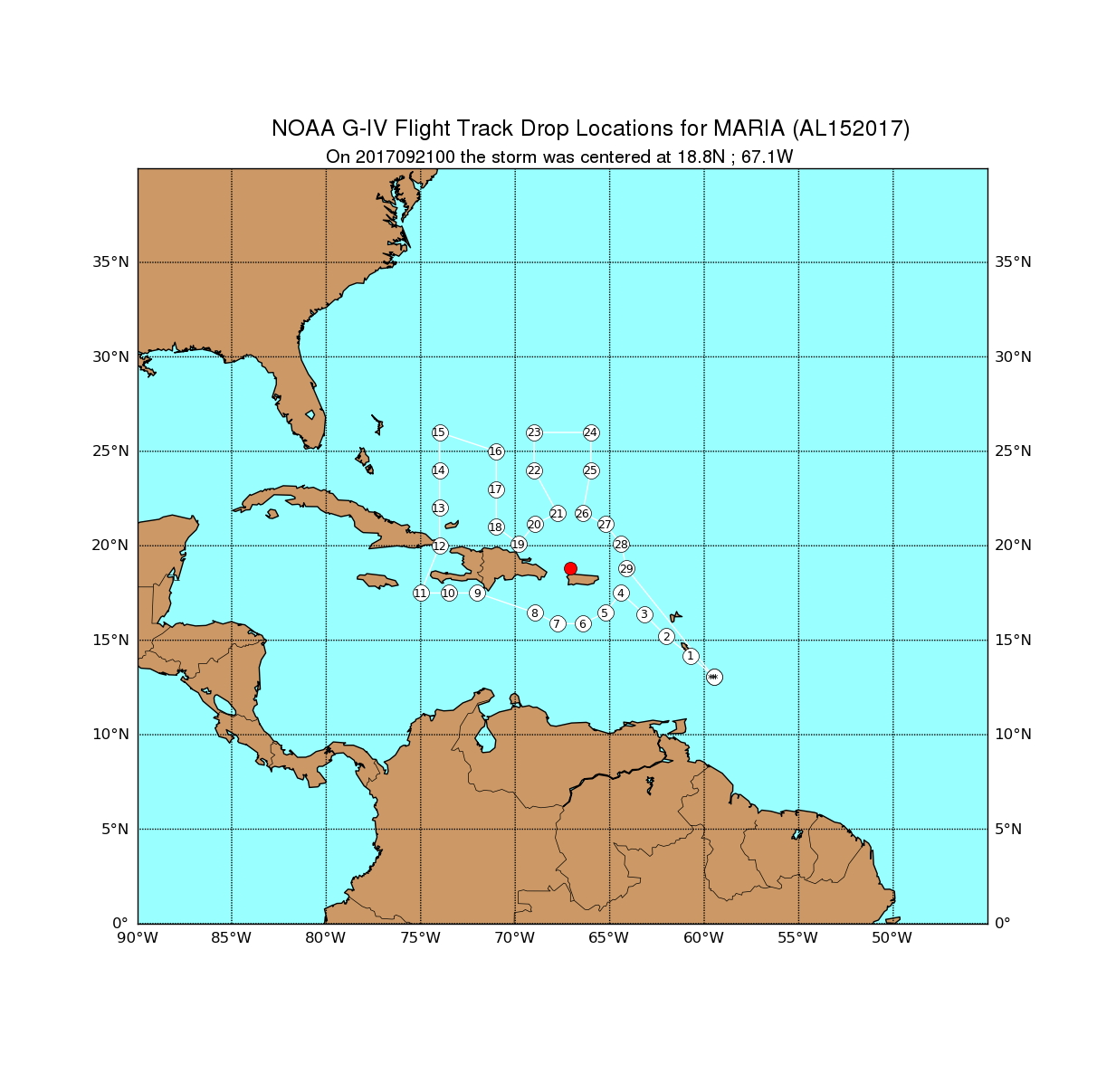
![]() Original Proposed NOAA 49 track |
![]() Actual Synoptic Surveillance NOAA 49 track |
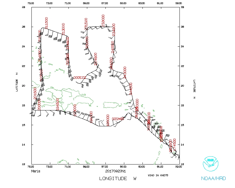
Mission Plan :
NOAA 49RF (N49) will fly a synoptic surveillance mission around Hurricane Maria.
|
Prepared by the National Hurricane Center September 19, 2017 3:29:18 PM Aircraft: N49RF Proposed takeoff: 20/1730Z | |||||||
| DROP LOCATION TABLE | |||||||
| # | LAT | LON | Time | ||||
| deg min | deg min | hr:min | |||||
| 1 | 14 10 | -60 43 | 0:13 | ||||
| 2 | 15 12 | -62 00 | 0:27 | ||||
| 3 | 16 23 | -63 10 | 0:40 | ||||
| 4 | 17 30 | -64 24 | 0:54 | ||||
| 5 | 16 27 | -65 14 | 1:05 | ||||
| 6 | 15 53 | -66 26 | 1:15 | ||||
| 7 | 15 53 | -67 46 | 1:26 | ||||
| 8 | 16 27 | -68 58 | 1:37 | ||||
| 9 | 17 30 | -72 00 | 2:02 | ||||
| 10 | 17 30 | -73 30 | 2:14 | ||||
| 11 | 17 30 | -75 00 | 2:26 | ||||
| 12 | 20 00 | -74 00 | 2:48 | ||||
| 13 | 22 00 | -74 00 | 3:05 | ||||
| 14 | 24 00 | -74 00 | 3:21 | ||||
| 15 | 26 00 | -74 00 | 3:37 | ||||
| 16 | 25 00 | -71 00 | 4:02 | ||||
| 17 | 23 00 | -71 00 | 4:18 | ||||
| 18 | 21 00 | -71 00 | 4:35 | ||||
| 19 | 20 06 | -69 48 | 4:47 | ||||
| 20 | 21 09 | -68 58 | 4:58 | ||||
| 21 | 21 43 | -67 46 | 5:08 | ||||
| 22 | 24 00 | -69 00 | 5:29 | ||||
| 23 | 26 00 | -69 00 | 5:46 | ||||
| 24 | 26 00 | -66 00 | 6:09 | ||||
| 25 | 24 00 | -66 00 | 6:25 | ||||
| 26 | 21 43 | -66 26 | 6:44 | ||||
| 27 | 21 09 | -65 14 | 6:55 | ||||
| 28 | 20 06 | -64 24 | 7:06 | ||||
| 29 | 18 48 | -64 06 | 7:16 | ||||
Mission Summary :
| Take off | Landing
| Barbados, BWI
| 17:39 UTC
| Barbados, BWI
| 01:53 UTC
| | ||
Problems :
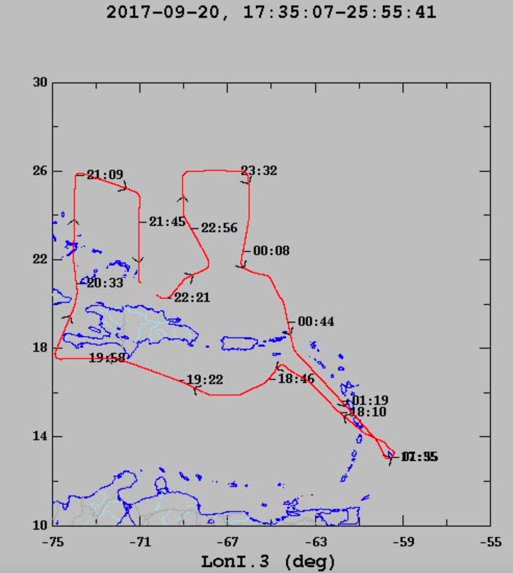
![]() Flight track |
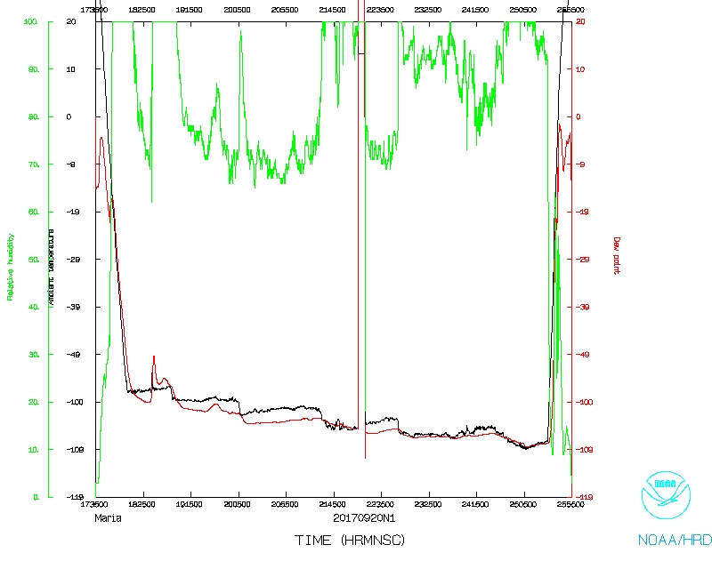
![]() Temperature and Moisture |
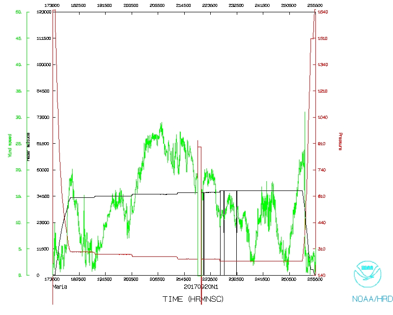
![]() Wind and Atlitude |