| Aircraft Commander | Al Girimonte |
| Co-pilot | Cathy Martin |
| Co-pilot | Justin Kibbey |
| Navigator | Chris Sloan |
| Flight Engineer | Ken Heystek |
| Flight Engineer | Paul Darby |
| Flight Director | Ian Sears |
| Flight Director | Richard Henning |
| Data Technician | Joe Bosko |
| AVAPS | Charles Lynch |
| AVAPS | Jeff Smith |
| Electronics Technician | Todd Richards |
| Lead Scientist | Rob Rogers(HRD) |
| Radar Scientist | John Gamache(HRD) |
| Dropsonde Scientist | Rich Henning (AOC) |
| Ocean Winds scientist | Paul Chang(NESDIS) |
| (NESDIS) | |
Mission Plan :
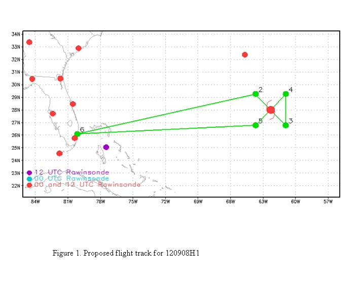
Fly TDR mission into Tropical Storm Leslie. Pattern will consist of a single Figure-4, with an IP on the NW side and leg lengths of 105 nm (Fig. 1). Drop combination GPS/AXBT drops at turn, midpoints, RMW points on NW and NE sides, plus midpoint of downwind leg and second center pass. Fly at 8000 ft radar altitude. We may shorten the legs on the SE side to 75 nm since there is no precipitation there and the peak winds are likely to be inside that.
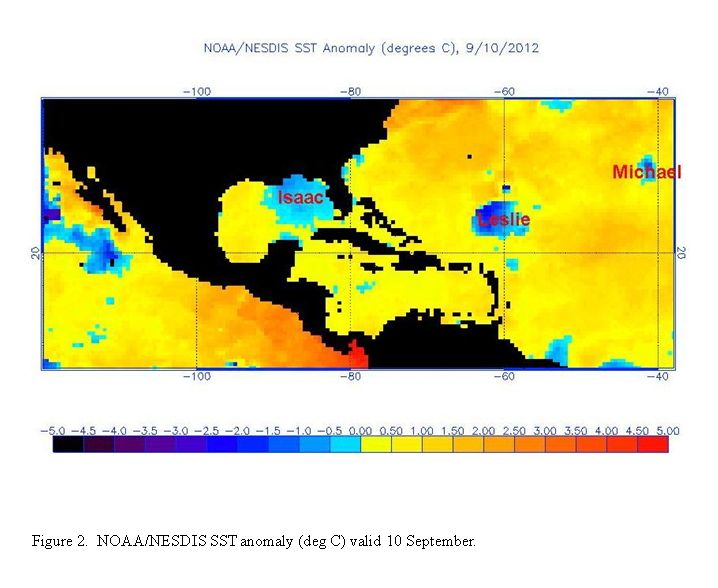
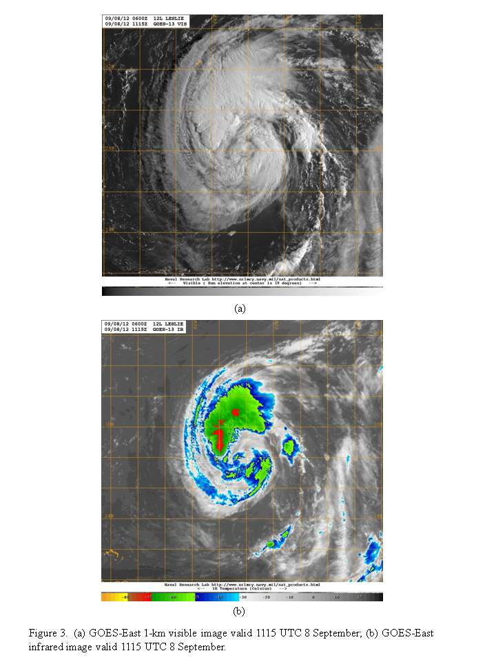
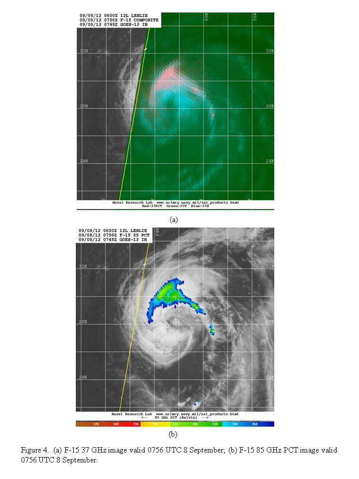
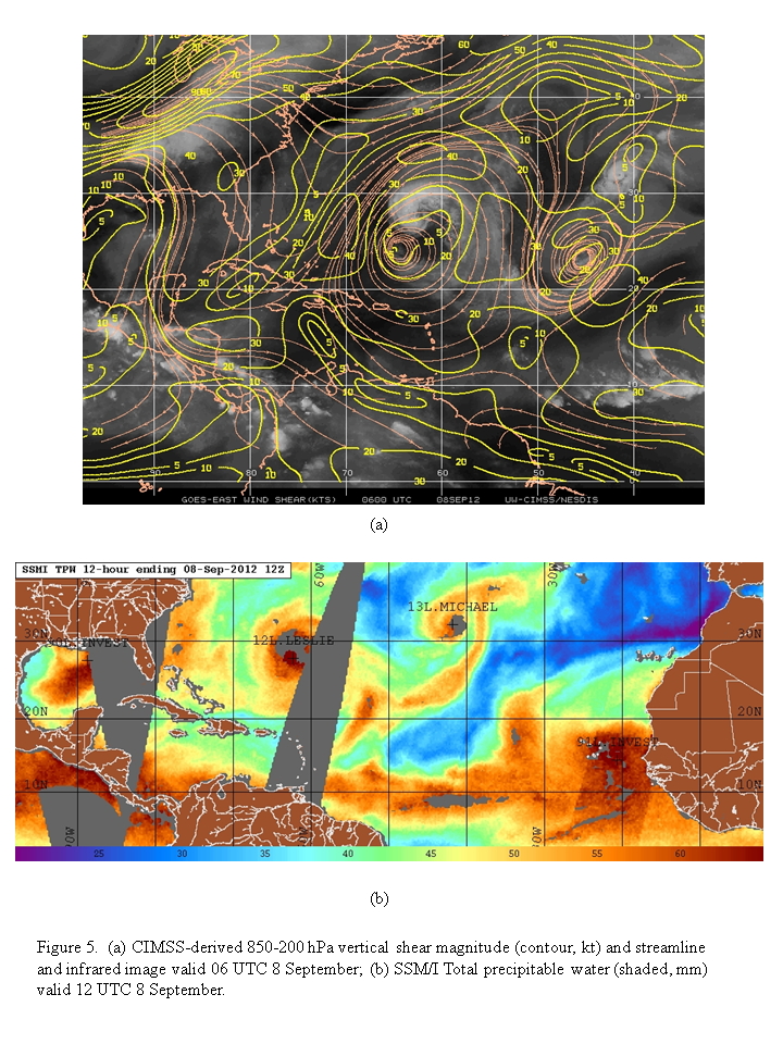
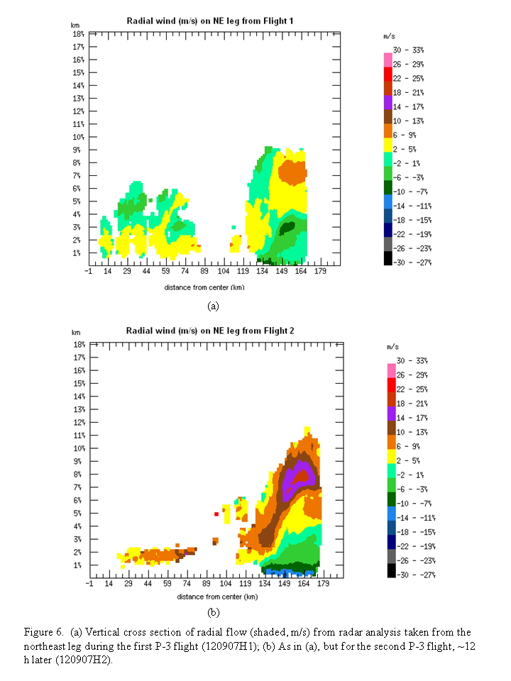
The system is still struggling, with cold upwelled water (Fig. 2) and dry air. It consists of a band of precipitation on the west and north sides, though recent satellite imagery suggests precipitation may be try to wrap around the SW side as the storm moves slowly toward the north over warmer waters (Fig. 3,4). The shear is comparatively light, about 15 kt over the center, but once again the upper-level anticyclone is displaced to the SW of the center, imparting westerly shear over the storm center (Fig. 5). The possibility for intensification exists. Vertical cross-sections of radar-derived radial wind on the NE side of the storm from the first two flights, taken 12 h apart, showed that the secondary circulation associated with the broad eyewall has strengthened from the first to second flight (Fig. 6). However, dry air, particularly on the west side of the storm (cf. Fig. 5b), along with the storm-induced cold anomaly in SST, may limit that potential. For these reasons, intensification is not likely until the storm moves further north, away from the self-induced cold anomaly.
Mission Summary :
| Take off | Landing
| Ft. Lauderdale, FL | 07:56 UTC
| Ft. Lauderdale, FL | 16:14 UTC
| | ||
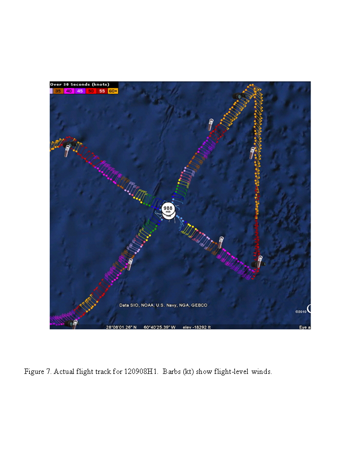
The pattern was flown as planned (Fig. 7). Takeoff was at 0756 UTC from Ft. Lauderdale. Because of the broadness of the circulation, we were not able to find a clear RMW, so we did not do any RMW drops. We shortened the leg on the SE side because of a lack of scatterers. We dropped two center combination drops. The AXBT endpoint drop on the SE side did not work, so we backed it up during the downwind leg.
Mission Evaluation:
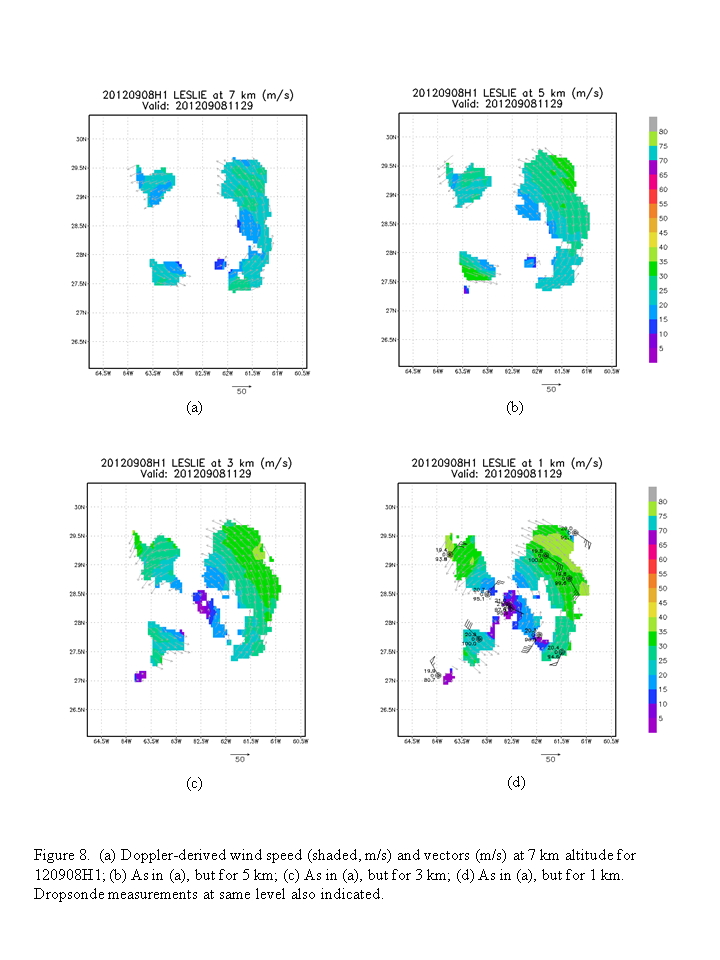
The mission did meet its objectives. It sampled the structure of the storm during this third flight. The storm remains very broad, with a RMW estimated at 75 nm and no indication of strengthening of the wind field. Significant cooling of the ocean is apparent, particularly at the center and to the south of the center.
Problems :
There were no major problems. The sondes all worked well. One AXBT did not transmit and its backup was suspect as well. Superobs were limited on the NW side. A total of 11 GPS sondes were transmitted and 12 AXBT's were dropped. Two radar analyses were performed.
Rob Rogers
Sept. 11, 2012
Mission Data :
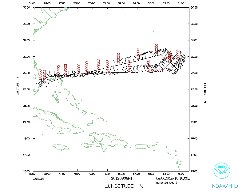 Flight track |
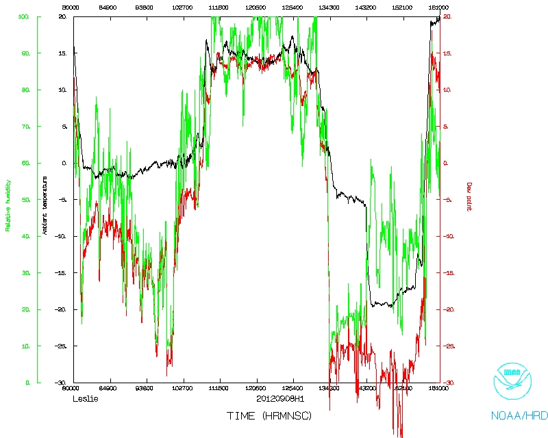 Temperature and Moisture |
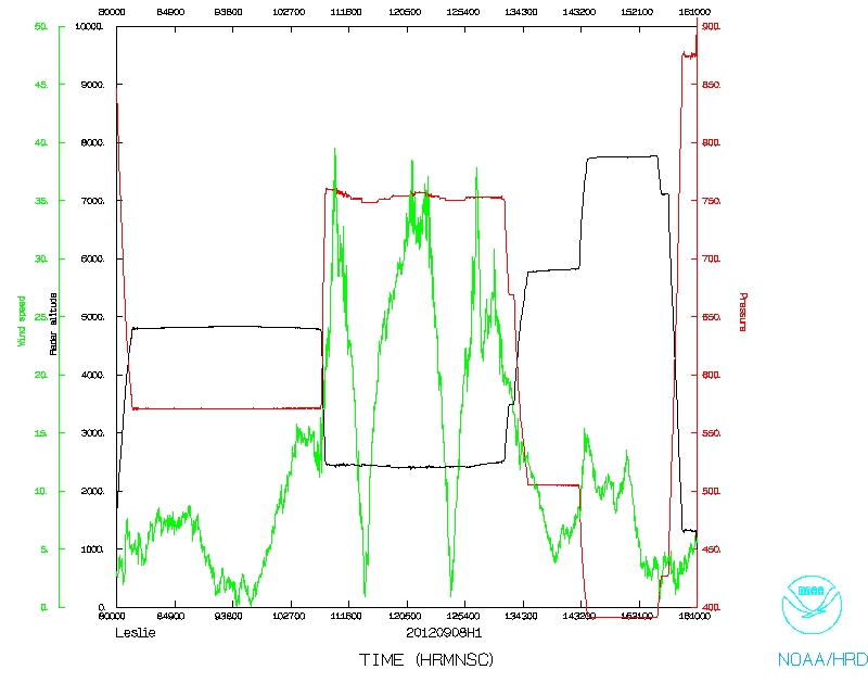 Wind and Atlitude |
|
Flight track detail |
Flight Director's manifest | 1 second data | NetCDF data | raw Fast data