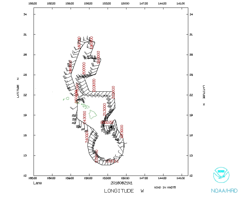
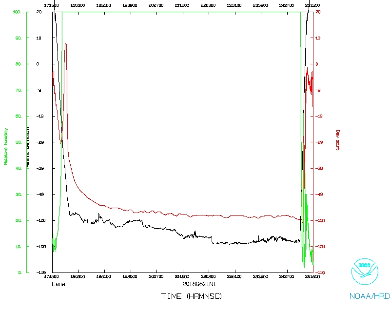
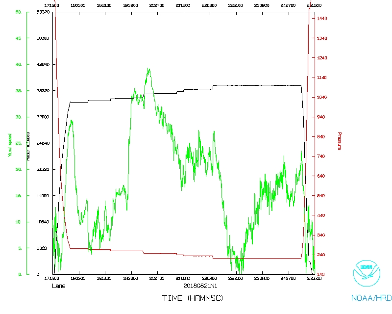
Aircraft Commander | Kristie Twining |
Co-pilot | Rebecca Waddington |
Co-pilot | Tanner Sims |
Flight Director | Ian Sears |
Flight Director | Paul Flaherty |
System Engineer | Jeff Smith |
Data Technician | Gabe Defeo |
Data Technician | Jeff Hartberger |
Dropsonde Operator | Leonard Miller |
None |
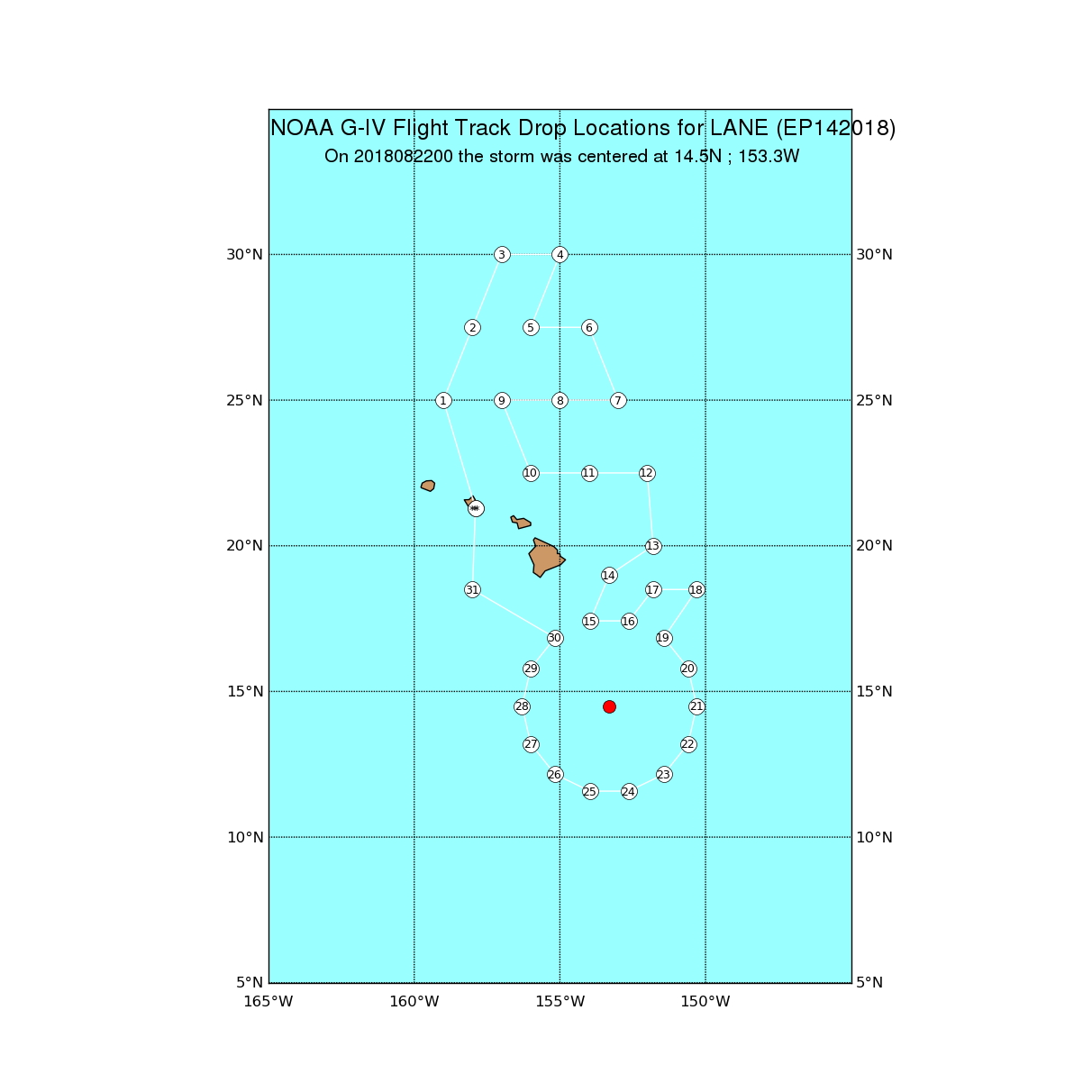
Proposed NOAA 49 track |
Mission Plan :
NOAA 49RF (N49) will fly a NHC-tasked Synoptic Surveillance missions around Hurricane Lane.
Prepared by the National Hurricane Center August 20, 2018 2:54:05 PM Aircraft: N49RF Proposed takeoff: 21/1730Z | |||||||
DROP LOCATION TABLE | |||||||
# | LAT | LON | Time | ||||
deg min | deg min | hr:min | |||||
1 | 25 00 | -159 00 | 0:32 | ||||
2 | 27 30 | -158 00 | 0:54 | ||||
3 | 30 00 | -157 00 | 1:16 | ||||
4 | 30 00 | -155 00 | 1:31 | ||||
5 | 27 30 | -156 00 | 1:53 | ||||
6 | 27 30 | -154 00 | 2:08 | ||||
7 | 25 00 | -153 00 | 2:30 | ||||
8 | 25 00 | -155 00 | 2:46 | ||||
9 | 25 00 | -157 00 | 3:01 | ||||
10 | 22 30 | -156 00 | 3:23 | ||||
11 | 22 30 | -154 00 | 3:39 | ||||
12 | 22 30 | -152 00 | 3:55 | ||||
13 | 20 00 | -151 48 | 4:15 | ||||
14 | 19 00 | -153 18 | 4:30 | ||||
15 | 17 25 | -153 58 | 4:44 | ||||
16 | 17 25 | -152 38 | 4:54 | ||||
17 | 18 30 | -151 48 | 5:05 | ||||
18 | 18 30 | -150 18 | 5:17 | ||||
19 | 16 51 | -151 26 | 5:34 | ||||
20 | 15 48 | -150 36 | 5:45 | ||||
21 | 14 30 | -150 18 | 5:55 | ||||
22 | 13 12 | -150 36 | 6:06 | ||||
23 | 12 09 | -151 26 | 6:17 | ||||
24 | 11 35 | -152 38 | 6:28 | ||||
25 | 11 35 | -153 58 | 6:39 | ||||
26 | 12 09 | -155 10 | 6:50 | ||||
27 | 13 12 | -156 00 | 7:01 | ||||
28 | 14 30 | -156 18 | 7:11 | ||||
29 | 15 48 | -156 00 | 7:22 | ||||
30 | 16 51 | -155 10 | 7:33 | ||||
31 | 18 30 | -158 00 | 7:60 |
Mission Summary :
Take off | Landing
Honolulu, HI
| 17:17 UTC
| Honolulu, HI
| 01:10 UTC
| |
Problems :
Flight track |
Temperature and Moisture |
Wind and Atlitude |
Flight Director's log |
Flight Director's manifest |
NetCDF data |
serial data |
1 second data