Mission Summary
20180821H1 Aircraft 42RF
Hurricane Lane (EP14)
Tail Doppler Radar (TDR)
Aircraft Crew (42RF)
| Aircraft Commander | Nate Kahn
|
| Co-pilot | Adam Abitol
|
| Co-pilot | Pat Didier
|
| Flight Engineer | Ken Heystek
|
| Flight Engineer | Mike Sanchez
|
| Navigator | Sam Urato
|
| Flight Director | Rich Henning
|
| System Engineer | Joe Greene
|
| Data Technician | Mike Mascaro
|
| Dropsonde Operator | Akshar Patel
|
Scientific Crew (42RF)
| Sim Aberson | LPS | HRD
|
| Kathryn Sellwood | Radar | HRD
|
| Kelly Ryan | DWL | HRD
|
| John Bravender | Observer | CPHC
|
| Jillene Bushnell | Observer | JTWC
|
Scientific Crew (Ground)
| Radar | John Gamche | HRD
|
Mission Plan :
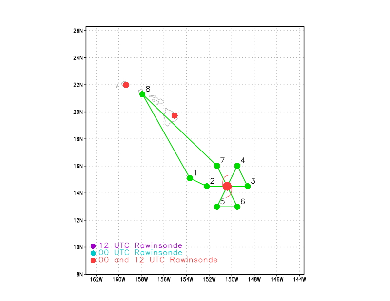
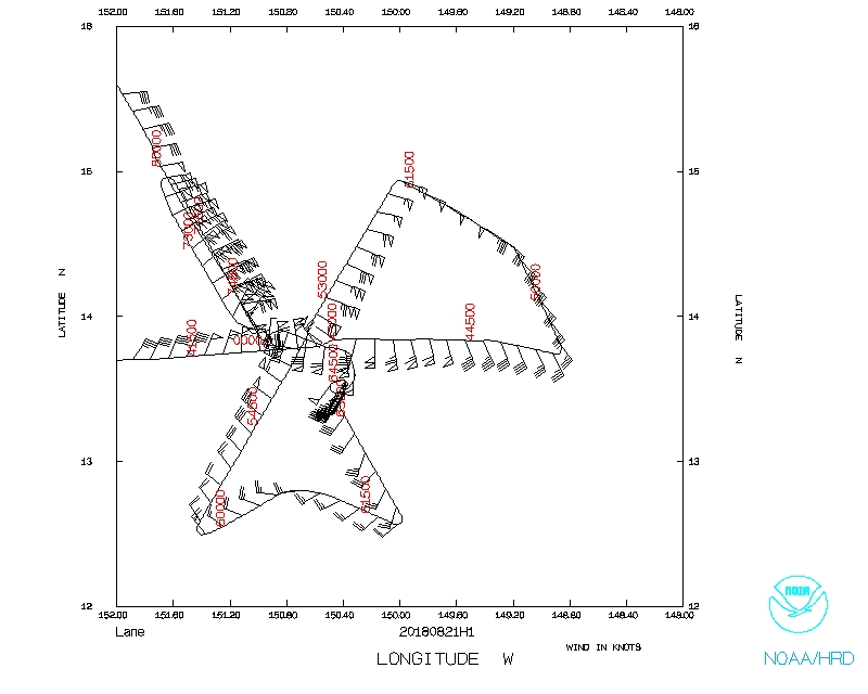
The plan for this EMC-tasked mission was to fly a butterfly pattern (Fig. 1)
with three passes through the center, but to first drop an AXBT at the 24-h
forecast location to sample changes in the ocean as the hurricane passed.
Further modules, such as one for stepped-frequency microwave radiometer
circles, and for a gravity-wave module, were at the discretion of time and
crew.
HURRICANE SYNOPTIC SURVEILLANCE MISSION PLAN: Lane
Prepared by the Hurricane Research Division
August 20, 2018 2:35:19 PM
Aircraft: N42RF
Proposed takeoff: 21/0200Z
|
DROP LOCATION TABLE
|
| #
| LAT
| LON
| RAD/AZM
| Time
|
|
| deg min
| deg min
| nm/deg
| hr:min
| | 1 | 15 06 | 153 42 | | 1:23
| | 2S | 14 30 | 152 12 | 105/270 | 1:48
| | 3S | 14 30 | 148 36 | 105/090 | 2:43
| | 4S | 16 01 | 149 30 | 105/030 | 3:11
| | 5S | 12 59 | 151 18 | 105/210 | 4:07
| | 6S | 12 59 | 149 30 | 105/150 | 4:35
| | 7S | 16 01 | 151 18 | 105/330 | 5:30
| |
Mission Summary :
| Take off
| Landing
| Honolulu, HI
| 02:03 UTC
| Honolulu, HI
| 09:52 UTC
| | Penetrations
| 4
| |
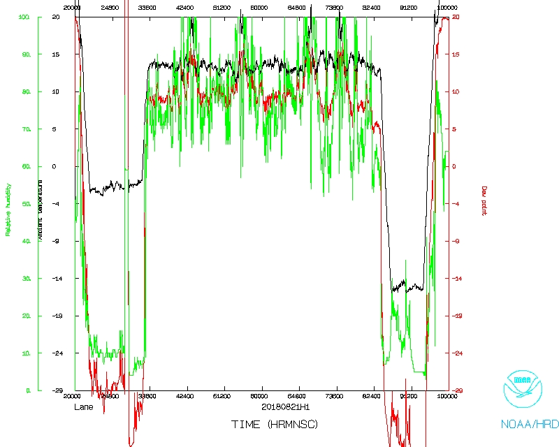
At the mission start time, Hurricane Lane was a major hurricane with estimated
maximum sustained wind of 135 kt, moving westward. The previous intensity
forecast was for Lane to remain steady state of slowly weaken, but instead, it
rapidly intensified to the cusp of category 5. The forecast was for it to pass
well south of the Big Island of Hawai'i and then turn north (Fig. 2). At this
point, a clear, circular eye was seen on both visible and infrared satellite
imagery, and an eye was also seen on microwave imagery, though it may have been
open to the north (Fig. 3).
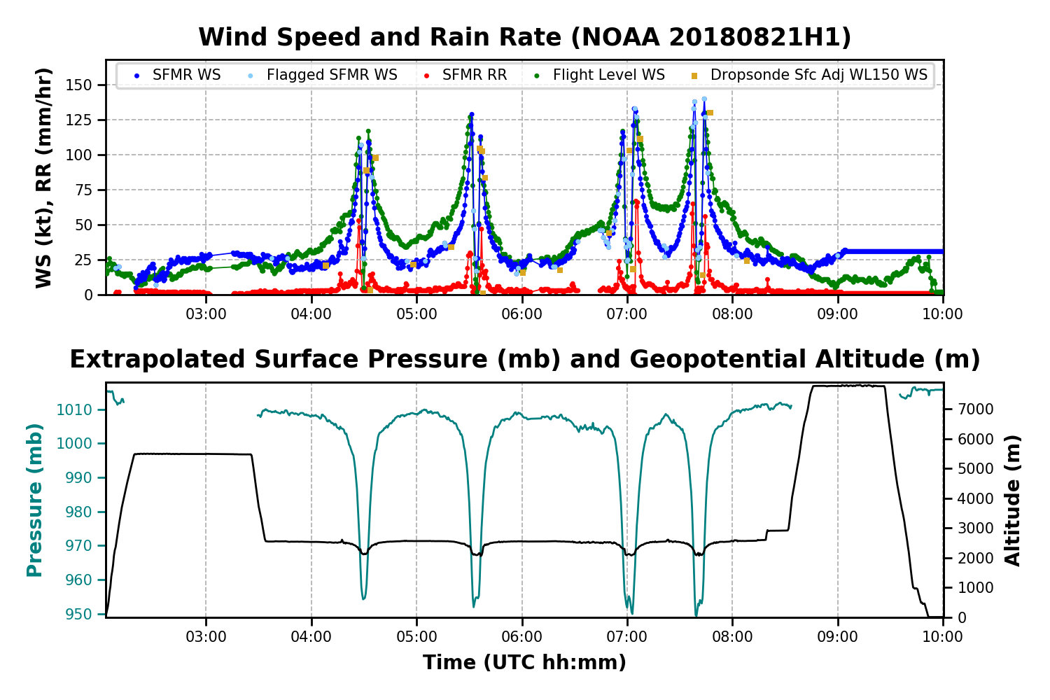
The IP was reached, and an AXBT was launched, reporting a sea-surface
temperature of about 27.9C, which was slightly warmer than the previous day.
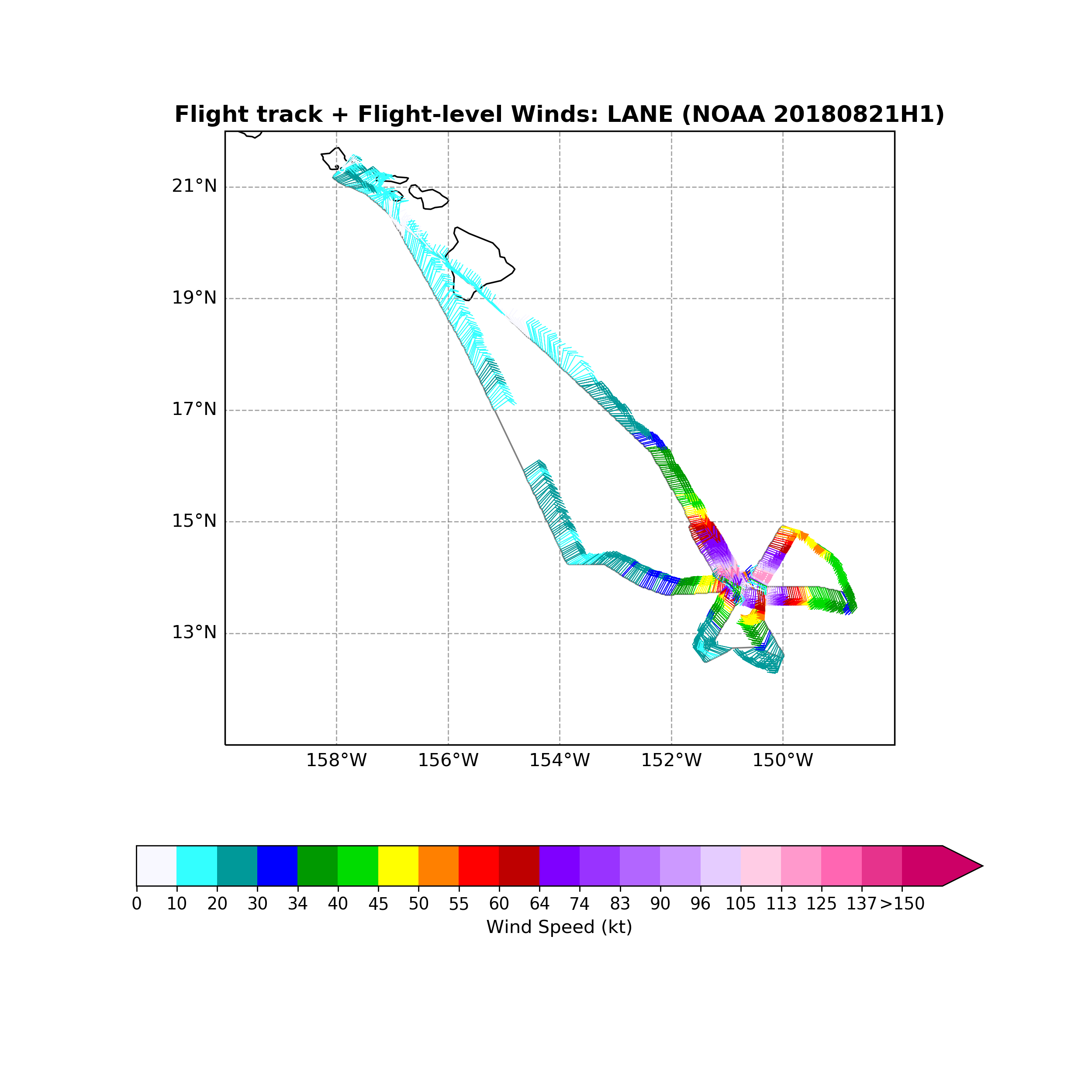
The butterfly pattern was completed largely as planned, and circles for the
stepped-frequency microwave radiometer were conducted in approximately 20 m/s
surface winds before the third pass into the center. A final pass was
conducted as part of a gravity-wave module. Four radar analyses were
transmitted. During the mission, Lane's central pressure fell by 4 mb to a
still high (for such a strong hurricane wind-wise) 951 mb, suggesting that the
intensity forecast was correct, at least in the short term; Lane was 20 mb
deeper than during the previous day's mission. Lane was moving just north of
due west during the period.
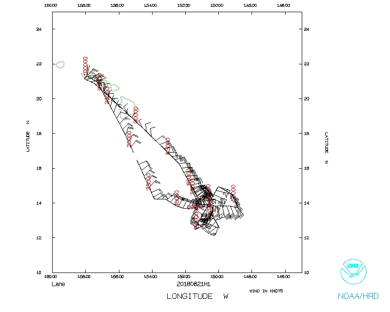
During this flight, the radar showed a closed eyewall during all passes. One
interesting aspect of the radar data was the display of surface mode, which
showed more structure at further distances than the standard weather mode.
(Fig. 4). The figure also shows the attenuation limitations of the new radar.
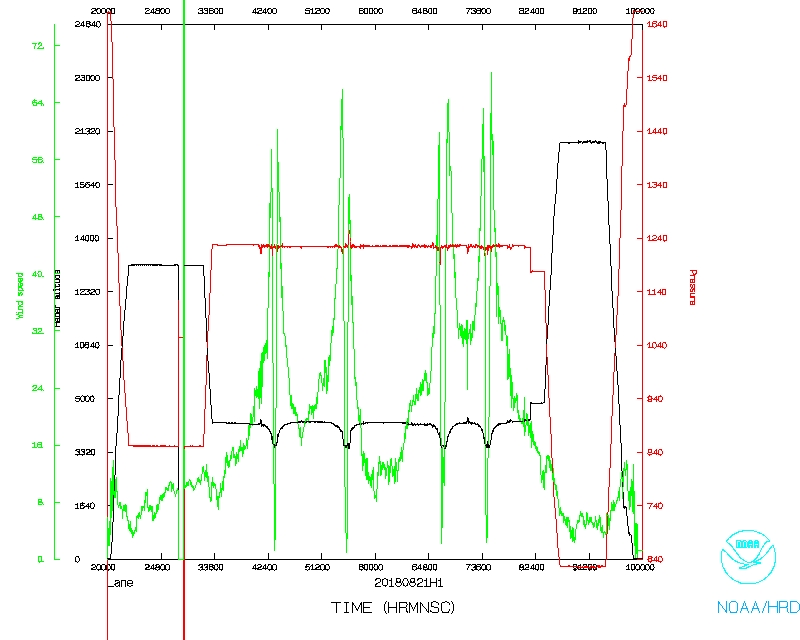
Radar analyses also showed that the strongest winds remained on the northern
side of the eyewall, as well as strong upper-level outflow, though not as
strong as during the previous day (Figs. 5 and 6). Multiple AXBTs were dropped
in storm. The SST was reported to be 27.3C in the core, which was more than
one degree lower than was reported the previous day.
The wind-speed reports from various instruments suggested that Lane continued
to be a healthy hurricane. One dropwindsonde reported 176 kt at 192 m above
the surface in the northeastern eyewall. In that same location, a sonde
reported a 21.3-m/s updraft at about 1000 m and a 9.1-m/s downdraft at 532 m.
This is one of the five largest updrafts measured by dropwindsondes in a
hurricane. The strongest surface wind speed reported by the SFMR was 133 kt,
and the highest flight-level wind speed was 132 kt.
Problems :
There were numerous problems during this flight. Most importantly, the NOAA
Gateway went down during the flight, stopping all data transmission. The only
way to contact CARCAH and CPHC was by satellite phone. This also prevented
download of Doppler Wind Lidar data. The flight director was on the phone with
CARCAH and CPHC telling them what we were seeing for significant parts of the
flight. Because of this, the flight director was not always available ro ready
for the science mission. Recommendation: Either the flight director of the
lead project scientist should not be shy about calling for a time out so that
everyone can catch up to what is happening on the flight.
Before the Gateway issue was diagnosed, we tried to contact John Hill to see
if there was an issue at AOC preventing transmission. AOC did not have (or
utilize) a way to contact John Hill, so John Gamache had to do it.
The pilots were conducting slightly curved legs instead of straight legs.
Straight legs are important for many reasons, including the DWL. This was
discussed at the post-flight brief, but should be clearly communicated before
each flight. In addition, the lead project scientist requested straight legs
during the gravity-wave module, but the flight director started turns to
improve the fix; this was caught before it created problems.
There were multiple issues with the SFMR circles. First, the flight director
insisted on doing the circles outside a rainband where the winds were too low,
even though the pilots were fine with the area that the lead project scientist
designated inside that band; ultimately, they were conducted inside the band.
Second, it was requested that an AXBT and sonde be dropped at the beginning of
the circles so that, if either failed, they could be backed up at the end of
the circles and the mission could proceed; this advice was ignored. Finally,
at the end of the circles, the pilots rolled out of the turns directly and
immediately into the eye of this category-4 hurricane; this left very little
time for the pilots to safely maneuver, and prevented the plane from returning
to the inbound azimuth. Due to constraints on the aircraft, the lead project
scientist could not hear that the pilots were planning this maneuver, so could
not help. Some recommendations are to reposition to the start location at the
start of each set of circles and to clearly communicate safety issues during
the maneuvers.
SVN locked up for radarsync; this reason for this is unknown, but it worked by
the time the plane reached the IP.
The area of the aircraft near the head started vibrating intensely during the
last pass through the center of Lane. Cause remains unknown.
Mission Data :
Flight Director's log |
Flight Director's manifest |
SFMR data |
NetCDF data |
serial data |
1 second data
LPS log |
DWL log |
Drop log
Page last updated Feb. 14, 2019
Return to Mission page.