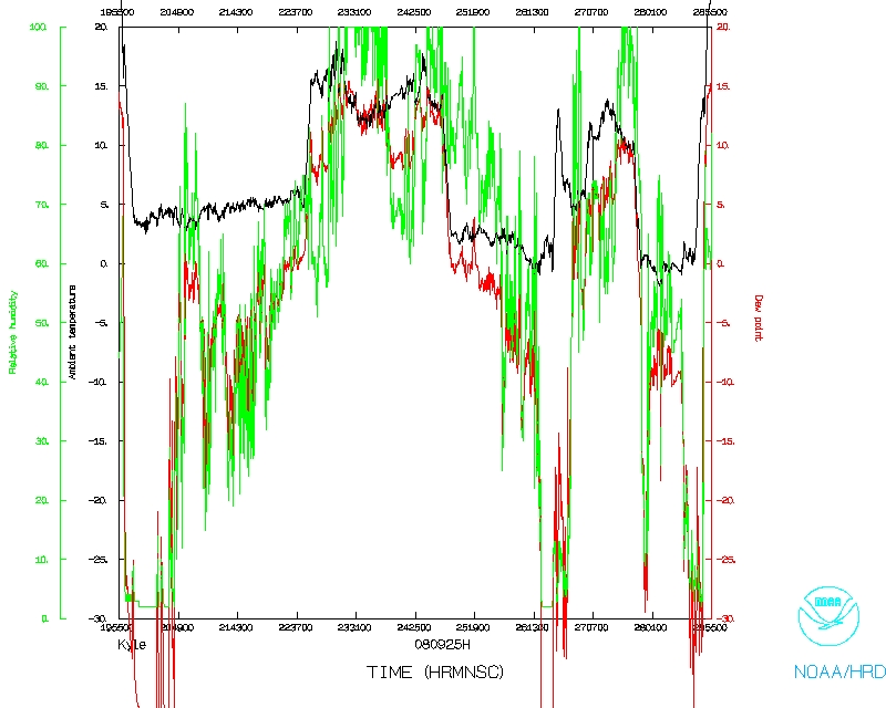
Mission Summary
20080925H1 Aircraft 42RF
Mission ID: 0911A KYLE
Tropical Storm Kyle Ocean Winds flight 2008
Scientific Crew (42RF)
| Lead Scientist | Shirley Murillo |
| Ocean Winds Lead Scientist | Paul Chang (NESDIS) |
| Radar Scientist | Sim Aberson |
| Dropsonde Scientist | Kathryn Sellwood |
| IWRAP Engineer | Zorana Jelenak (NESDIS) |
| IWRAP crew | Joe Manus (NESDIS) |
Flight Crew (42RF)
| Pilots | Mark Nelson
Al Girimonte
Scott Pierce
|
| Flight Director | Barry Damiano |
| Navigator | Joe Bishop |
| Flt. Eng. | Steve Wade
Greg Bast |
| Data Tech | Jim Roles
|
| Elec. Tech | Bill Olney
Joe Bosko |
| Computer Scientist |
Leonard Miller |
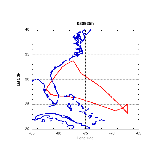
Mission Plan :
The plan for this mission onboard N42RF was to fly into TS Kyle and then
sample AL94 - a convective area off the N. Carolina coast. This research
flight mission was a combination Ocean Vector Winds/TDR (Tail Doppler
Radar). The plan was to sample the eastern side of the system where most of
the convection was present and then ferry to sample AL94.
Mission Summary :
| Take off
| Landing
| MacDill AFB, FL | 19:55 UTC
| MacDill AFB, FL | 04:55 UTC
| |

Fig1. GOES-12 Visible Satellite image of AL93 on Sept. 25, 2008 at 2115Z.
We took off from Tampa (MacDill AFB) at 1955 UTC on 25 September 2008. AL93 is
now TS Kyle. The surface pressure at 21Z is 1003 mb. We flew at 8,000 feet.
Kyle continued to be an asymmetric storm and was still experiencing moderate
shear. Most of the convection was on the eastern size of the storm. This
area contained most of the convection (Figs. 1 & 2). We started on the
southwest and headed toward the center. We spent a few minutes trying to
determine where the surface center was located. We then headed towards to NE
and then south. We made one last pass through the circulation center before
ferrying out to AL94. The system did not organize much throughout the time we
were out there. Below are two satellite images of how the system looked like
while we were sampling it. Kyle did not exhibit organized convection at this
time (Fig. 2).
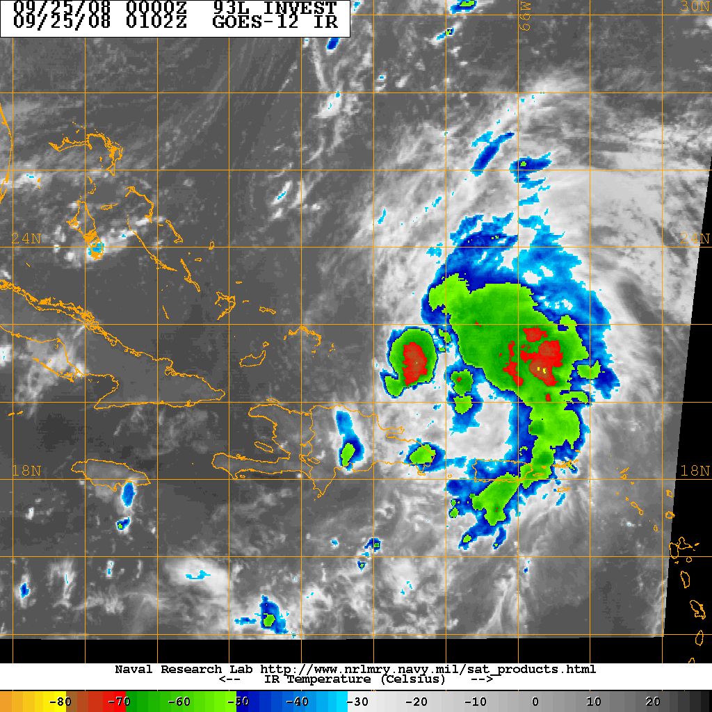
Fig. 2. GOES-12 infrared satellite image of TS Klye on Sept. 25, 2008 at 0102Z.
On our way towards AL94, we climbed up to 14,000 feet. As we were ferrying
through the mid-Atlantic, we experienced clear air turbulence (CAT) around
0118Z. It was an 8 m/s updraft followed by a 4 m/s downdraft. Luckily no one
onboard was hurt. The flight director said that he saw overshoot tops right
below us. That may have caused the CAT.
We did a downwind leg through AL94. The plan was to descend to 8,000 ft but
the FAA had blocked it because the Air Force Hurricane Hunters were also
sampling the system. We had to fly at 11,000 ft. We dropped 3 sondes on the
downwind leg and also created a radar analysis. The system was over the Gulf
Stream. There wasn't much convection in AL94. We landed in MacDill at 0455Z
(9/26).
Expendables and Transmitted operational data:
Total number of GPS sondes used: 9
Total number of GPS sondes processed (in-flight): 9
Total number of GPS sondes transmitted: 8
Total number of Tail Doppler Radar analyses transmitted: 2
Total number of Tail Doppler Radar SuperObs (SO) transmitted: 2
Problems :
The LF radar is still not working. We are still using a borrowed trackball
mouse from Jim Roles (AOC) since the HRD workstation trackball mouse is broken.
We experienced clear air turbulence in the middle of the Atlantic on our ferry
to sample AL94 off the coast of N.Carolina.
Shirley Murillo
Nov. 24, 2008
Mission Data :
Dropsonde plots
700 mb
850 mb
925 mb
1000 mb
surface
One second listing
NetCDF listing
Page last updated February 25, 2008
Return to Mission page.