Mission Summary
20080924I1 Aircraft 43RF
Disturbance 93 Tail Doppler Radar/Genesis Mission flight 2008
Scientific Crew (43RF)
| Lead Project Scientist | Rob Rogers |
| Radar Scientist | Sylvie Lorsolo |
| Dropsonde Scientist | Neal Dorst |
Engineers
Flight Crew (43RF)
| Pilots | Barry Choy
Carl Newman
Amelia Ebhart |
| Flight Director | Paul Flaherty |
| Navigators | Tim Gallagher
|
| Flt. Eng. | Joe Klippel
Dewie Floyd |
| Data Tech | Terry Lynch |
| Elec. Tech | Jeff Smith
Damon San Souci |

Mission Plan :
Conduct combination tail Doppler radar (TDR)/Genesis mission based on NOAA
tasking. Fly a west-east leg south of Hispañola, in an area where
deep convection was concentrated, in a broad, diffuse circulation centered
on the south coast of Hispañola. Depending on the distribution of
convection, either return back to the west but shifted about 50 nm south of
original leg, or circumnavigate the island. If widespread scatterers are
south of the island and nothing on the north, return back on the south side.
If scatterers are limited, circumnavigate. Fly entire pattern at 10,000 ft.
Drop about 6 sondes spaced evenly along pattern. Takeoff was planned for
0800 UTC for an approximately 8-h mission.
Mission Summary :
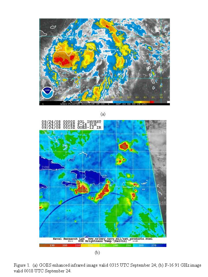
The system AL93 was a broad circulation located near Hispañola.
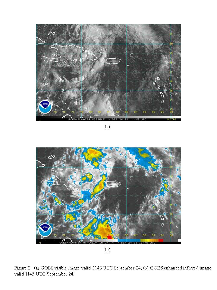
Several hours prior to takeoff, satellite imagery showed two areas of deep
convection and cold cloud tops south of the island
(Fig. 1). A few hours after takeoff, the
convection had dissipated with remnant clouds in the area
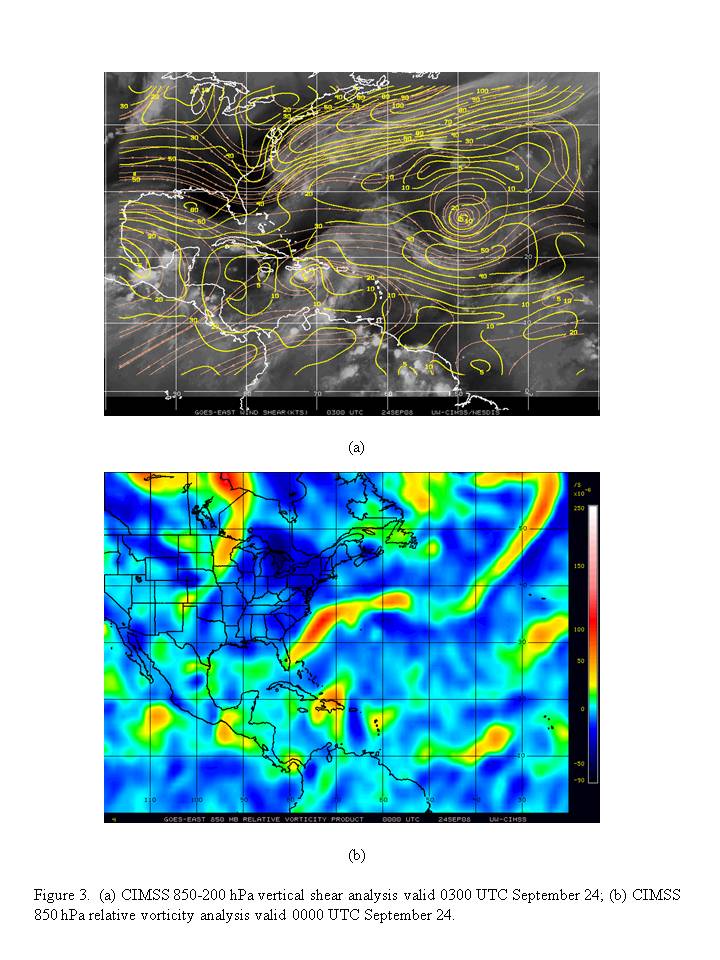
(Fig. 2). Vertical shear was low-to-moderate
over the system (i.e., 10-20 kt), but north of Hispañola it exceeded 30
kt (Fig. 3). High shear was also evident
over the northern Gulf of Mexico northwest of AL93. The 850-hPa vorticity
analysis also showed a notable vorticity center corresponding to AL93.
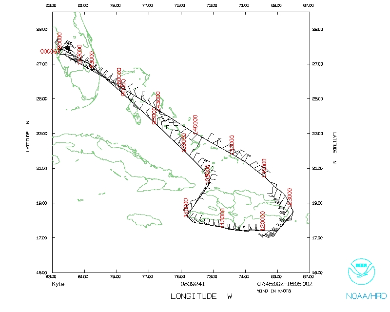
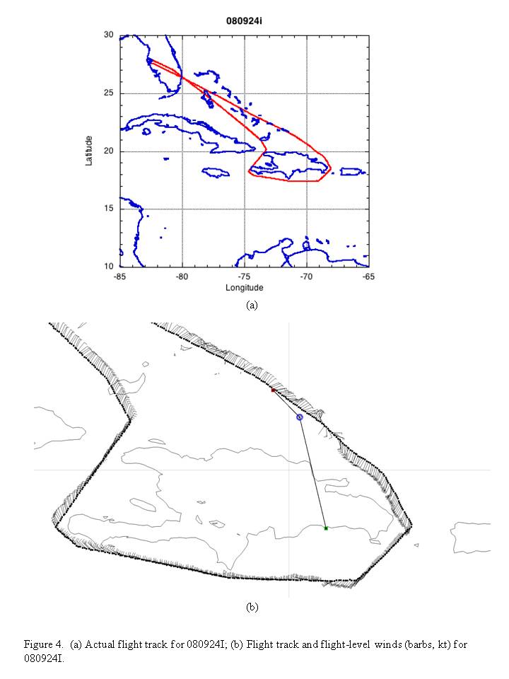
The resulting flight did circle Hispañola
(Fig. 4). The system remained disorganized,
with a very broad circulation and flight-level center over Hispañola or
just north of it. There was little or no convection on the south side of the
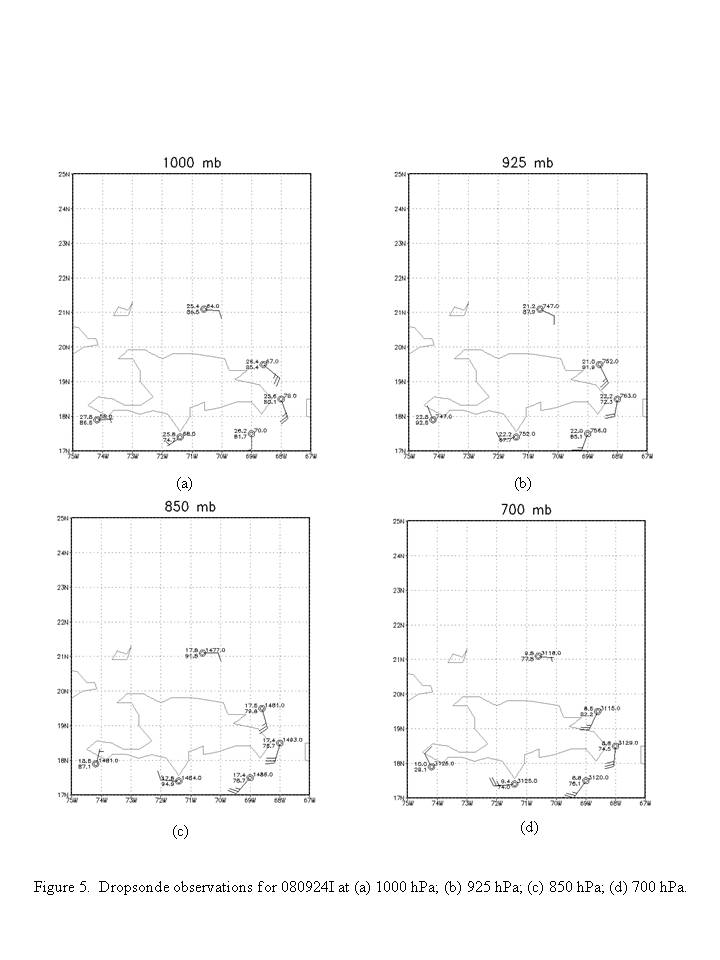
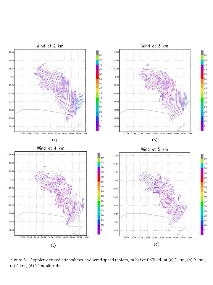
island. Dropsondes suggested that the circulation extended
only to about 900 hPa (Fig. 5). This was
also supported by Doppler radar analyses
(Fig. 6). These radar analyses showed a
broad circulation between about 3 and 5 km, possibly extending higher.
Embedded within the broad circulation was a smaller-scale circulation spanning
the same depth. Below 3 km there was lower-tropospheric divergence, based on
the wind vectors. There was evidence of dry air on the west side of the
circulation as well.
The experiment accomplished the overall goals, i.e., the collection of Doppler
data. Because the system was so disorganized, with such little coverage of
scatterers, reliable analyses were difficult to produce.
Problems :
The equipment functioned properly, but the disorganization of the system
hampered much success in the analyses. Two radar analyses were performed, but
only one produced anything meaningful. Six sondes were dropped, all of which
worked. Satcom was sporadic at times, so the transfer of analyses was slow.
Takeoff was at 0758 UTC September 24, landing was at 1600 UTC September 24.
Robert Rogers
Nov. 19, 2008
Mission Data :
Dropsonde plots
700 mb
850 mb
925 mb
1000 mb
surface
One second listing
NetCDF listing
Page last updated November 19, 2008
Return to Mission page.