Mission Summary
20080924H1 Aircraft 42RF
Mission ID: 06FFA Wave
Tropical Disturbance 93L (Kyle)
Ocean Winds flight 2008
Scientific Crew (42RF)
| Lead Project Scientist | Shirley Murillo
|
| Ocean Winds Lead Scientist | Paul Chang (NESDIS)
|
Radar Scientist
Dropsonde Scientist | Kathyrn Sellwood
|
| AXBT Scientist | Sim Aberson
|
| IWRAP Engineer | Zorana Jelenak (NESDIS)
|
| IWRAP crew | Joe Manus (NESDIS)
|
Flight Crew (42RF)
| Pilots | Mark Nelson
Scott Pierce
Al Girimonte |
| Flight Director | Barry Damiano |
| Navigator | Pete Siegel |
| Flt. Eng. | Greg Bast
Steve Wade |
| Data Tech | Jim Roles |
| Elec. Tech | Bill Olney
Joe Bosko
Mark Sweeny |
| Computer Scientist | Leonard Miller |
Mission Plan :
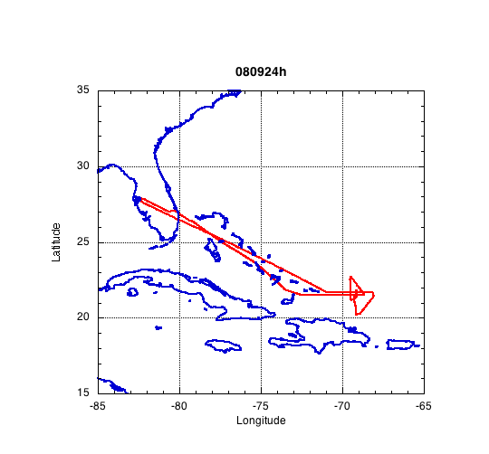
This was the second mission for N42RF into AL93. This research flight mission
was a combination Ocean Vector Winds/TDR (Tail Doppler Radar). The plan was
to fly a figure four pattern and sample the eastern side of the system where
most of the convection was present. We would deviate from the pattern to
sample areas that Paul Chang is interested in.
Mission Summary :
| Take off
| Landing
| MacDill AFB, FL | 19:15 UTC
| MacDill AFB, FL | 04:12 UTC
| |
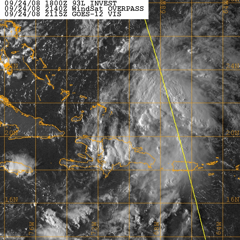
Fig1. GOES-12 Visible Satellite image of AL93 on Sept. 24, 2008 at 2115Z.
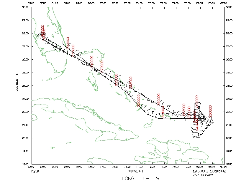
We took off from Tampa (MacDill AFB) at 1951 UTC on 24 September 2008. AL93
remains a board area of low pressure N of Hispanola. The system lacked a
well-defined surface circulation. Most of the convection was east of Puerto
Rico. Upper level winds were marginally favorable for development. There was
a trough in place, just west of the system. We were flying at 8,000 ft.
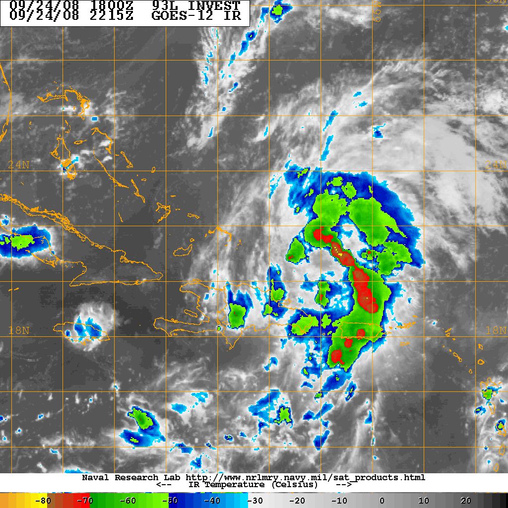
Fig. 2. GOES-12 infrared satellite image of AL93 on Sept. 24, 2008 at 2115Z.
Shortly after reaching the IP (2123z) we dropped the first sonde. There was
little convection in this part of the system. We head towards the west in our
flight pattern to search for a circulation center and complete our figure four
pattern by heading NW and then south. As we headed south we deviated from out
flight pattern to sample an area in the storm that Paul Chang was interested
in. Afterwards we continued south and then towards the NW to our westernmost
point. This area contained most of the convection (Figs.1 & 2). The system
did not organize much throughout the time we were out there. Below are two
satellite images of how the system looked like while we were sampling it. The
colder cloud tops were on the east side of the storm (Fig. 2). Six sondes were
dropped into the system and three radar analyses and super obs were created and
transmitted. We landed back in MacDill at 0412Z (9/25).
Expendables and Transmitted operational data:
Total number of GPS sondes used: 6
Total number of GPS sondes processed (in-flight): 6
Total number of GPS sondes transmitted: 6
Total number of Tail Doppler Radar analyses transmitted: 3
Total number of Tail Doppler Radar SuperObs (SO) transmitted: 3
Problems :
The LF radar is still not working. We are still using a borrowed trackball
mouse from Jim Roles (AOC) since the HRD workstation trackball mouse is broken.
Shirley Murillo
Nov. 24, 2008
Mission Data :
Dropsonde plots
700 mb
850 mb
925 mb
1000 mb
surface
One second listing
NetCDF listing
Page last updated February 25, 2008
Return to Mission page.