Mission Summary
20110907N1 Aircraft 49RF
Saharan Air Layer Interaction Mission Hurricane Katia
Aircraft Crew (49RF)
| Aircraft Commander | Jeff Hagen |
| Co-pilot | Nick Toth |
| Co-pilot | Ron Moyers |
| Flight Director | Rich Henning |
| ASPEN operator | Nick Morgan |
| Data Technician | Gabe Defeo |
| AVAPS Operator | Mike Mascaro |
| AVAPS Operator | Steven Paul |
Science Crew (49RF)
| Lead Scientist | Jason Dunion
|
Mission Plan :
NOAA 49RF will fly an HRD-tasked Saharan Air Layer Interaction mission around
Hurricane Katia. The G-IV will leave MacDill AFB, FL 1100 UTC and will recover
back at MacDill AFB, FL by 1900 UTC that day.
HURRICANE SALEX MISSION PLAN: Katia
Prepared by the
Hurricane Research Division
Aircraft: N49RF
Altitude: FL410-450
Proposed takeoff: 07/1100 Z
|
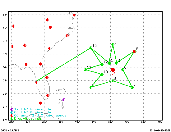
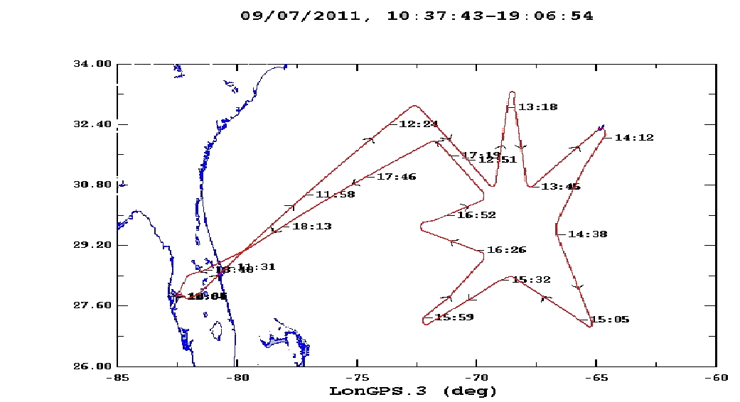
TURN LOCATIONS
|
| #
| LAT
| LON
| LEG
| TOTAL
| TIME
|
|
| deg min
| deg min
| naut mile
| naut mile
| hh:mm
| | 0 | MACDILL | 0. | 0. | 0:00
| | 1 | 32 57 | 72 32 | 601. | 601. | 1:32
| | 2 | 30 39 | 69 14 | 218. | 819. | 2:01
| | 3 | 33 27 | 68 32 | 172. | 991. | 2:25
| | 4 | 30 39 | 67 50 | 172. | 1163. | 2:48
| | 5 | 32 27 | 64 32 | 201. | 1364. | 3:15
| | 6 | 29 39 | 66 44 | 203. | 1567. | 3:43
| | 7 | 26 57 | 65 02 | 186. | 1752. | 4:08
| | 8 | 27 57 | 68 32 | 196. | 1948. | 4:34
| | 9 | 26 57 | 72 32 | 222. | 2170. | 5:05
| | 10 | 28 57 | 70 32 | 160. | 2330. | 5:26
| | 11 | 29 39 | 73 32 | 163. | 2493. | 5:48
| | 12 | 30 27 | 70 32 | 163. | 2656. | 6:11
| | 13 | 32 57 | 72 32 | 182. | 2838. | 6:35
| | 14 | MACDILL | 601. | 3439. | 8:07
| |
Mission Summary :
| Take off
| Landing
| MacDill AFB, FL | 11:11 UTC
| MacDill AFB, FL | 18:58 UTC
| |
During the flight diurnal cold rings as well as arc clouds were observed.
Transects across a large arc cloud SSW of the storm center were made which
produced a sequence of soundings behind the arc cloud which were dry adiabtic
up to 900 mb and with 70% surface relative humidity. 35 dropsondes were
released and transmitted.
Problems :
The G-IV tail doppler radar was not working on this mission.
Mission Data :
NetCDF file |
Flight Director log |
Dropsonde log
Page last updated September 06, 2011
Return to Mission page.