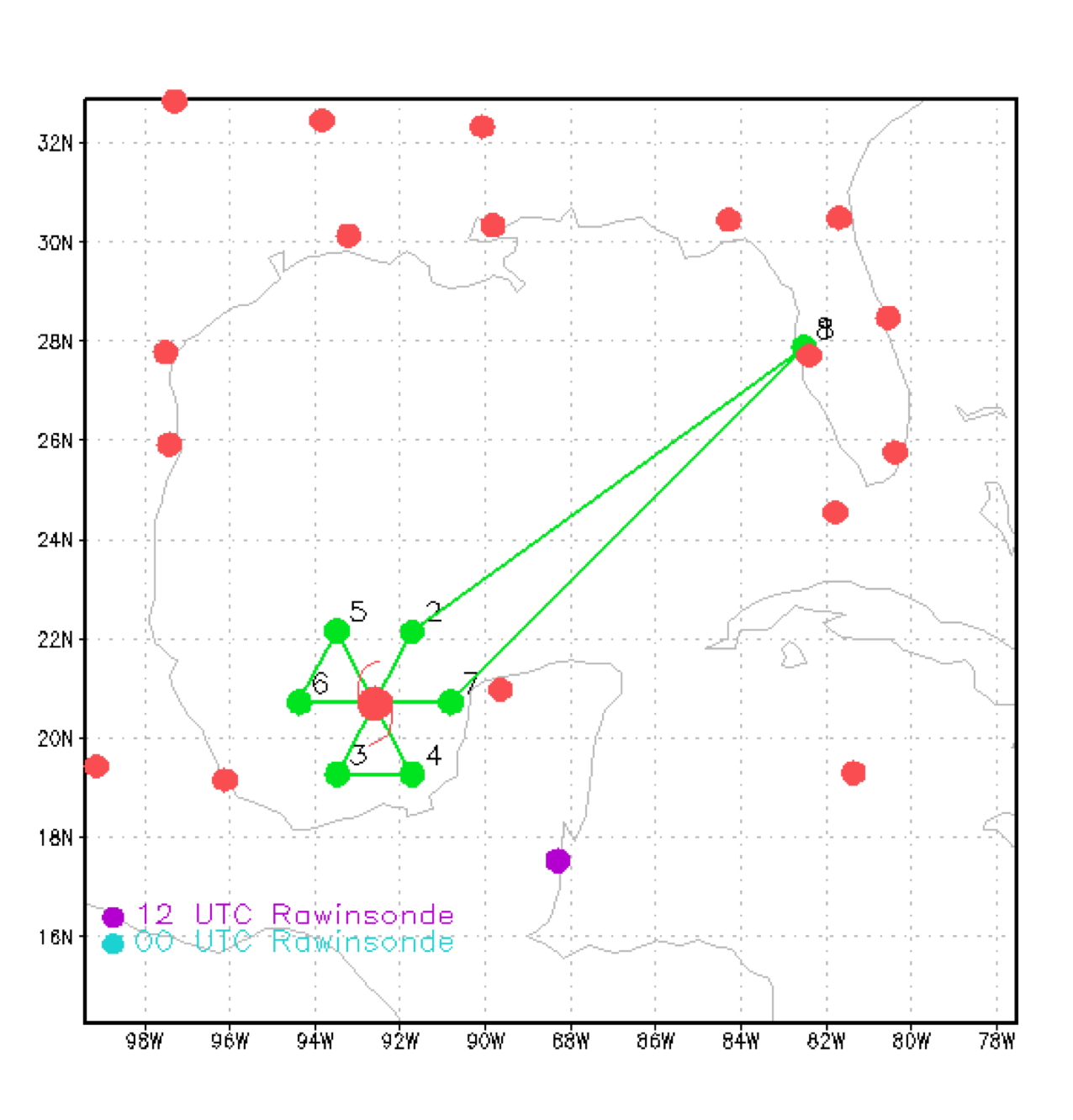
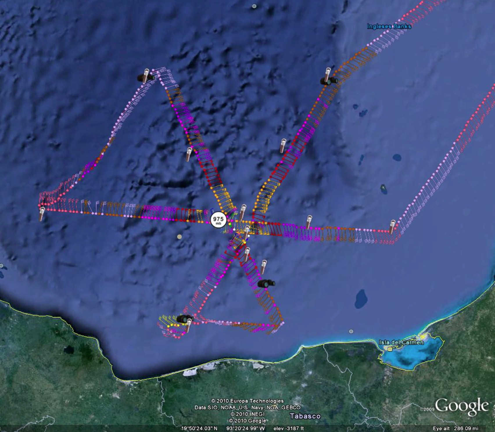
Figure 1. Proposed flight track for 20100916H1.
| Aircraft Commander | Carl Newman |
| Co-pilot | Justin Kibbey |
| Flight Engineer | Paul Darby |
| Flight Engineer | Joe Klippel |
| Navigator | Devin Brakob |
| Flight Director | Ian Sears |
| Flight Director | Paul Flaherty |
| Flight Director | Jess Williams |
| Data Technician | Joe Bosko |
| Engineer | Steven Paul |
| Engineer | Joe Greene |
| Lead Scientist | Rob Rogers |
| Radar Scientist | Sylvie Lorsolo |
| Dropsonde Scientist | Shirley Murillo |
| SFMR Scientist | Ivan Popstefanija (ProSensing) |
| SRA Scientist | Ed Walsh (ESRL) |
Mission Plan :
Conduct a rapid intensification (RI) mission into Hurricane Karl, which has emerged from the Yucatan peninsula after having retained its inner core during passage over land. Fly a butterfly pattern (Fig. 1), 100 nm legs, IP on the northeast side and end up on the east side. Release dropsondes at the turn points, midpoints, eyewall, and the first and third center passes. The system is rapidly getting better-organized, with the possibility for RI over the next 24 h. The mission will be coordinated with the DC-8, Global Hawk, and WB-57. The G-IV is also flying a star pattern.
Mission Summary :
| Take off | Landing
| MacDill AFB, FL
| 16/15:36 UTC
| MacDill AFB, FL
| 16/23:41 UTC
| | ||
 (a) |
 (b) |
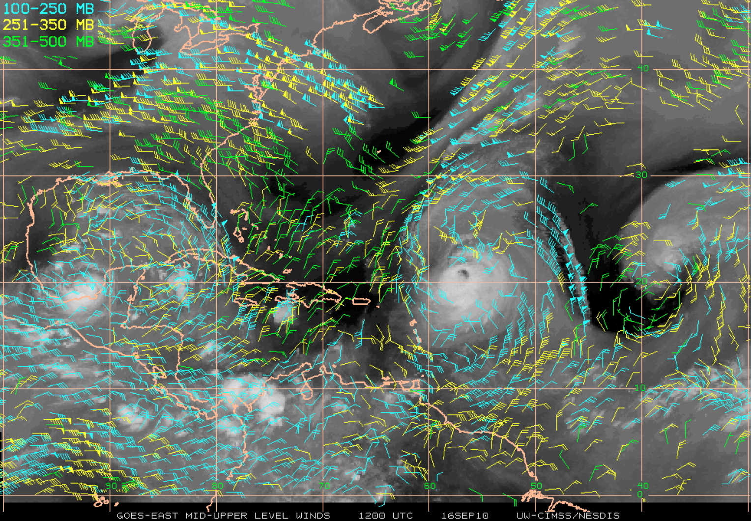
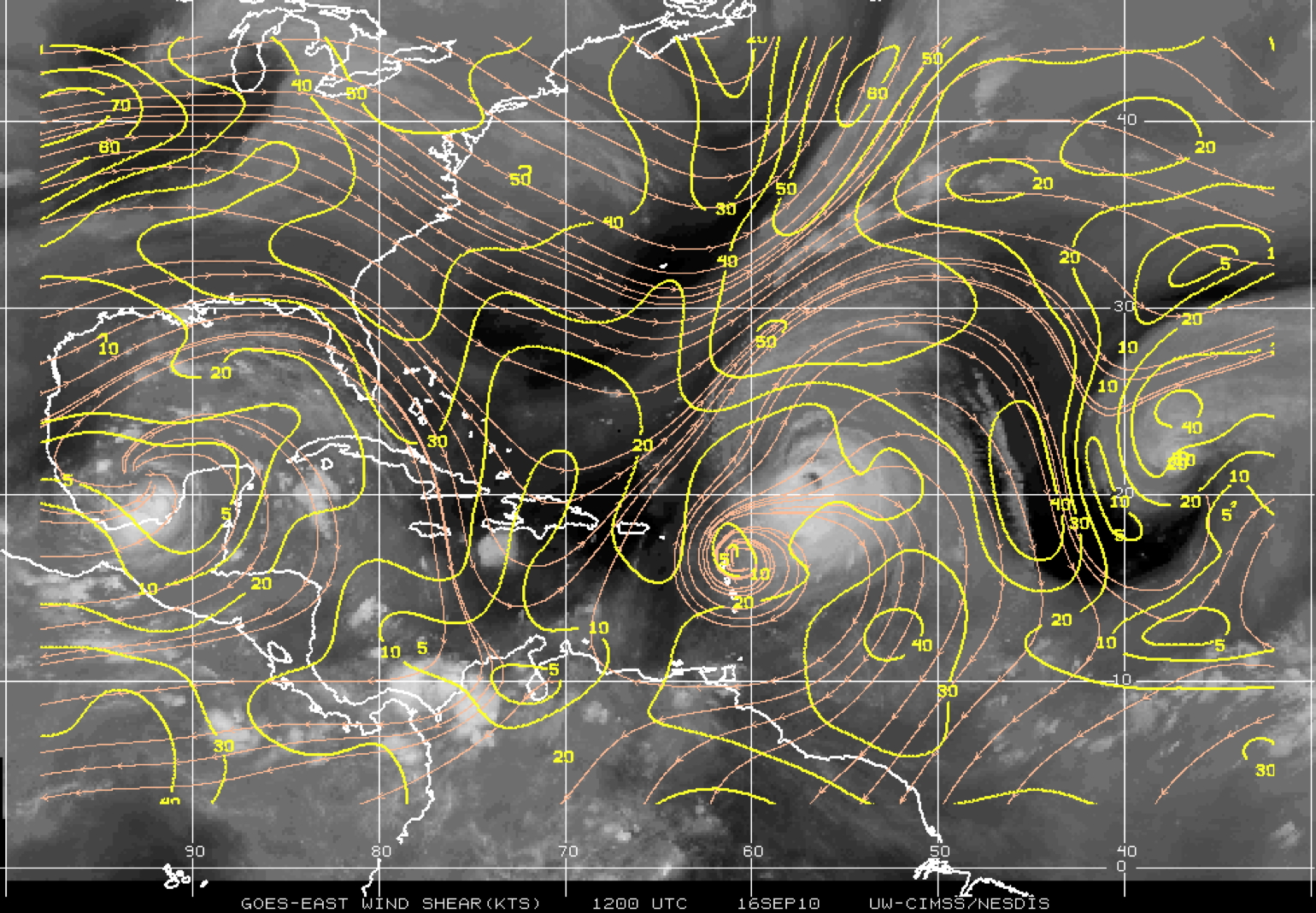
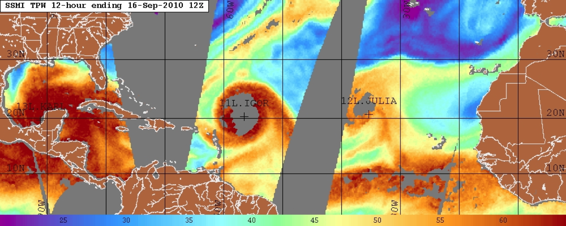
Karl was located within the southwestern region of a broad upper-level anticyclonic flow pattern (Fig. 2a) centered over the tip of the Yucatan peninsula. The deep-layer shear over the storm center was analyzed by CIMSS (Fig. 2b) to be quite weak, with a magnitude of < 5-10 kt. The lower troposphere was also very moist (Fig. 3), as indicated by total precipitable water values in excess of 60 mm in most of the Gulf of Mexico and Bay of Campeche, except for an area off the coast of Texas and northern Mexico. Combined with sea-surface temperatures in excess of 29C (not shown), the likelihood of rapid intensification was high. Indeed, the SHIPS RI index (not shown) indicated the potential of RI exceeding the 30 kt threshold was 4.3 times average, which is a very high value.
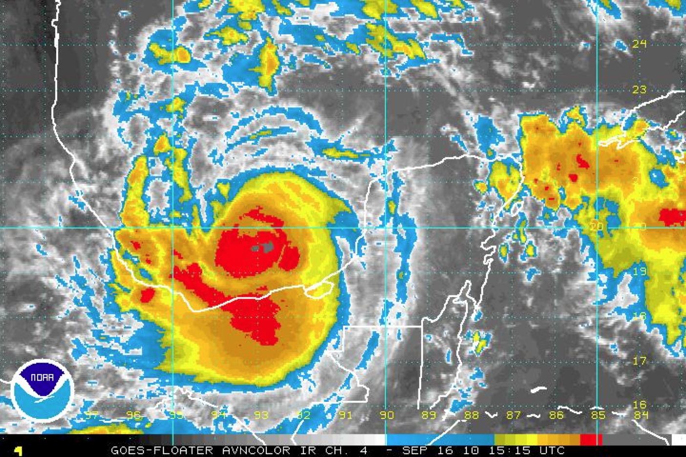
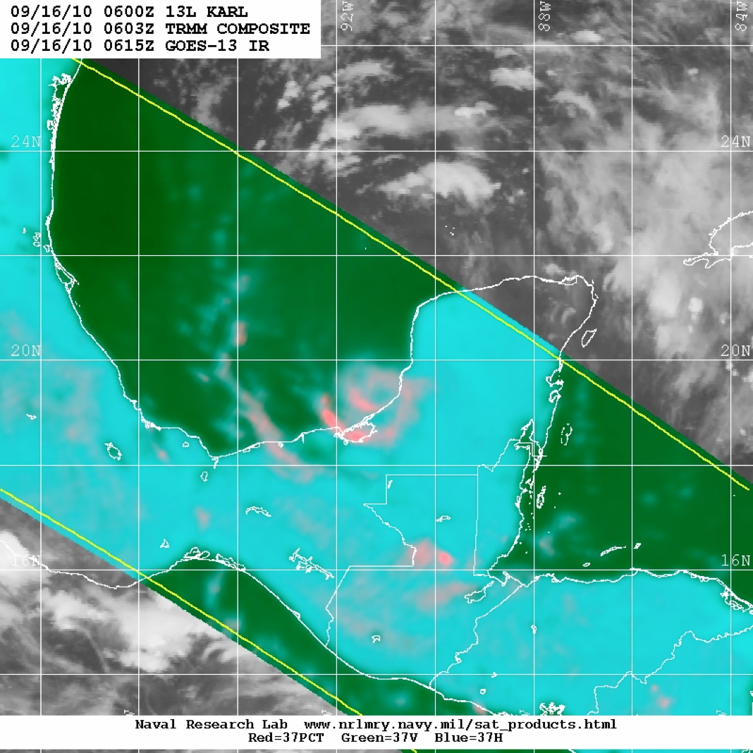
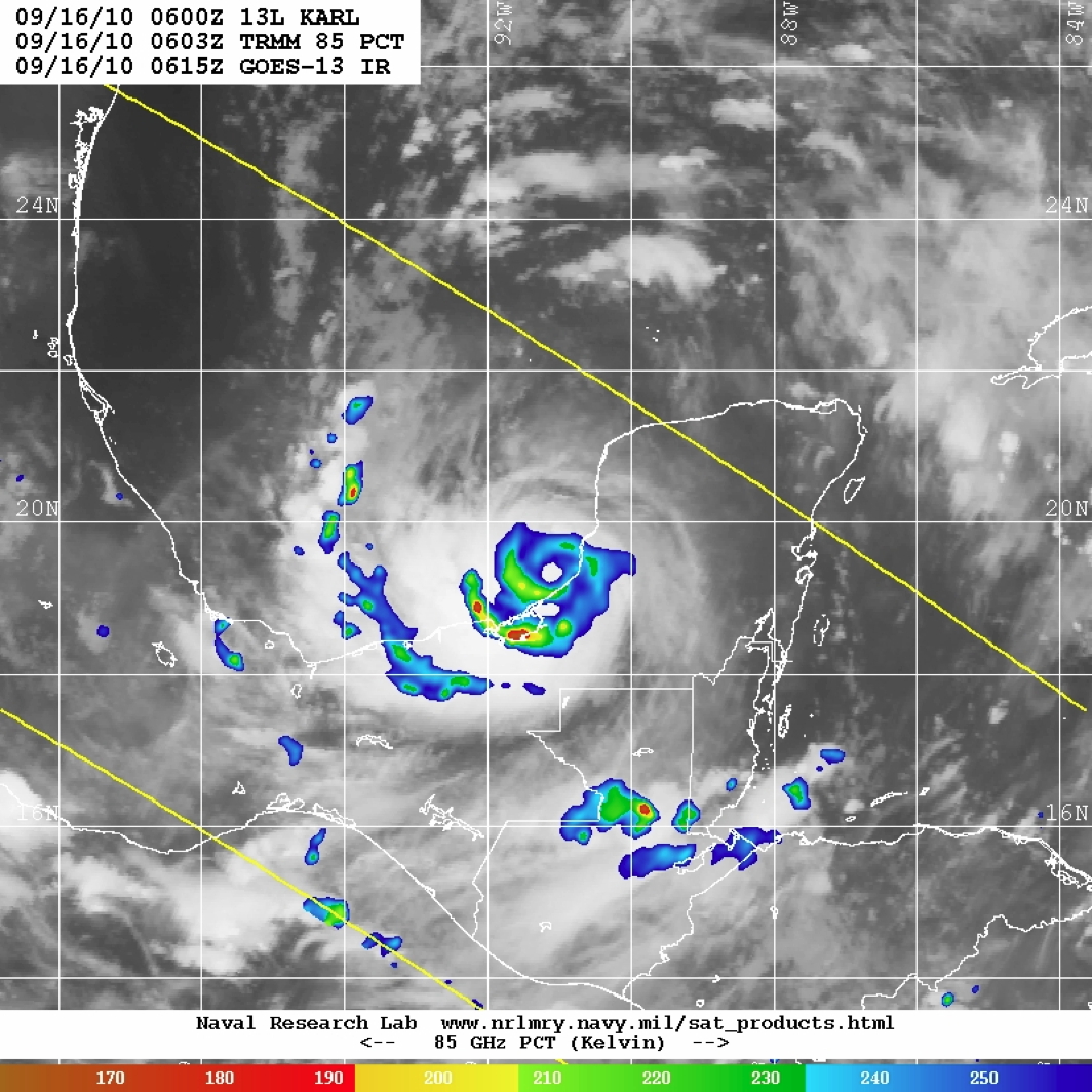
Visible and infrared satellite imagery taken at the time of take-off (Fig. 4) clear show the center of circulation and suggest the possible development of an eye. This eye is even more evident in 37- and 85-GHz microwave imagery (Fig. 5). The eye is clear in the microwave even 9 h prior to the time of the visible and infrared imagery.
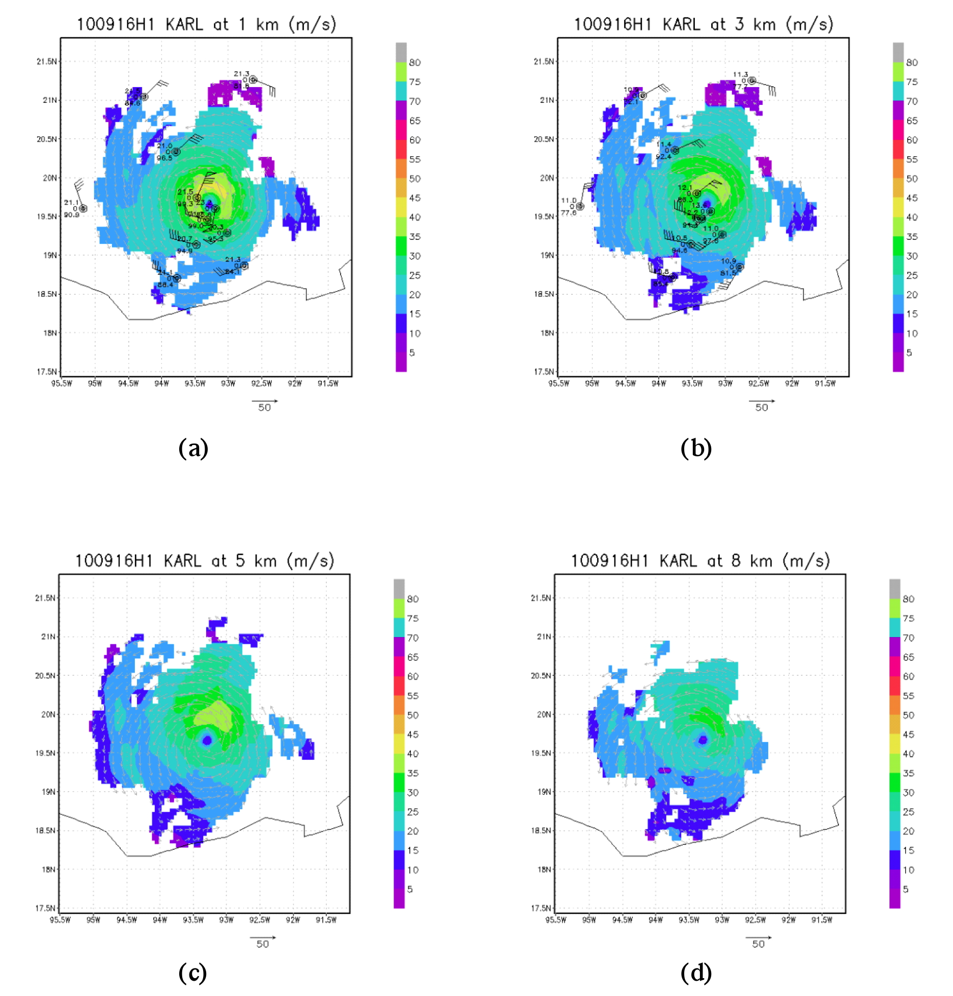
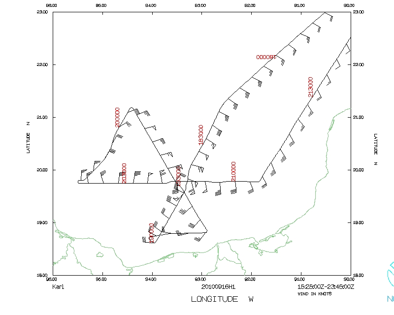
Takeoff was at 1537 UTC. The pattern was generally flown as planned, except the crew had to cut short legs on the southwest and southeast sides of the storm due to proximity to land(Fig. 6). The storm was intensifying during the flight. The central pressure during the first pass was 978 hPa measured by a dropsonde and it was 975 hPa on the third pass, 2 h later. Peak flight-level winds were 85 kt on the northwest side, while peak SFMR winds of 70 kt were located on both the west and east sides of the storm. There was not too much turbulence, but there were some bumps around convective cells in the outer band on the northeast side of the storm in the central Gulf (cf. Fig. 4a). The storm was small, with an eye diameter of about 30 nm. Doppler composites from the flight (Fig. 7) show that the wind was maximized on the north side of the storm at 1, 3, and 5 km altitude, and it rotated slightly to the northeast side of the storm by 8 km altitude. Peak winds at 1 km exceed 40 m/s. There is some indication of relatively drier air at 1- and 3-km altitude at the periphery of the storm, where relative humidity values are about 80% or less compared with humidity values of 95% or greater in the inner core. Landing was at 2342 UTC.
 (a) |
 (b) |
Mission Evaluation :
The mission did accomplish the objectives quite well. There were three Doppler analyses performed, all of which performed well. Since the eye was small, analyses were able to capture all of the eyewall in each swath, which showed 40-45 m/s winds at 0.5 km. The sondes generally worked well, though two were not transmitted.
 (a) |
 (b) |
Problems :
There were no major problems with this flight, except with the lower fuselage at the beginning of the mission, which appeared to be reading high (50-60 dBZ at times). The system was reset after the first pass, which seemed to correct the problem. A total of 20 GPS sondes were dropped, and 3 radar analyses were transmitted.
Rob Rogers
Sept. 21, 2010
 Flight track |
 Temperature and Moisture |
 Wind and Atlitude |
Page last updated September 22, 2010
Return to Mission page.