| Aircraft Commander | Mark Nelson |
| Co-pilot | Mark Sweeney |
| Co-pilot | Chris Kerns |
| Navigator | Pete Siegel |
| Flight Engineer | Joe Klippel |
| Flight Engineer | Chris LaLonde |
| Flight Director | Barry Damiano |
| Flight Director | Rich Henning |
| System Engineer | Jim Roles |
| Data Technician | Joe Bosko |
| Data Technician | Terry Lynch |
| Data Technician | Charles Lynch |
| LPS | Rob Rogers |
| Dropsondes/AXBT | Kathryn Sellwood |
| Radar | Andy Hazelton (FSU) |
| Observer | Nikki Perrini (FSU) |
| Observer | Kerryn Schneider (PUMA) |
| Observer | Sean Davis (ESRL) |
Mission Plan :
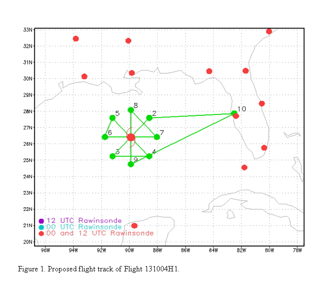
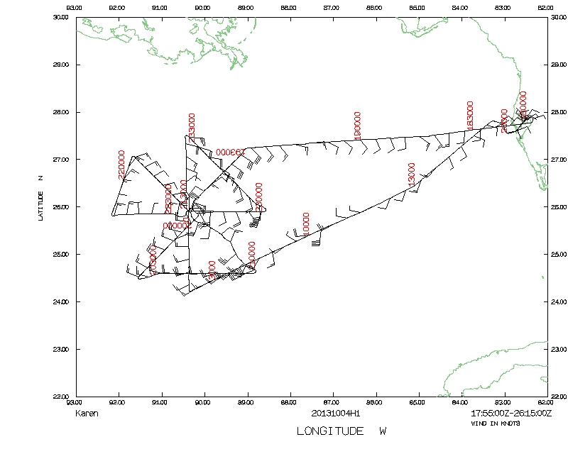
Conduct an EMC-tasked TDR mission into TS Karen, which is tracking north-northwest in the central Gulf of Mexico. Fly a rotating Figure-4 (Fig. 1), initial point on the northeast side, and final point on the south. Fly 100 nm legs, drop sondes at all turn and mid points, plus all center passes. Drop AXBT's in combination with the sondes at all turn points and the first center pass. Fly at 8000 ft altitude.
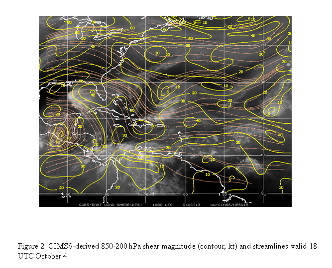
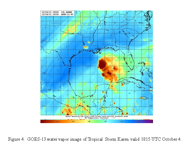
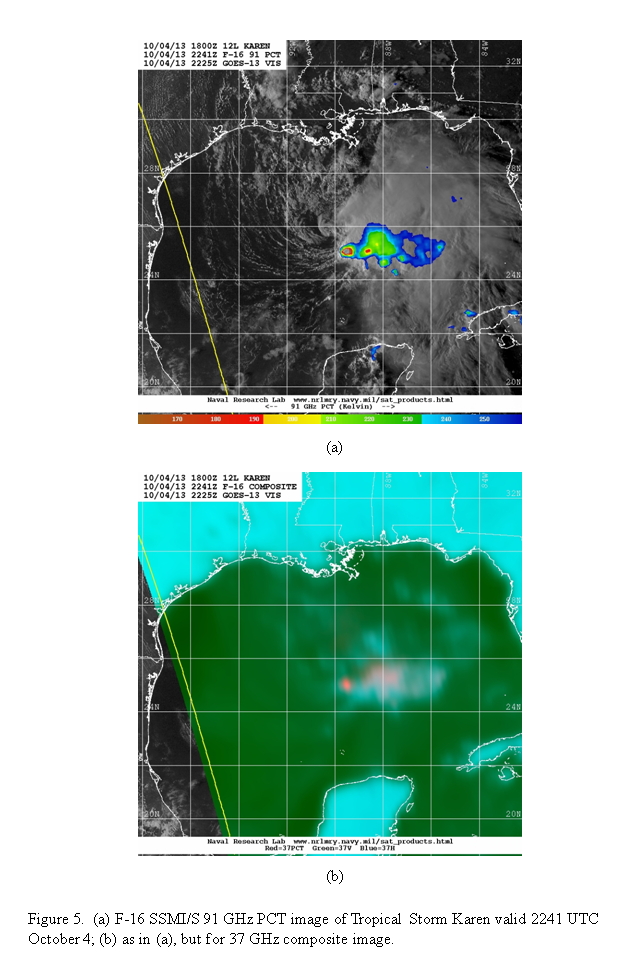
The storm has weakened slightly from the previous day, with convection well-displaced from the center on the east side of what is an exposed low-level circulation (Fig. 2). Infrared imagery shows relatively cold cold tops, but the sharp gradient of cloud top temperatures on the west side of the shield indicates shear impacting the system from the west. This is confirmed by CIMSS analyses (Fig. 3), which shows shear of ~20 kt over Karen. Water vapor imagery (Fig. 4) shows that the extremely dry air in the mid- and upper-troposphere is closer to Karen, and is likely impacting the inner-core and the convective structure and evolution. Microwave imagery (Fig. 5) shows that ice scattering indicative of deep convection and heavy precipitation, confined to the southeastern portion of the circulation, is more limited in extent than it was on the previous day.

|
|
Mission Summary :
| Take off | Landing
| MacDill AFB, FL | 06:11 UTC
| MacDill AFB, FL | 14:07 UTC
| | ||
|
|
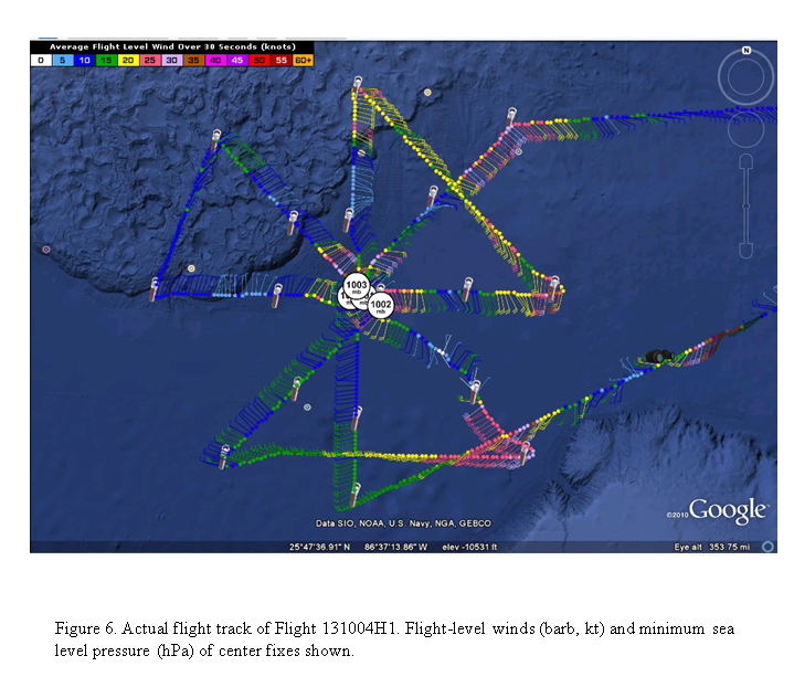
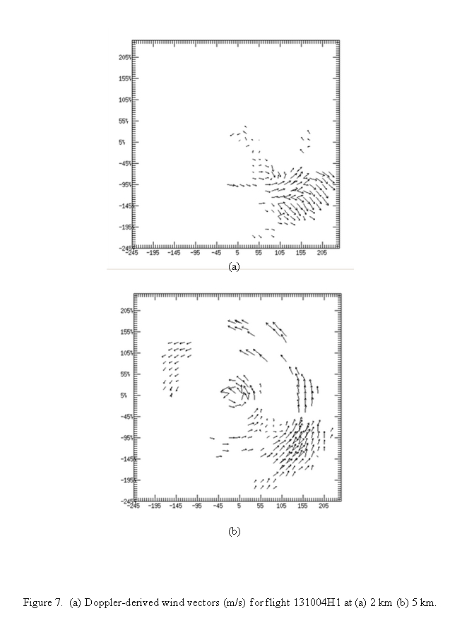
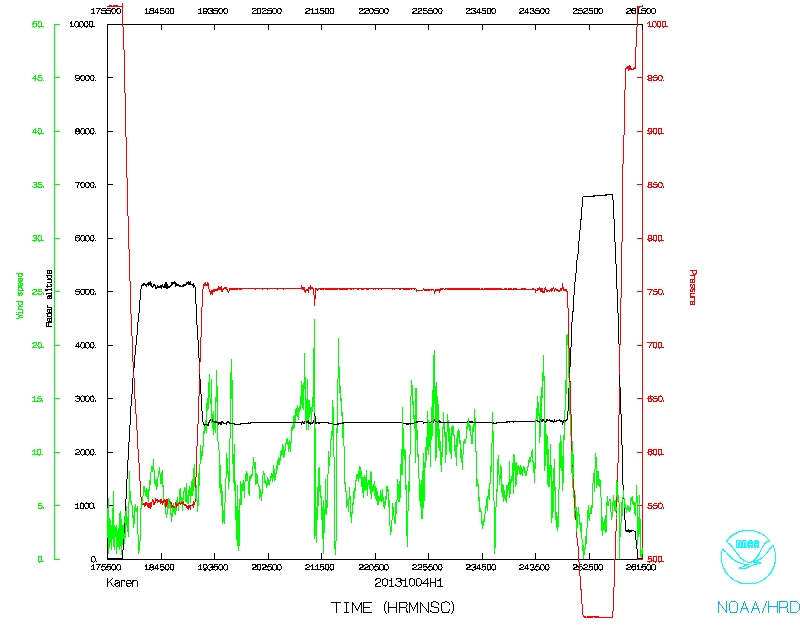
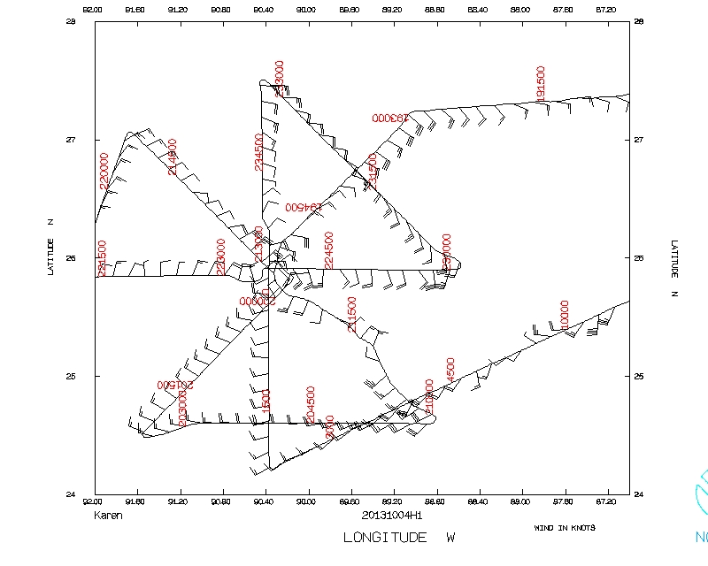
The mission was flown as planned (Fig. 6). We completed four radar analyses, and dropped the sondes and AXBT's as planned. The storm is looking less well-defined than the previous day, with MSLP about 1002-1003 hPa, about 3-4 hPa higher than the previous day. Flight-level winds showed a complicated structure, with wind on the inbound northeast leg turning to northeasterly for a portion of the leg. The drop on the first center fix showed winds from the northeast at 50 kt. It's possible another center was trying to form on the southeast side, where the deepest convection was located. This is indicated in the flight-level winds in Fig. 6. The storm was very shallow now, with limited coverage and chaotic winds at 5-km altitude (Fig. 7). A complicated flow structure in the southeast part of the storm is also indicated at 5-km atltitude, with tangential wind at some radii and pronounced outward flow radially outward. Vertical cross sections through this feature (Fig. 8) show a deep convective core, deep updraft, anticyclonic flow between 3 and 6 km altitude radially inward from the updraft and cyclonic flow outward - indicating a vorticity maximum at that interface - and shallow secondary circulation consisting of strong inflow in the lower troposphere (3-5 km altitude) and strong outflow immediately above (5-10 km). The strongest SFMR winds were about 50-55 kt, on the southeast side.
|

|
Mission Evaluation:
The mission objectives were achieved. All drops worked, as did all AXBT's except for one. Radar analyses were completed and transmitted to EMC. We did extend the final radar leg for a portion of our downwind leg to sample the convection on the southeast side a second time.
Problems :
There were no problems with this flight, other than the one AXBT failure. A total of 20 GPS sondes and 9 AXBT's were dropped.
Rob Rogers
Oct. 18, 2013
 Flight track |
 Temperature and Moisture |
 Wind and Atlitude |
 Flight track detail |