Mission Summary
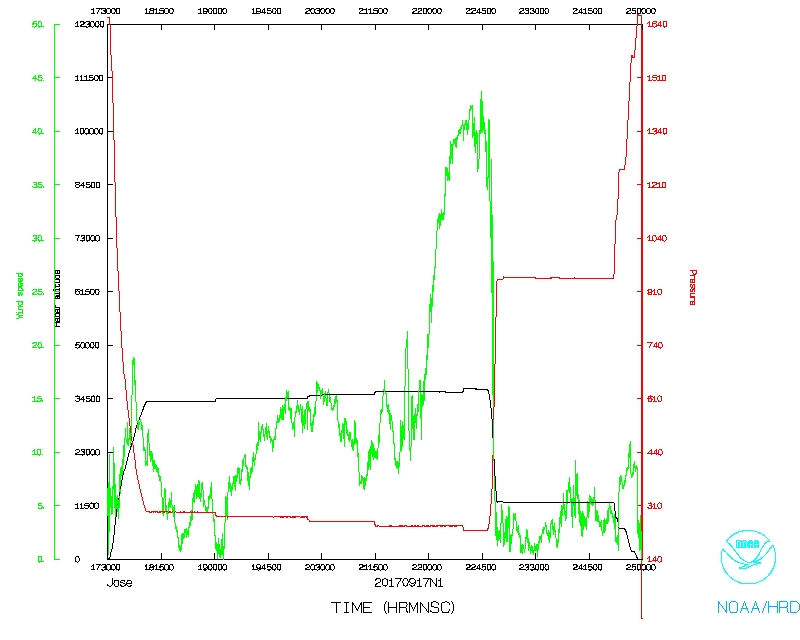
20170917N1 Aircraft 49RF
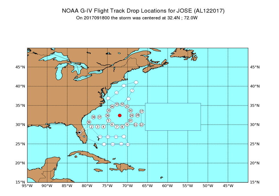
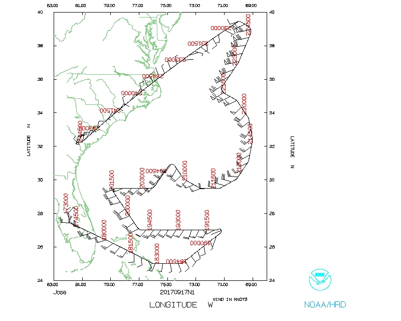
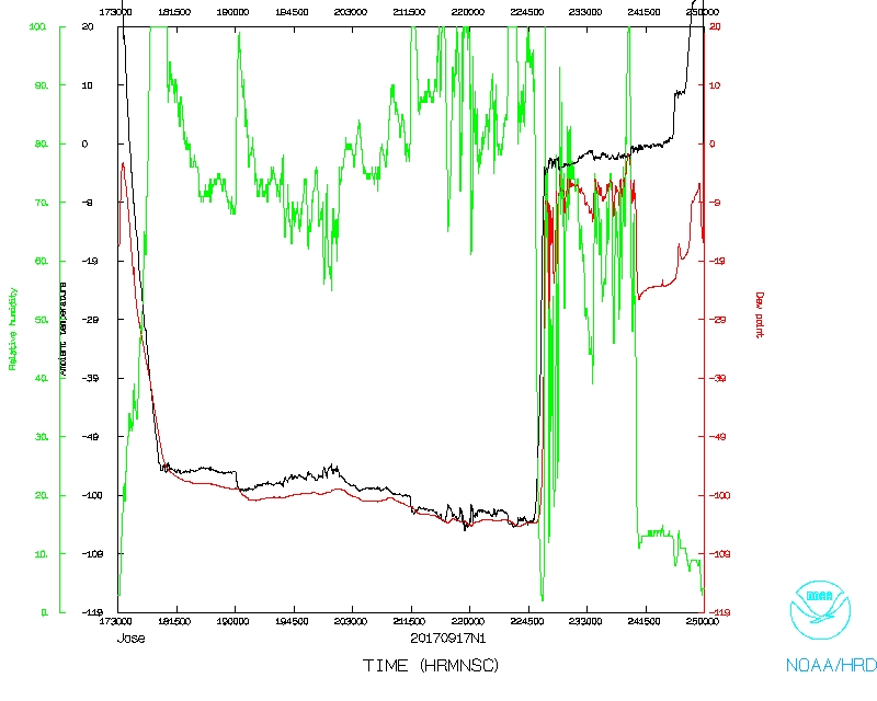
Hurricane Jose (AL12)
Synoptic Surveillance
Aircraft Crew (49RF)
| Aircraft Commander | Doug MacIntyre
|
| Co-pilot | Fritzler
|
| Co-pilot | Tanner Sims
|
| Flight Director | Rich Henning
|
| Flight Director | Brian Belson
|
| Data Technician | Gabe DeFeo
|
| Dropsonde Operator | Underwood
|
| Dropsonde Operator | Paul
|
| Syystem Engineer | Joe Greene
|
Mission Plan :
NOAA 49RF (N49) will fly a synoptic surveillance mission around Hurricane Jose.
HURRICANE SYNOPTIC SURVEILLANCE MISSION PLAN: JOSE
Prepared by the National Hurricane Center
September 06, 2017 12:57 PM
Aircraft: N49RF
Proposed takeoff: 17/1730Z
|
|
DROP LOCATION TABLE
|
| #
| LAT
| LON
|
|
| degs
| degs
|
| Take off | 27.960 | -81.950
|
| 1 | 25.000 | -76.000
|
| 2 | 25.000 | -74.000
|
| 3 | 25.000 | -72.000
|
| 4 | 25.000 | -70.000
|
| 5 | 27.000 | -71.000
|
| 6 | 27.000 | -73.000
|
| 7 | 27.000 | -75.000
|
| 8 | 27.000 | -77.000
|
| 9 | 29.500 | -79.000
|
| 10 | 29.500 | -77.500
|
| 11 | 29.500 | -76.000
|
| 12 | 31.100 | -74.700
|
| 13 | 30.057 | -73.868
|
| 14 | 29.478 | -72.667
|
| 15 | 29.478 | -71.333
|
| 16 | 30.057 | -70.132
|
| 17 | 31.100 | -69.300
|
| 18 | 30.000 | -68.000
|
| 19 | 30.000 | -66.500
|
| 20 | 33.500 | -66.500
|
| 21 | 32.500 | -67.500
|
| 22 | 32.400 | -69.003
|
| 23 | 33.700 | -69.300
|
| 24 | 34.743 | -70.132
|
| 25 | 35.322 | -71.333
|
| 26 | 37.000 | -70.000
|
| 27 | 39.000 | -69.000
|
| 28 | 41.000 | -68.000
|
| 29 | 40.000 | -71.000
|
| 30 | 38.000 | -73.000
|
| 31 | 37.000 | -75.000
|
| 32 | 35.322 | -72.667
|
| 33 | 34.743 | -73.868
|
| 34 | 33.700 | -74.700
|
| 35 | 32.400 | -74.997
|
| 36 | 32.000 | -77.000
|
| 37 | 32.000 | -78.500
|
| 38 | 30.653 | -79.650
|
| Land | 27.960 | -81.950
|
Mission Summary :
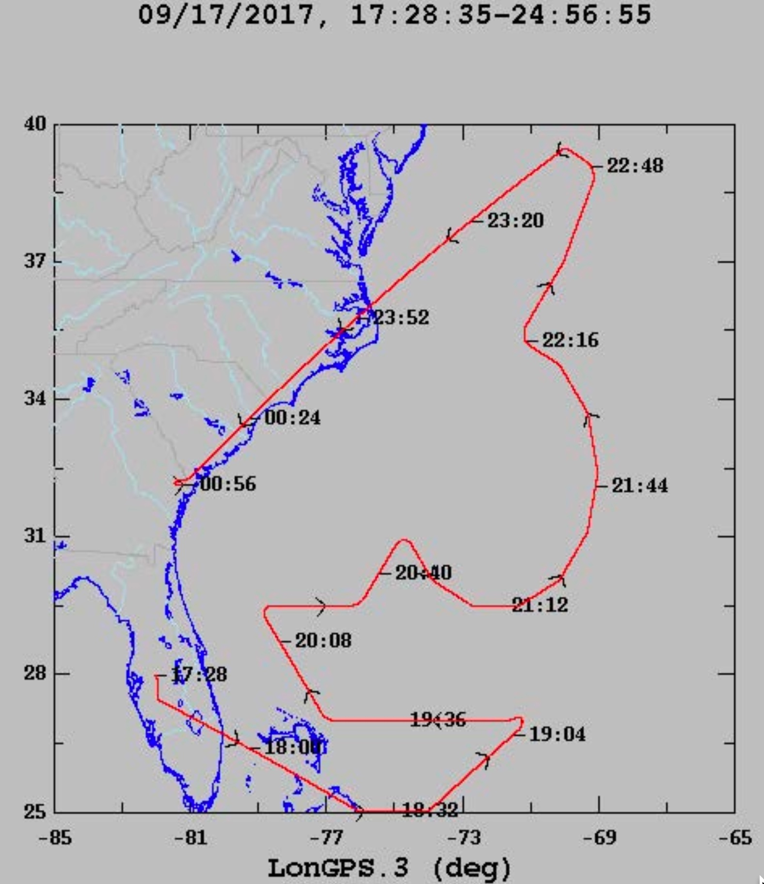
| Take off
| Landing
| Linder-Lakeland, FL
| 17:32 UTC
| Savannah, GA
| 00:56 UTC
| |
21 sondes deployed, 21 sent.
Problems :
This flight was scrubbed after drop point #27 due to
mechanical problems
Mission Data :
Flight Director's log |
serial data |
Flight Director's manifest |
NetCDF data |
Page last updated Jan. 2, 2018
Return to Mission page.