| Aircraft Commander | Justin Kibby |
| Co-pilot | Robert Mitchell |
| Co-pilot | John Rossi |
| Co-pilot | Jeff Newnam |
| Co-pilot | Jeff Carrion |
| Navigator | Sam Urato |
| Navigator | Pete Freeman |
| Flight Engineer | Paul Darby |
| Flight Engineer | Chris Lalonde |
| Flight Director | Mike Holmes |
| System Engineer | Jeff Greene |
| Data Technician | Mike Mascaro |
| AVAPS Operator | Nick Underwood |
| LPS | Heather Holbach | HRD |
| Dropsonde | Kathryn Sellwood | HRD |
| Radar | Hui Christopherson | HRD |
| LPS | Paul Chang | NESDIS |
| Observer | Zorana Jelenek | NESDIS |
| Radar | Joe and Nancy Griffin | HRD |
Mission Plan :
This is an NHC-tasked fix mission for the 1130Z and 1730Z center fixes of Tropical Storm Isaac. The plan is to begin with a N-S leg then NE-fix-NW leg with 105 nm legs. We will then fix as many other times as possible prior to needing to depart for our return to Lakeland. Because of our need to recover in Lakeland we will be unable to meet the 1730Z fix requirement.
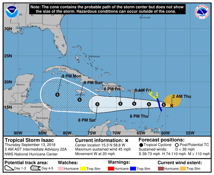
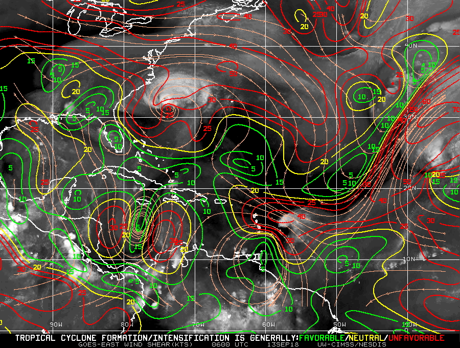
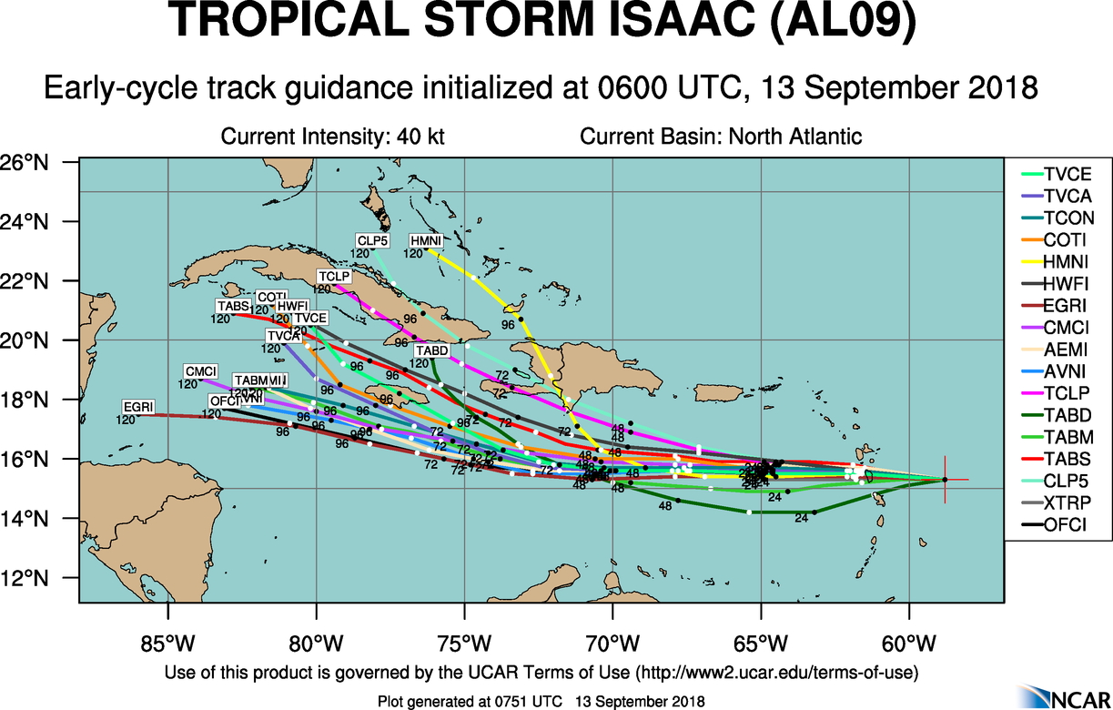
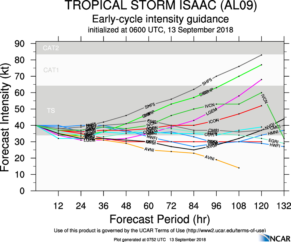
Isaac is currently a 40 kt tropical storm as of the 09Z NHC advisory. It has a minimum central pressure of 1006 mb and is centered at 15.4°N 59.7°W and is approaching the Lesser Antilles. The official NHC forecast track from 2AM AST is for Isaac to continue its westward motion through the Caribbean as a tropical storm (Fig. 1). Isaac is still battling strong vertical wind shear (Fig. 2) and continues to outrun any deep convection that develops near the core (Fig. 3). There is still quite a bit of spread in the model forecast track (Fig. 4) and intensity (Fig. 5) guidance in the 2-5 day range. Our planned flight level is 5000 ft pressure altitude, but we may need to go to 6000 ft pressure altitude because of terrain on Dominica.
Mission Summary :
| Take off | Landing
| St. Croix, USVI
| 10:25 UTC
| Linder-Lakeland, FL
| 18:37 UTC
| Penetrations
| 3
| | ||||
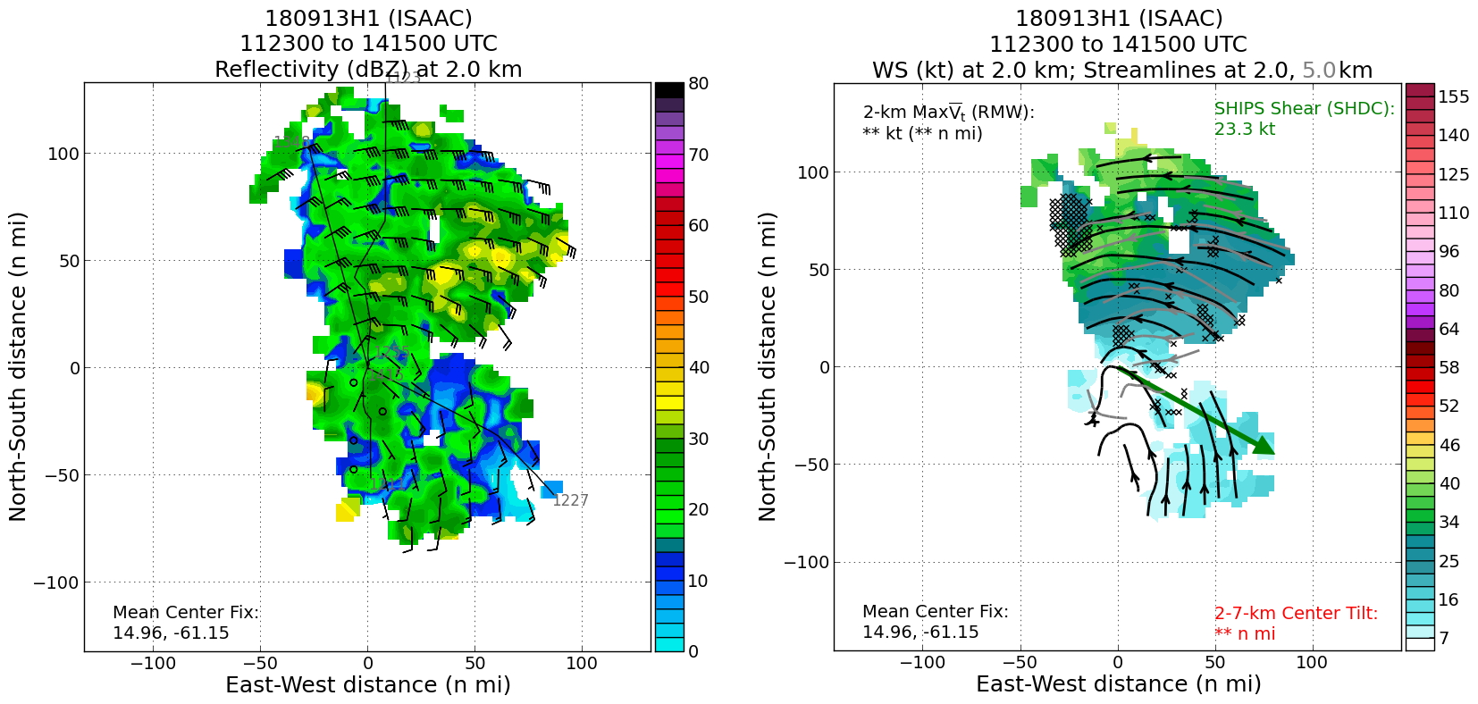
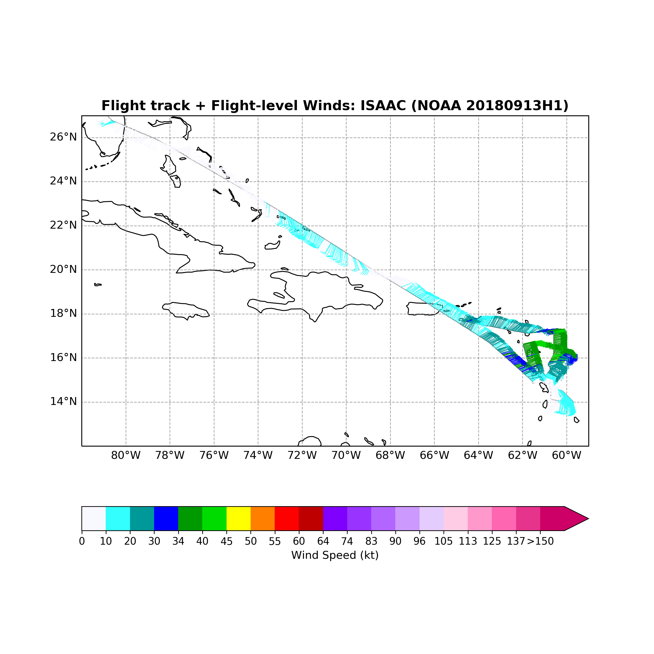
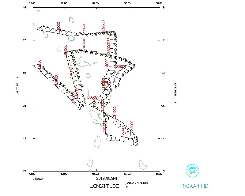
We completed 3 center fixes of TS Isaac for NHC. The actual flight track is shown in Figure 6. The first fix was based on flight level winds and the last two fixes were locations given to us by NHC. Isaac's center looked very disorganized on visible imagery and began drying out as the flight progressed making the visible imagery less useful than yesterday's mission for helping to fix the center. We observed maximum flight level winds of 44 kts and SFMR winds of 39 kts with a minimum central pressure of 1006 mb (Fig. 7).
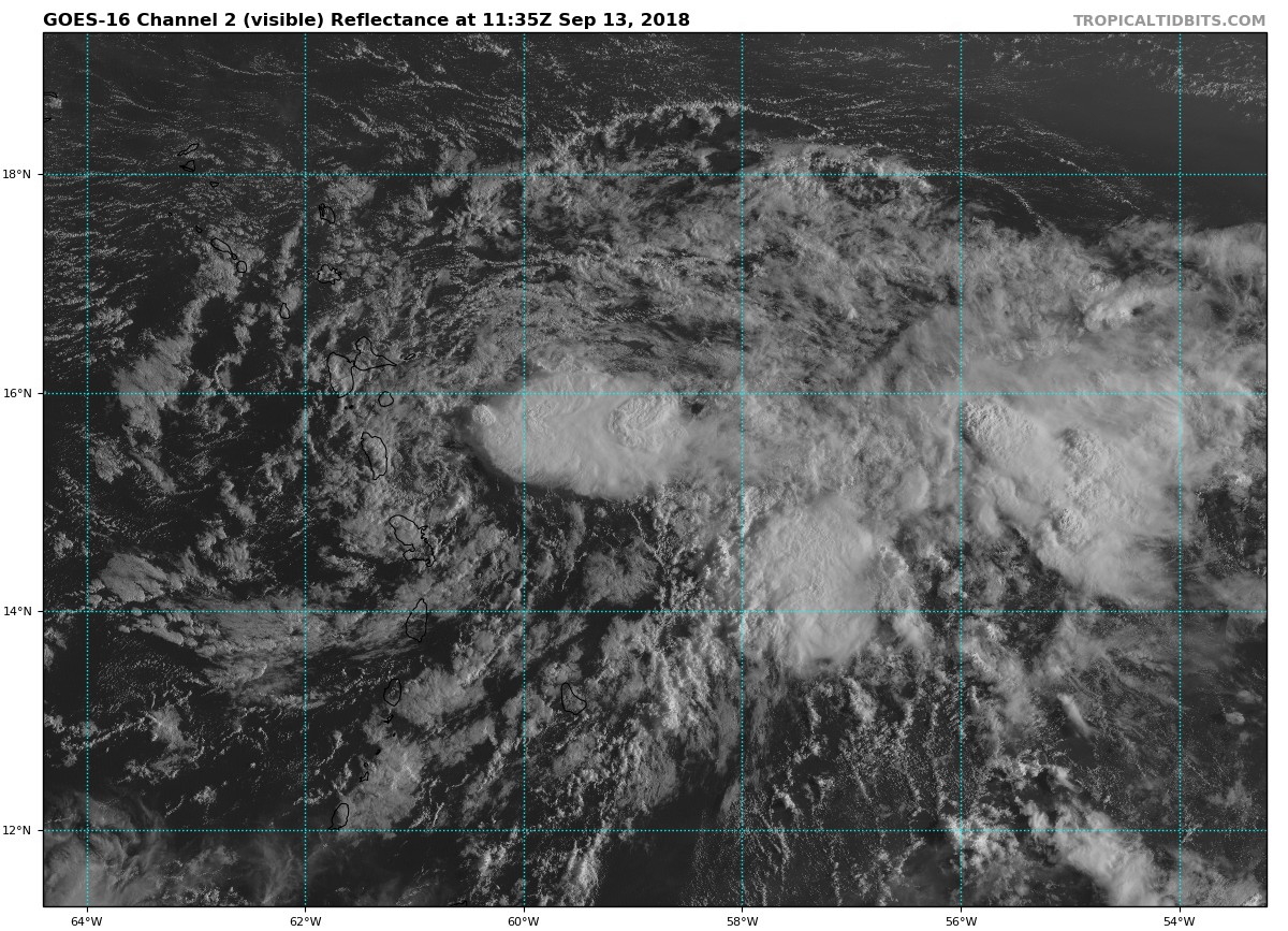 Figure 3: GOES-16 visible imagery from 1135Z on September 13, 2018. Image courtesy: www.tropicaltidbits.com |
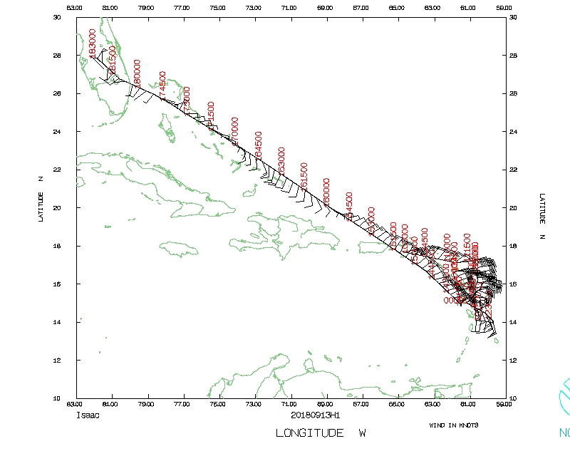
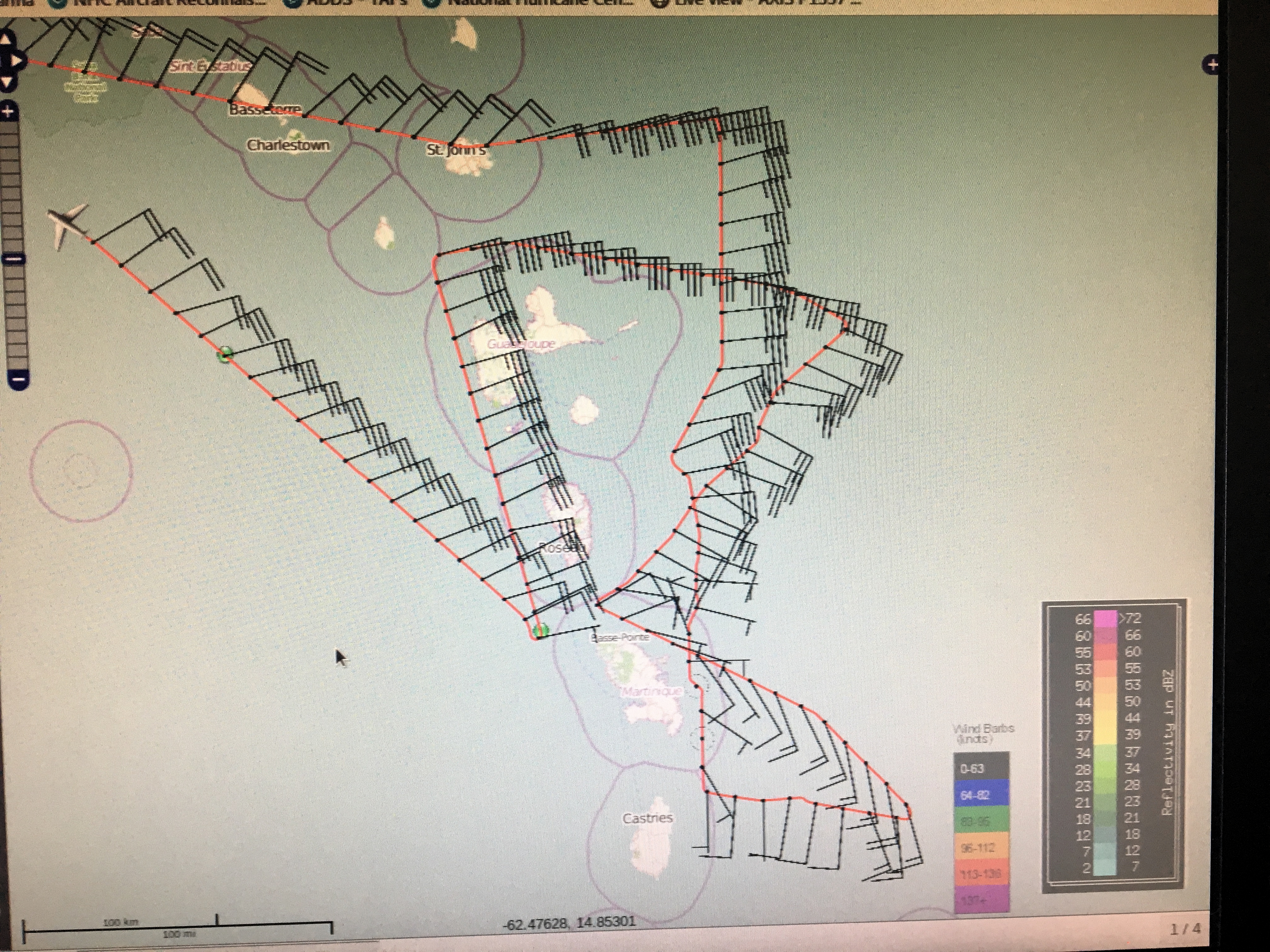 Figure 6: Actual flight track for mission 20180913H1. |
Mission Evaluation:
We were able to provide NHC with the 1130Z fix and two additional fixes before having to depart Isaac to return to Lakeland based on fuel requirements. Unfortunately, we were not able to satisfy the 1730Z fix requirement. We released dropsondes at the endpoints and centers and one midpoint on the first leg for a total of 9 dropsondes (8 NWS, 1 HRD). We were also able to collect TDR data, primarily on the north and east sides of the storm (Fig. 8)
Problems :
The power supply for the C-band IWRAP was still not operating because of a faulty power supply. We also were still unable to transmit TDR data to EMC because the HWRF ensembles would have run on Isaac instead of Florence.
Heather Holbach
Oct. 5, 2018
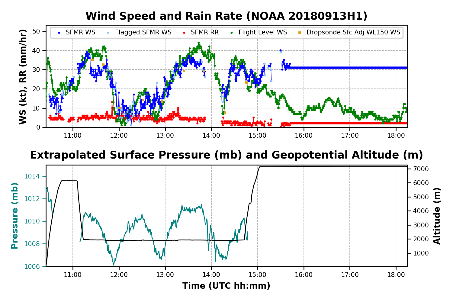
Timeseries wind, SFMR wind, rain rate, altitude and pressure plots |
Flight-level wind plot |
 Flight track |
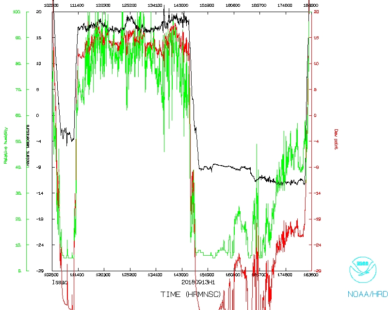 Temperature and Moisture |
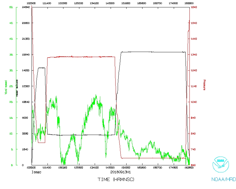 Wind and Atlitude |
 Flight track |
Flight Director's log |
Flight Director's manifest |
NetCDF data |
serial data |
SFMR data |
1 second data
LPS log |
Radar log |
Drop log