| Aircraft Commander | Doug MacIntyre |
| Co-pilot | David Cowan |
| Flight Director | Ian Sears |
| Flight Director | Paul Flaherty |
| System Engineer | Al Goldstien |
| Data Technician | Miller |
| AVAPS | Jim Roles |
| AVAPS | Hartberger |
| Guest | George Waldenberger |
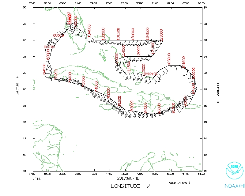
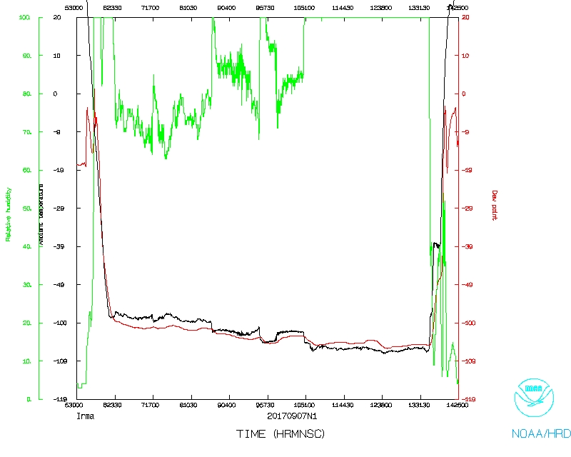
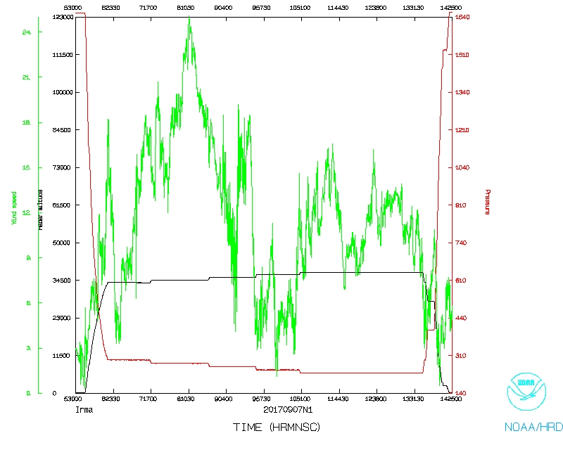
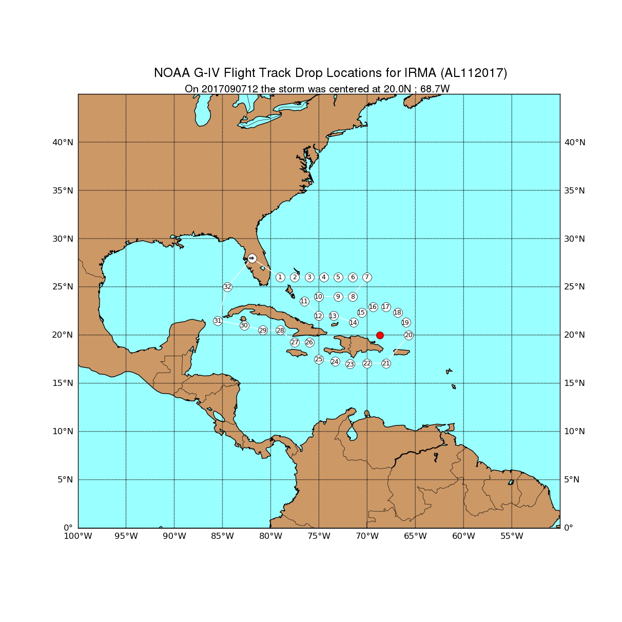
![]() Original Proposed NOAA 49 track |
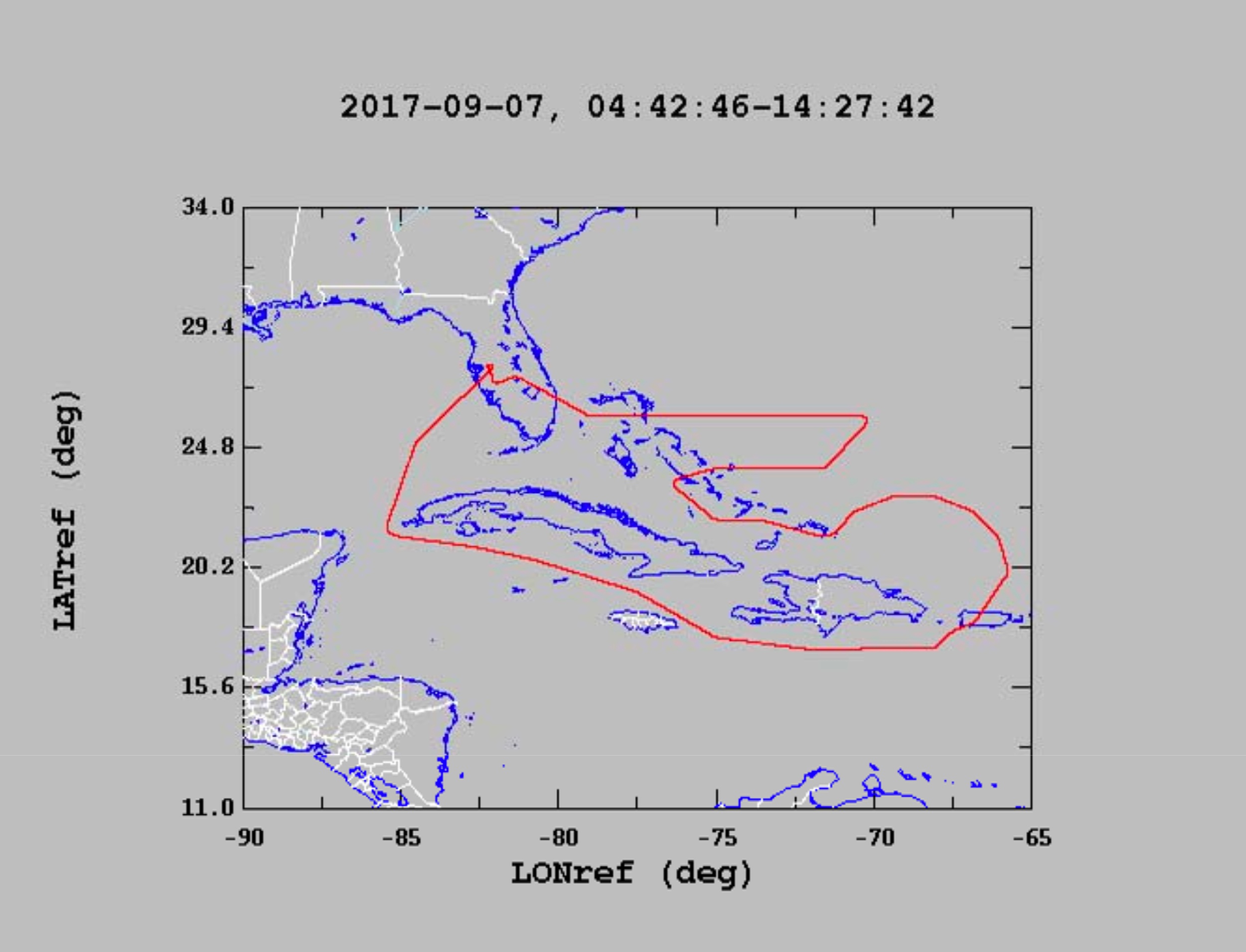
![]() Actual Synoptic Surveillance NOAA 49 track |
Mission Plan :
NOAA 49RF (N49) will fly a synoptic surveillance mission around Tropical Storm Nate.
|
Prepared by the National Hurricane Center October 06, 2017 7:44:16 AM Aircraft: N49RF Proposed takeoff: 07/0530Z | |||||||
| DROP LOCATION TABLE | |||||||
| # | LAT | LON | Time | ||||
| deg min | deg min | hr:min | |||||
| 1 | 25 42 | -84 12 | 0:22 | ||||
| 2 | 26 00 | -86 00 | 0:36 | ||||
| 3 | 24 42 | -85 42 | 0:47 | ||||
| 4 | 23 24 | -86 00 | 0:58 | ||||
| 5 | 23 12 | -84 12 | 1:12 | ||||
| 6 | 21 42 | -85 12 | 1:26 | ||||
| 7 | 22 21 | -86 50 | 1:40 | ||||
| 8 | 21 48 | -88 02 | 1:51 | ||||
| 9 | 22 21 | -90 34 | 2:11 | ||||
| 10 | 23 24 | -91 24 | 2:22 | ||||
| 11 | 21 42 | -92 12 | 2:37 | ||||
| 12 | 20 12 | -91 42 | 2:50 | ||||
| 13 | 19 42 | -93 12 | 3:03 | ||||
| 14 | 19 42 | -94 42 | 3:15 | ||||
| 15 | 21 12 | -95 12 | 3:28 | ||||
| 16 | 21 12 | -93 42 | 3:40 | ||||
| 17 | 23 12 | -93 12 | 3:56 | ||||
| 18 | 23 12 | -94 42 | 4:08 | ||||
| 19 | 23 12 | -96 12 | 4:20 | ||||
| 20 | 23 09 | -97 35 | 4:31 | ||||
| 21 | 24 42 | -96 12 | 4:47 | ||||
| 22 | 26 12 | -95 42 | 5:00 | ||||
| 23 | 27 42 | -95 42 | 5:13 | ||||
| 24 | 26 12 | -94 12 | 5:29 | ||||
| 25 | 24 42 | -94 42 | 5:42 | ||||
| 26 | 24 42 | -93 12 | 5:54 | ||||
| 27 | 24 42 | -91 42 | 6:06 | ||||
| 28 | 26 00 | -91 24 | 6:17 | ||||
| 29 | 27 30 | -93 00 | 6:34 | ||||
| 30 | 28 30 | -91 30 | 6:48 | ||||
| 31 | 27 03 | -90 34 | 7:02 | ||||
| 32 | 27 37 | -89 22 | 7:12 | ||||
| 33 | 27 37 | -88 02 | 7:23 | ||||
| 34 | 27 03 | -86 50 | 7:33 | ||||
| 35 | 28 42 | -86 42 | 7:47 | ||||
| 36 | 28 42 | -85 12 | 7:58 | ||||
| 37 | 28 42 | -83 42 | 8:10 | ||||
Mission Summary :
| Take off | Landing
| Linder-Lakeland, FL | 05:43 UTC
| Linder-Lakeland, FL | 14:21 UTC
| Expendables
| 35 dropsondes, 5 bad
| | ||||
Problems :
![]() Flight track |
![]() Temperature and Moisture |
![]() Wind and Atlitude |
Flight Director's log | Dropsonde log | Flight Director's manifest | NetCDF data | serial data | One second data