|
|
| Aircraft Commander | Justin Kibbey |
| Co-pilot | Nate Kahn |
| Co-pilot | Ruckman |
| Flight Engineer | Ken Heystek |
| Flight Engineer | Mike Sanchez |
| Navigator | Pete Freeman |
| Flight Director | Mike Holmes |
| System Engineer | Underwood |
| Data Technician | Dana Naeher |
| Dropsonde Operator | Todd Richards |
| Mechanic | Geoffrey Carrion |
| Lead Project Scientist | Rob Rogers | HRD |
| Radar Scientist | Sim Aberson | HRD |
| Dropsonde/Boundary layer Scientist | Kathryn Sellwood | HRD |
| Observer | Trey Alvey | Univ.Utah |
| Radar Scientist | John Gamache | HRD |
Mission Plan :
|
|
|
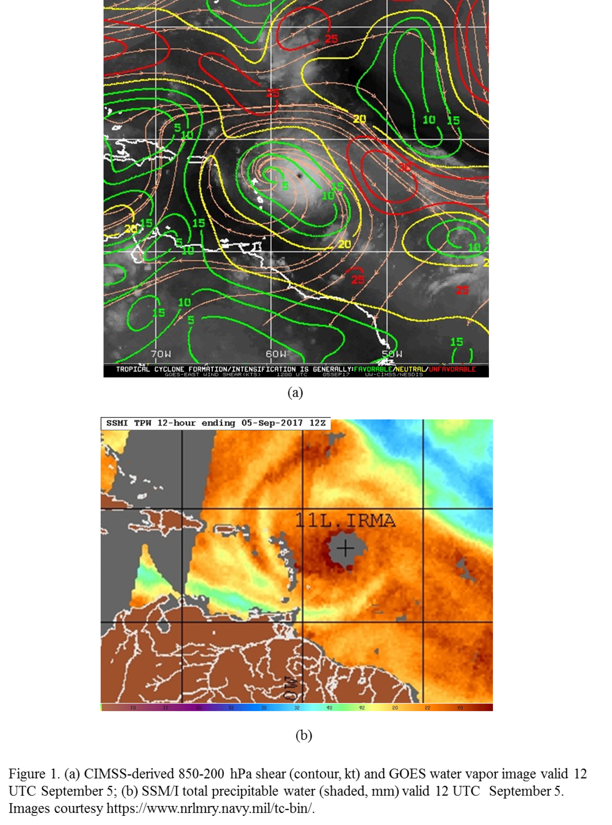
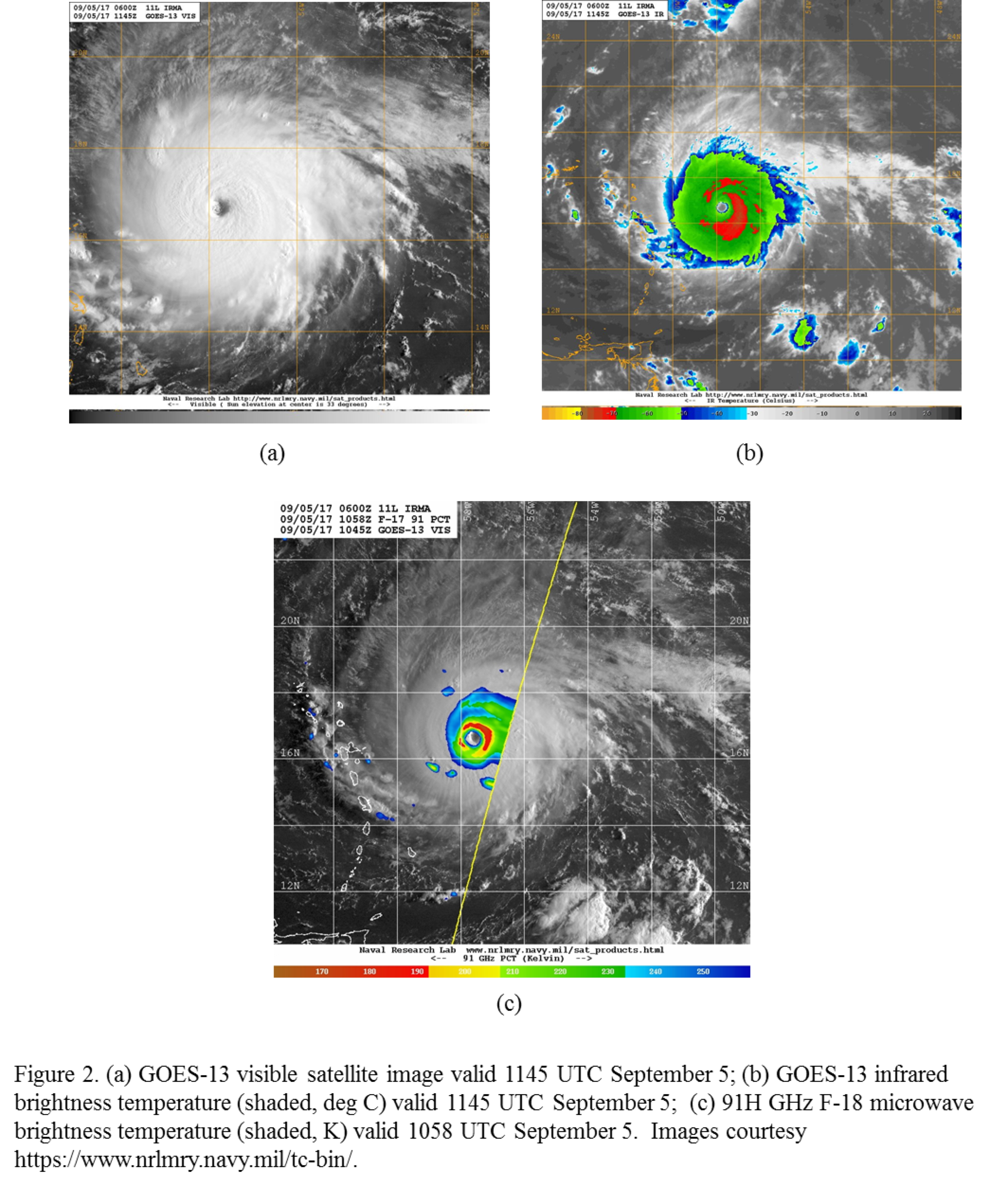
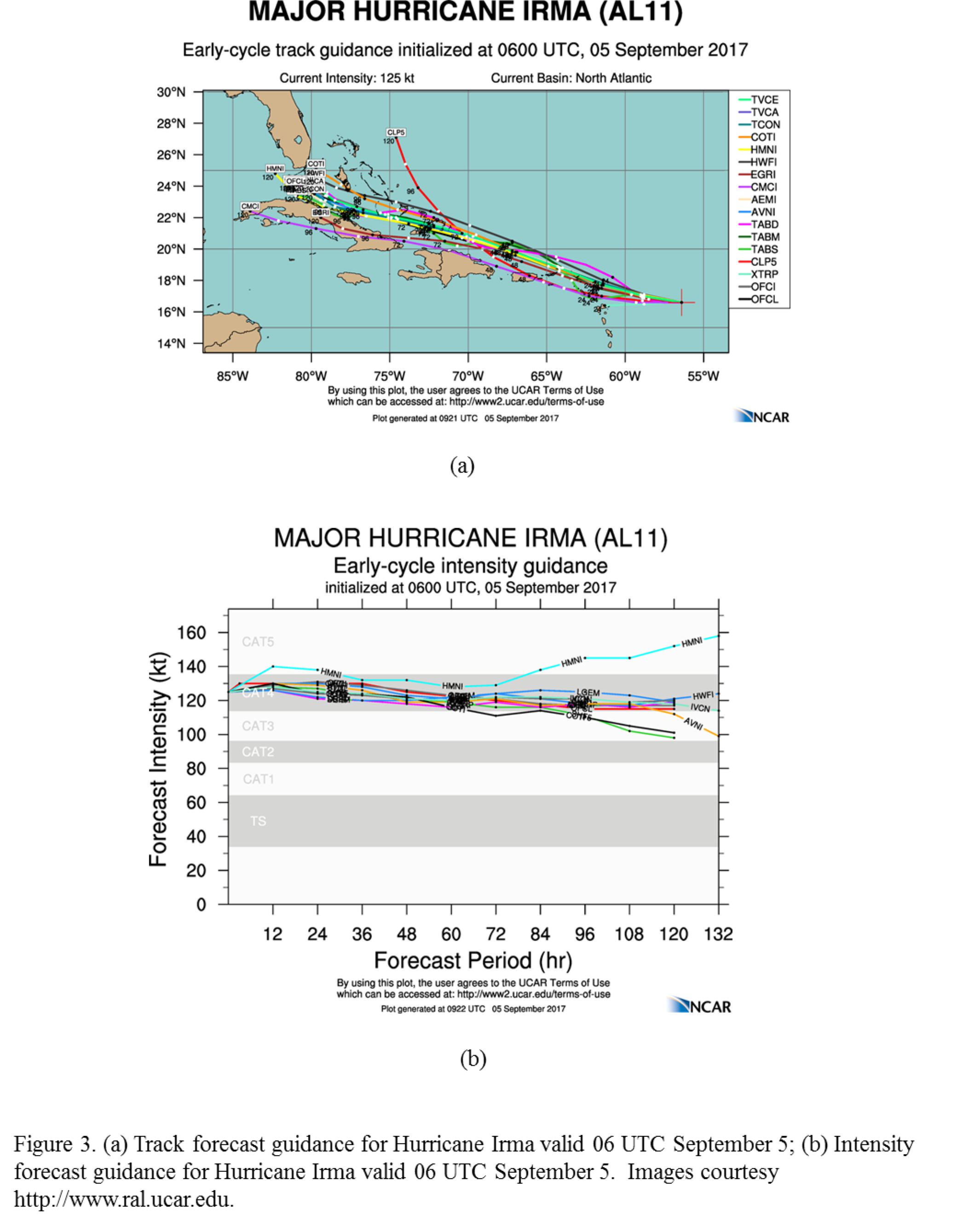
NOAA 42RF (N42) will perform an EMC-tasked TDR mission in Hurricane Irma, now a Category-4 hurricane approaching the northeastern Leeward Islands. The environment remains conducive for intensification, with deep-layer shear at ~10 kt over the core and predominantly moist lower-tropospheric air in a broad area around the storm (Fig. 1). About the only limitation to continued strengthening is that the storm is approaching its maximum potential intensity, as well as possible secondary eyewall formations and eyewall replacement cycles which often occur with storms of this strength. Visible satellite imagery (Fig. 2) shows the eye has completely cleared out, with a healthy central dense overcast apparent in infrared imagery and a ring of high ice scattering nearly encircling the center. Microwave imagery does indicate that there is a more expansive area of ice scattering on the east side of the storm, possibly reflective of the weak westerly shear impacting Irma. The model guidance is in good agreement that Irma will continue to track toward the west-northwest, brushing the northeast windward islands and moving just north of the Greater Antilles, threatening south Florida at the 5-day period. Most models maintain Category-4 intensity for Irma throughout the period.
|
|
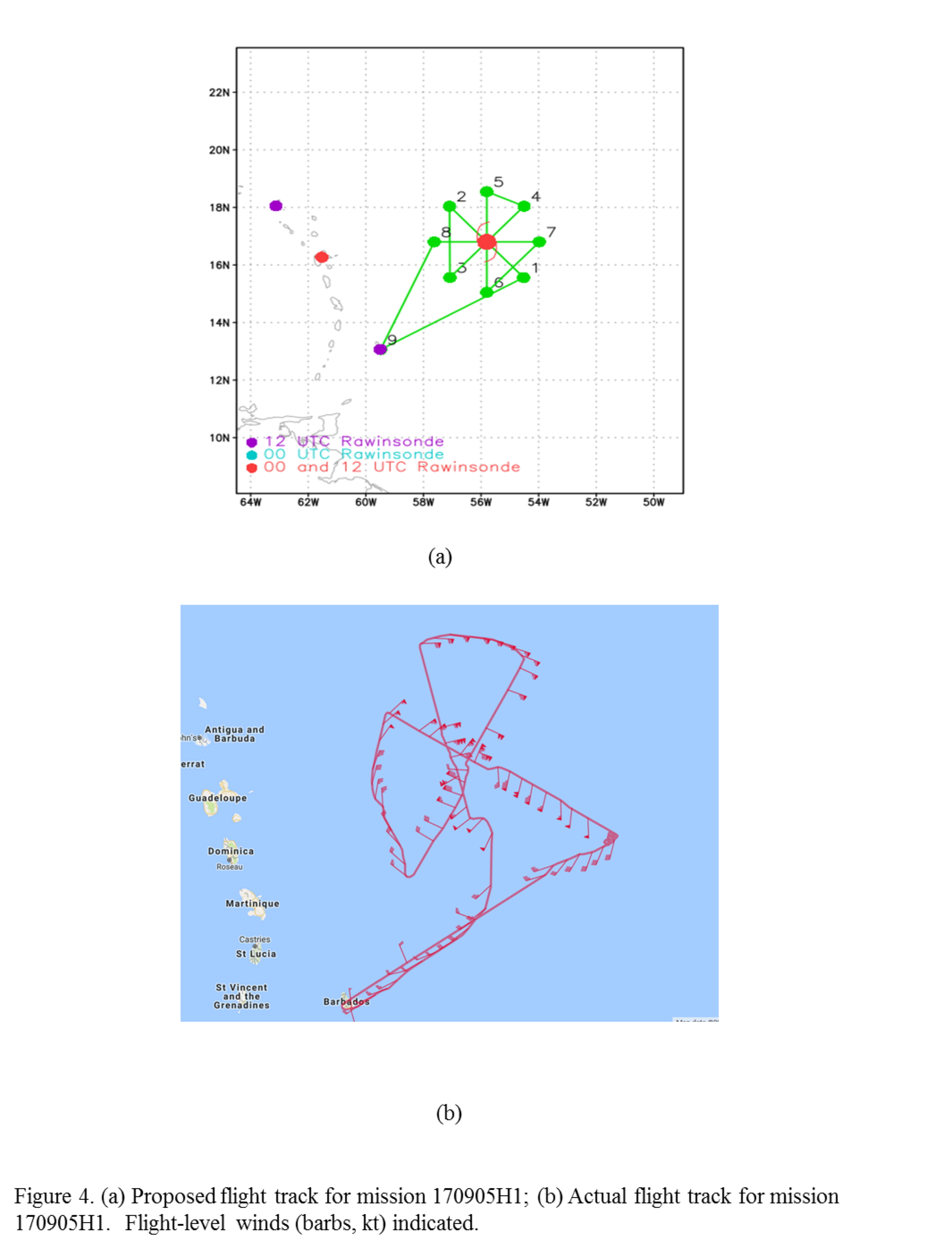
The plan called for flying a rotated Figure-4 (Fig. 4), with 105 nm leg lengths and an initial point (IP) on the southeast side. The first leg would be flown at 10,000 ft, while subsequent legs would be flown at 8000 ft pressure, since a C-130 would be flying at 10,000 ft pressure at that time. Takeoff was set for 08 UTC. Similar to the 170904H1 mission, the IP was established on the southeast side to align the initial center pass with an overpass from a satellite in the CYGNSS constellation. Sondes would be dropped at all turn points and center fixes. If the eye is large enough, and time permits, an eye/eyewall mixing module would be flown.

|
|
Mission Summary :
| Take off | Landing
| Barbados, BWI
| 07:54 UTC
| Barbados, BWI
| 13:56 UTC
| Penetrations
| 3
| | ||||
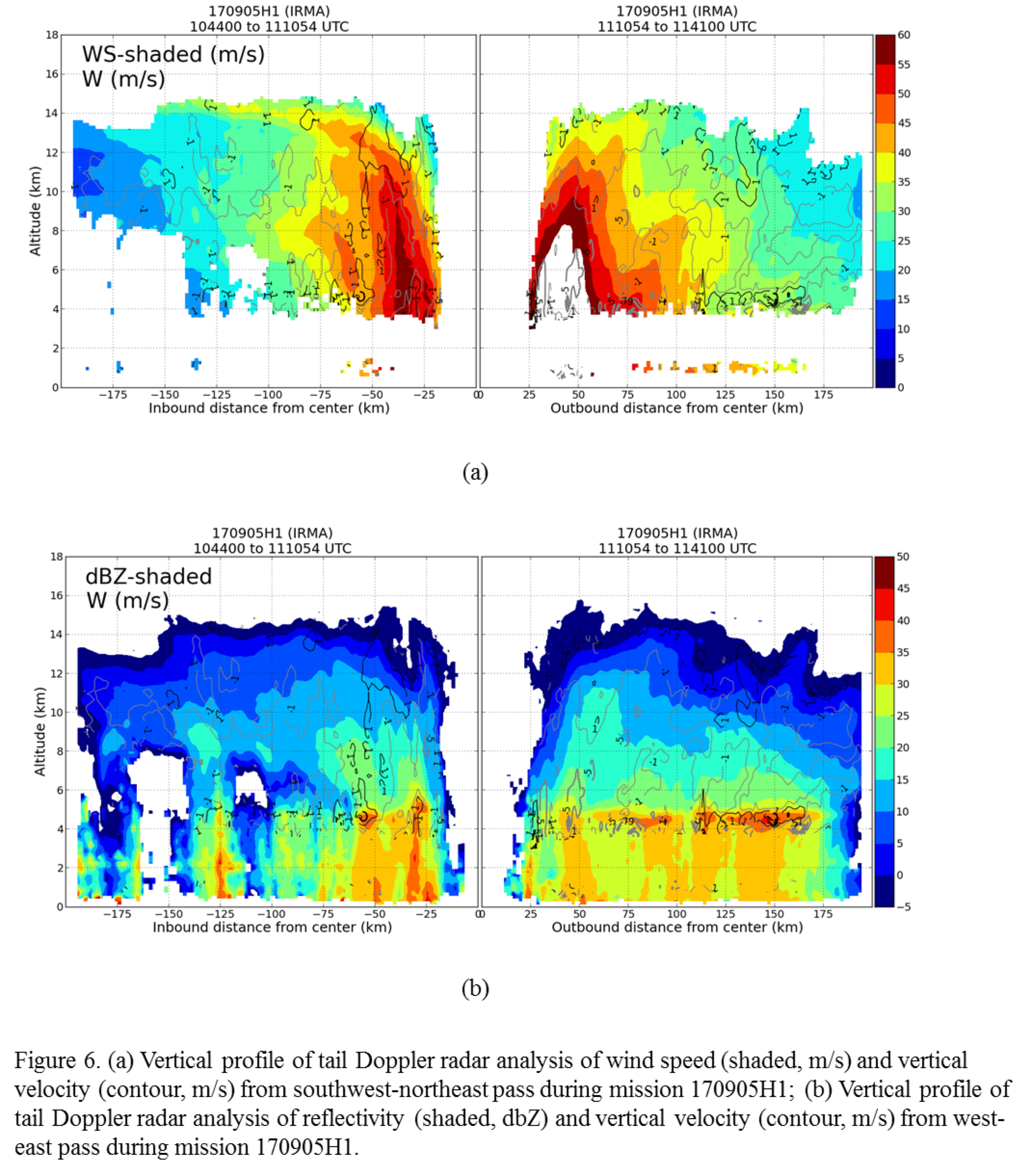
Takeoff was at 0754 UTC from Lakeland, FL. The mission was flown as planned (cf. Fig. 4b). However, as the IP was neared there was a crash of the radar computer, as well as some issues with the SFMR. The aircraft circled for a few minutes at the IP while repairs were attempted. The radar computer was repaired and the SFMR issue was resolved, so the mission proceeded. Radar analyses (Fig. 5) showed that the inner core was again nearly perfectly aligned, with an estimated 2-7 km tilt of ~2 km. There was a clear wavenumber-1 asymmetry in 2-km wind speed, with the maximum of ~70 m/s located on the north (right of motion, downshear left) side. Vertical cross sections of wind speed and reflectivity (Fig. 6) show extremely high wind speeds, particularly on the northeast side of Irma. Values in excess of 60 m/s (and off the scale) extended from flight level up to > 8 km altitude and spanned >25 km radius. While flight-level data did not clearly indicate a secondary wind maximum forming, the vertical cross section shows a clear secondary maximum at ~55 km radius on the southwest side and ~80 km on the northeast side.
Similar to the previous day, the strongest winds were in the northern eyewall, at both flight-level and the surface. Peak flight level winds were 175 kt there, while peak surface winds were 160 kt, making Irma a Category 5 hurricane. The storm had intensified ~60 kt in 24 h, despite already being a Category 3 hurricane during the previous night's mission.
During the north-south center pass a vibration in the aircraft was noticed. An attempt was made to diagnose the source of the vibration, but it could not be isolated. As a result, the mission was aborted after only three center passes.
Mission Evaluation:
The mission generally was a success, though the vibration mentioned above did cause an early end to the mission. Three analyses were created and transmitted. The first center pass was aligned with the CYGNSS overpass. There was a problem with the radar computer, but that was quickly found and repaired. Nine dropsondes were released, and all nine worked.
Problems :
Vibration-related termination of mission was only major problem. All dropsondes worked.
Rob Rogers
Sept. 25, 2017
| NetCDF SFMR data | |

Timeseries wind, rain rate, and pressure plots |
|

Flight level wind plots full flight |

Flight level wind plots in storm |

SFMR wind plots full flight |

SFMR wind plots in storm |
 Flight track |
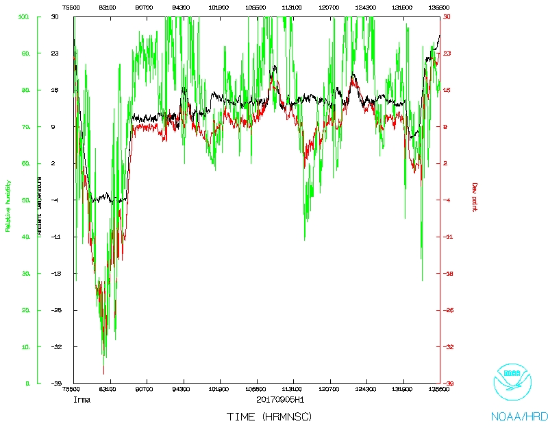 Temperature and Moisture |
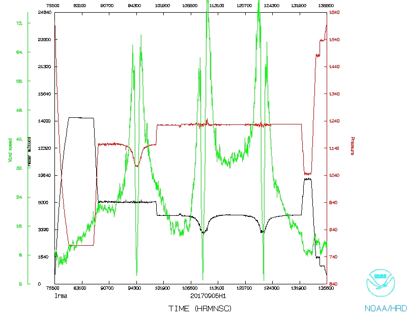 Wind and Atlitude |
LPS log |
Radar log |
Drop log
Flight Director's manifest
Flight Director's log |
NetCDF data |
SFMR data |
serial data
1 second data