|
|
| Aircraft Commander | Justin Kibbey |
| Co-pilot | Nate Kahn |
| Co-pilot | Ruckman |
| Flight Engineer | Ken Heystek |
| Flight Engineer | Mark Sanchez |
| Navigator | Pete Freeman |
| Flight Director | Mike Holmes |
| System Engineer | Underwood |
| Data Technician | Dana Naeher |
| Dropsonde Operator | Todd Richards |
| Lead Project Scientist | Rob Rogers | HRD |
| Radar Scientist | Sim Aberson | HRD |
| Dropsonde/Boundary layer Scientist | Kathryn Sellwood | HRD |
| Radar Scientist | John Gamache | HRD |
Mission Plan :
|
|
|
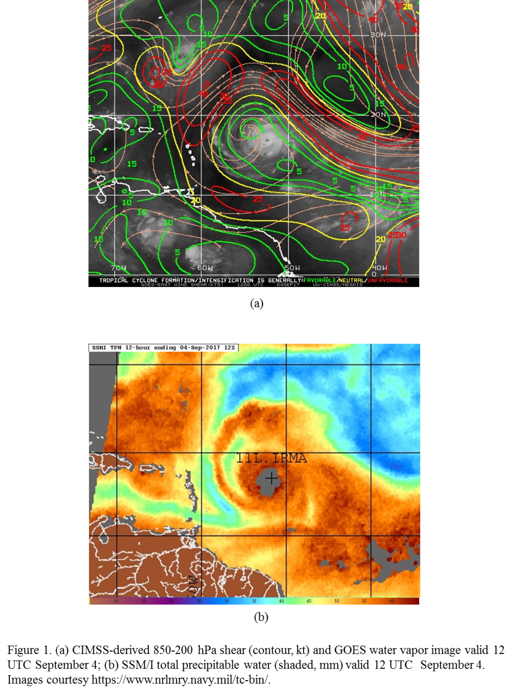
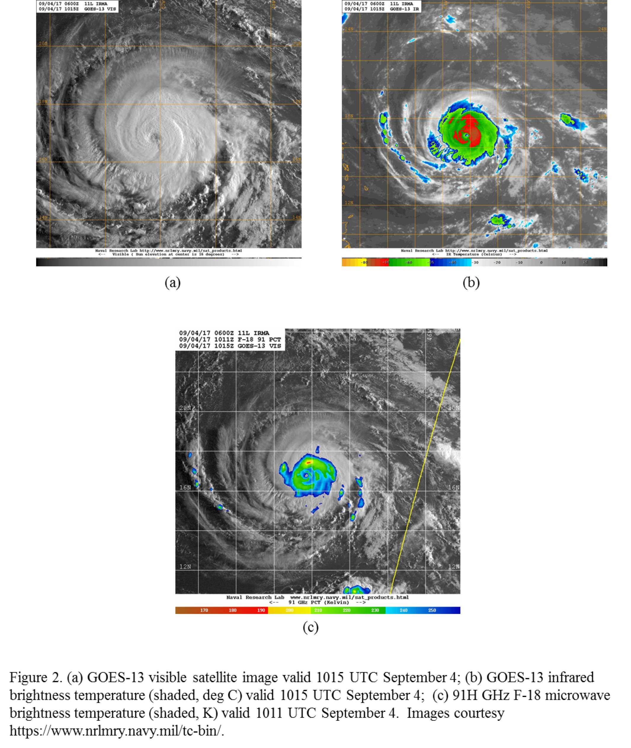
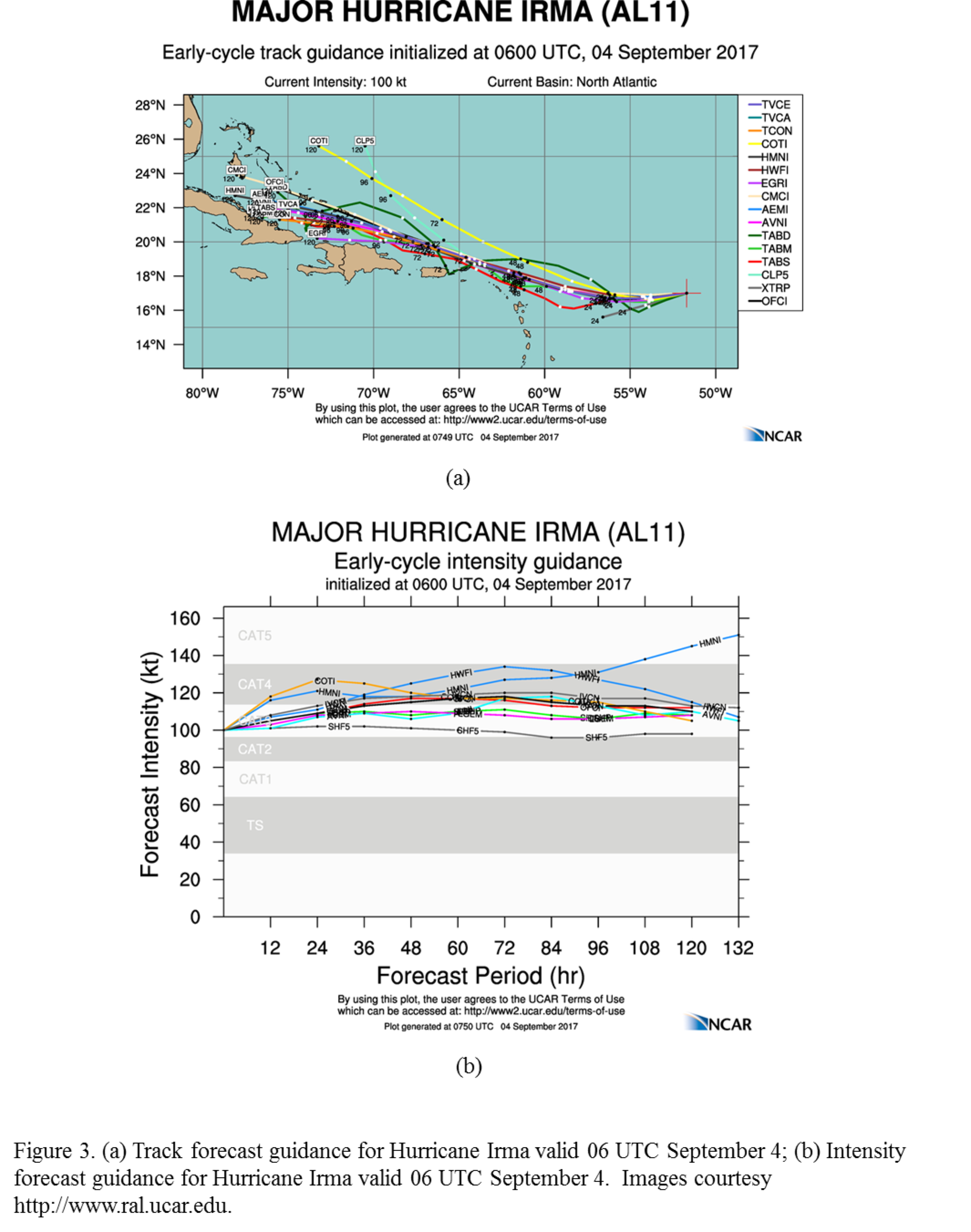
NOAA 42RF (N42) will perform an EMC-tasked TDR mission in Hurricane Irma, a 100-kt hurricane approaching the northern Leeward islands. The storm has maintained a relatively steady intensity for the past 48 h, in the presence of light north-northwesterly shear and a limited region of dry air in the lower troposphere on the northwest side (Fig. 1). The satellite presentation (Fig. 2) shows a healthy storm, though, with high, cold cloud tops distributed symmetrically around and eye beginning to become apparent. Microwave imagery confirms this structure, with a broad, symmetric distribution of moderate levels of ice scattering and a localized core of high ice scattering on the north side (upshear left) of the storm. Irma is forecast to continue tracking south of west for the next 24 h before turning west-northwest, slowly intensifying along the way to likely reach Category 4 on the Saffir-Simpson scale (Fig. 3).
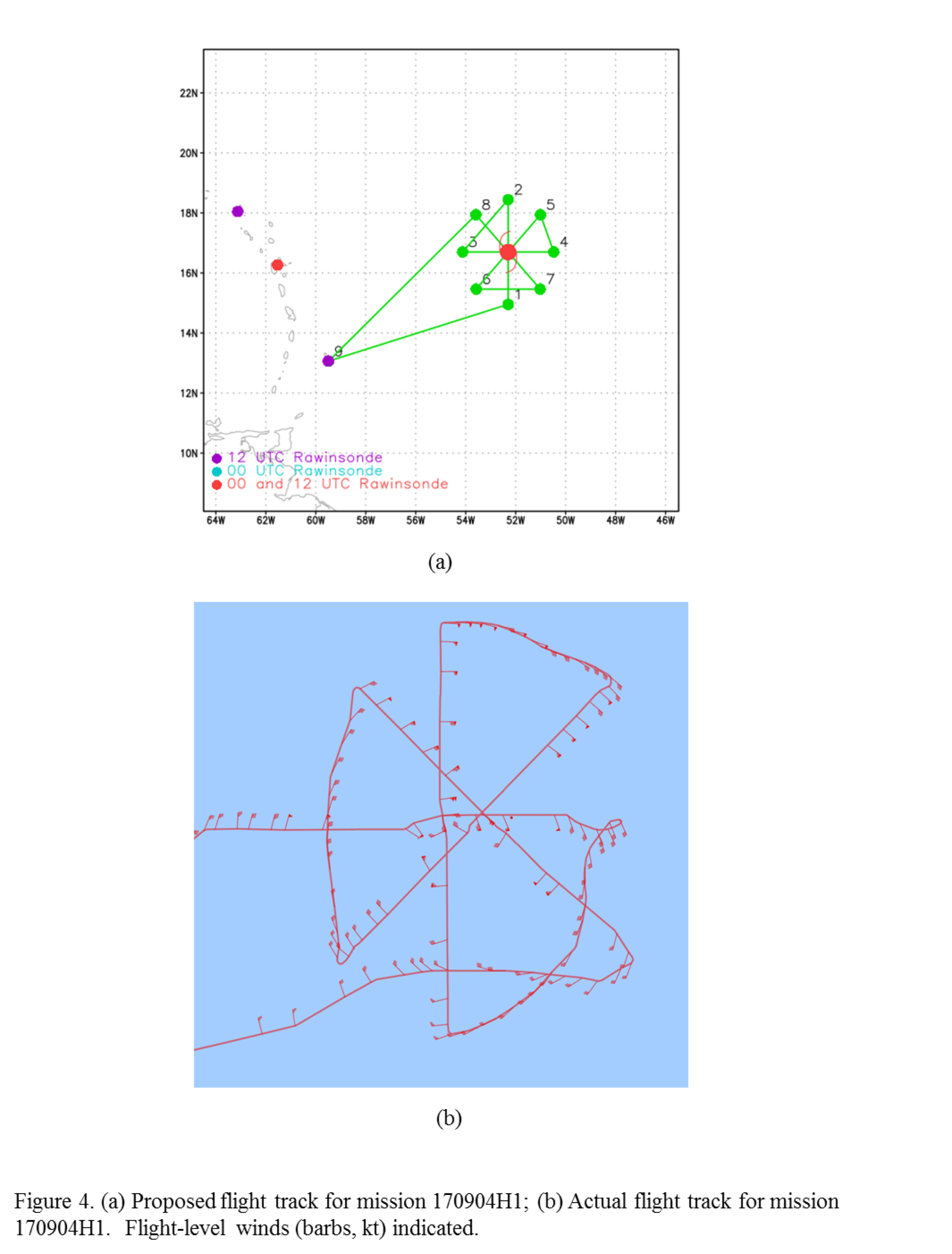
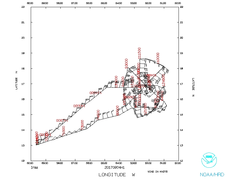
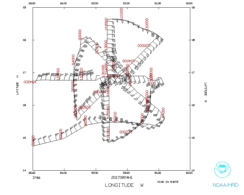
The plan called for flying a rotated Figure-4 (Fig. 4), with 105 nm leg lengths at 10,000 ft altitude and an initial point (IP) on the south side. Takeoff was set for 07 UTC. Prior to takeoff, however, the pattern was rotated 45 degrees counterclockwise to align the initial southeast-northwest center pass with an overpass from a satellite in the CYGNSS constellation. Sondes would be dropped at all turn points and center fixes, plus a sonde/AXBT combination would be dropped at the location of maximum winds on the southeast, northwest, southwest, and northeast legs.
|
|
Mission Summary :
| Take off | Landing
| Barbados, BWI
| 06:49 UTC
| Barbados, BWI
| 14:50 UTC
| Penetrations
| 4
| | ||||
|
|
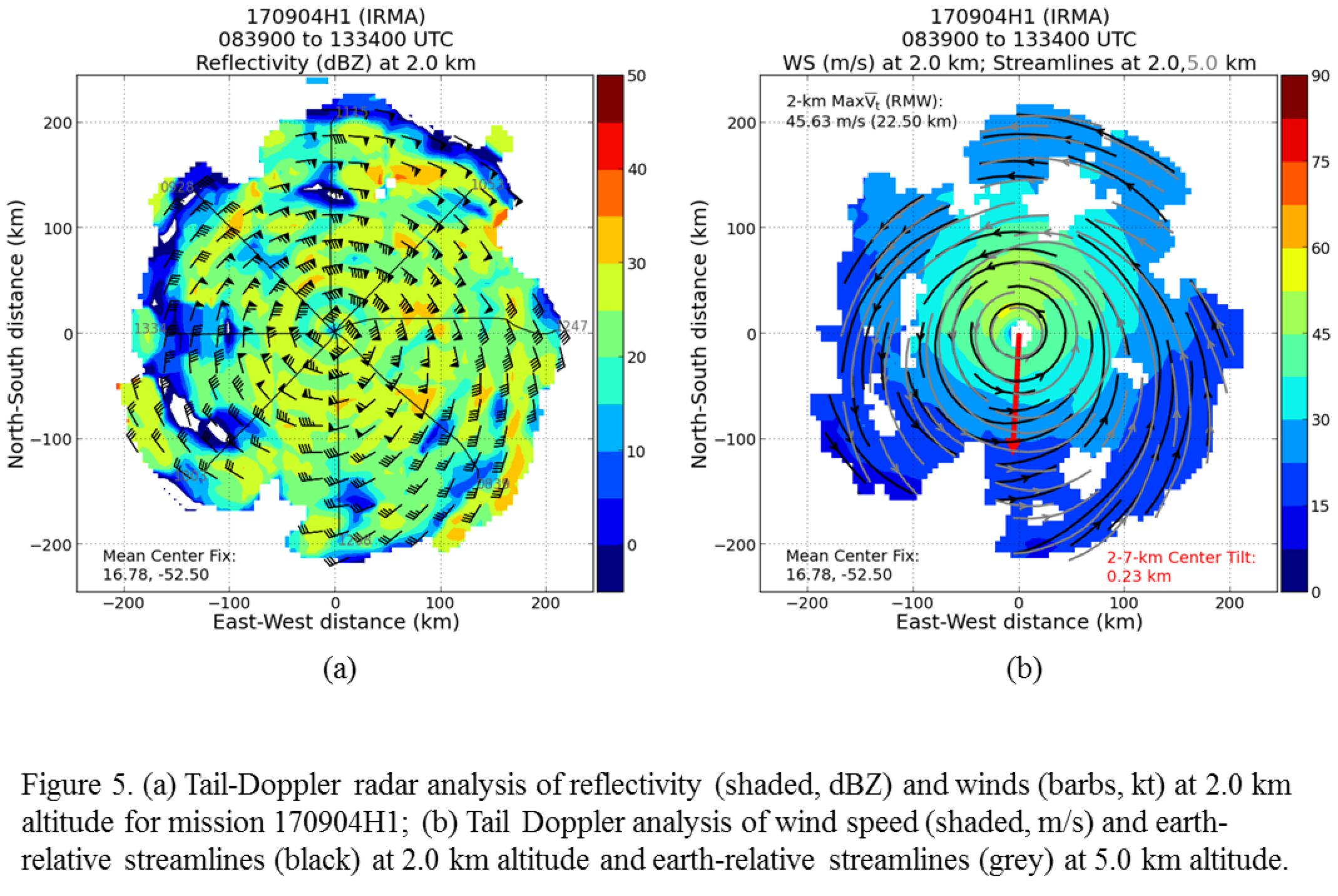
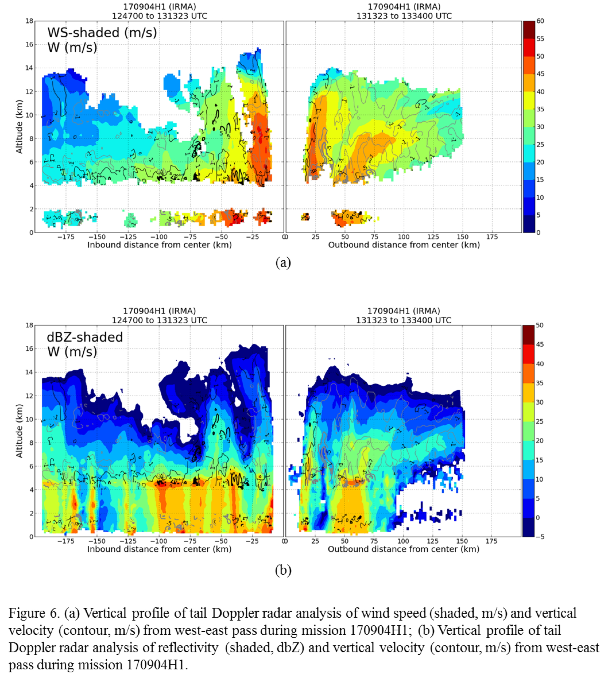
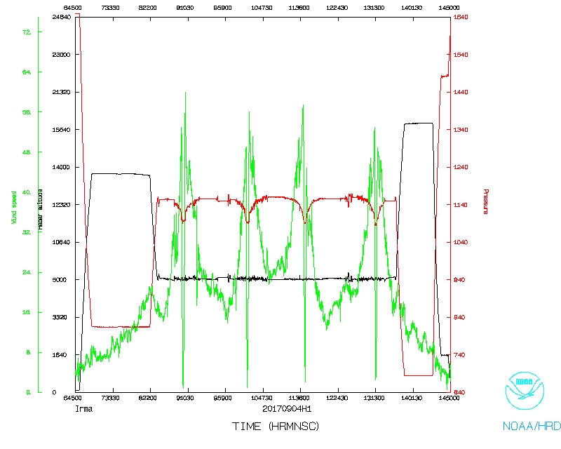
Takeoff was at 0650 UTC from Lakeland, FL. The mission was flown as planned (cf. Fig. 4b). Center fixes showed that Irma was tracking due west. The inner core was almost perfectly aligned (Fig. 5), though there was an azimuthal asymmetry in the outer-core precipitation field to the south side of the storm. The lower fuselage radar (not shown) indicated clear banding features and a possible concentric eyewall structure, with the inner eyewall open to the west. This structure is also seen in vertical profiles of wind speed taken east-west through the storm center (Fig. 6). The inner eyewall has a radius of ~20 km, while an indication of an outer wind maximum, especially on the east side of the storm, is seen at ~60 km radius in the presence of what appears to be heavy stratiform precipitation.
The strongest winds were on the north side of the storm, at both flight-level and the surface. Radar analyses showed an outer wind maximum around the east and north sides of the storm (i.e., downshear and upshear left, though shear was relatively weak here). Peak flight level winds of 115 kt, and surface winds of 100 kt, were seen in the northern eyewall.
Mission Evaluation:
The mission did succeed. Four analyses were created and transmitted. The first center pass was aligned with the CYGNSS overpass. Fourteen dropsondes were released; only one failed, in the northeast eyewall. Three of the four AXBTs failed. There was also some networking issues early in the flight, but this was resolved.
Problems :
No major problems; 1 dropsonde reported no launch detect, plus 3 of 4 AXBTs failed.
Rob Rogers
Sept. 25, 2017
| NetCDF SFMR data | |

Timeseries wind, rain rate, and pressure plots |
|

Flight level wind plots full flight |

Flight level wind plots in storm |

SFMR wind plots full flight |

SFMR wind plots in storm |
 Flight track |
 Temperature and Moisture |
 Wind and Atlitude |
 Detailed Flight track |
LPS log |
Radar log |
Drop log |
Flight Director's manifest
Flight Director's log |
NetCDF data |
SFMR data |
serial data |
1 second data