| Aircraft Commander | Carl Newman |
| Co-pilot | Chris Kerns |
| Co-pilot | Scott Price |
| Flight Engineer | Dewie Floyd |
| Flight Engineer | Paul Darby |
| Navigator | Devin Brakob |
| Flight Director | Ian Sears |
| Flight Director | Paul Flaherty |
| Data Technician | Joe Bosko |
| Electronics Technician | Bill Olney |
| Electronics Technician | Todd Richards |
| Electronics Technician | Bobby Peek |
| Lead Scientist | Rob Rogers (HRD) |
| Radar Scientist | Sylvie Lorsolo (HRD) |
| Dropsonde Scientist | Brad Klotz (HRD) |
| Observer | Lisha Roubert (UWisc) |
| Guest | Howard Altman(Tampa Tribune) |
| Guest | Chris Urso(Tampa Tribune) |
Mission Plan :
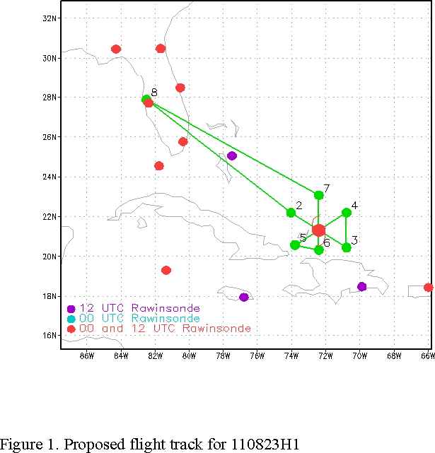
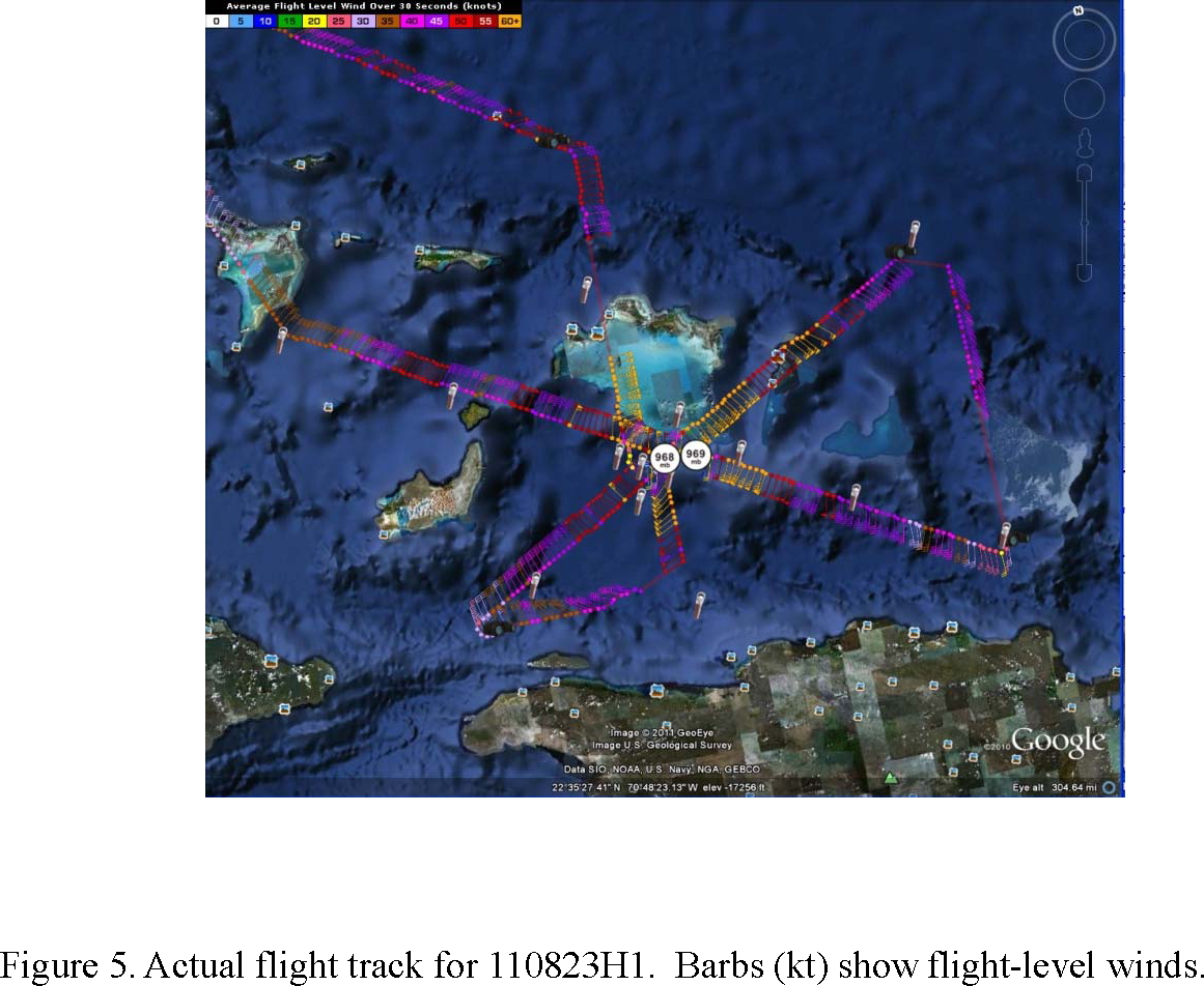
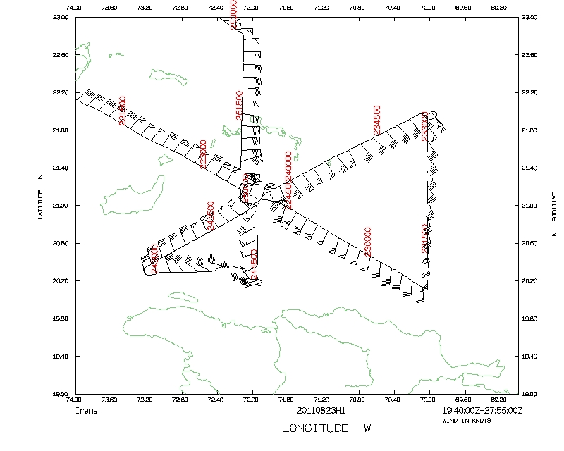
NOAA 42RF will perform a Tail Doppler Radar (TDR) mission into Hurricane Irene, a Cat 2 hurricane tracking WNW north of Hispañola. This is the first of a series of such flights. We will fly a butterfly pattern, IP on the 300° azimuth, 105 nm leg lengths, except on south and southwest side where the legs will be shortened because of Cuba and Hispañola (Fig. 1).
We will perform 3 radar analyses for superob transmission. Dropsondes at the turn, midpoints, RMW and first and third center passes. Fly at 8000 ft pressure. The P-3 will leave Macdill AFB, FL by 2000 UTC and will land at Macdill AFB, FL by 0400 UTC on the 24th.
Mission Summary :
| Take off | Landing
| MacDill AFB, FL | 23/19:52 UTC
| MacDill AFB, FL | 24/03:47 UTC
| | ||
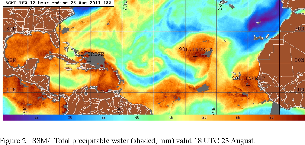
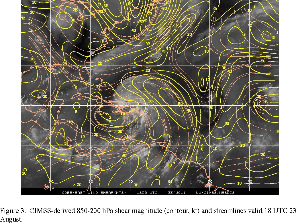
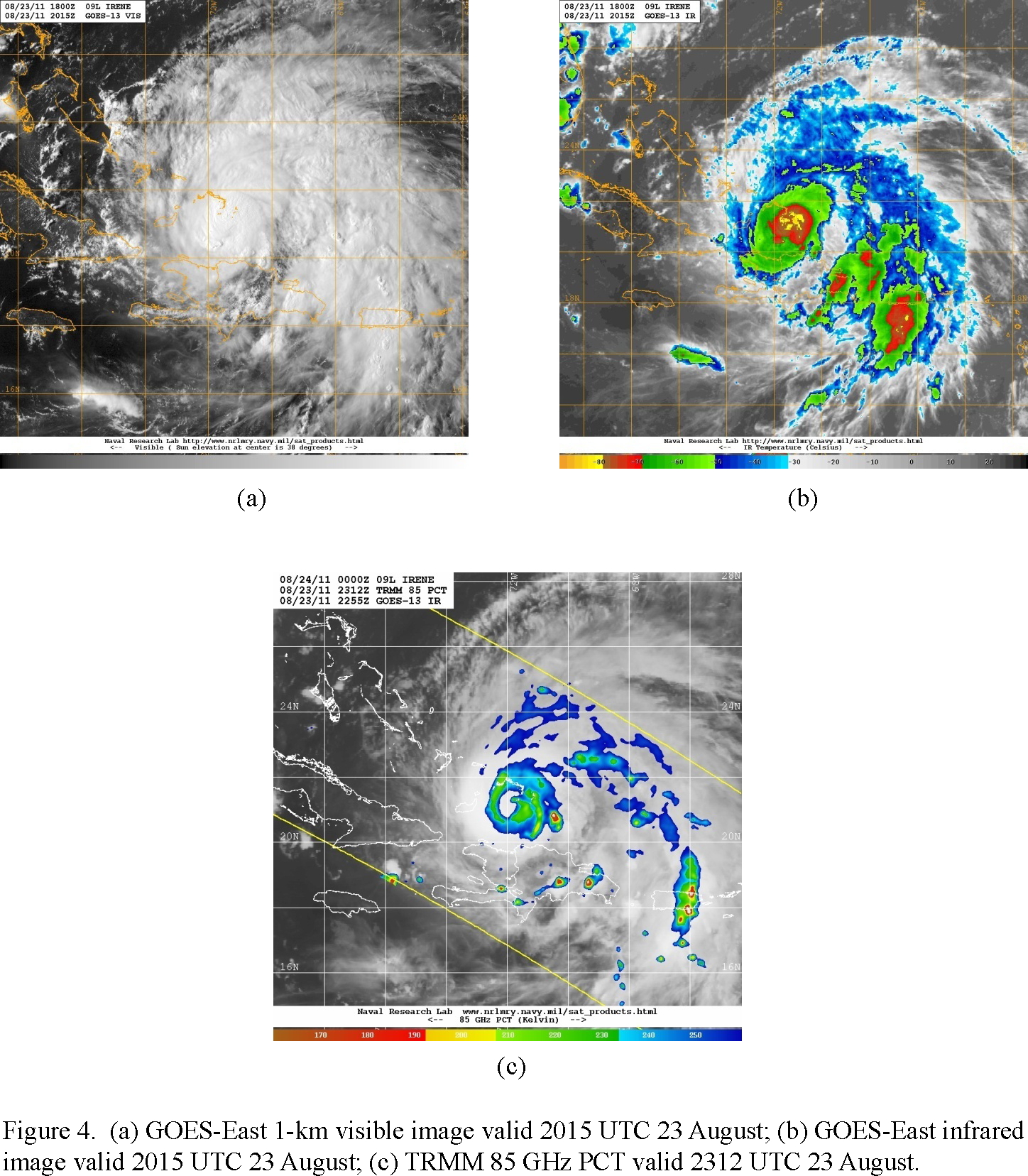
The storm is trying to organize, but it is being limited by proximity to Hispañola and dry air on the north side (Fig. 2). The large-scale environment generally is favorable for intensification, with relatively low 850-200 hPa shear (Fig. 3), except for the proximity to dry air. Visible, infrared, and microwave imagery show cold cloud tops in an area where an eye may be trying to develop (Fig. 4).
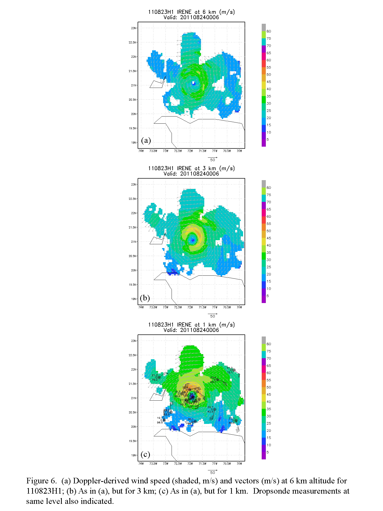
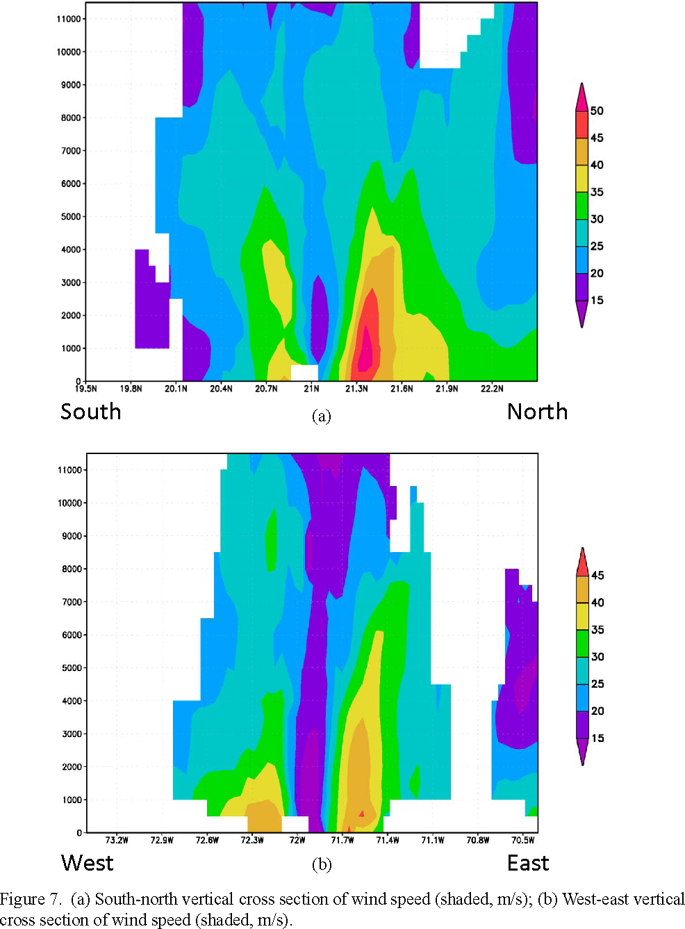
Takeoff was at 1952 UTC. Flew pattern as planned (Fig. 5). Radar analyses (Fig. 6) showed peak winds at 1 km of 50-55 m/s on the north side of the storm. The RMW based on this plot was estimated at about 20 nm. Going up to 3 km altitude the peak winds shift to the northeast side, and that azimuthal position remains at 6 km. Vertical cross sections of wind speed oriented north-south and east-west through the center (Fig. 7) show that the storm wind field is asymmetric over a deep layer, with peak values on the north and east side. A well-defined core is evident from the wind fields, with values as large as 35 m/s extending up to 5 km altitude and a narrow band of 45+ m/s coinciding with the eyewall on the north side. Peak SFMR winds of ~ 35 m/s were seen in the northeast eyewall. Flight-level winds of ~50 m/s were measured there as well. It was on the east side of the storm that the most turbulence was experienced, with some couplets of +4/-8 m/s up- and downdraft couplets encountered.
The aircraft completed its mission and landed at MacDill AFB at 0347 UTC.
Mission Evaluation:
There were no major problems during the flight. The radar analyses worked well, as did the dropsondes. The primary objectives of the mission were accomplished, as three Doppler analyses and superobs were transmitted from the aircraft.
Problems :
There were no major problems with the flight, other than a few dropsonde failures (telemetry issues). A total of 22 dropsondes were released.
Rob Rogers
Sept. 7, 2011
 Track |
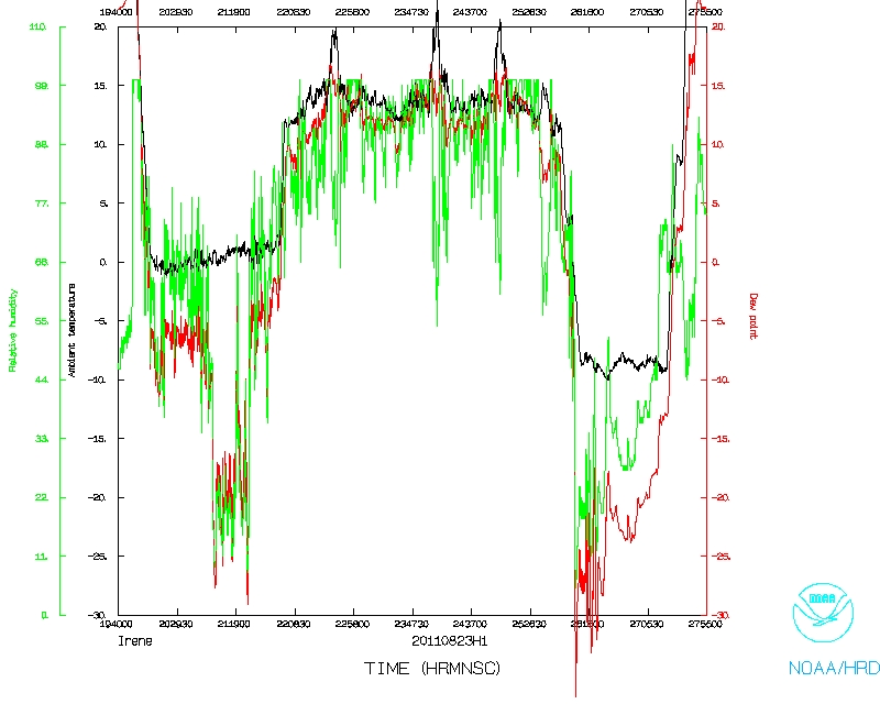 Temperature and Moisture |
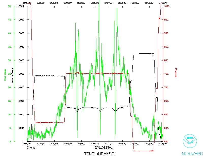 Wind and Atlitude |
 Track Detail |
1 second data | NetCDF flight level data | serial data | SFMR (NetCDF)
FDir log | Error Summary | LPS log | Radar log | Dropsonde log