Mission Summary
20080910H1 Aircraft 42RF
Ike Ocean Winds flight 2008
Scientific Crew (42RF)
| Lead Scientist | Frank Marks |
| Dropsonde Scientist | Bob Black |
| Radar Scientist | Sundaraman Gopalakrishnan |
| Guest | Dr. Rick Spinrad (OAR) |
| Observer | Jason Sippel (TTU) |
Flight Crew (42RF)
| Pilots |
Al Girimonte |
| Flight Director | Barry Damiano |
| Navigator | |
| Flt. Eng. | Greg Bast |
| Data Tech | Bobby Peek |
| Elec. Tech | Bill Olney
Steve Wade |
Mission Plan :
N42RF will fly an EMC-tasked Tail Doppler Radar (TDR) mission into Hurricane
Ike in the Gulf of Mexico, dropping AXBTs in the vicinity of the pre-storm Ike
and post-storm Gustav AXBT locations. After the TDR legs are completed we will
do penetrations for NESDIS Ocean-winds. T/O from MacDill AFB, FL at 2000 UTC,
and recover at MacDill AFB, FL by 0400 UTC. Plan is to send superobs back to
AOML ftp site for use by Fuqing Zhang and the HFIP-TACC real-time test to
initialize the ARW model starting at 0000 UTC 11 September. Rick Spinrad
(DAA OAR) will be on this mission.
MISSION PLAN: IKE
Prepared by the Hurricane Research Division
Aircraft: N42RF Altitude: FL180-250 Proposed takeoff: 10/2100Z
|
TRACK DISTANCE TABLE
|
Point
#
| LAT
(d m)
| LON
(d/m)
| RAD/AZM
(nm/dg)
| LEG
(nm)
| TOTAL
(nm)
| TIME
(h:mm)
| Comments
|
| 0 | MACDILL | 0. | 0. | 0:00 | AXBT @ 5 min > 100 fathom
|
| 1S | 25 36 | 88 09 | 105/315 | 331. | 331. | 1:27 | Combo @ mid, center
|
| 2S | 24 21 | 86 48 | 0/000 | 105. | 436. | 1:55
|
| 3S | 23 07 | 85 27 | 105/135 | 105. | 541. | 2:23
|
| 4S | 25 36 | 85 27 | 105/045 | 149. | 690. | 3:03
|
| 5S | 23 07 | 88 09 | 105/225 | 210. | 900. | 3:58 | Combo @ center, mid SW ,end
|
| 6S | 22 36 | 86 48 | 105/180 | 81. | 981. | 4:20
|
| 7S | 24 21 | 86 48 | 0/000 | 105. | 1086. | 4:48
|
| 8S | 25 11 | 86 48 | 50/360 | 50. | 1136. | 5:02
|
| 9S | 24 21 | 86 48 | 0/000 | 50. | 1186. | 5:16
|
| 10S | 24 56 | 86 09 | 50/045 | 50. | 1236. | 5:30
|
| 11S | 24 21 | 86 48 | 0/000 | 50. | 1286. | 5:44
|
| 12S | 25 11 | 86 48 | 50/360 | 50. | 1336. | 5:58
|
| 13S | 24 21 | 86 48 | 0/000 | 50. | 1386. | 6:11
|
| 14S | 24 56 | 87 27 | 50/315 | 50. | 1436. | 6:25
|
| 15S | 24 21 | 86 48 | 0/000 | 50. | 1486. | 6:39
|
| 16S | 25 11 | 86 48 | 50/360 | 50. | 1536. | 6:53
|
| 17 | MACDILL | 281. | 1816. | 7:51
|
Mission Summary :
Actual flight track
| Take off
| Landing
| MacDill AFB, FL | 20:02 UTC
| MacDill AFB, FL | 03:29 UTC
| |
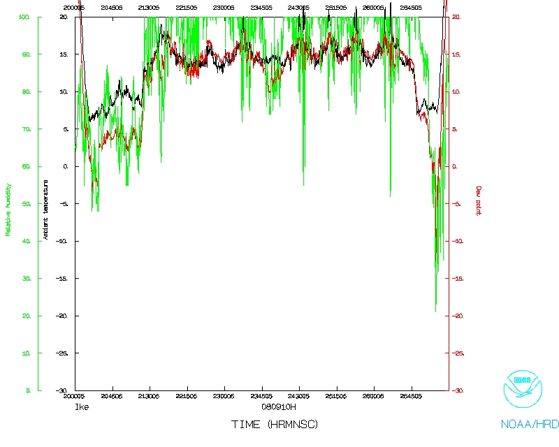
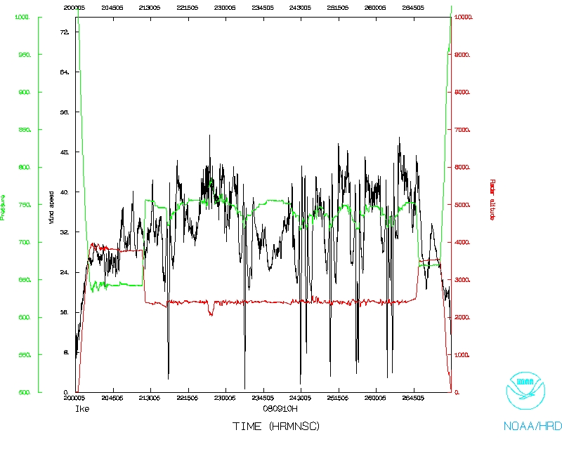
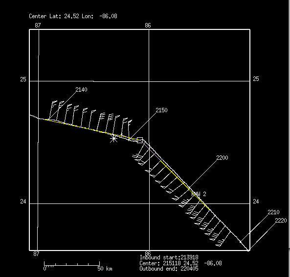
Great missions! Storm is stronger than on the last mission and appears to be
getting a little better organized. Very interesting storm structure with large
outer rainband surrounding very small and relatively weak inner eyewall (see
Figure 1). Very interesting SFMR data showing
multiple wind maxima over the eastern semicircle of the storm. Western
semicircle had much less reflectivity and weaker rainbands.
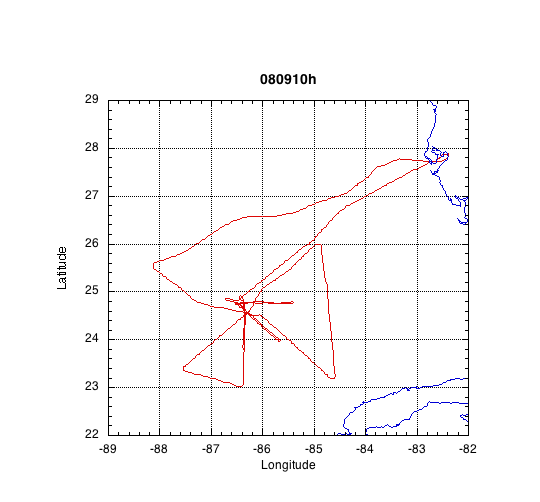
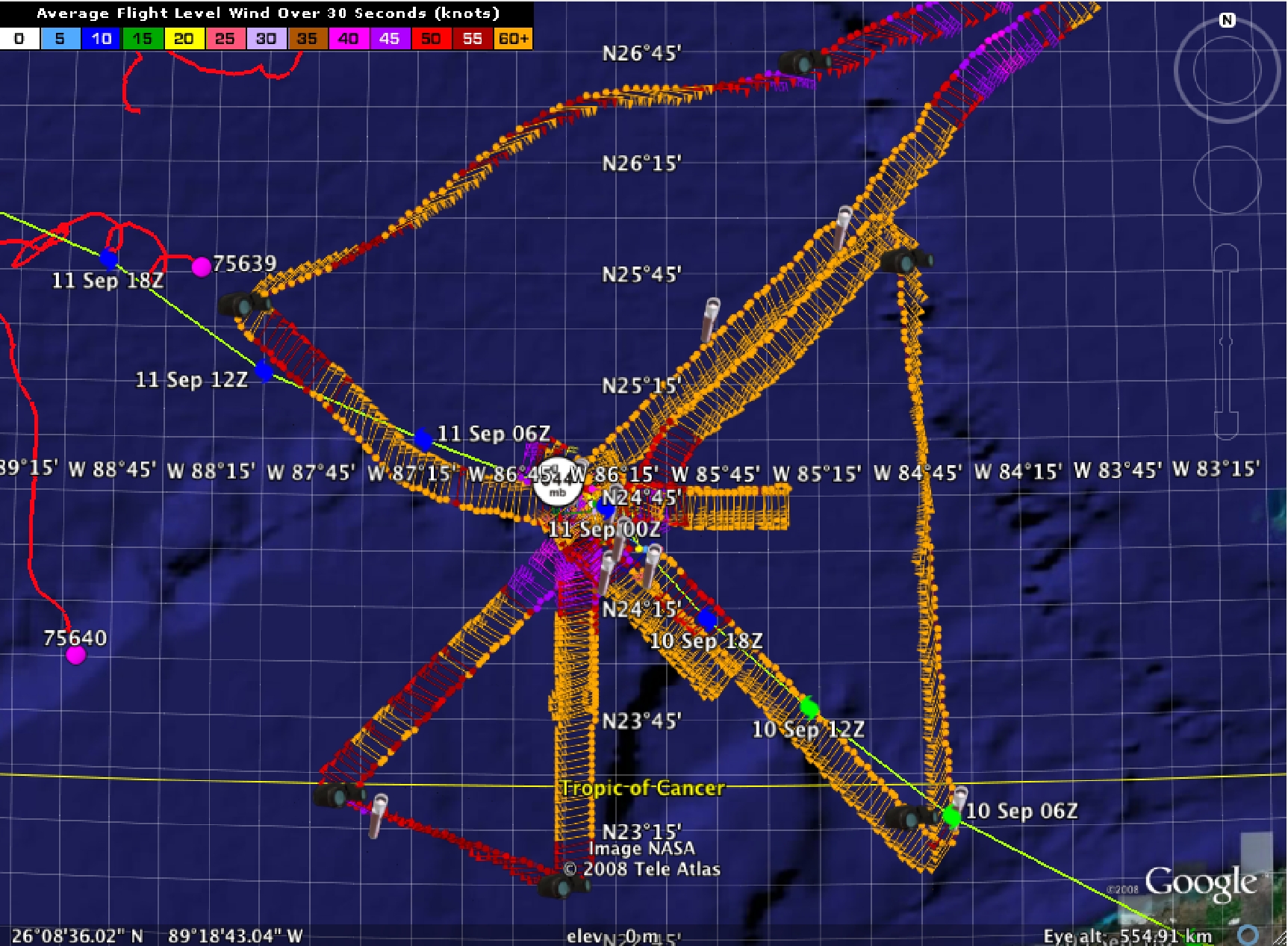
TDR mission went really well with analyses and superobs completed for the first
three legs: (1) 1st leg from NW-SE; (2) 2nd leg from NE to SW; and (3) 3rd leg
from S to NE. See flight track in Figure. Completed AXBT drops along track on
1st leg. Other AXBT drops combo with dropsondes at end points of legs (NW, NE,
S, and SW) and in eyewall.
Superobs were generated on the Mac laptop connecting via ftp to the HP
Workstation. While the process worked reasonably smoothly, it was a relatively
intense process because of lack of experience and automation of the processes.
Thanks to X-Chat and John Gamache we were able to get the superobs completed
and off the plane to the ftp site (see X-Chat summary). Fuqing was able to
access the superobs and use them in time to do a real-time run on the TACC.
Rick Spinrad and one of Fuqing's students (Jason Sippel) were on
the flight.
| Penetrations | 9
|
| AXBT | 10
8 good
|
| Dropsondes | 15
|
Lead Project Scientist's Log
X-chat Log
Problems :
No LF radar again during this mission. Some issues ftp'ing superobs from Mac,
but improved over last mission. Need more automation of the processing to
streamline the analysis and superob generation.
Frank Marks
Mission Data :
First center pass
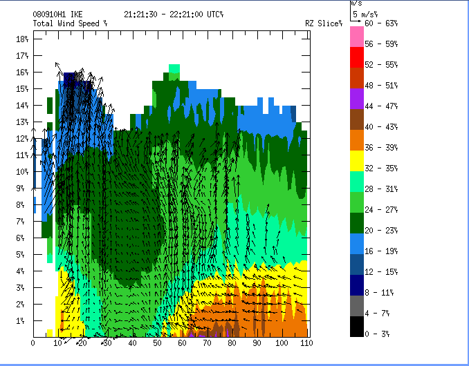
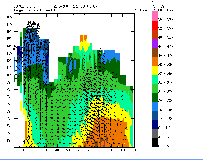
Vertical Doppler profiles for pass 1 and 2
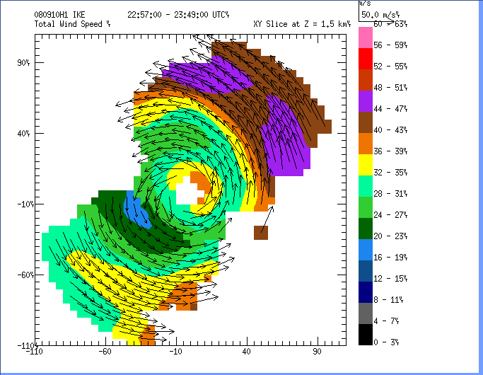
Doppler analysis pass 2
Dropsonde plots
850 mb
925 mb
1000 mb
surface
NetCDF listing
Ten second listing
Page last updated April 20, 2009
Return to Mission page.