![]()


| Staff | Data Center | Contact Information |
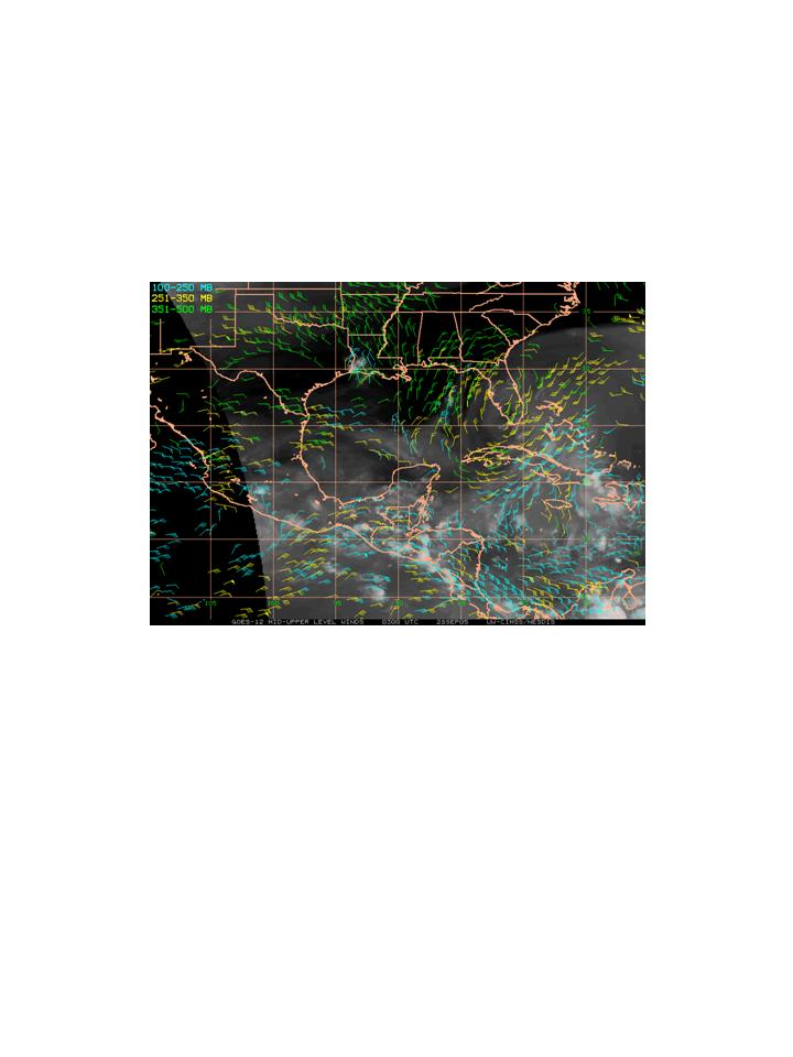
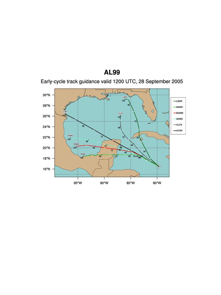
IFEX daily logWednesday, September 28, 2005 Whereas the Caribbean system looked promising yesterday, today it looks very disorganized. Infrared imagery (Fig. 208) indicates that the system has returned to a more linear state. The system has been following a pattern where concentrated convection develops during the daytime hours and then dissipates during the overnight hours. This is opposite from the normal diurnal cycle of convective maximum during the overnight hours and convective minimum during the daytime hours. One of the factors that may be playing an inhibiting role in the organization of convection is an upper-level cyclonic circulation located over Florida and extending into western Cuba (Fig. 209). This may be imparting some westerly shear on the northern part of the system that is preventing convection from developing and organizing. If it does become a depression, however, track guidance (Fig. 210) generally brings it close to the Yucatan within 2 days. Because of the lack of organization of the system, no research flights are planned for tomorrow. The last window of opportunity for flying is Friday. If the system does become a tropical depression by tomorrow a mission may be tasked for Friday. That will be dependent on how close the system is to land, however. 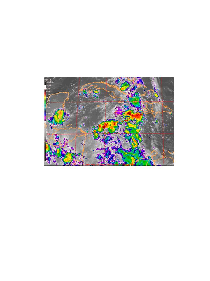 Figure 208. GOES-East infrared image valid 1245 UTC September 28.
Rob Rogers |
![[OAR/DOC/NOAA Logos]](../../../oar_noaa_doc_logos3.jpg)