![]()


| Staff | Data Center | Contact Information |
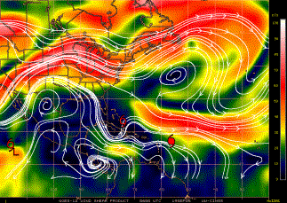
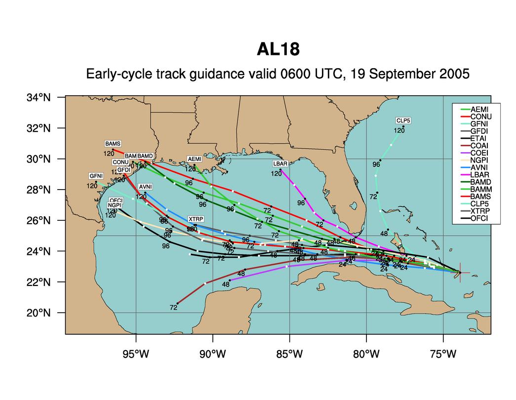
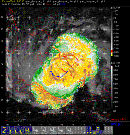
IFEX daily logMonday, September 19, 2005 Tropical Depression #18 became Tropical Storm Rita by Monday morning. Infrared imagery (Fig. 165) shows a rather disorganized system, with convection mostly located in a band that wraps around the northeast side and concentrated on the southwest side of the circulation center. This banded structure is also supported by an AMSR microwave overpass from a few hours earlier (Fig. 166). This band would be the target for the NRL P-3 to fly. Since N43RF is flying a tasked mission, there is no flexibility for the pattern it will fly. It will fly a figure-4 pattern with 105-nm legs beginning on the southeast side of the storm. Shear is light over the system (Fig. 167) and the waters are still very warm (not shown), indicating a favorable environment for continued intensification. The low-level steering flow (Fig. 168) bring Rita west into the Florida Straits and then possibly turning to the west-southwest along the southern side of a strong anticyclone located over Louisiana and Arkansas. Track forecast guidance (Fig. 169) reflect this pattern for the first few days, bringing Rita into the southeastern Gulf of Mexico in two days. After that point, however, Rita is forecast to turn more to the west- northwest. Intensity forecast guidance (not shown) indicates Rita could be a minimal hurricane by the time it reaches the Florida Keys and then possibly develop into a strong hurricane in the Gulf. Rita will clearly be a significant player for the next several days. The mission into Rita with N43RF and the NRL P-3 was a successful one. N43RF mapped out the surface winds using the SFMR and performed its tasked fixes at 18 and 21 UTC. Upon reaching the storm, the LF from N43RF showed that there was also a band on the southwest side of the storm. This was the band that was targeted by the NRL P-3 (Fig. 170). N43RF was tasked again to fly a SFMR into Rita the following day. The NRL P-3 would not fly on this day, since the system would be close to land between Cuba and the Florida Keys. Today�s flights did provide a good mapping of a potentially significant hurricane in the early stages of its development. 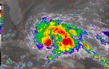 Figure 165. GOES-East infrared image valid 1045 UTC September 19.
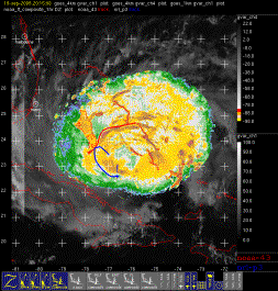
The mission into Rita with N43RF and the NRL P-3 was a successful one. Elsewhere in the tropics, Tropical Storm Philippe has been upgraded to Hurricane Philippe (Fig. 171). It is northeast of the islands and is forecast to continue moving toward the north-northwest. Because of the presence of Tropical Storm Rita so close to the U.S. mainland, however, Philippe is no longer a target of interest. 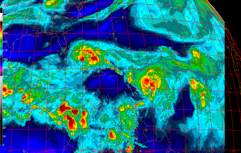 Figure 171. GOES-East water vapor image valid 1045 UTC September 19. Rob Rogers |


![[OAR/DOC/NOAA Logos]](../../../oar_noaa_doc_logos3.jpg)