| Rob Rogers | Lead Scientist |
| Paul Leighton | Radar |
| Shirley Murillo | Workstation |
| Phil Kennedy Barry Choy | Pilots |
| Steve Wade | Flight Engineer |
| Tim Gallagher | Navigator |
| Paul Flaherty | Flight Director |
| Sean McMillan John Hill Mark Rogers | Data Engineers |
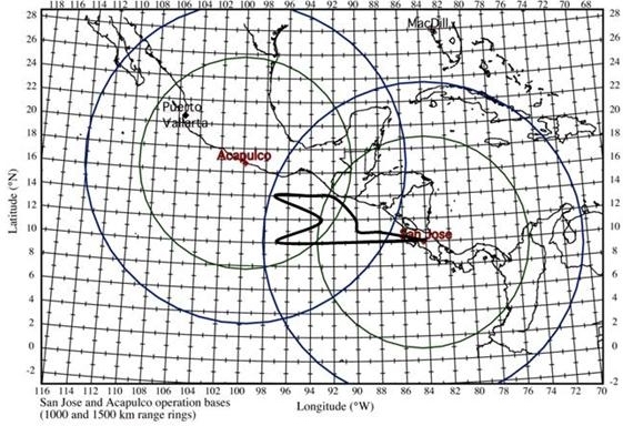
The NOAA N42RF will fly a tropical cyclone genesis experiment as part of IFEX. The P3 will leave San Jose, Costa Rica at 1:00 PM EDT and will recover at San Jose, Costa Rica at 10:00 PM EDT. This was a survey pattern in a suspect area in the East Pacific along 94-96 West. Southwesterly flow at the surface had produced a shear axis and a zone of vorticity oriented southwest-northeast. The IP was located just offshore to drop a combination GPS/BT drop for aerosonde calibration. From there, proceed to 10 N 89 W, then travel west along 10 N to 97 W. Turn northeast to 12 N 93 W, then turn northwest to 14 N 97 W. Then turn east along 14 N to 92 W, turn southeast to 12 N 90 W, then south to 11 N 90 W, then east to 11 N 89 W. Return to base from there. Drop 23 GPS sondes and 8 BT's to map out the structure of the southwesterly surface flow and document the possible wave axis. If there is any significant convective development along the way, deviate to that to map out the flow fields, but not if it sacrifices the grid pattern. Fly at 14,000 ft.
Mission Summary :
During the previous day, a north-south oriented squall line moved
offshore of Costa Rica and may have been associated with a tropical wave,
although there was some disagreement as to whether or not a wave was
actually there. What was clear, however, was southwesterly flow in the
low-levels and at the surface. The western boundary of that flow,
delineating a cyclonic shear zone, is oriented roughly SW-NE and centered at
about 94-96 W. The upper-level winds show moderate northeasterly shear,
associated with the southern edge of a strong upper-level anticyclone
situated over the Gulf of Mexico. Some of the global models have
predicted that this upper-level anticyclone will move toward the
southwest and become centered over Mexico, indicating a possible decrease
in the vertical shear over the region of interest. Thus, conditions may be
becoming more favorable for genesis.
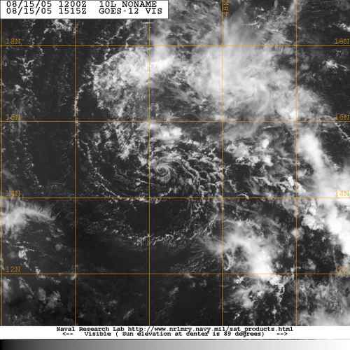
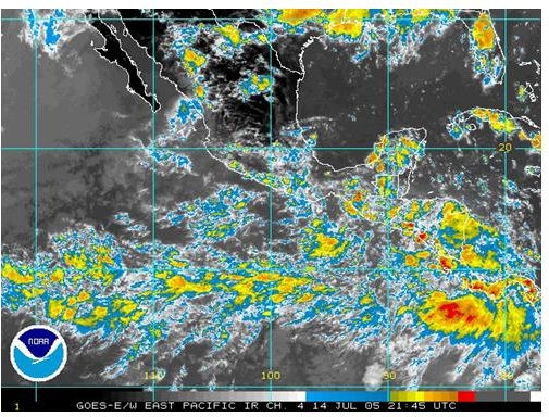
On the day of the scheduled flight, persistent southwesterly flow was evident in the East Pacific, and QuikScat imagery suggests a cyclonic rotation south of the Gulf of Tehuanapec (see Fig. 1). Convection developed overnight in various regions; one associated with the suspected wave and other convection near the Gulf of Tehuanapec.
Shear remained moderate over the region, but with the persistence of the
southwesterly flow in the area, a cyclonic shear axis that arose as a
result of this flow, and the possible approach of another wave in the
next 24 h, it still appeared possible that genesis could occur after 2-3 days.
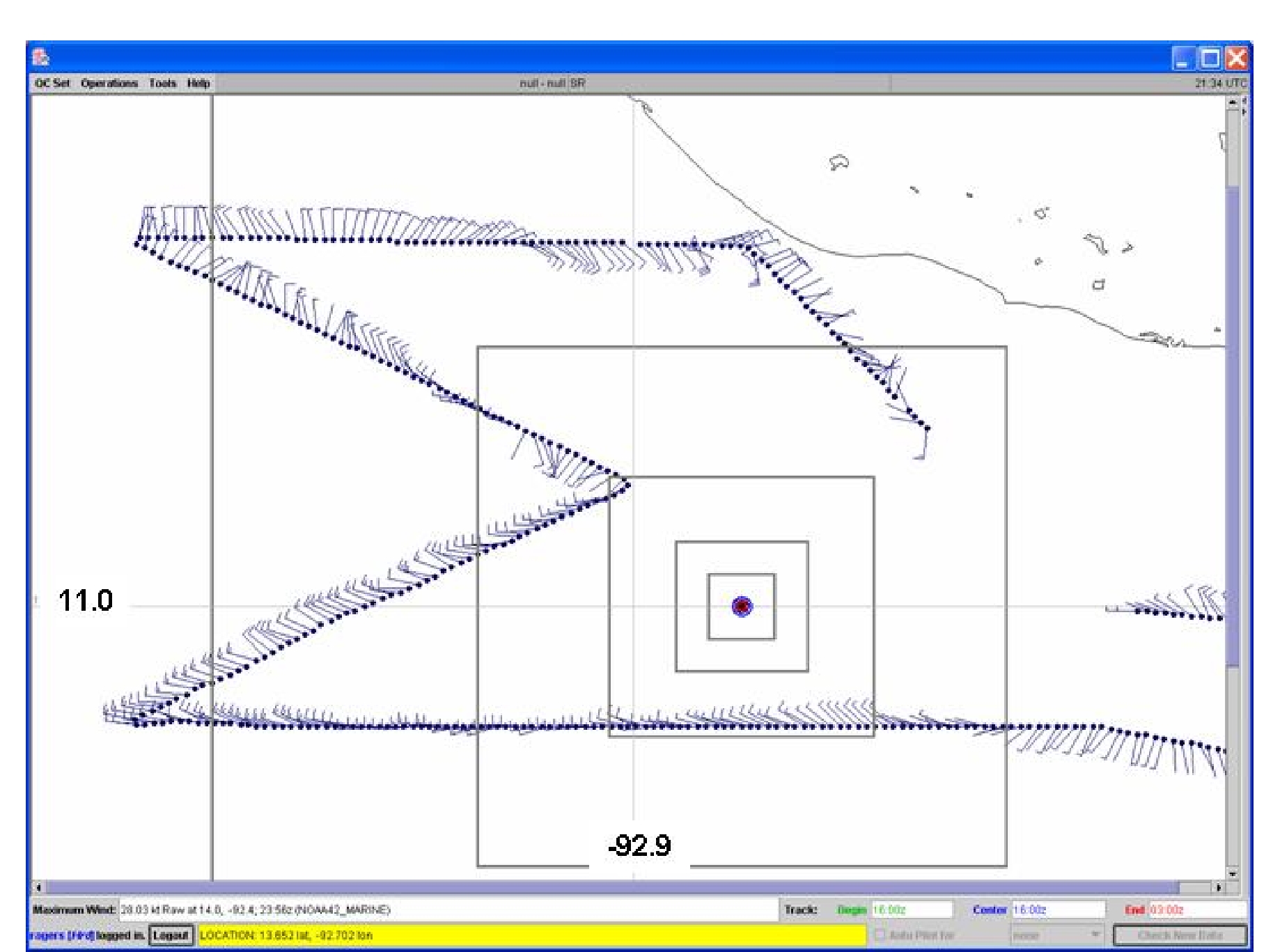
The flight plan for N42RF called for a survey pattern (see Fig. 2) where
the plane would fly west along 10 N, from 89 to 97 W. Then it would turn
NE to 12 N 93 W, then turn NW to 14 N 97 W. It would then turn east
along 14 N to 92 W, then turn southeast to 12 N 90 W. Then S to 11 N 90
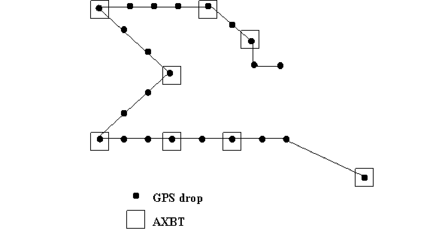
W, and finally east to 11 N 89 W. A total of 23 sondes were planned and
8 BT's (Fig. 3). If there was any significant convective development along
the way, the aircraft would deviate to map out the flow field associated with it, provided the deviation would not seriously alter the flow fields. The plane would fly at 14,000 ft.
Takeoff was at 1750 UTC from San Jose, Costa Rica. Along the flight of N42RF,
there was not a clear sign of a shift in wind direction at flight level
(Fig. 4) that
would indicate a tropical wave at this altitude for the beginning of the
flight (15,000 ft or 600 mb). Winds started out from 195 just offshore
of Costa Rica, then switched to 225 about 200 nm offshore. Moving further
west the flight-level winds turned to westerly, then generally stayed
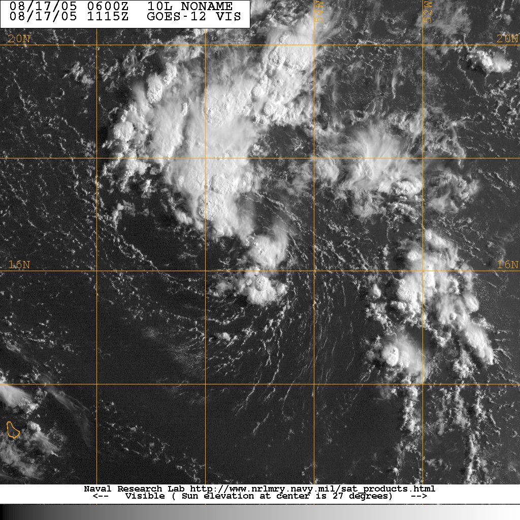
there for much of this part of the pattern. A visible satellite image
(Fig. 5) showed generally isolated convection along the flight track,
except for a larger area of convection about 150-200 nm south-southeast
of the Gulf of Tehuanapec. Upon passing 12 N, 93 W, there was a NW-SE
oriented line of stratiform rain, with some convective elements embedded
within it, about 10-20 nm to the southwest of the aircraft track. At
12.5 N 93.75 W, there was a pronounced wind shift from south to
west-northwest at flight level. This may be indicative of the horizontal
shear axis discussed previously, or it may be related to the rainfall
seen off to the left of the aircraft. As the flight continued, it was
evident that the flight-level wind field was rather chaotic along about
13-14 N. Multiple wind shifts were detected, but in general there was
northwesterly and northeasterly flow at flight-level west of 94 W and
southeasterly flow east of there. A flare-up of moderate convective
and stratiform rain did occur centered at 12 N 96 W while N42RF was in
the pattern (Fig. 6). The aircraft flew within about 20 nm of the
convection, so the tail radar should have sampled some of that. The
vertical shear still appeared to be moderate to somewhat high, so there
are doubts as to whether this system will have a reasonable chance of
developing. The aircraft landed back at San Jose at 0209 UTC the next day.
Problems :
The main problem with this flight was with the dropsondes. There were eight no launch detects. The BT's worked well, as did the radar.
Data :
| Start | End |
| 18:02:06 Z | 01:43:04 Z |