Mission Summary
20160901I2 Aircraft 43RF
Hurricane Hermine
RI / Landfall / Intense Rainband Module
Aircraft Crew (43RF)
| Aircraft Commander | Christopher Kerns
|
| Co-pilot | Adam Abitbol
|
| Co-pilot | Didier
|
| Flight Engineer | Paul Darby
|
| Flight Engineer | Josh Sanchez
|
| Navigator | Tim Gallagher
|
| Flight Director | Ian Sears
|
| Flight Director | Jess Williams
|
| System Engineer | Terry Lynch
|
| Data Technician | Mike Mascaro
|
| Dropsonde Operator | Todd Richards
|
Scientific Crew (43RF)
| LPS/Dropsonde | Jon Zawislak
| FIU/UM/CIMAS/HRD
|
| Radar | Bachir Annane | HRD
|
| Media | Matthew Apthorp | Bay News 9
|
| Media | Melissa Eichman | Bay News 9
|
Mission Plan :
NOAA 43RF will conduct a research-tasked mission into Hurricane Hermine, with
a focus on landfall and rainband structures. Altitude will be 10 kft for the
entire mission. The storm steadily intensified from a tropical storm to a
category 1 hurricane in the hours prior to the flight. Initial plan is to
parallel a landfalling rainband to the north of Tampa in the Big Bend region
of Florida where DOWs are deployed. We will track downwind behind the band,
dropping 2 sondes. One sonde will be located offshore near the UF T5 tower
deployed near N 29° 40' 24.478" / W 83° 23' 44.403". We will then
proceed to fly a Fig. 4 for vortex context (N-S, then E-W), followed by an
intense rainband module around a rainband of our choosing.
Mission Summary :
| Take off
| Landing
| MacDill AFB, FL
| 19:03 UTC
| MacDill AFB, FL
| 00:22 UTC
| |
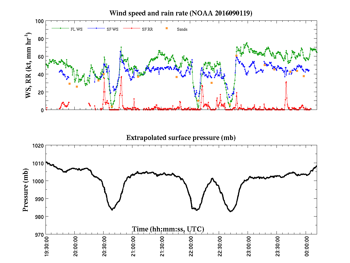
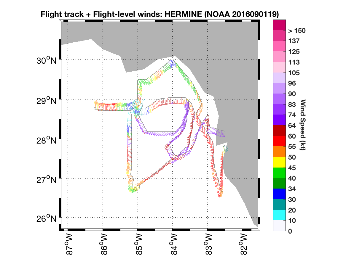
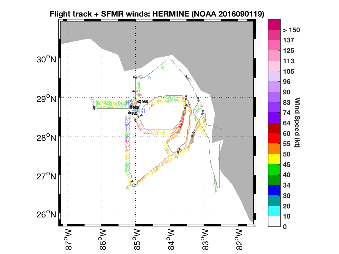
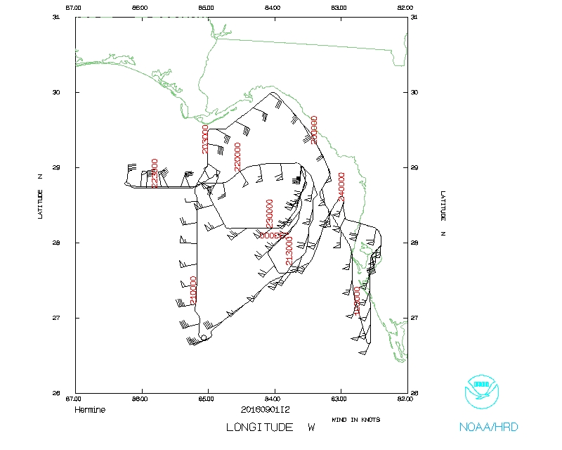
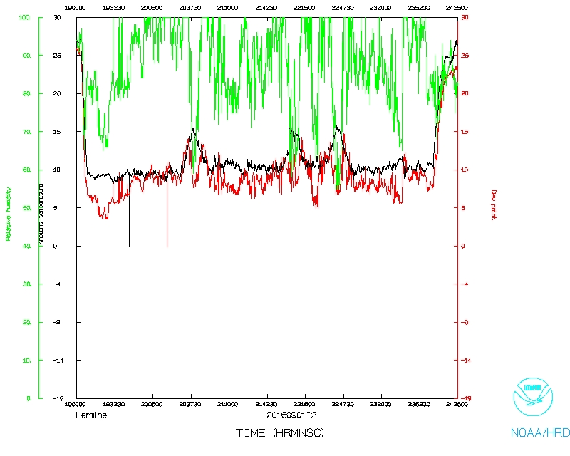
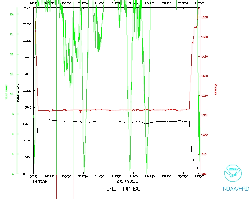
After takeoff, we were able to fly downwind, paralleling a rainband that had,
in the hour before, come onshore in the Big Bend region of Florida; maintained
a separation of 5-10 nm off the coastline. Although it appeared to be
predominantly stratiform rain, we were able to sample a large extent of the
band before reaching our northern endpoint. A sonde was dropped initially when
we began following the band, as well as near as possible offshore of the UF T5
tower. We then proceeded from N to S across the center, dropping sondes at the
turn points, maximum wind on the inbound, as well as at the center. On our down
wind leg to the eastern point, we followed another rainband, keeping it to our
west. Some deep convection was seen at times along this band. On reaching the
eastern point, we made a pass of the center to the west, shortening the
outbound on the W side. At this time, eyewall precipitation appeared to wrap
completely around the center. Sondes were dropped at turn points and the center
on this leg. We then reversed course, going through the center again, but this
time dropping a sonde at the maximum wind on the SE side of the storm. We
received direction from the ground to target a rainband oriented N-S just W
and SW of Tampa. We flew the Intense Rainband Module with an initial point in
the NW. The sequence was upwind along the west side of the band axis, cross the
band axis to the east and follow downwind, ending at the NE point. We dropped
sondes at the turn points and midpoints of the upwind and downwind legs (~60
nm in length). Precipitation along this band was a mix between convection and
stratiform. 17 total sondes were dropped on this mission.
Jon Zawislak
Sept. 7, 2016
Mission Data :
LPS log |
Radar log |
Drop log |
Flight Director's log |
Flight Director's manifest |
NetCDF data |
1 second data |
serial data
Page last updated Oct. 2, 2016
Return to Mission page.