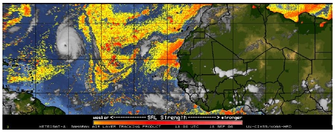
Fig. 1 Large scale, microwave-enhanced satellite image of Helene and the Eastern and Central Atlantic at 180 UTC 18 September.
| Lead scientists | Mike Black |
| Dropsonde scientist | Pete Black |
| Aircraft Commander | Michele Finn |
| Pilots | Will Odell John Longenecker |
| Flight Director | Barry Damiano |
| Engineers | Mark Rogers
John Hill Bobby Peek |
Mission Plan :
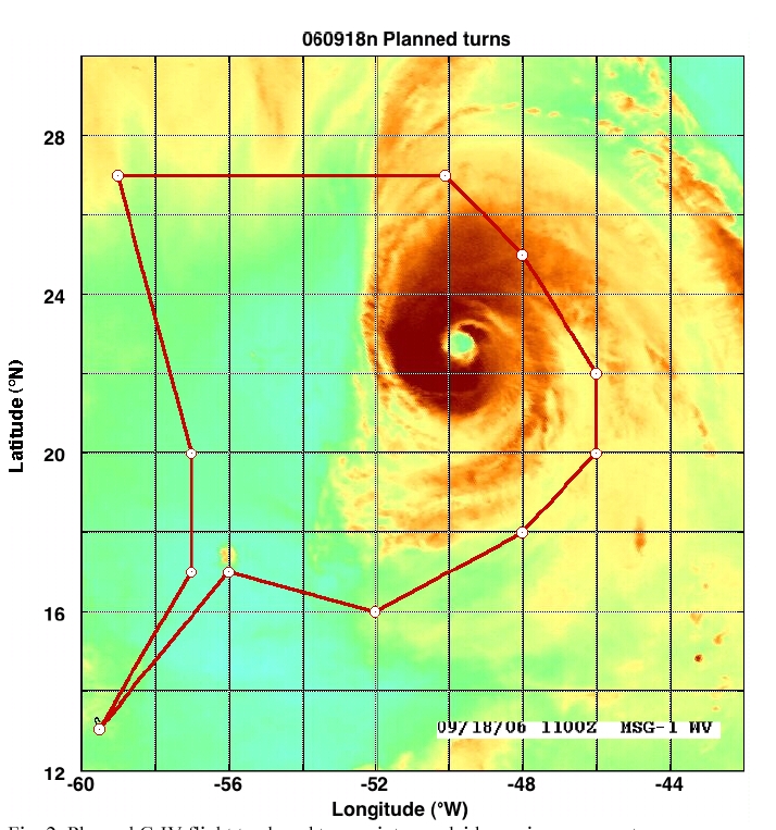
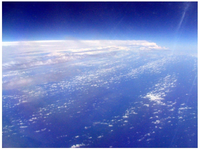
The G-IV will fly a Saharan Air Layer Experiment (SALEX) around Hurricane Helene with a takeoff from Barbados at 1500 UTC and a recovery there 7 hours later. This mission would be coordinated with NOAA42, which would fly an inner core pattern during the same time period. Before the flight, Hurricane Helene was analyzed by NHC as a Category 3 storm with maximum surface winds of 105 kts and a minimum central pressure estimated at 958 mb. The hurricane, located in the mid-Atlantic near 22.5°N, 50°W, was moving to the NW at about 6 kts but a more westward motion was expected to occur later in the day. There was a lot of uncertainty in the track forecast. Helene was imbedded between two large areas of moderately-dry air, according to satellite imagery (Fig. 1). The G-IV would sample this dry air by releasing dropsondes around the periphery of Helene, particularly in the environmental air west of the storm (Fig.2).
Mission Summary :
Takeoff from Barbados was at 1450 UTC and we headed NE to our first drop point at 15°N, 58.2°W (Fig. 3). In route we uploaded precipitable water imagery and other satellite pictures to determine if we needed to alter the flight plan. After looking at the imagery, we decided to try and make some minor modifications to the flight track. We conveyed these changes via X-Chat to Jason Dunion, the SALEX PI who was on NOAA42. He agreed to the changes and we requested them to Michele Finn, the G-IV Aircraft Commander. After discussing the changes with several FAA controllers, Michele received approval. The track changes included extending our NE point further east to 26.1°N, 46.5°W, heading straight south to 22°N along 46.5°W, then head straight west along 18°N (Fig. 3).
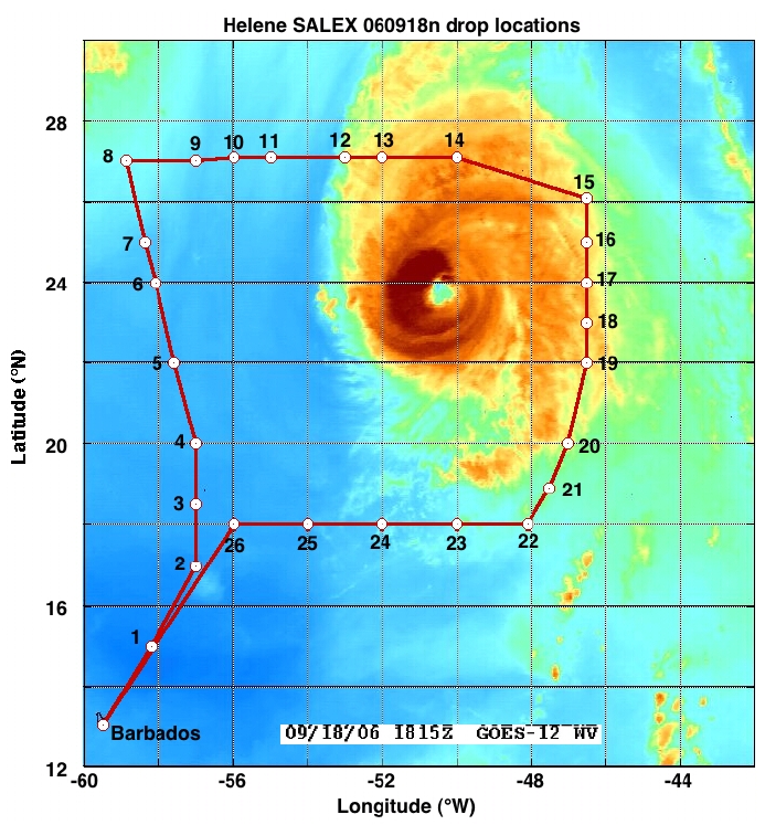
We were hoping to sample some of the dry air immediately adjacent to Helene's convection on the East and South side of the storm.
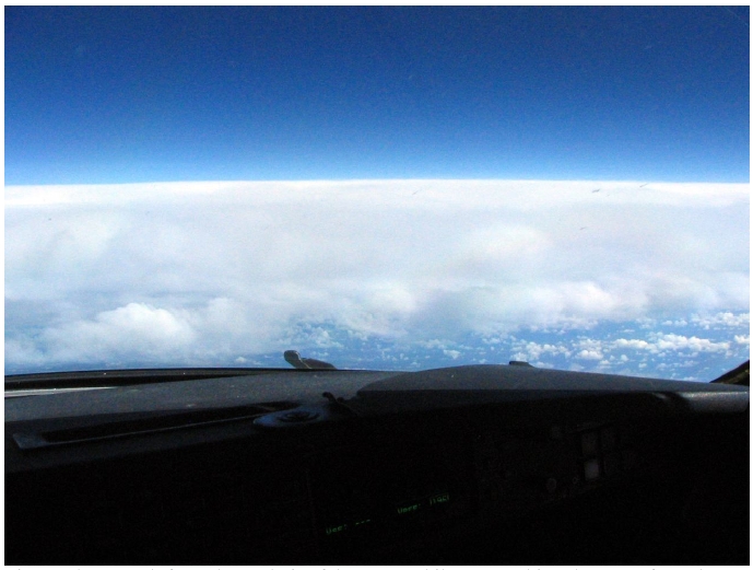
The G-IV was flying through and above virtually cloud-free air during our northward run along 57°-59°W on Helene's west side (Fig.4). Here, we encountered very dry air that extended from flight altitude (~150-175mb) down to at least 850 mb (Fig. 5). In this area, the relative humidity (RH) ranged from 7-18% at 200 mb and from 27-82% at 850 mb.
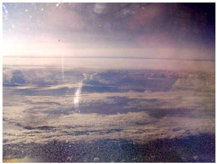
A photograph from the side window of the G-IV looking east toward Helene (Fig. 6) indicates the extent, both vertically and horizontally, of this dry air. The G-IV turned to the east at 1655 UTC near 27°N, 59°W or about 900 km NW of Helene's eye (Fig 3).
After traversing through cirrus clouds that ranged from thin to very thick, we reached drop 15 at 1827 UTC located about 300 km NE of Helene's center (Fig. 3). We then headed south along 46.5° W right along the eastern periphery of cirrus outflow from Helene's eyewall and rainbands. Here we were flying between two cirrus canopies, one that was beneath the flight-level of about 150 mb and another was that was located quite a bit higher than the G-IV's altitude. The RH at 200 mb (just below the G-IV) was dry, ranging from 10-20% while at 500 mb it was more moist with RH ranging from 68-88%. Below 500 mb, all of the sondes on Helen's east side recorded high amount of moistures with RH averaging about 80% in the lowest layers (Fig. 5). We broke out of the cirrus between drops 20 and 21 (Fig. 3) and entered another region of very dry air (Fig. 5). Once again, we were just on the edge of the CDO and in an area where convection was very limited. Where convection did exist, it was relatively shallow. A photograph (Fig. 8) shows some of the shallow convection and the lower portion of the CDO on Helene's east side (looking toward the west).
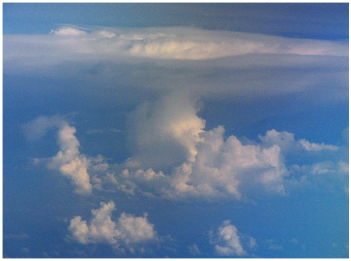
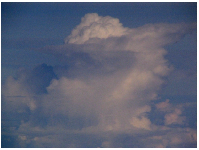
A rare isolated CB, with tops that were just below the G-IV's flight level was found in the area SE of Helene's center (Fig. 9). It is interesting that the horizontal spreading of the cirrus outflow from this CB in at least two opposite directions indicate that the shear was relatively low here locally.
Our final leg was on the south side of Helene, along 18°N which we traversed from 1923- 2031 UTC (drops 21-26, Fig. 3). Here, the air was very dry from 200 mb to 700 mb with RH varying from 3-28% at 200 mb and from 7-34% at 700 mb. Visually, we flew in clear air the whole time and there was almost no convection nearby. An exception was another isolated thunderstorm, this time with cloud tops that exceeded the G-IV altitude (Fig. 10). We landed without incident back at Barbados near 2145 UTC.
Problems :
We used vintage sondes that were manufactured between 2000 and 2003 (most were from 2001) and they mainly performed well. Five of the 26 drops had wind gaps, primarily at the lower levels. We did not observe any noticeable dry bias from these dropsondes.
Michael Black
10/04/06
Page last updated Nov. 9, 2006
Return to Mission page.