Mission Summary
20080830I1 Aircraft 43RF
Gustav Tail Doppler Winds flight 2008
Scientific Crew (43RF)
| Lead Project Scientist | Eric Uhlhorn |
| Radar Scientist | Paul Leighton |
| Dropsonde Scientist | Jun Zhang |
| Videographer | Erica Rule |
Flight Crew (43RF)
| Pilots | M. Nelson
C. Newman
A. Ebhardt
|
| Flight Director | J. Parrish |
| Navigator | T. Gallagher |
| Flt. Eng. | Dewey |
| Data Tech | T. Lynch
J. Smith |
| Elec. Tech | D. Naher
Steve Wade |
Mission Plan :
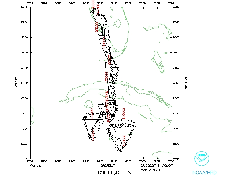
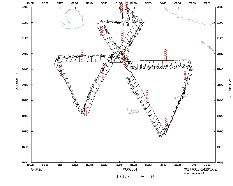
N43RF will fly a EMC-tasked Tail Doppler Winds mission into Tropical Storm
Gustav. It will leave MacDill AFB, FL at 04:00 UTC, and recover at MacDill
AFB, FL by 12:00. The planned flight altitude was 12000', and a "butterfly"
pattern with 100 nmi radial legs designed to obtain three separate Doppler
wind analyses. Ten dropsondes were planned at turn points and storm centers
for each penetration. Additionally, 20 AXBT were loaded for deployment.
Mission Summary :
| Take off
| Landing
| MacDill AFB, FL | 04:50 UTC
| MacDill AFB, FL | 14:20 UTC
| |
N43RF took off from KMCF at 0405 UTC on 30 Aug. Overflight clearance of Cuba
airspace was granted, reducing the ferry time to/from Gustav, which at takeoff
time was located near 20.2°N, 81.3°W. The IP (21.48°N, 82.20°W)
was set up NW of the center, but due to proiximity to the Cuban coast, the
inbound leg was shortened somewhat; the first NW to SE radial leg began at
0941 and ended at 1028 UTC. During the first penetration, a GPS sonde reported
a MSLP of 959 mb. SSTs from the AXBTs ranged from 28.5 to 29.3°C.
The aircraft proceeded north to begin the second inbound (E-to-W) leg at 1053
UTC (20.63°N, 79.75°W). A dropsonde measured 955 MSLP during the second
pass through the eye, and the leg ended to the W of the center at 1140 UTC
(20.51°N, 83.36°W).
The third inbound leg from SW-to-NE began at 1201 UTC and ended at 1246 UTC,
with a shortened outbound radial leg due to proximity to the Cuban coast.
MSLP from an eye dropsonde indicated 955 mb.
Summary of Expendables
| GPS dropwindsondes | 9
|
| AXBTs | 17/19
|
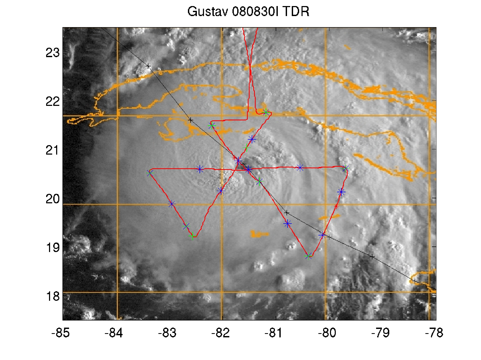
Figure 1. Flight track and expendable locations. GPS dropwindsondes in
green, AXBTs in blue.
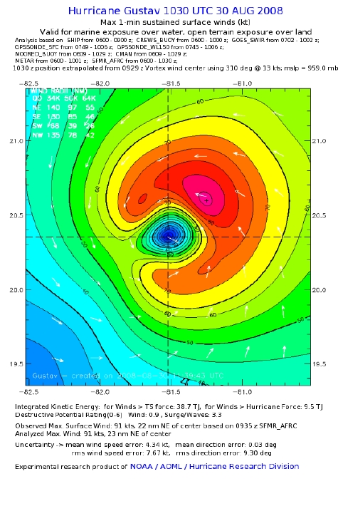
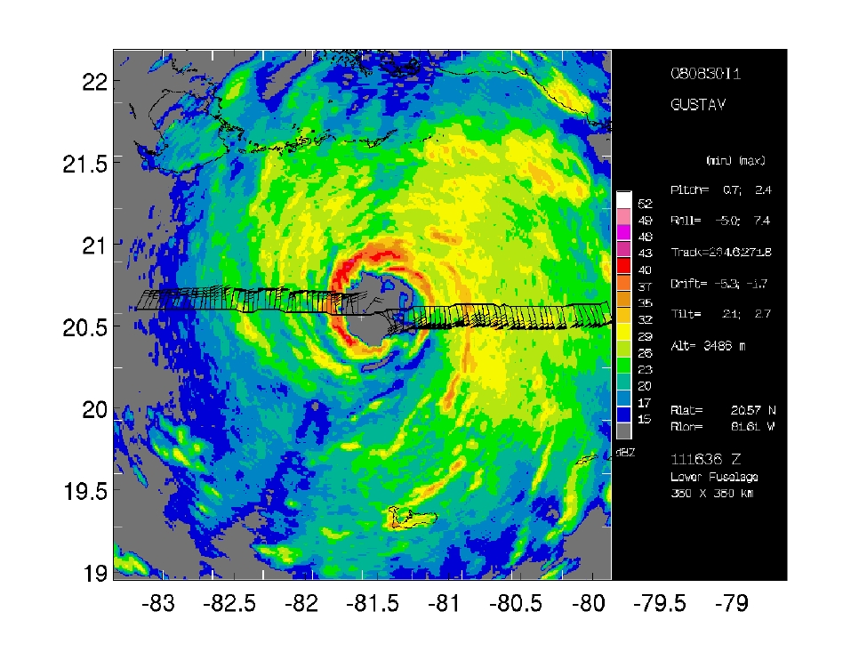
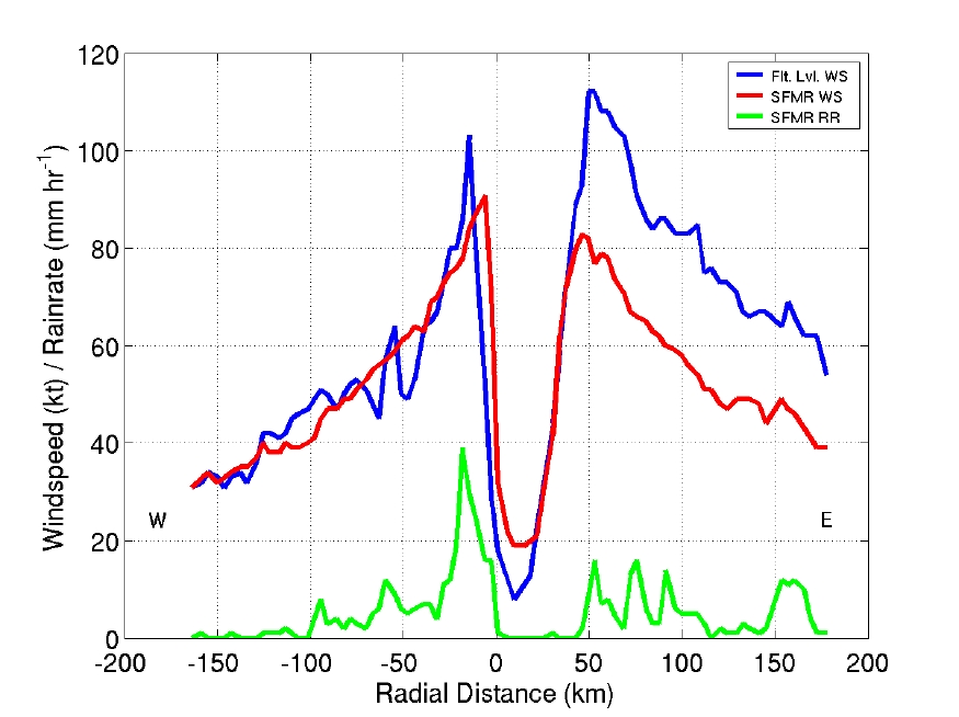
Figure 2. HWind analysis (left); LF radar reflectivity and flight-level
winds for east-to-west radial leg (center); flight-level and SFMR sfc.
windspeed, and SFMR rainrate for same radial leg (right).
Problems :
No major problems to report. Doppler analyses were shortened to NW and NE due
to Cuban airspace restrictions.
EWU
23 April 2009.
Mission Data
Dropsonde plots
700 mb
850 mb
925 mb
1000 mb
1 second data file |
NetCDF data file
Page last updated April 23, 2009
Return to Mission page.