Mission Summary
20080830H1 Aircraft 42RF
Gustav Ocean Winds flight 2008
Scientific Crew (42RF)
| Lead Project Scientist | Sim Aberson |
| Doppler Scientist | John Gamache |
| Radar Scientist | Sylvie Lorsolo |
| Dropsonde Scientist | Bachir Annane |
| NESDIS Scientist | Zorana Jelenak |
| NESDIS Scientist | Chu |
| NESDIS Scientist | Joe Manus |
Flight Crew (42RF)
| Pilots | Barry Choy
Brian Taggert
Al Girimonte |
| Flight Director | Barry Damiano |
| Navigator | Joe Bishop |
| Flt. Eng. | Greg Bast
Steve Wade |
| Data Tech | Bobby Peek |
| Elec. Tech | Bill Olney
Joe Bosko |
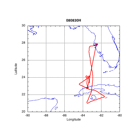
Mission Plan :
A mission as Gustav emerges from the Cuban coast moving northwestward. A
figure-4 is planned with no modification for land, followed by maneuvers for
Ocean Winds (NESDIS).
Mission Summary :
Takeoff: MacDill 2018 UTC
Landing: MacDill 0153 UTC
NOAA42 departed MacDill slightly late due to thunderstorms in the Tampa area
delaying fueling and engine start-up. At the time NOAA42 approached the core
of Gustav, land-based radar (Fig. 1) showed that the eye was just making
landfall on the southern coast of Cuba, and was very well defined. In
addition, a recent pass by the AF reported "stadium effect", suggesting that
the Gustav was a very strong and well organized storm. The figure-4 was
completed when Gustav was inland over western Cuba. During the first pass,
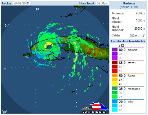
Figure 1: Radar reflectivity from Punta del Este, Isla de la Juventud
radar at 2100 UTC 30 August, as Gustav was making landfall as a category 4
hurricane, and at about the time that NOAA42 entered the core.
flight-level winds of about 136 kt were reported; because Gustav was over land,
no SFMR reading was available during this time. Two radar analyses (not shown)
were completed after the figure-4 pattern. Neither was particularly
interesting except that the low-level wind speeds decreased about 5 m/s from
the first to the second pass (after landfall). In both analyses, the cyclonic
circulation extended upward well past 15 km in height. Nine dropwindsondes
were released during the pattern (not shown), including a few along the south
coast of Cuba between La Isla de la Juventud and mainland Cuba, in shallow
bathymetry.
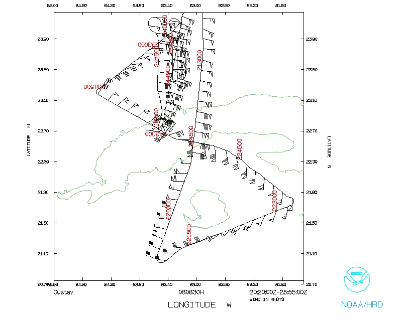
After the figure-4 pattern over land was completed, the aircraft turned
southward back into the northern eyewall for Ocean Winds. However, because it
was dark, that region of Cuba is mountainous, and the eye was not completely
offshore, this portion of the mission was cut short and the plane returned to
MacDill without completing much in the way of Ocean Winds. During this last
part of the mission, lightning became evident in the eye.
During the ferry back to MacDill, radar clearly showed the beginning of a
secondary eyewall on the northern side of the storm, though a secondary wind
maximum at flight level was not yet evident. Microwave imagery (Fig. 2) from
the closest time after this time clearly shows the secondary eyewall nearly
completely formed.
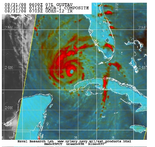
Figure 2: 89 gHz composite from the Aqua satellite over Hurricane
Gustav at 0709 UTC, about six hours after the NOAA42 left the storm, showing
a secondary eyewall nearly completely encircling the inner one.
Problems :
Mission Data
Dropsonde plots
700 mb
850 mb
925 mb
1000 mb
1 second listing |
NetCDF listing
Page last updated Sept. 17, 2008
Return to Mission page.