| LPS | Rob Rogers |
| Radar | Peter Dodge |
| Dropsonde | Daniel Stern |
| Pilots | Randy Tebeest Mike Silah |
| Flight Engineers | Steve Wade |
| Navigators | Tim Gallagher |
| Flight Director | Paul Flaherty |
| Data Engineers | Sean McMillan John Hill Mark Rogers |
The NOAA N42RF will fly a genesis mission as a part of IFEX. It will consist of a survey pattern into a strong tropical wave emerging off the Yucatan peninsula while conducting a modified diamond pattern paralleling the coast of the Yucatan. N32RF will fly at 12,000 ft. There are 19 sondes, 4 AXBT's planned for this flight. The P3 will leave MacDill AFB, FL at 10:00 AM EDT and will recover at MacDill AFB, FL by 7:00 PM EDT.
Mission Summary :
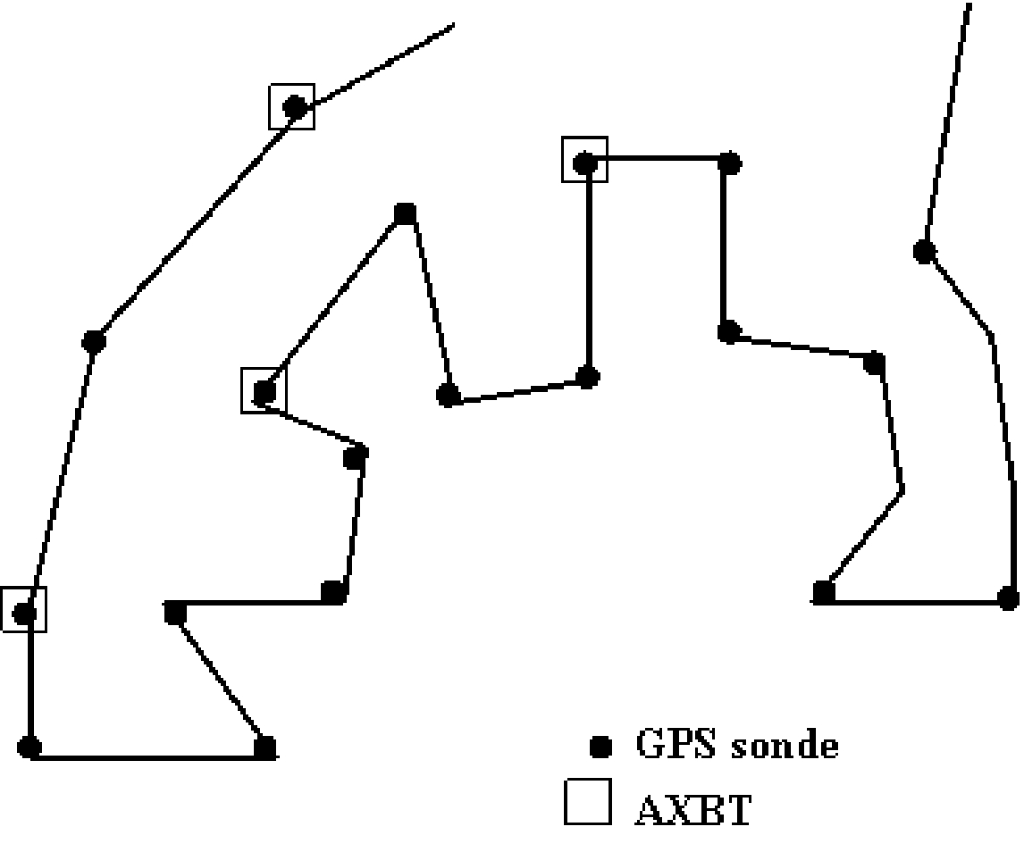
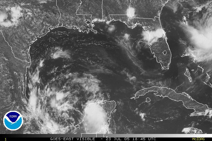
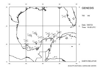
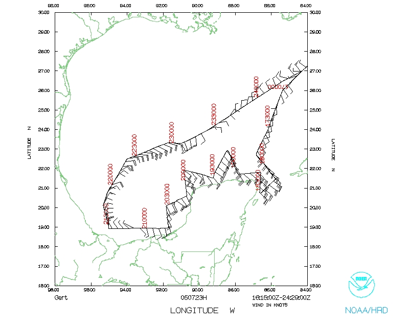
This was a mission designed to follow the previous night's mission into the suspect system over the Yucatan peninsula. Today's mission had a planned takeoff time of 14 UTC. The pattern called for a similar type of survey pattern as the previous night (Fig. 1), though with a greater emphasis on the western boundary of the Yucatan peninsula. There were plans to drop 19 GPS sondes and 4 AXBTs (Fig. 2). Because of some problems with the inertial navigation system on the aircraft, there was a ~2 hour delay in taking off, meaning N42RF did not take off until 1630 UTC. By the time the IP was reached, it was evident from satellite imagery that the system was centered in the Bay of Campeche as a broad circulation center (Fig. 3). The center of the circulation appeared to be in the central Bay of Campeche. There was a burst of convection in the eastern periphery of the circulation over the Yucatan peninsula, but this did not appear to be the dominant feature in the system. Scattered convection was also evident on the northern and western side of the circulation center.
Because of this new position, the pattern was altered. N42RF did not travel as far down the eastern side of the Yucatan; rather it was extended further to the west along the southern Bay of Campeche in an attempt to capture the circulation seen in the satellite
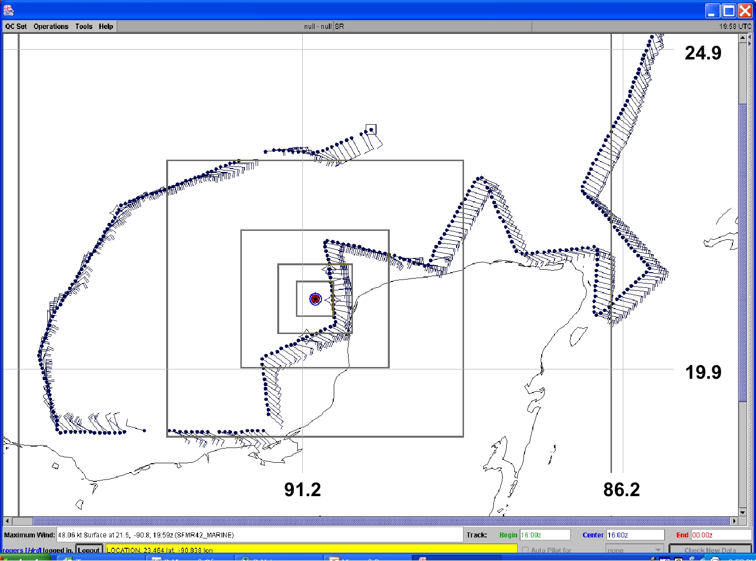
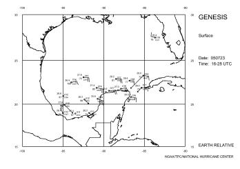
imagery. In addition, to conserve time and allow for a longer extension to the west, the square edges of the pattern on the north and west side of the Yucatan were replaced by a triangular shape. Flight-level winds from the flight (Fig. 4) showed generally east-southeasterly winds around the Yucatan peninsula. These winds shifted to northeasterly at a location northwest of the peninsula, and they switched to northwest in the Bay of Campeche, thus confirming the existence of a circulation center as indicated in satellite imagery (cf. Fig. 3). GPS drop data from this flight (Fig. 5) showed northwesterly winds near the Mexican coast at 95 W, indicative of a center of circulation just north of the coast at around 19 N 93 W and consistent with the flight-level winds. The similarity in location in the 700 mb and surface circulations indicates that the vortex at this time was reasonably vertically coherent. The plane returned to MacDill at 0058 UTC. As a result of the data collected on this flight, NHC declared this system a tropical depression,
T.D. #7. The upgrade was made during the flight, which marks the first time that a system was declared a depression while a NOAA P-3 was still investigating it. N42RF recovered at MacDill AFB, FL by 9:00 PM EDT.
Mission Data :
Flight Data | ||
 Flight track |
 Temperature and Moisture |
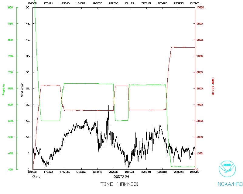 Wind and Atlitude |
| Start | End |
| 16:30:19 Z | 23:24:56 Z |
Problems :
There were no problems with the instrumentation. The only problem was with a ~2 hour delay at takeoff due to inertial navigation problems. Two sondes failed, but the AXBTs and the SFMR worked well.
Rob Rogers
Lead Project Scientist