 |
 |
| Aircraft Commander | Scott Price |
| Co-pilot | John Rossi |
| Co-pilot | Nate Kahn |
| Flight Engineer | |
| Navigator | Brian Richards |
| Flight Director | Ian Sears |
| System Engineer | Mike Mascaro |
| Data Technician | Joe Greene |
| LPS | Rob Rogers | HRD |
| Dropsonde/AXBT | Jun Zhang | HRD |
| Radar | Jon Zawislak | HRD |
| IWRAP | Paul Chang | NESDIS |
| IWRAP | Joe Sapp | NESDIS |
|
|
|
Mission Plan :
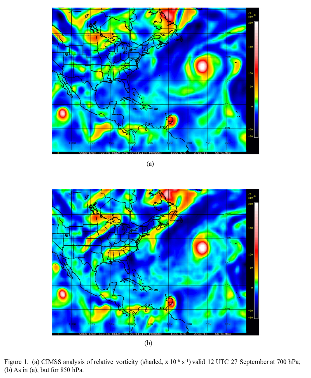
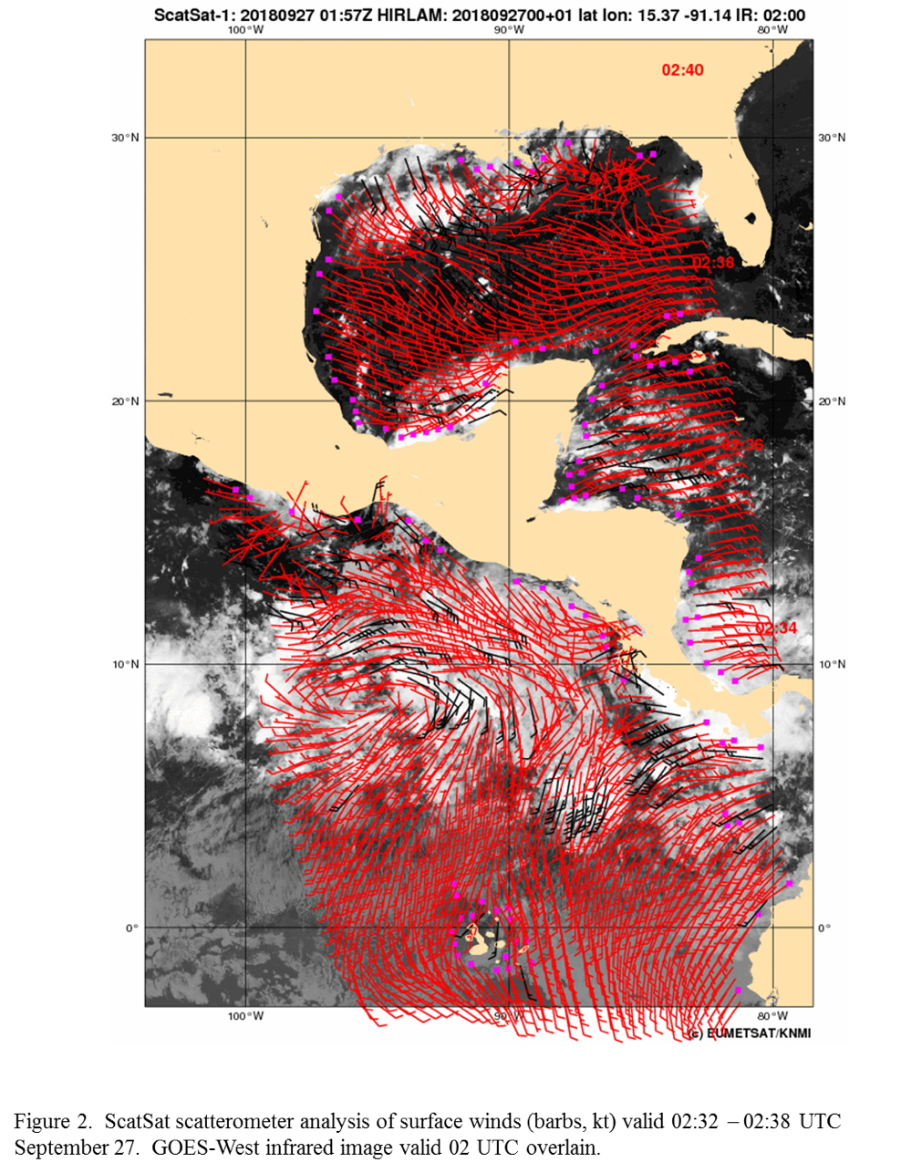
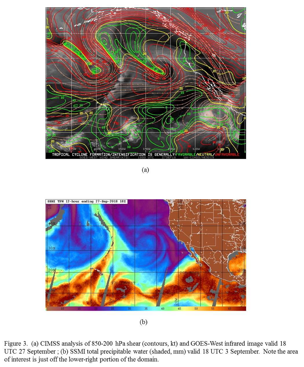
Conduct second HRD-tasked genesis mission into system in the east Pacific. The system has moved away from the coast and appears as an elongated circulation oriented southwest/northeast with 700- and 850-hPa vorticity maxima centered around 10°N 96°W (Fig. 1). Surface winds from a scatterometer overpass several hours prior to takeoff (Fig. 2) show this circulation as well, though a bit south of the vorticity analysis. Also evident in the surface winds is strong easterly flow to the north of the circulation, which may be associated with easterly flow advecting from the western Caribbean through the terrain gap in Costa Rica and Nicaragua and into the east Pacific (the "Papagayo Jet"). A broad region of monsoonal southwesterly flow to the south of the elongated circulation is also seen in the surface winds. Scattered showers and convection have occurred in the general vicinity of the elongated circulation, but it has not consolidated yet (cf. Fig. 2). The environment generally was moderately conducive for genesis, with light-to-moderate (~10-15 kt) 850-200 hPa shear (Fig. 3; note that actual location of system is just off the lower right edge of the figure) and high total precipitable water indicative of a moist lower troposphere.
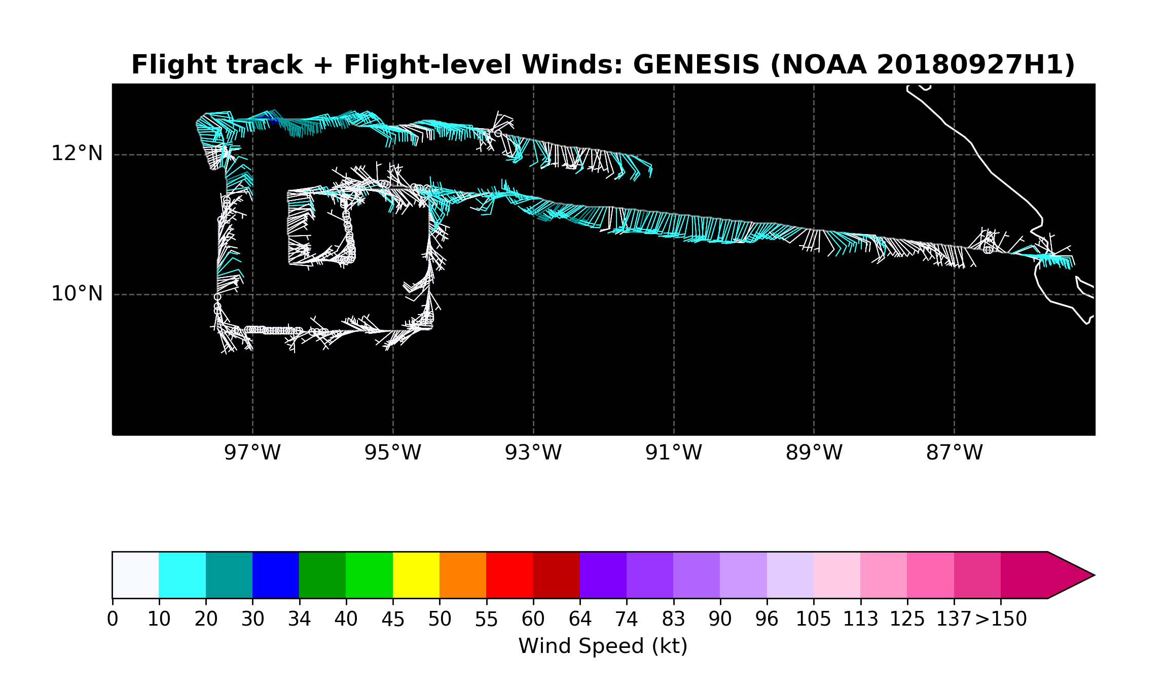
Fly a square-spiral pattern (Fig. 4), with a 3 x 3 degree outer box centered on the best guess of the 700 hPa vorticity center. Drop sondes at each 1-degree latitude/longitude point. Begin the square-spiral on the northeast outer corner, head west, and complete the outer box. Then fly the inner box, continuing to drop sondes at each 1-degree point. Drop AXBTs at the four outer corner points, with an IR sonde paired with those. Fly at 12,000 ft altitude.
Mission Summary :
| Take off | Landing
| Liberia, Costa Rica
| 13:00 UTC
| Liberia, Costa Rica
| 20:33 UTC
| | ||
 |
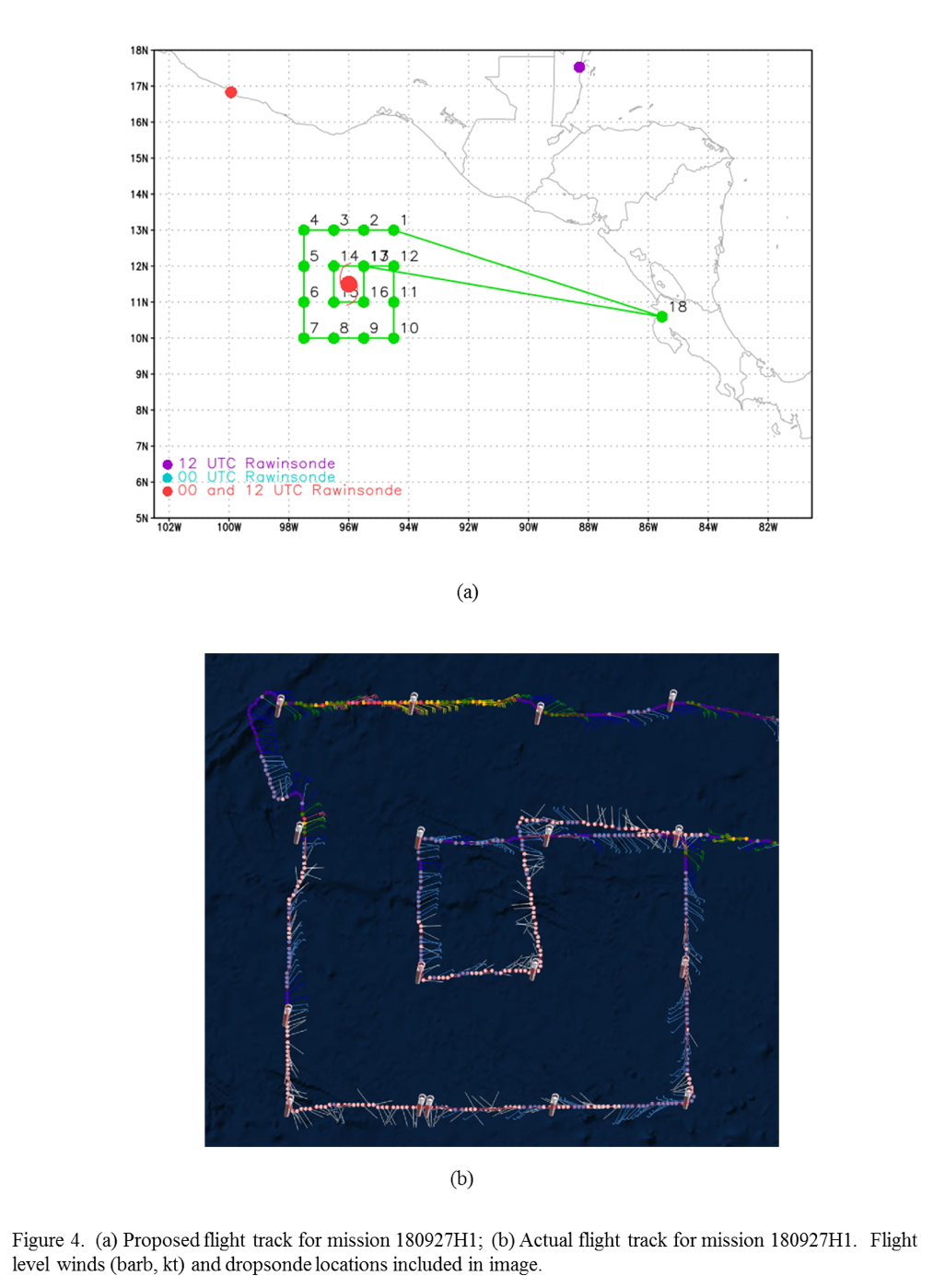 |
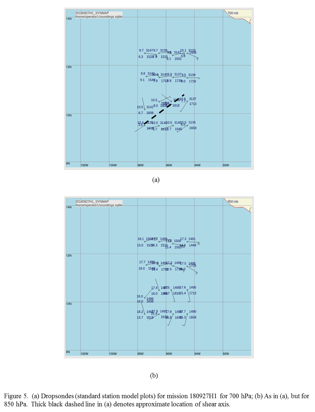
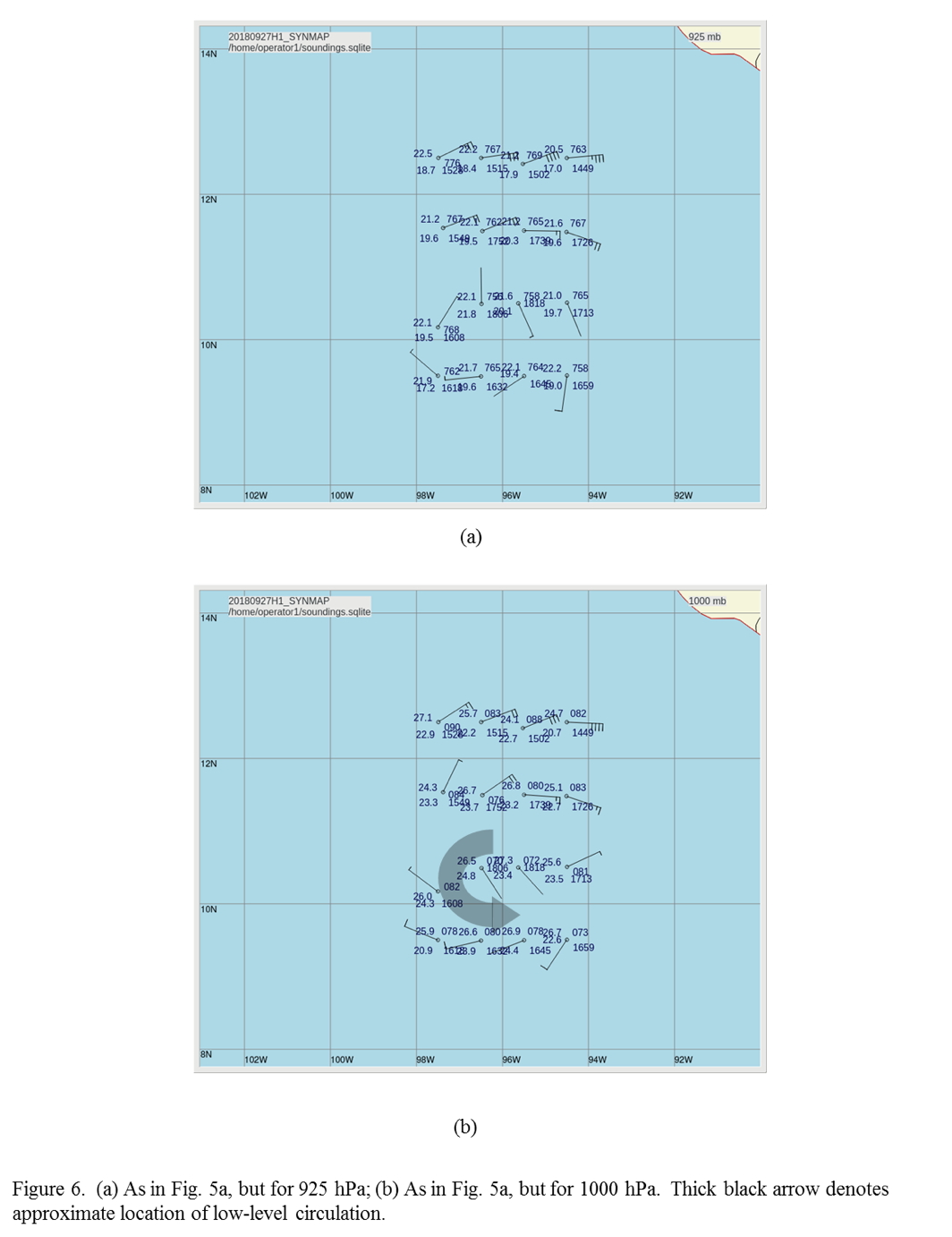
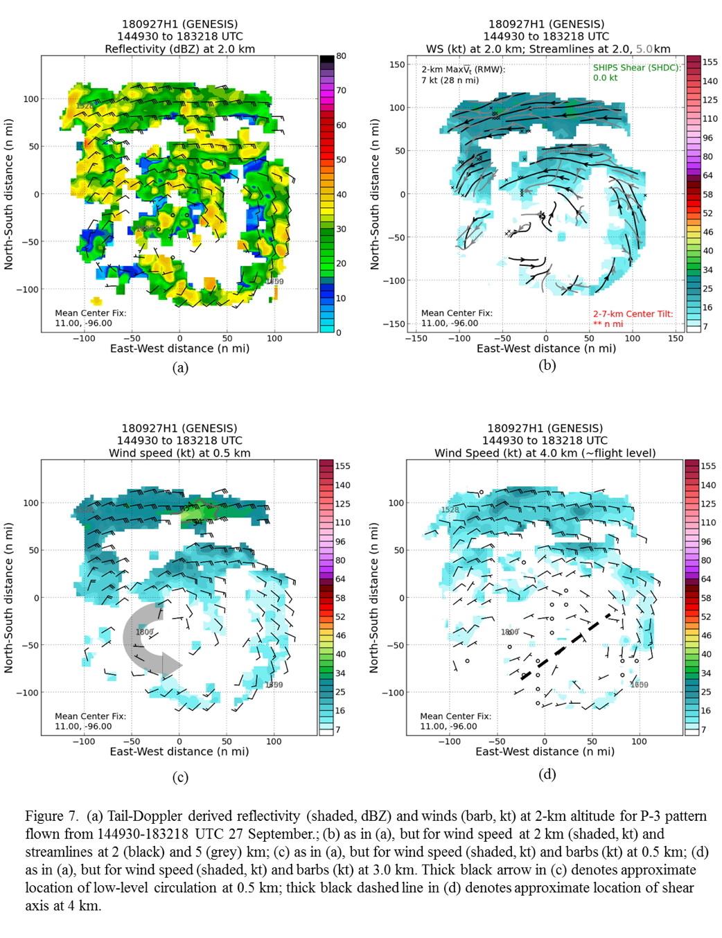
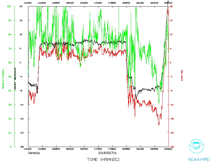
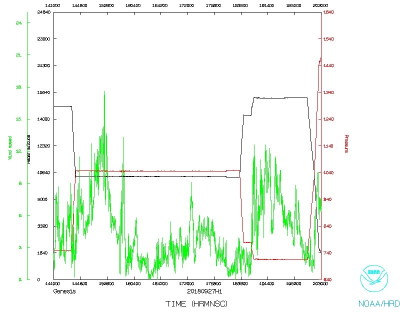
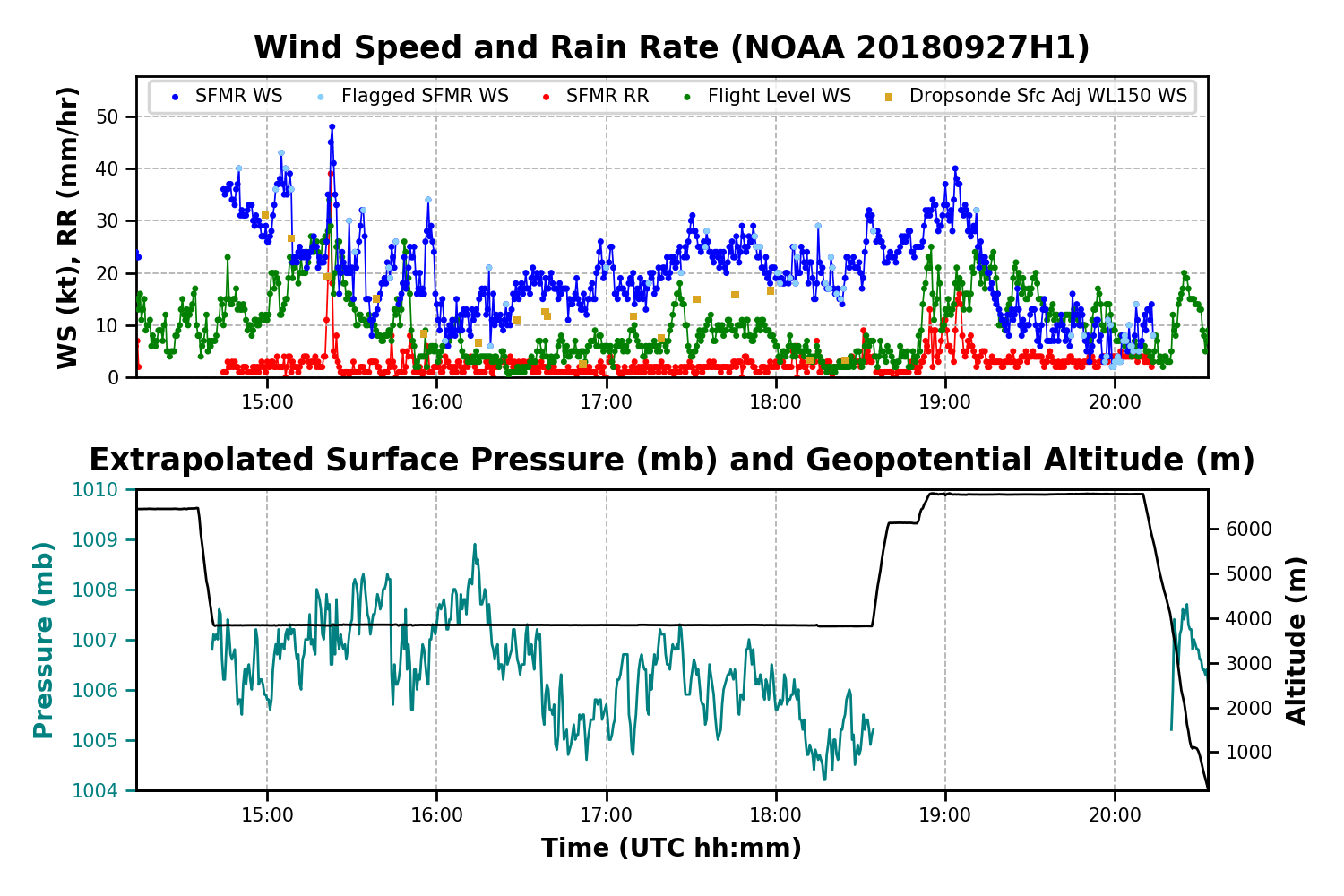
Takeoff was at 1300 UTC from Liberia, Costa Rica. The mission was conducted as planned (cf. Fig. 4b). Both tail Doppler radar and dropsondes show a fairly clear low-level circulation (LLC) in the southwest region of the outer box. This is most pronounced below 700 hPa. At 700 hPa there is mostly easterly flow but a region of weak westerlies along the southern west-east leg (Fig. 5a). It almost looks like more of a shear axis that is oriented west-southwest/east-northeast at 700 hPa, and resembling more of a circulation closer to the surface (cf. Figs. 5b, 6). The strongest near-surface winds are 25 kt on the northern side, similar to that shown by the scatterometer (cf. Fig. 2), and there is 15 kt westerly flow on the south side (cf. Fig. 6b). Radar generally confirms this interpretation of a shear axis aloft and circulation center in the lower levels (Fig. 7). Dropsondes show mostly moist air throughout the box, with relative humidity ~80% or higher, so it does not appear like there is low- to mid-level dry air inhibiting precipitation.
 |
 |
At the start of the flight there was scattered convection and precipitation around the edge of the box. During the mission the interior started to fill in with more congestus, stratiform, and occasional deeper convection with echo tops reaching near 14 km altitude. The system is definitely better-organized than the previous day. With continued periods of diabatic heating, it seems likely to develop into a tropical depression. This could happen by Friday, if deep persistent convection develops. The aircraft landed at 2033 UTC in Liberia. A total of 18 (16 planned plus 2 backup) sondes were released, of which 4 were IR sondes. Four AXBTs were also launched.
|
Prepared by the Hurricane Research Division Sept. 26, 2018 7:16 PM EDT Aircraft: N42RF Proposed takeoff: 27/1300Z | |||||||
| DROP LOCATION TABLE | |||||||
| # | LAT | LON | Time | ||||
| deg min | deg min | hr:min | |||||
| 1 | 13 00 | 94 30 | 1:41 | ||||
| 2I | 13 00 | 95 30 | 1:54 | ||||
| 3I | 13 00 | 96 30 | 2:07 | ||||
| 4 | 13 00 | 97 30 | 2:21 | ||||
| 5I | 12 00 | 97 30 | 2:35 | ||||
| 6I | 11 00 | 97 30 | 2:48 | ||||
| 7 | 10 00 | 97 30 | 3:03 | ||||
| 8I | 10 00 | 96 30 | 3:16 | ||||
| 9I | 10 00 | 95 30 | 3:29 | ||||
| 10 | 10 00 | 94 30 | 3:43 | ||||
| 11 | 11 00 | 94 30 | 3:57 | ||||
| 12 | 12 00 | 94 30 | 4:12 | ||||
| 13 | 12 00 | 95 30 | 4:26 | ||||
| 14 | 12 00 | 96 30 | 4:40 | ||||
| 15 | 11 00 | 96 30 | 4:54 | ||||
| 16 | 11 00 | 95 30 | 5:08 | ||||
| 17 | 12 00 | 95 30 | 5:23 | ||||
Mission Evaluation :
The mission was definitely a success. All the dropsondes were released mostly at their planned locations. We managed to capture a broad LLC both with radar and dropsondes, with the sondes also providing thermodynamic measurements. With this dataset we should be able to calculate circulation budget terms and mass flux profiles to determine the roles of stretching and tilting in the circulation spin-up. As well as possibly the contribution of different precipitation modes to genesis. NHC looked at these drops as well, which helped them in writing their outlook.
 |
Problems :
None of the AXBTs worked, and there was one fast-fall sonde. All four IR sondes seemed to work.
Rob Rogers
Oct.19, 2018
 Flight track |
 Temperature and Moisture |
 Wind and Atlitude |
 Flight track |
 Altitude, Pressure, Rain Rate, and Wind |
Flight Director's log |
Flight Director's manifest |
NetCDF data |
serial data |
1 second data
LPS log |
Radar log |
Drop log |