Mission Summary
20190903H2 Aircraft 42RF
TDR/Reconnaissance
Aircraft Crew (42RF)
| Aircraft Commander | Nate Kahn
|
| Co-pilot | John Rossi
|
| Co-pilot | Adam Abitbol
|
| Flight Engineer | Paul Darby
|
| Flight Engineer | Tuffael
|
| Navigator | Sam Urato
|
| Flight Director | Jack Parrish
|
| System Engineer | Todd Richards
|
| Data Technician | Mike Mascaro
|
| Data Technician | Mac McAlister
|
Science crew (42RF)
| LPS | Frank Marks | HRD
|
| Dropsonde | Kathryn Sellwood | HRD
|
| Radar | Xuejin Zhang | HRD
|
| Observer | Karen Holbrook | Teachers in Air
|
| Observer | Jodie Nanni | Teachers in Air
|
| Observer | Andrea Blomeley | Teachers in Air
|
Science crew (Ground)
| Radar | John Gamache | HRD
|
Mission Plan :
NOAA42 will conduct an NHC-tasked Reconnaissance mission and an EMC-requested
TDR mission into Tropical Storm Fernand.
Mission Summary :
| Take off
| Landing
| Linder_Lakeland, FL
| 19:10 UTC
| Linder_Lakeland, FL
| 03:38 UTC
|
| Expendables
| GPS sondes Deployed 0
AXBTs Deployed 0
| |
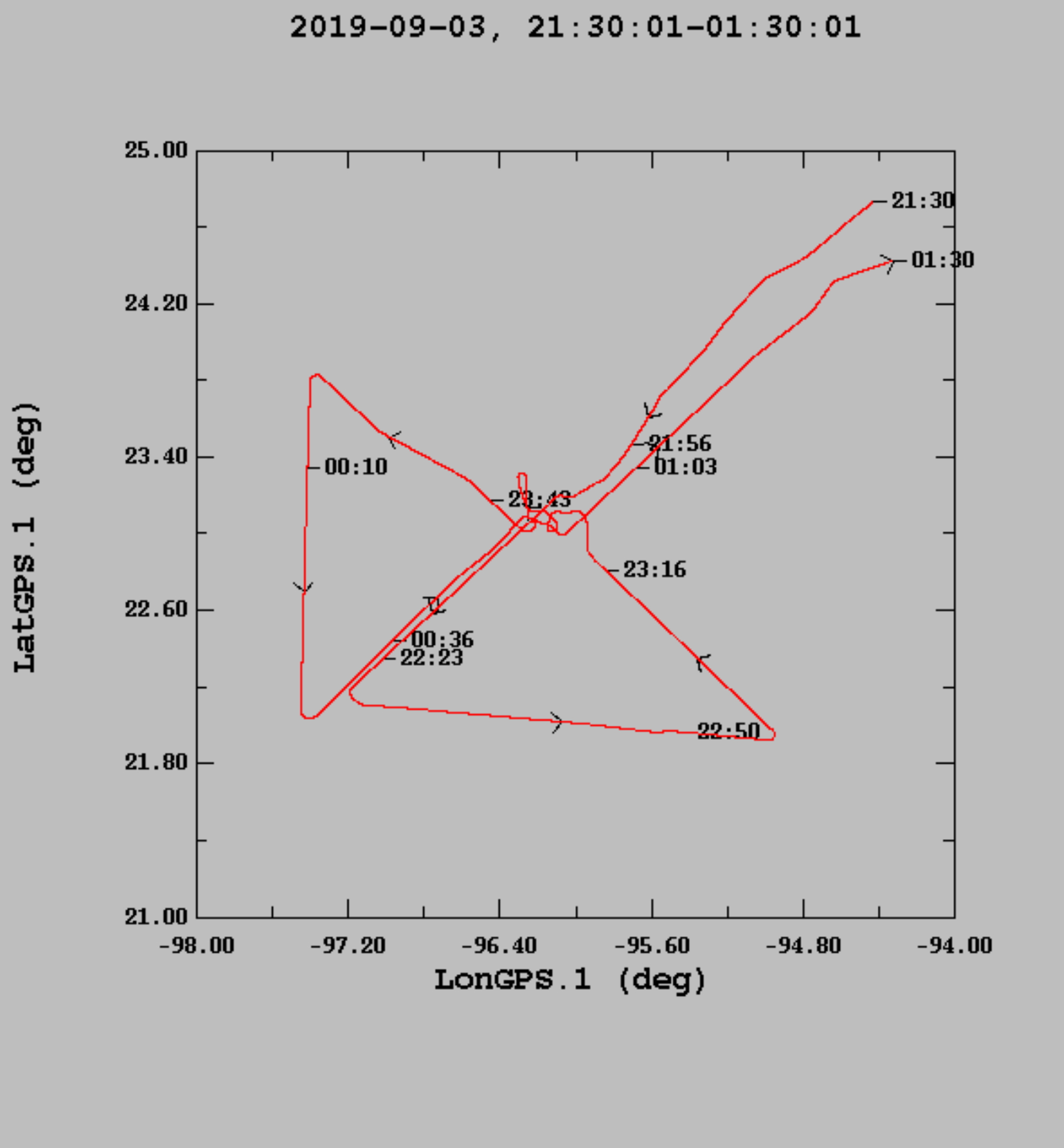
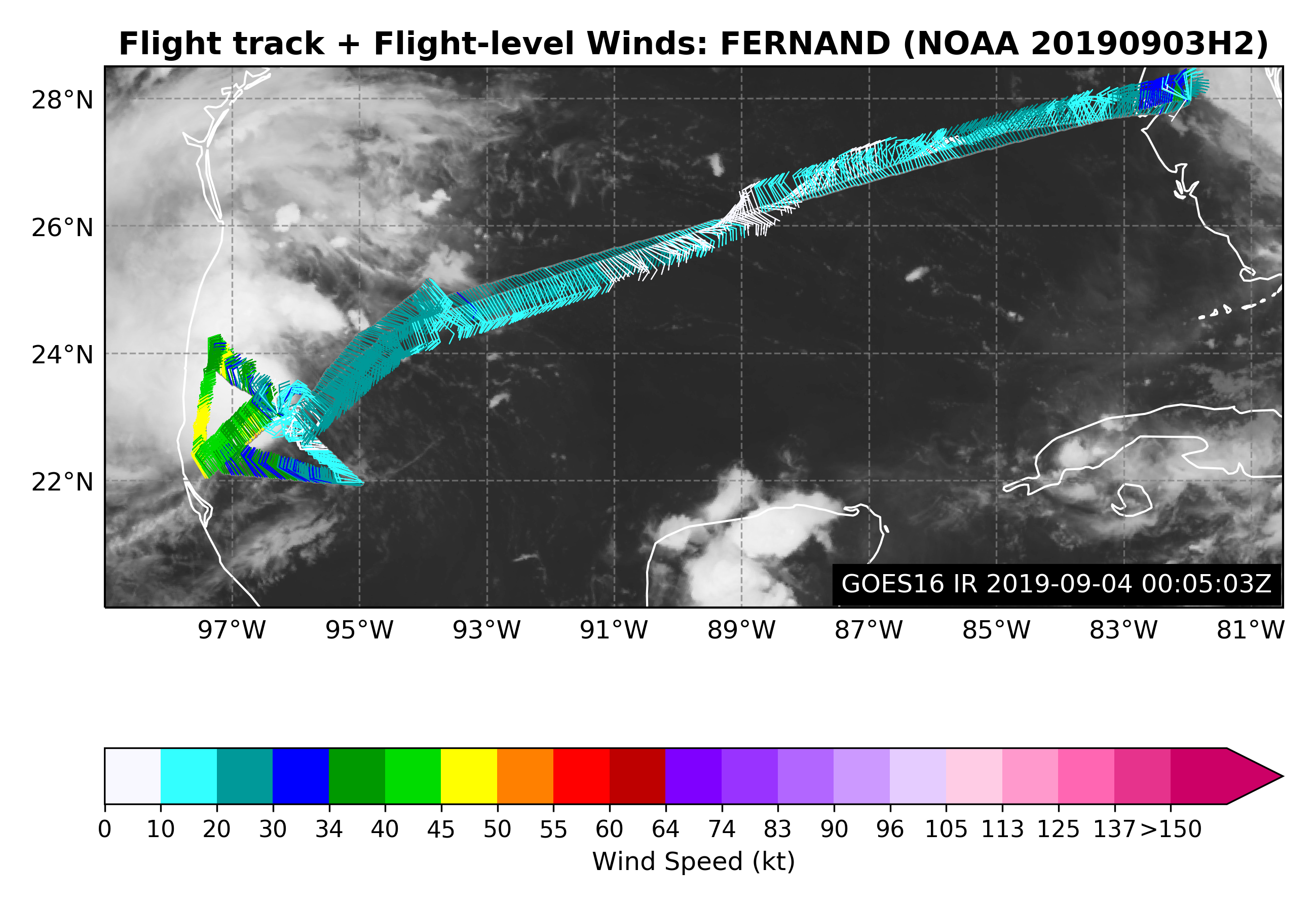
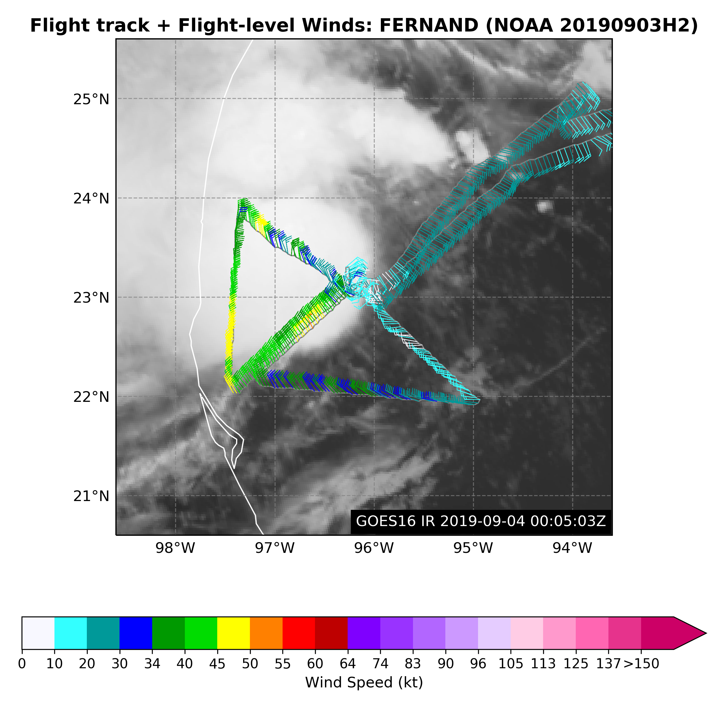
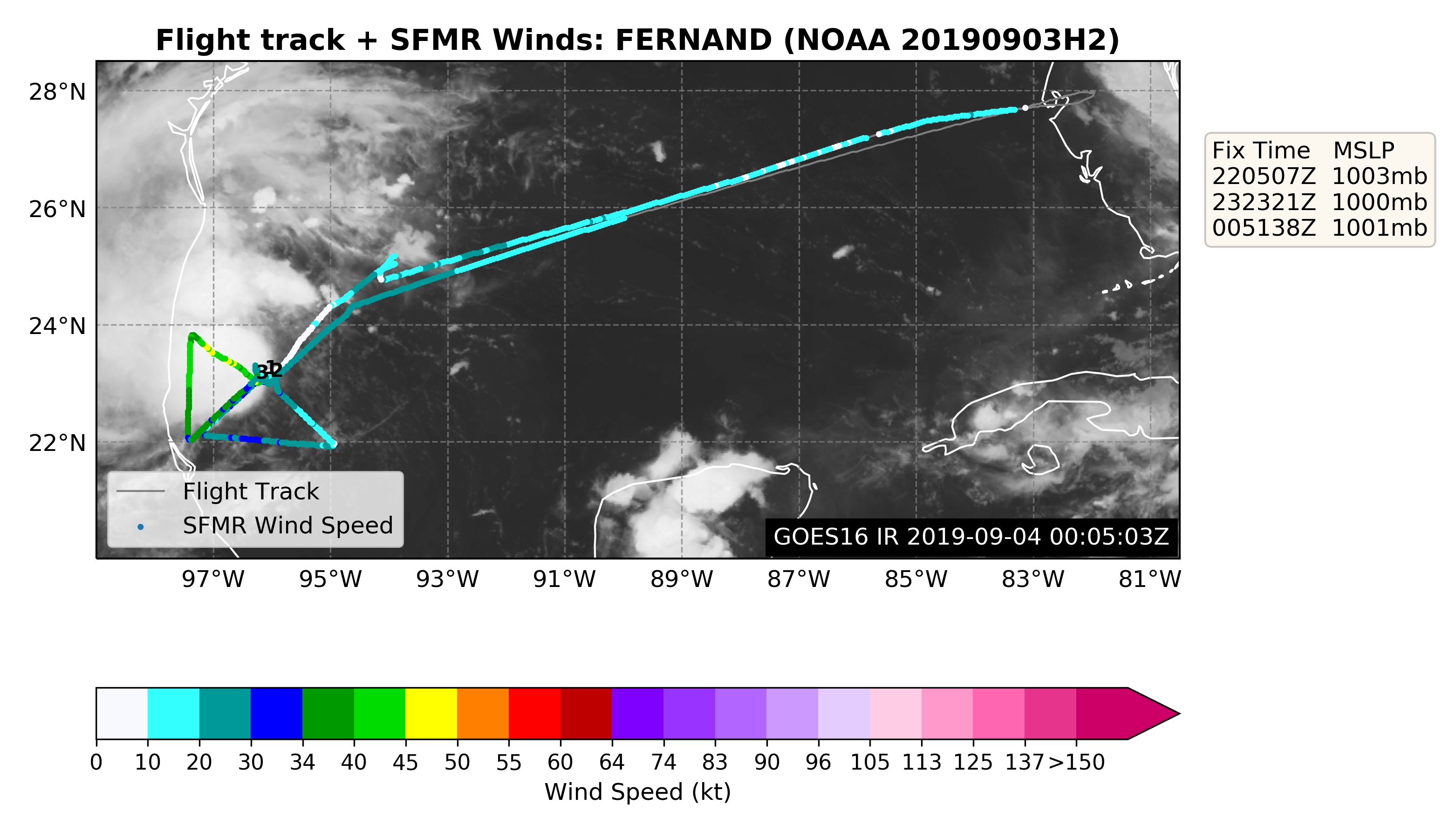
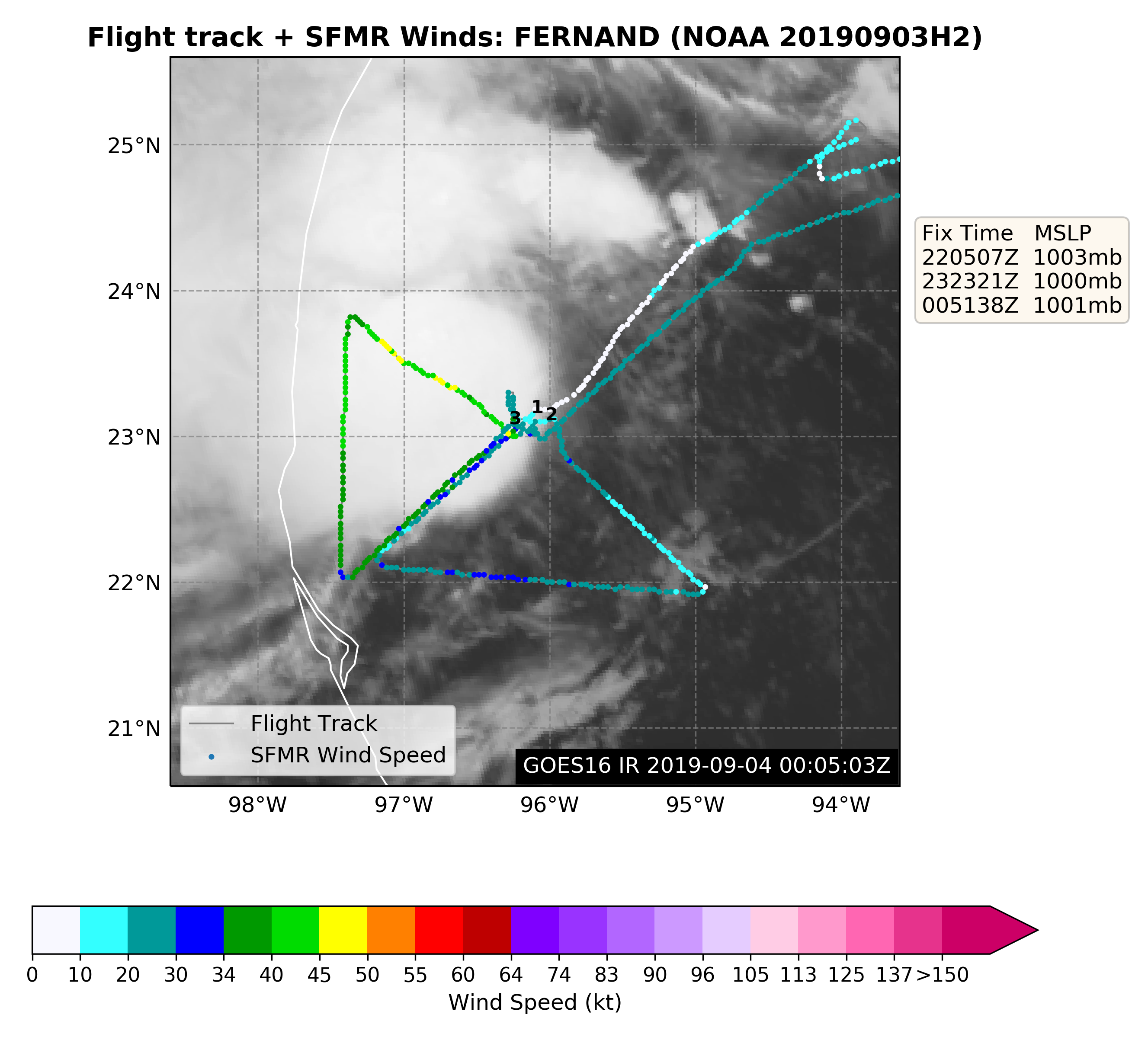
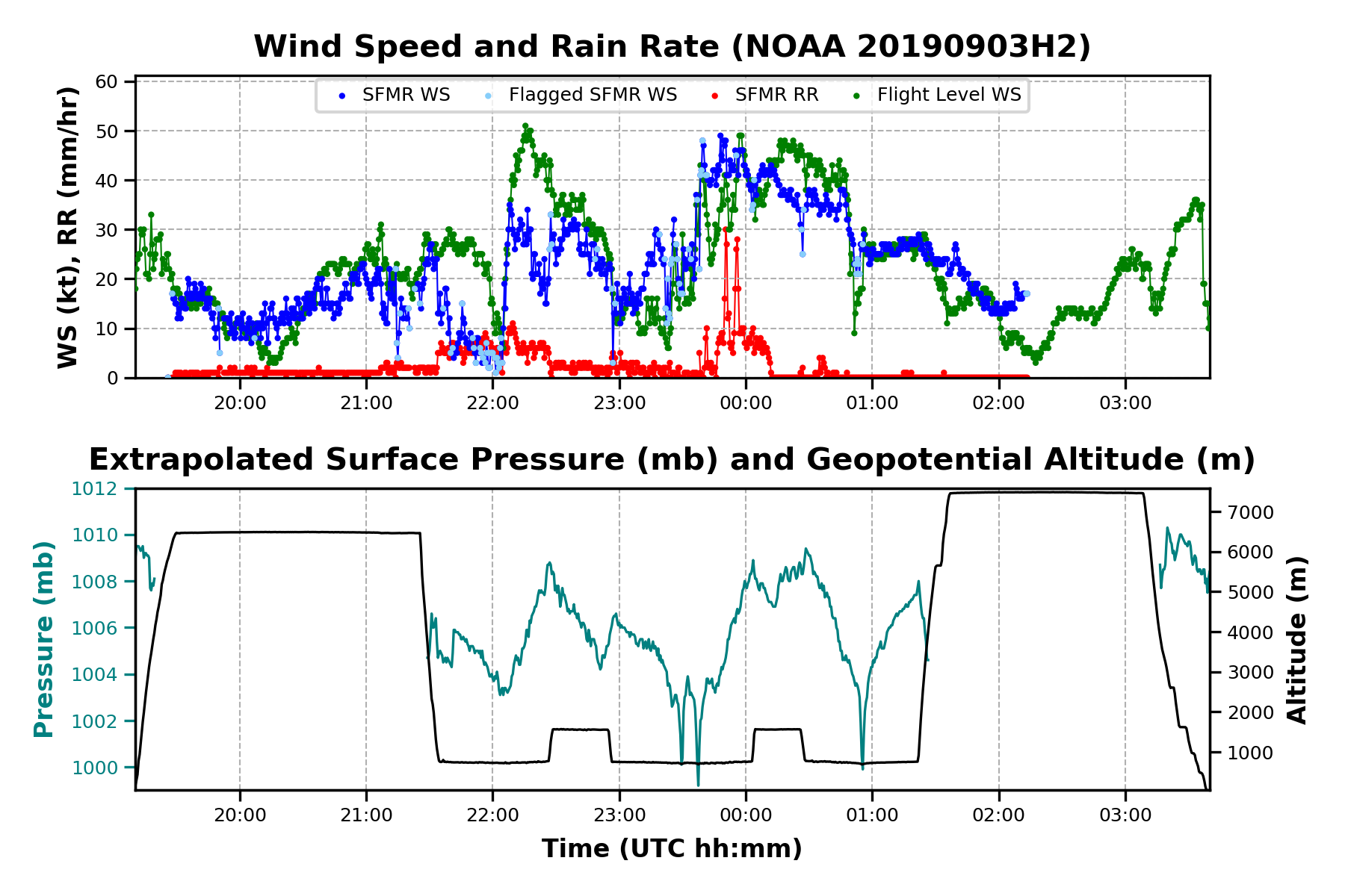
Completed reconnaissance Alpha pattern at 2500 ft pressure altitude with
3 legs across the center of developing TS Fernand. TDR coverage of
Fernand’s circulation within 105 nm of the center using 3 Doppler
analyses. All analyses were transmitted to NHC and all of the TDR
data quality controlled and transmitted to NCO meeting the EMC
objectives.
Very difficult to locate the center with a broad area of light and
variable winds southeast of the major precipitation shield. Lowest
wind and pressure were tucked up against the major convective band
ending in a hook west to southwest of the circulation. There was a
lot of hunting for the center on the mission but it did not affect
the TDR analyses.
The TDR analyses depicted a very shallow vortex (< 2 km altitude) with
40-50 kt winds to the northwest of the center and 15-20 kt wind
southeast of the center. The vortex was tilted downshear (from
southeast to northwest) from 2 km to 5 km altitude by 40-50 km.
Encountered extremely heavy rain to the NW of the center with a very
large stratiform rain area covering the NW semicircle of the storm.
This storm will be a major rain threat over northeastern Mexico as
it hits the Sierra Madre Occidental mountains.
No dropsondes were deployed as the pattern was flown at such low
altitude.
Mission Problems :
MMR suffered quite a bit from severe attenuation on the legs to the
northwest and downwind leg to the west of the center.
Frank Marks
6 September 2019
Mission Data :
LPS log |
Radar log |
Drop log
Flight Director's log |
Flight Director's manifest |
NetCDF data |
1 second data
|
SFMR data
Page last updated January 21, 2020
Return to Mission page.