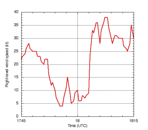
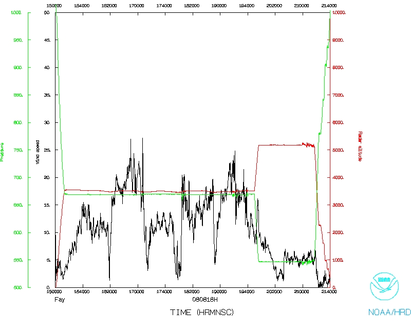
Figure 1: Flight-level wind speed showing multiple wind speed minima along south to north pass through the center of Fay.
| Lead Scientist | Sim Aberson |
| Dropsonde Scientist | Kathryn Sellwood |
| Pilots | Mark Nelson Al Girimonte |
| Flight Director | Barry Damiano |
| Navigator | Gallagher |
| Flt. Eng. | Greg Bast |
| Data Tech | Bobby Peek
Green |
| Elec. Tech | Bill Olney Chuck Rasko Darby |
Mission Plan :
A mission as Fay emerged from the Cuban coast moving northwestward. A butterfly pattern is planned, modified to make sure we do not fly within 12 nm of land (Cuba and Florida).
Mission Summary :
| Take off | Landing
| MacDill AFB | 15:01 UTC
| Louis Armstrong Airport | New Orleans, LA 21:41 UTC
| | ||
The pattern started with a northwest-southeast pass through the center, though the second leg was modified to go toward the east to stay offshore Cuba. An uneventful second pass from northeast to southwest was then completed. The third pass, south to north, was interesting in that there were two distinct wind speed maxima on the south side, though the northern one was clearly the center as it was concurrent with a wind direction shift (Fig. 1).
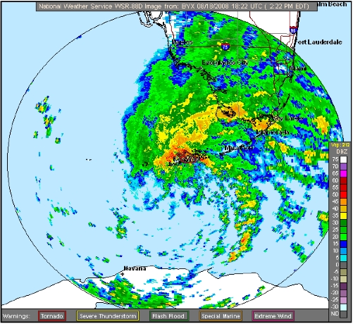
A fourth pass, northwest to southeast, was then completed. As the northbound track began to the southeast of the center, Key West radar showed a strong rainband with embedded mesocyclones making landfall in the Florida Keys and Southwest Florida, and some tornado warnings were issued (Fig. 2). The flight track then went along the inside of the first band, then a right turned moved the plane between two bands along the inside of the second. A left turn up the southwestern Florida coast crossed the second band.
Dropwindsondes were released at regular intervals near the bands, accomplishing two goals:
Problems :
No major problems were noted except for hotels in New Orleans.
Mission Data
Flight Data Plots
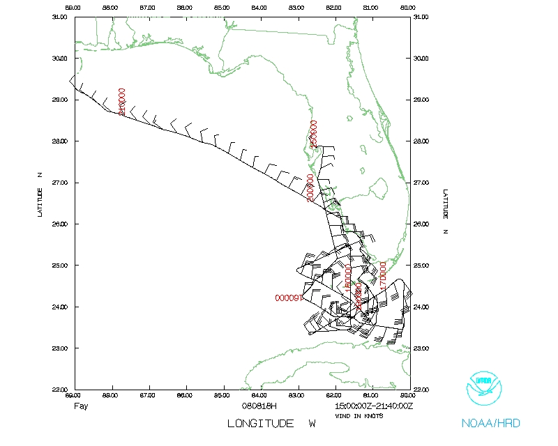
Flight track
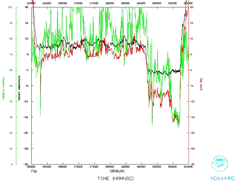
Temperature and Moisture
Wind and Atlitude

Flight track detail
Return to Mission page.