Flight Data | ||
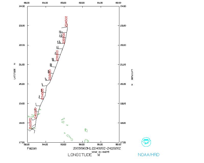
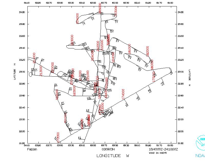 Flight track |
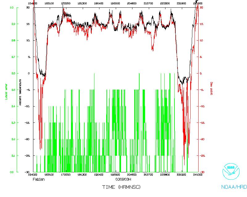 Temperature and Moisture |
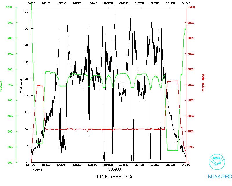 Wind and Altitude |
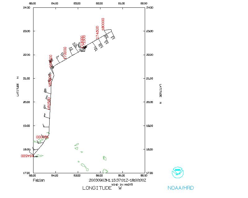 Flight track start |
 Flight track end |
|
| Lead Scientist | Peter Dodge |
| Lead Scientist | Paul Chang (NESDIS) |
| Radar Scientist | Frank Marks |
| Sonde Scientist | Sim Aberson |
| CBLAST Scientist | Kerry Emanuel (MIT) |
| CBLAST Scientist | Daniel Esteban (UMass) |
| CBLAST Scientist | Beth Kern (UMass) |
The plane will leave St. Croix at 11:00 AM AST and fly a two-plane CBLAST butterfly pattern with stepped descents in between rainbands and recover at St.Croix by 8:00 PM AST.
Mission Summary :
The flight left St. Croix, USVI at 11:00 AM AST and recovered at 8:15 PM AST at St. Croix, USVI.
PDF plots of N42RF's GPS drops
PDF plots of all GPS drops' winds
PDF plots of AFRES's buoy drops
Today history was made for hurricane research as the NOAA P-3Õs went places and observed things never before documented in hurricanes and the 53rd weather Squadron of the Air Force Reserve Command deployed 16 drifting buoys, 4 Lagrangian floats and 2 ARGO/SOLO floats just ahead of Hurricane Fabian. It was another long, hard, difficult day for CBLAST PIÕs, HRD scientists, AOC flight crews, AFRC crews and AERO riggers. CBLAST PI and Aero riggers worked through last night to rig and load buoys and floats and on an AFRC WC-130J aircraft. 53rd crew labored to fix a broken aircraft component and then executed a long ferry to the storm and deployment operation well into the night before landing early this morning at St Croix.
Fabian began re-intensifying during the afternoon flight while the two P-3Õs were searching for rain-free regions to do the planned CBLAST stepped descent patterns into the hurricane boundary layer. At the same time the WC-130J took off from Keesler and headed for the storm, then flying the periphery while the 2 P-3's worked the eyewall and boundary layer. The entire inner core of the storm filled in with heavy rain during the afternoon, both with young convective bands and large stratiform regions. The BAT probe injested too much water and was only marginally functional until near the end of the flight when a rain-free area was identified in a region of 75 kt surface winds (90 kt flight level). The stair-step pattern was executed once in the upwind-downwind direction and once in the cross wind direction with the following systems working fully: CIP probe, BAT probe, IRGA, LICOR, SRA, Scripps MASS camera, IWRAP, SFMR, USFMR.
Despite the descents being halted at 400 ft due to the wind screen became so thickly coated with salt film that the pilots could not see the sea surface, all the visiuals were documented on the Scripps downward pointing, motion compensated, high-speed MASS camera system and supplemented with spray droplet spectra measurements, direct turbulence measurements and bulk surface wind speed measurements with the SMRP, USFMR and IWRAP plus dropsonde observations.
Numerous eyewall GPS sondes were deployed from 42RF concurrent with IWRAP observations, as the storm re-intensified. The last GPS sonde measured 146 kt at the 28 m elevation. One can only wonder what must be happening at the seas surface in these conditions if 75 kt conditions were so utterly spectacular.
Hats off to AFRC and the 53rd for a totally fantastic and professional execution of a very complex operation that was more than a year in the planning. Problems :
The descents were halted at 400 ft not due to excessive turbulence, but because the wind screen became so thickly coated with salt film that the pilots could not see the sea surface. Scientists and crew however, had an excellent view of the surface and all described a scene so vivid it is etched in my brain as if I seen it. It was a scene described as a series of spray streaks seen from eye level where visible spray plumes could be observed being torn off breaking waves and blown downstream in streaks separated by about one mile, the scale of boundary layer rolls- streaks distinctly different from foam streaks on the ocean surface.
Mission Data :
Flight Data | ||
Flight track |
Temperature and Moisture |
Wind and Altitude |
|
Flight track start |
Flight track end |
|
Future Plans :
Tomorrow the moment of truth will come when we learn if the storm will indeed follow a more easterly track and justify the last minute shift of the second line of buoys and floats to a more eastern location. And we will also learn about the functionality of the sensors themselves.
It was learned today that a UNOLS ship will be transiting from Barbados to Norfolk in about 2 weeks and which, with about 3 days of ship time funding, could pick up the floats before they become lost or damaged or loose power. Funding sources should be explored to make this happen so that such a unique and valuable data set as was obtained today, tonight and tomorrow is retrieved as soon as possible and its secrets unlocked.
Peter Black
HRD Field Program Director
Return to Mission page.