Proposed track
| Take off | Landing
| Bermuda
| 12:52 UTC
| Bermuda
| 18:53 UTC
| Penetrations
| 4
| | ||||
Proposed Coyote track
| Aircraft Commander | Justin Kibbey |
| Co-pilot | Catherine Martin |
| Co-pilot | Scott Price |
| Navigator | Pete Siegel |
| Flight Engineer | Joe Klippel |
| Flight Engineer | Paul Darby |
| Flight Director | Rich Henning |
| Flight Director | Kristie Twining |
| System Engineer | Steven Paul |
| Data Technician | Joe Bosko |
| AVAPS | Todd Richards |
| Observer | David Hall (OMAO) |
| LPS | Joe Cione (HRD) |
| Radar | Evan Kalina (UColo) |
| Dropsonde | Jason Dunion (HRD) |
| CCN spectra | Luke Ziemba (NASA) |
| COYOTE | Eric Redweick (Sensintel) |
| COYOTE | Drew Osbrink (Sensintel) |
Mission Plan :
NOAA43 will conduct both an HRD-tasked Model Evaluation mission with a COYOTE module into Hurricane Edouard. Takeoff is scheduled for 1230 UTC from Bermuda and recover there at 2130 UTC.
Mission Summary :
| Take off | Landing
| Bermuda
| 12:52 UTC
| Bermuda
| 18:53 UTC
| Penetrations
| 4
| | ||||
Proposed Coyote track
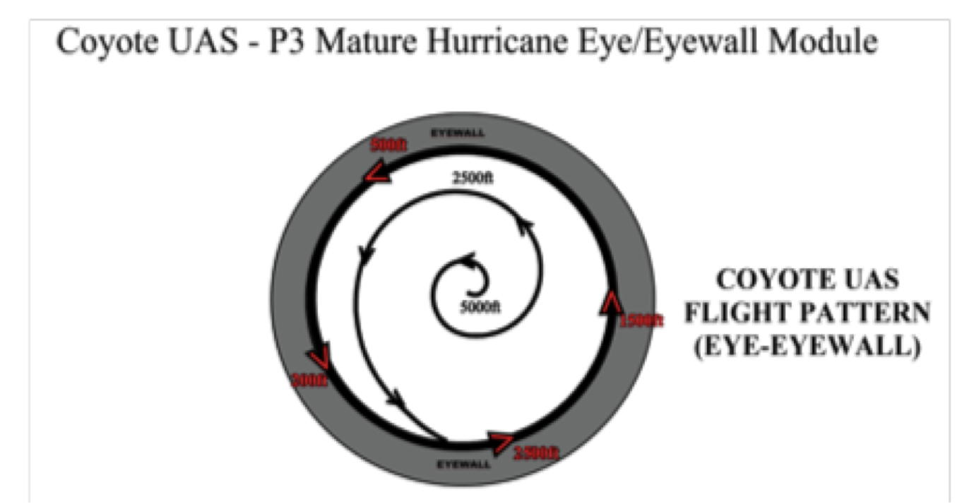
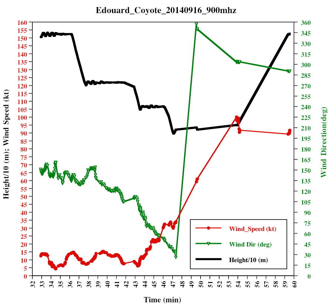
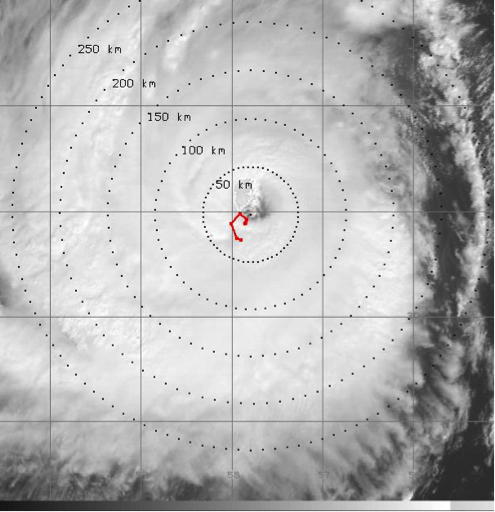
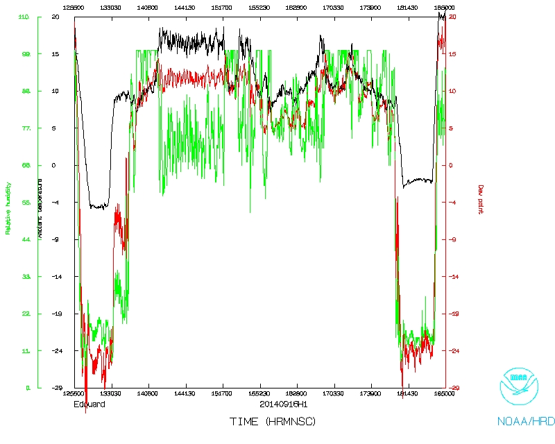
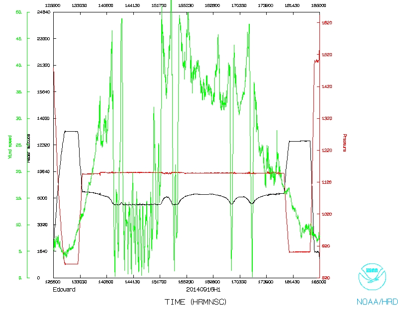
The mission into Hurricane Edouard began at 1432Z on September 16th, 2014. NOAA along with partners Sensintel and ItriCorp, conducted the first-ever air-deployed Unmanned Aircraft System (UAS) mission into a hurricane environment. While it was a Major Hurricane, Sensintel's Coyote UAS was released into Edouard's eye using NOAA's P-3 aircraft as the delivery vehicle. Once deployed, the 13 pound, 5-ft wingspan UAS proceeded to spiral downward and outward into the highest wind region of the storm known as the "eyewall". At an approximate altitude of 2940 ft, the UAS penetrated Edouard's western eyewall and recorded platform record-breaking winds of 100 kt as it proceeded to 'orbit' this high wind region during its historic 28-minute mission. The minimum altitude was 896m (2940 ft).
This type of concept of operations (conop), especially orbiting within the hurricane eyewall at various altitudes, is simply not possible using any other observing platform we currently have in our arsenal. It is among other things what makes an observing platform like the low flying Coyote UAS so unique, and highly desirable. We plan to look at these data closely and see what physical processes we can begin to better understand, especially in regions we have yet to fully observe using other observing tools. We also plan to use these unique and important data to compare with similar fields (in the hurricane eye and eyewall) obtained from operational models that are used to predict intensity change. Data from this experiment (pressure, temperature, humidity, winds and as well as many aircraft derived metrics) are currently being analyzed and evaluated. Preliminary investigations suggest a highly unique dataset with many possibilities going forward.
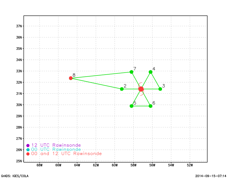
24 dropsondes, 11 AXBTs, and 1 COYOTE launched, with 4 bad AXBTs. All dropsondes and 7 AXBTs transmitted.
Mission Evaluation:
Problems:
Joe Cione
Oct. 25, 2014
Mission Data :
 Flight track |
 Temperature and Moisture |
 Wind and Atlitude |
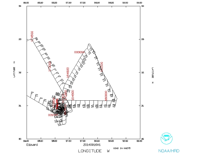 Flight track detail |