Mission Summary
20020903H Aircraft 42RF
Two plane CBLAST mission into Tropical Storm Edouard
Scientific Crew (42RF)
| Lead Scientist | Paul Chang (NESDIS) |
| GPS Dropsonde | Stan Goldenberg |
| HRD Workstation | Peter Dodge |
| Near real-time data | L. Connor(NESDIS) |
| IWRAP/USFMR | A.Zhang/D. Esteban (NESDIS) |
Mission Briefing:
This mission was designed to collect data for the NESDIS ocean
winds and rain experiment, collect data for CBLAST objectives,
test/practice coordination between planes for future CBLAST
missions, and test coordination for the high density 12 dropsonde
experiment through the eyewall.
Mission Synopsis
A pre-briefing was held with AOC flight directors before the
flight planning brief with the pilots and navigators to clarify
the CBLAST and ocean winds hurricane flight patterns. Two hours
prior to the flight, a second briefing with the flight crew was
held to discuss the flight profile.
The scheduled 1700 UTC takeoff of N42 was delayed a little over
30 minutes due to problems loading the AXBTs. The decision was
made to launch them from the inside since the planned flight
altitudes were less than 10,000ft. The mission was into
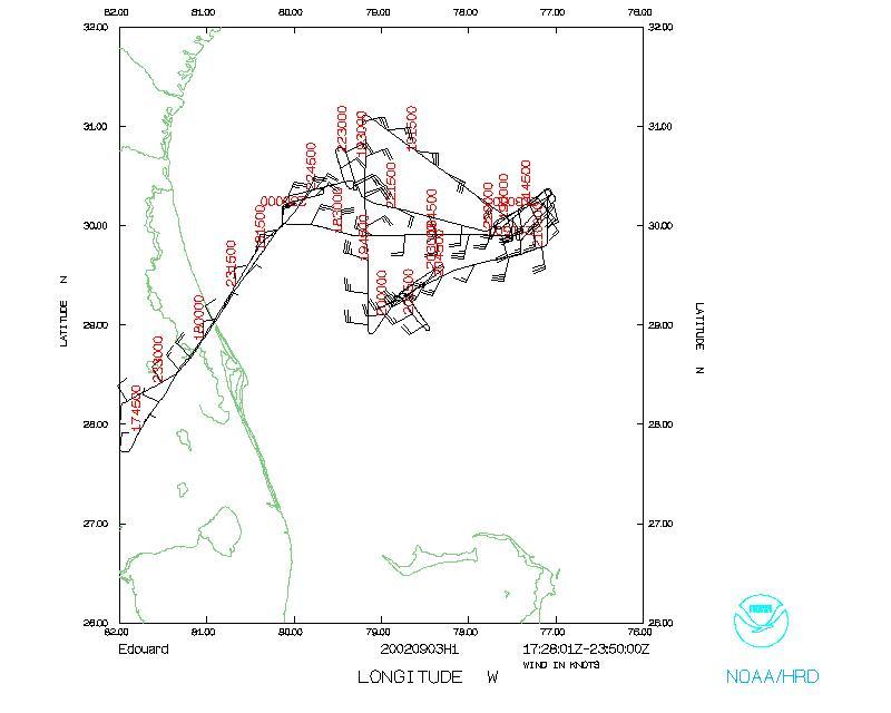
Tropical Storm Eduoard located off the East coast of Florida.
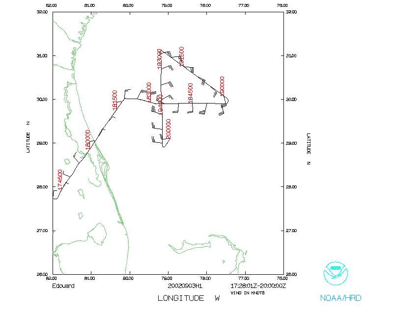
The first part of the mission was a figure four pattern through
the center with N42 (high plane 7,000ft) following N43 (low plane
1,000 and 5,000ft).
A 12 gps dropsonde drop was coordinated between the two planes as
we flew through into the convective region of Eduoard during the
figure four pattern. This portion of the mission was meant as a
practice exercise for deployment through an actual hurricane
eyewall. N42 dropped the first 8 sondes while N43 dropped the 4
remaining sondes. There were a few issues with the dropsonde
tube on N42 that required using the freefall chute, but otherwise
the drops went reasonably well. There was room for improvement
of between plane communications on when N42 finished the last
drop and when N43 should commence dropping.
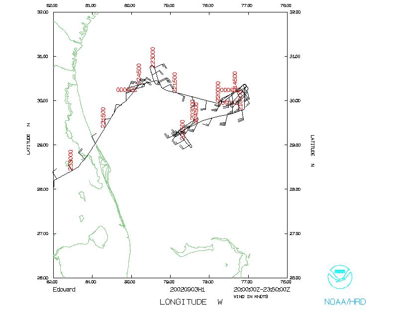
After completion of the figure four pattern, N43 commenced a low
altitude stepped decent for CBLAST with N42 flying a high
altitude crosswind and along wind leg with drops before departing
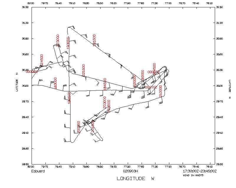
to find convection. N42 flew several racetrack legs across bands
of varying precipitation rates. Four gps dropsondes were dropped
in precipitation and splash points were noted and flown back
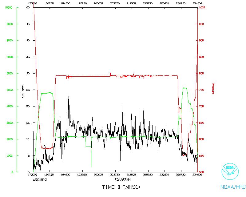
over. The maximum surface winds found were about 30 knots and
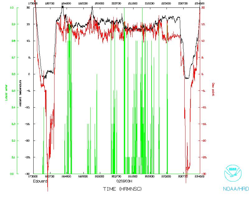
precipitaiton was in the 30-40 dBZ range. IWRAP and USFMR were
operating nominally and collecting data during the entire flight.
Upon completion of the precipitation flight legs, N42 met up at
N43 at the second planned CBLAST stepped decent pattern for a
high altitude upwind and alongwind pass with drops. Upon
completion of this N42 headed back to MacDill for a flight
duration of 6 hours and 15 minutes.
Problems:
A problem with loading the AXBTs externally inadvertently led to
complications with the gps dropsonde tube. The decision was made
to launch the AXBTs from the freefall chute since we would be
flying below 10,000ft and thus, avoid any further delay in
departure time. The lack of cabin pressure for the freefall
chute caused a dropsonde to get stuck in the tube and burn on the
motor that opens and closes the chute. This net result of all
this was that the freefall tube had to be used for the AXBTs and
gps dropsondes, which worked just fine for this mission.
The X-band tail radar failed early in the mission. Intitial
thoughts that the problem would be an easy motor swapout turned
out to be incorrect, and the radar antenna system is currently
out of the plan undergoing repair. Current estimates put
readiness for Tuesday.
Coordination between the planes worked out great and was expertly
handled by the AOC crew on both planes. However, the course
corrections performed by N42 (turns and speed changes) tended to
be less than ideal for the IWRAP/USFMR systems. So for future
coordinated two plane missions such as this we will try work out
a more amenable strategy.
Paul Chang
NESDIS
Lead Scientist
Mission Data
One minute listing
PDF plots of dropsonde data
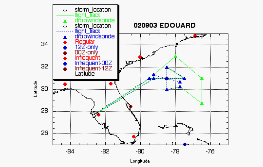
EDOUARD
HURRICANE SYNOPTIC SURVEILLANCE MISSION PLAN
Aircraft: N42RF Proposed takeoff: 03/1700Z
| TRACK DISTANCES |
| Drop # |
LAT
(d m) |
LON
(d m) |
LEG
(nm) |
TOTAL
(nm) |
TIME
(h:mm) |
| 0 | MACDILL |
0. | 0. | 0:00 |
| 1 | 31 00 | 79 30 |
254. | 254. | 1:03 |
| 2 | 31 00 | 78 30 |
56. | 309. | 1:17 |
| 3 | 31 00 | 77 30 |
56. | 365. | 1:31 |
| 4 | 32 00 | 78 30 |
82. | 446. | 1:51 |
| 5 | 31 00 | 78 30 |
60. | 506. | 2:06 |
| 6 | 30 00 | 78 30 |
60. | 566. | 2:21 |
| * 7 | 30 15 | 77 45 |
44. | 611. | 2:32 |
| 8 | 28 45 | 76 30 |
114. | 725. | 3:01 |
| 9 | 31 00 | 76 30 |
135. | 860. | 3:34 |
| 10 | 33 00 | 78 00 |
146. | 1006. | 4:11 |
| 11 | 31 20 | 79 15 | 122. | 1127. |
4:41 |
| * 12 | 31 00 | 79 15 |
20. | 1147. | 4:46 |
| 13 | MACDILL | 263. |
1410. | 5:52 |
* coordinate with 43 on cross-wind portion of CBLAST step-descent
pattern (Fig. 8 of 2002 HFP)
Return to Mission page.