Mission Summary
20160802I1 Aircraft 43RF
Tropical Storm Earl
Aircraft Crew (43RF)
| Aircraft Commander | Chris Kerns
|
| Co-pilot | Adam Abitbol
|
| Co-pilot | Robert Mitchell
|
| Flight Engineer | Ken Heystek
|
| Navigator | Pete Siegel
|
| Flight Director | Ian Sears
|
| Flight Director | Jess Williams
|
| Data Technician | Dana Naeher
|
| Dropsonde Operator | Bobby Peek
|
| Dropsonde Operator | Steven Paul
|
Scientific Crew (43RF)
| LPS | Lisa Bucci | HRD
|
| Dropsonde | Kathryn Sellwood | HRD
|
| Rdar | Gus Alaka | HRD
|
| Observer | Erin Daugherty | HRD
|
| Observer | Sandy Delgado | NHC
|
Mission Plan :
The mission is to conduct a at DWL experiment into Tropical Storm Earl. The
system is currently located in the southwestern Caribbean and moving west at
about 15 knots (Figure 1). It is embedded in ~20 knots of northwesterly shear
(Figure 2) causing an asymmetric convection pattern.
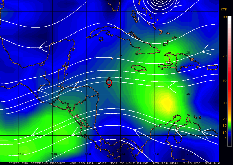
Figure 1.T.S. Earl in DLM flow
|
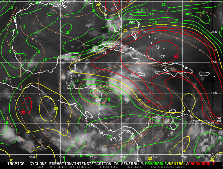
Figure 2.T.S. Earl in vertical shear
|
Track guidance suggests that Earl will continue to travel west until making
landfall in Belize. Models indicate it will maintain its tropical storm
intensity- possibly intensifying slightly during the mission (Figure 3).
Given the long transit time, the plan calls for a TDR pattern with an initial
point (IP) in the north quadrant. A figure-4 pattern will be flown and
completed in the west quadrant (Figure 4a). Upon completion of the mission,
the plane will return to MacDill AFB.
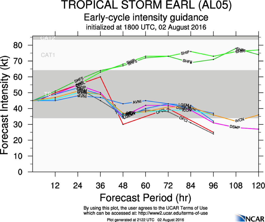
Figure 3.Forecast intensity for Earl
|
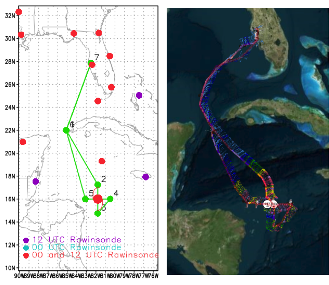
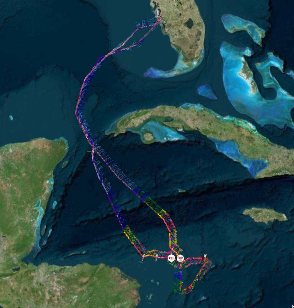
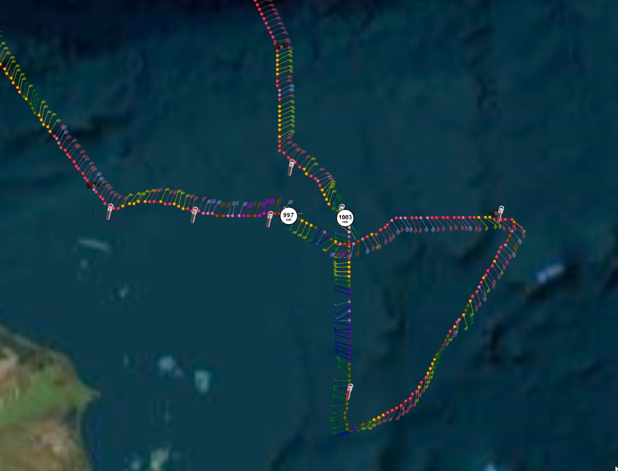
Figure 4a.Proposed flight track
Figure 4b.Actual flight track
|
MISSION PLAN: EARL
Prepared by the Hurricane Research Division
August 2, 2016
Aircraft: N43RF
Proposed takeoff: 02/1800Z
|
DROP LOCATION TABLE
|
| #
| LAT
| LON
| RAD/AZM
| Time
|
|
| deg min
| deg min
| n mi/deg
| hr:min
| | 1 | 22 00 | 85 06 | | 1:36
| | 2S | 17 15 | 81 48 | 75/000 | 3:43
| | 3S | 14 45 | 81 48 | 75/180 | 4:21
| | 4S | 16 00 | 80 30 | 75/090 | 4:49
| | 5S | 16 00 | 83 06 | 75/270 | 5:27
| | 6 | 22 00 | 85 06 | | 7:02
| |
Mission Summary :
| Take off
| Landing
| MacDill AFB, FL
| 18:04 UTC
| MacDill AFB, FL
| 01:27 UTC
| |
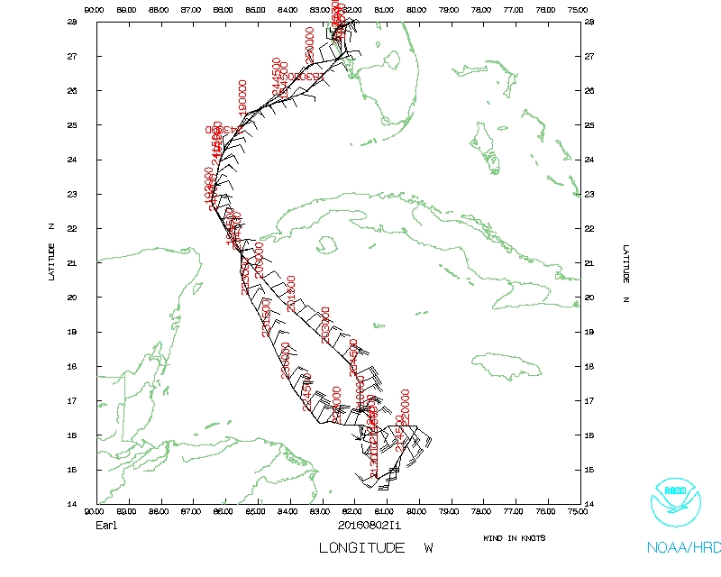
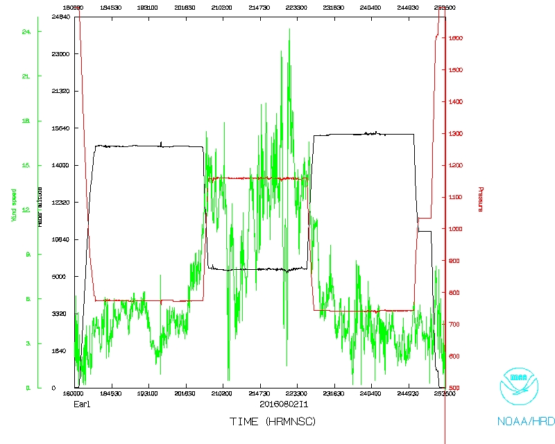
A figure-4 pattern was flown as planned, finishing to the west of the storm. As forecasted, Earl continued to maintain its tropical storm intensity and asymmetric convection (Figure 4b). The strongest surface and flight level winds were located in the north. Radar composites show increased reflectivity in the southeastern quadrant of the storm, with a tilted vortex to the southeast reflecting the northwesterly shear (Figure 5).
The mission was completed at 01:27Z with a recovery at MacDill airport. A total of 9 GPS sondes were dropped.
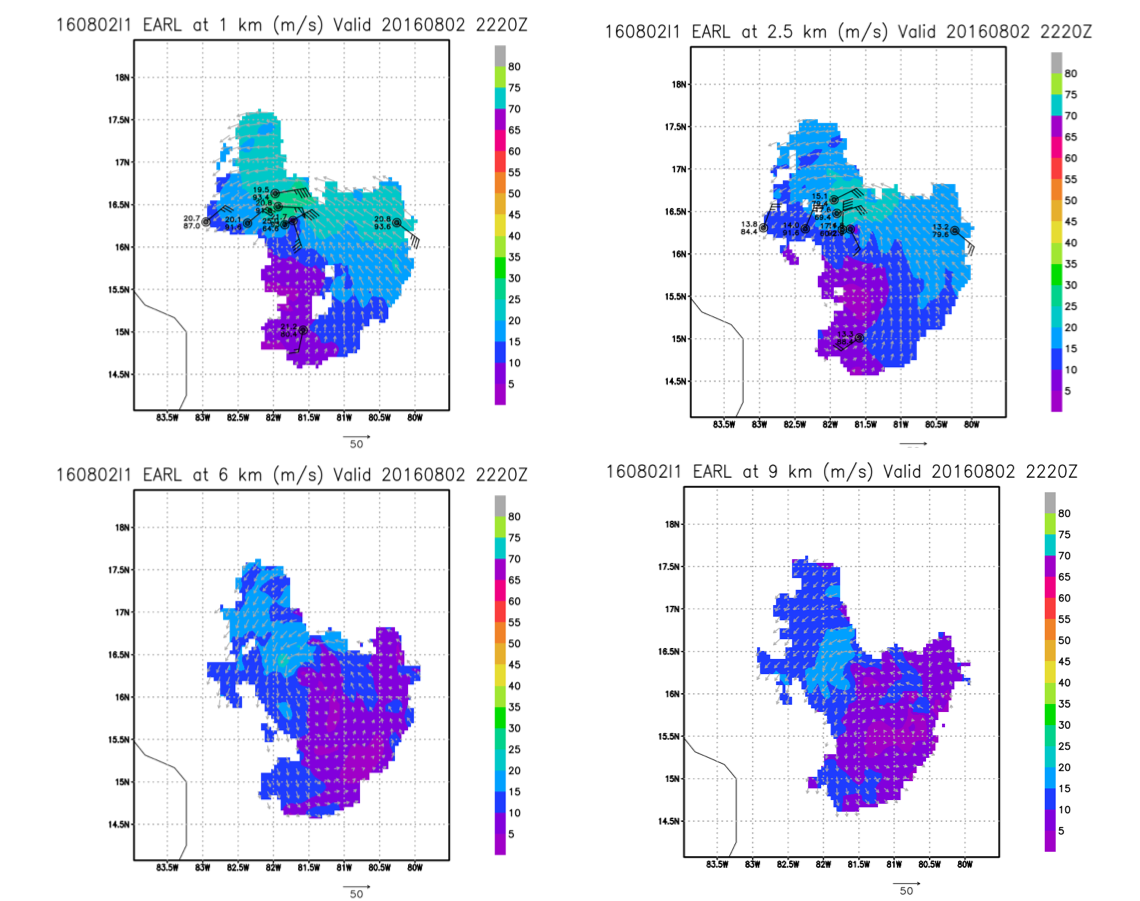
Figure 5.Doppler wind analyses
|
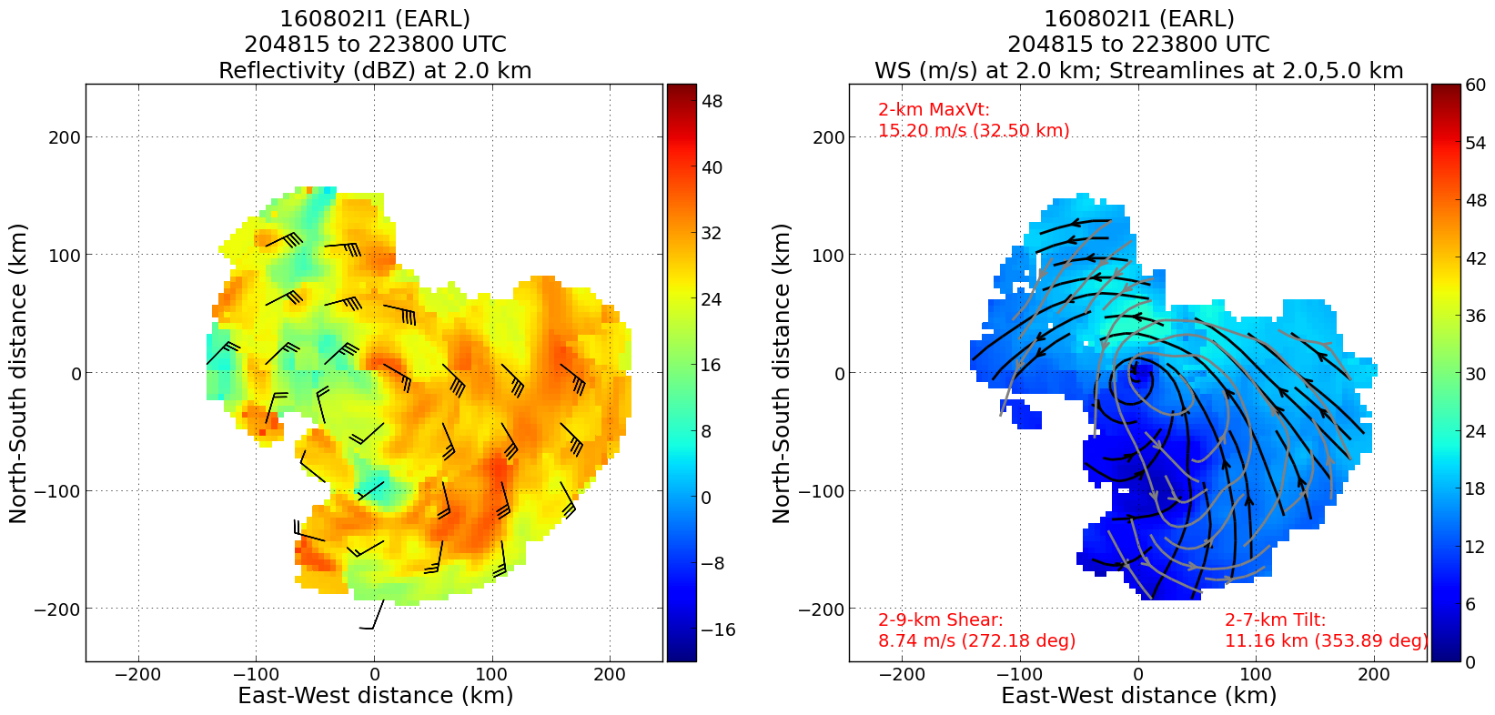
Figure 6.Reflectivity and Wind Speed analyses
|
Mission Evaluation:
Though the GPS/INS failed to initialize on the DWL, the mission was completed
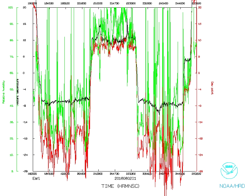
successfully. Observations were captured en route to Earl and within Earl.
Within the storm, the DWL collected wind profiles both above and below the
plane (4 conical scans downward, 1 upward). The flight level navigation data
will be used to post process the DWL data to completely remove the plane
motion.
Two radar analyses were completed and transmitted. One sonde stopped
transmitting at 946 mb and one drop had an early launch.
Problems :
The GPS/INS failed on the DWL failed to properly initialize prior to take off.
To ensure the DWL observations were captured, the DWL operator manually entered
the plane speed. A strong oscillation in the lateral plane motion occurred
while ascending out of MacDill AFB. It was unknown what caused it and did not
repeat itself.
Lisa Bucci
October 19, 2016
Mission Data :
LPS log |
Radar log |
DWL log |
Dropsonde log
Flight Director's manifest |
NetCDF data |
1 second data
Page last updated Nov. 10, 2016
Return to Mission page.