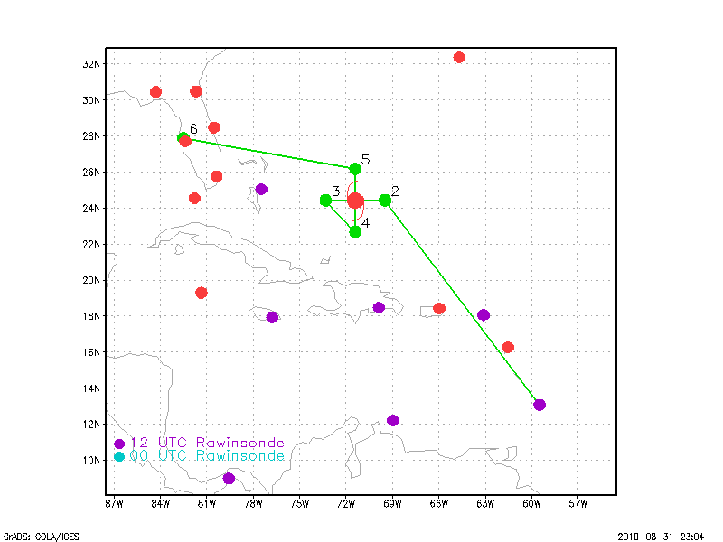
Figure 1. Proposed flight plan
| Aircraft Commander | Carl Newman |
| Co-pilot | Mark Sweeney |
| Co-pilot | Cathy Martin |
| Flight Engineer | Joe Klippel |
| Flight Engineer | Paul Darby |
| Navigator | Devin Brakob |
| Flight Director | Ian Sears |
| Flight Director | Barry Damiano |
| Flight Director | Jess Williams |
| Data Technician | Joe Bosko |
| Data Technician | Terry Lynch |
| Electronics Technician | Todd Richards |
| Electronics Technician | J Warnecke |
| Electronics Technician | Bill Olney |
| Dropsonde Operator | Dale Carpenter |
| Mechanic | Wes Crouch |
| Lead Scientist | John Gamache |
| Radar Scientist | Eric Uhlhorn |
Mission Plan :
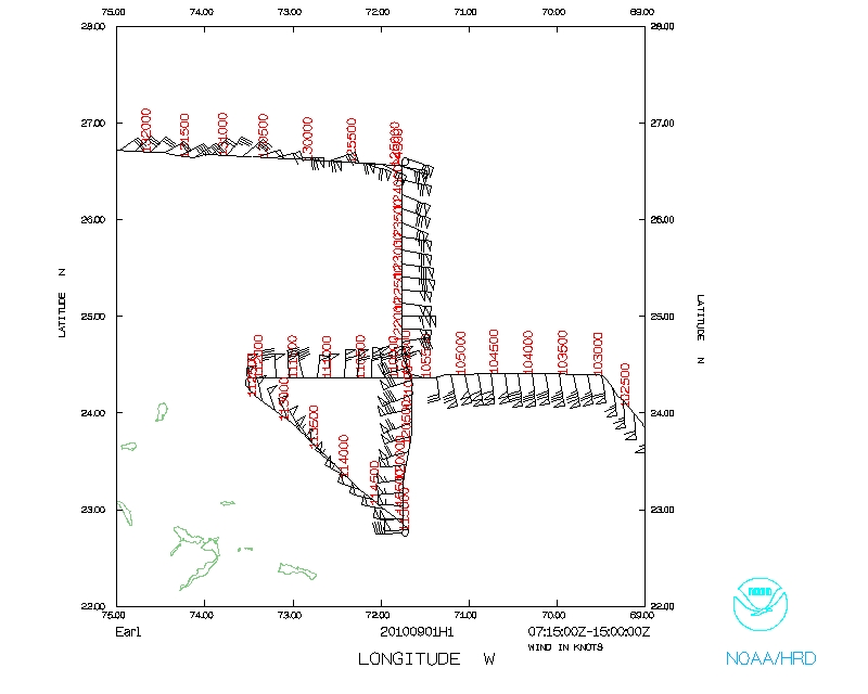
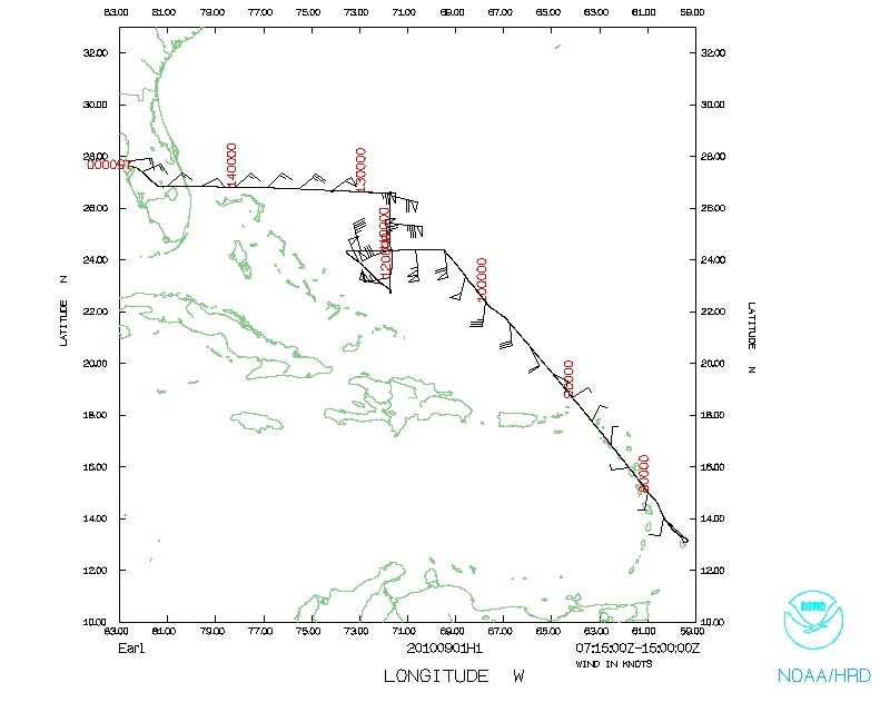
Continued monitoring of Hurricane Earl after it's period of rapid intensification. The plan was to fly a single figure 4 as the NOAA 42 ferried back to MacDill from Barbados. Radial legs were again to extend 105 nm from the storm center on all four sides at bearings of E-W-S-N in that order, and drops were to be made at all 4 exterior points, and at wind maxima, particularly maxima co-located with convection. An eye sounding was also to be taken on first pass through eye. This flight was the first in a second set of flights into Earl, in this case six flights in a row. The flight was part of IFEX, in this case a tail-Doppler-radar mission requested by the NWS Environmental Modeling Center to augment the Doppler data sets on which to develop/refine/test HWRF Doppler assimilation.
Mission Summary :
| Take off | Landing
| Barbados | 01/07:23 UTC
| MacDill AFB, FL | 01/14:59 UTC
| | ||
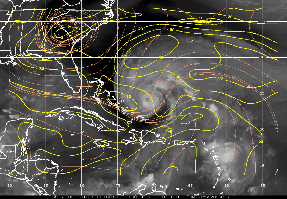
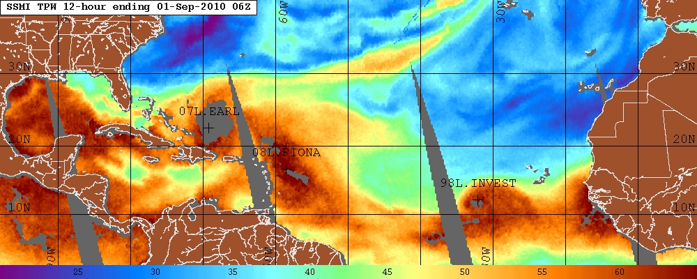
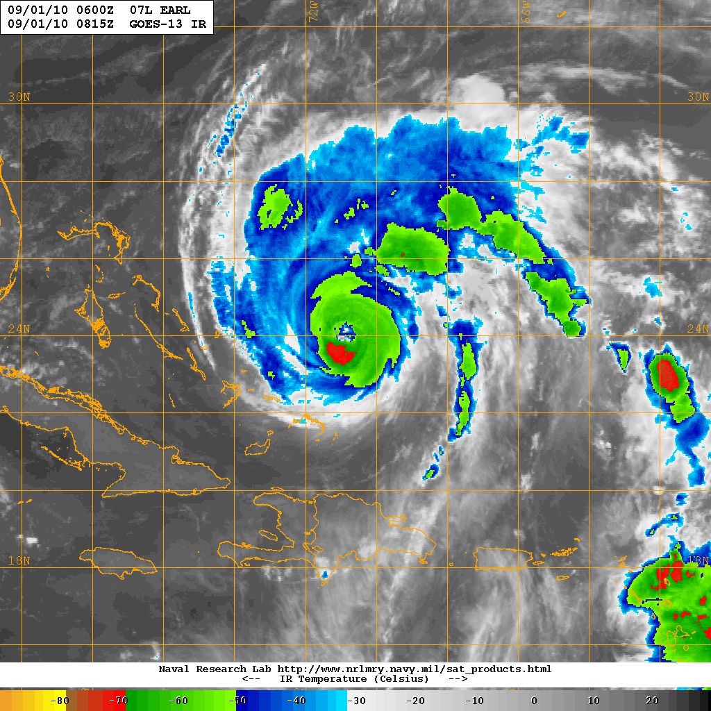
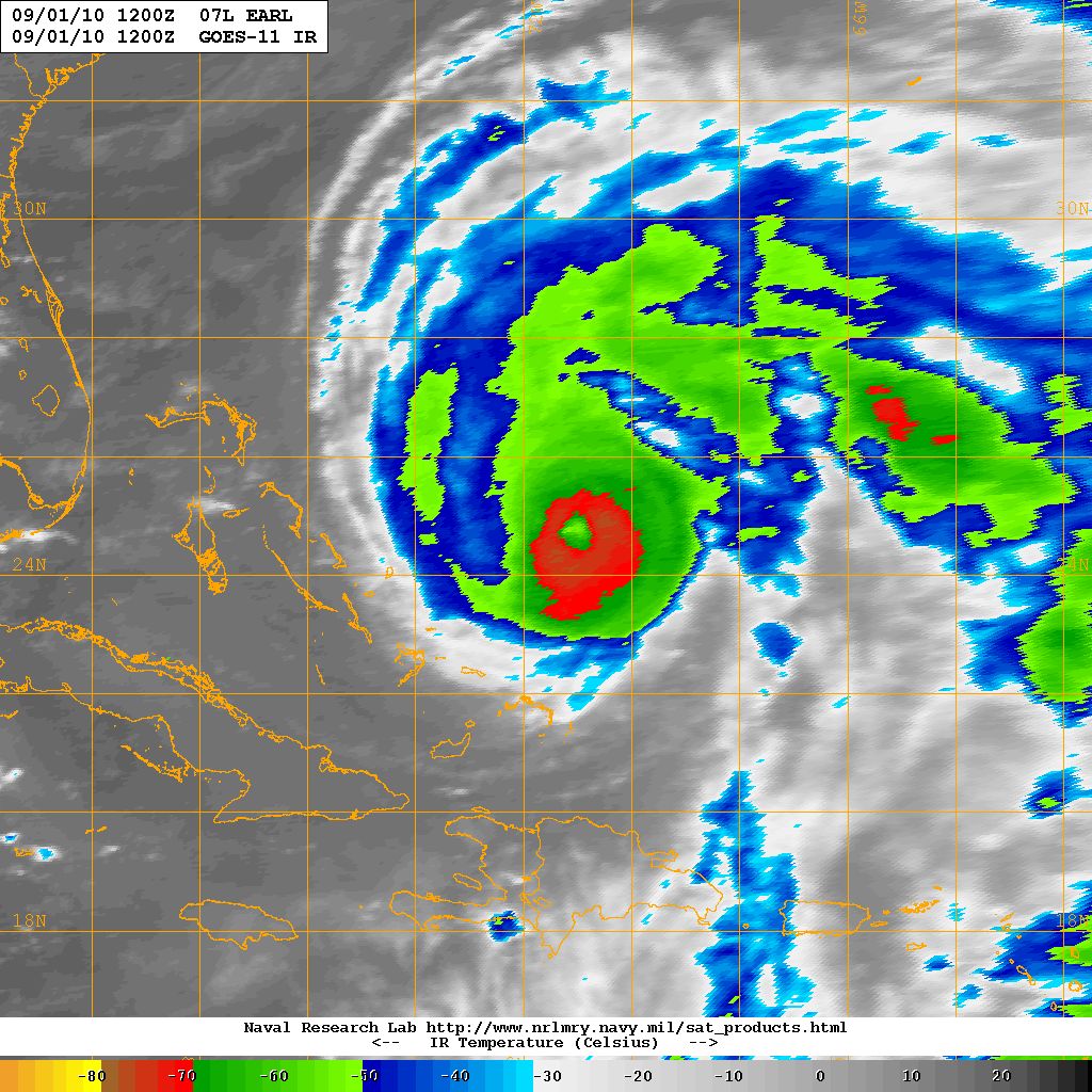
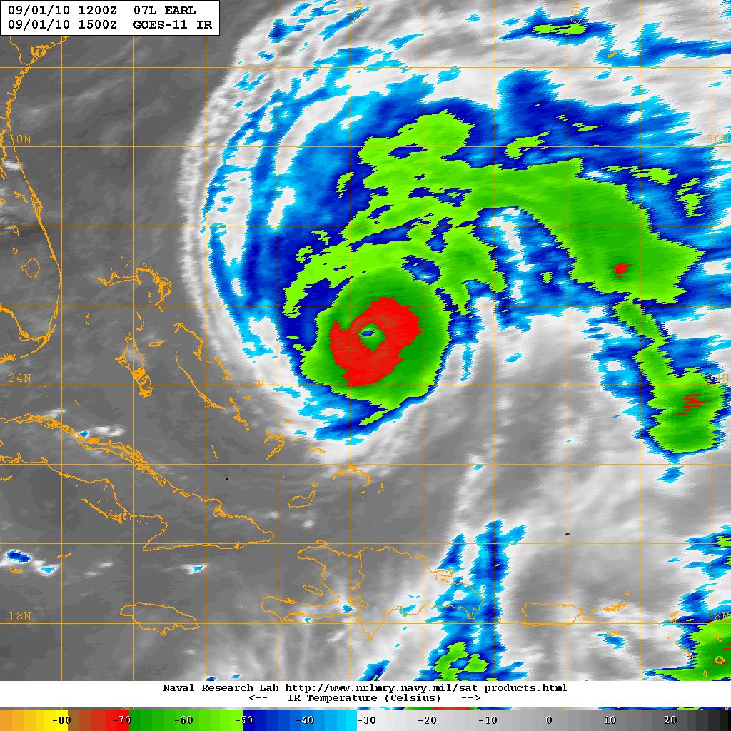
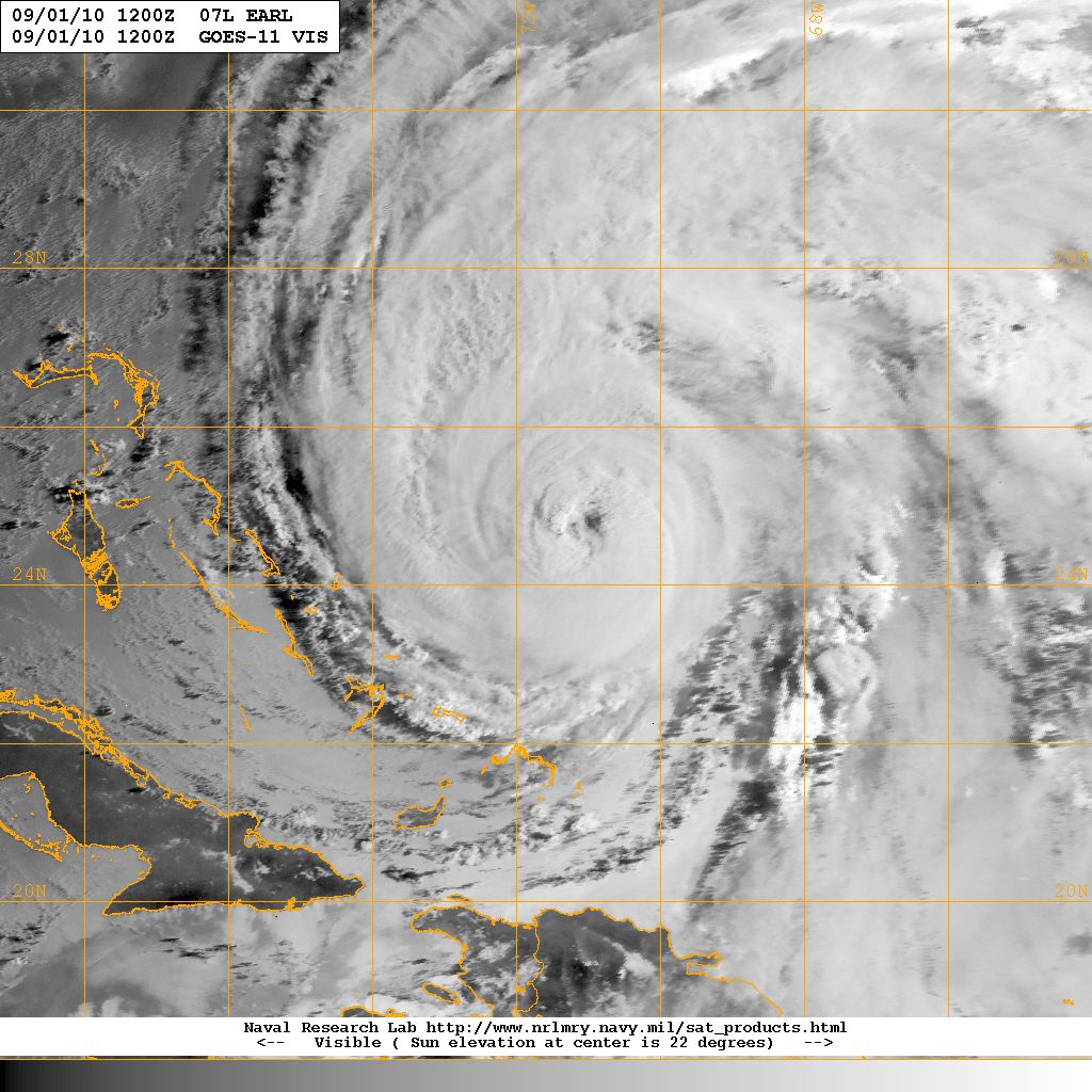
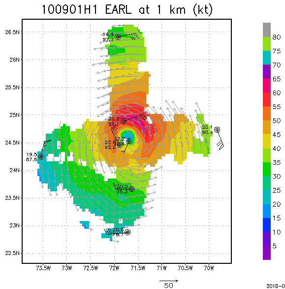
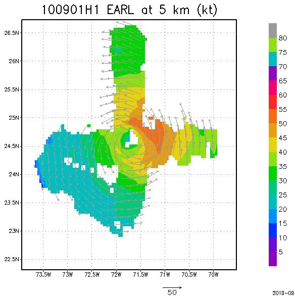
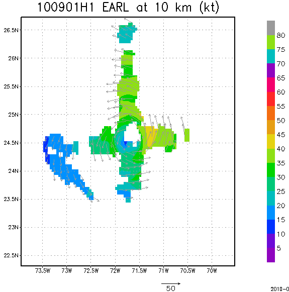
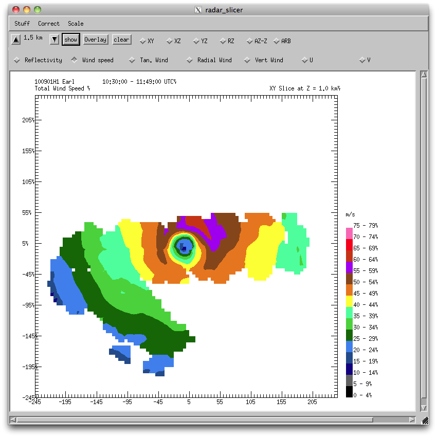
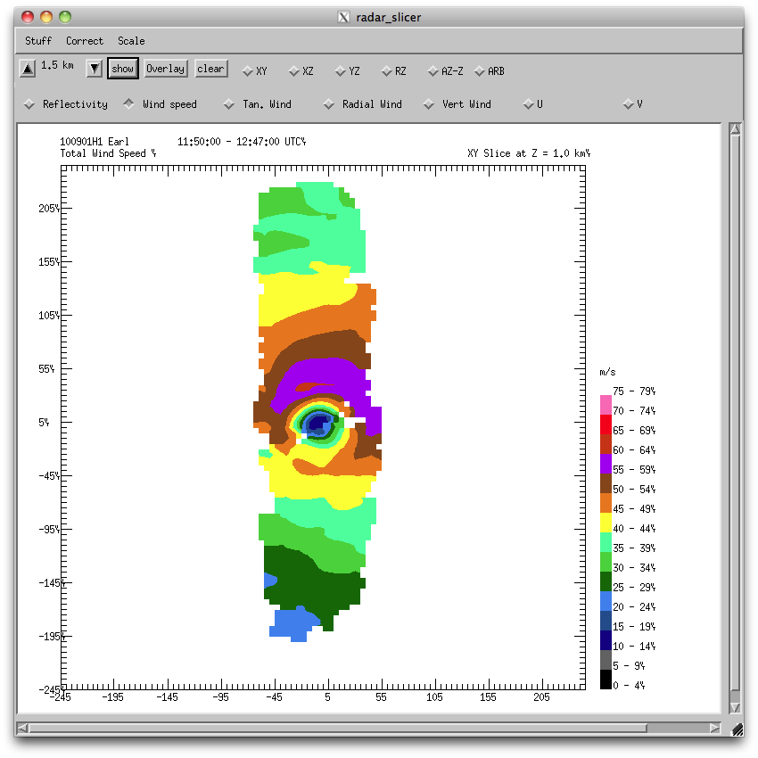
Officially Hurricane Earl was a 110-kt, category 3 Hurricane throughout the flight; thus, it was in approximately steady state. The official motion was toward 315 at 15 kts (8 m/s). The CIMMS imagery (Fig. 3) shows a shear over Earl at 15 kts from the SW, with very moist conditions being shown in the TPW imagery (Fig. 4). Hurricane Earl had a well-formed eye, as seen in the infrared and visible satellite imagery (Figs. 5 and 6, respectively).
a |
b |
|
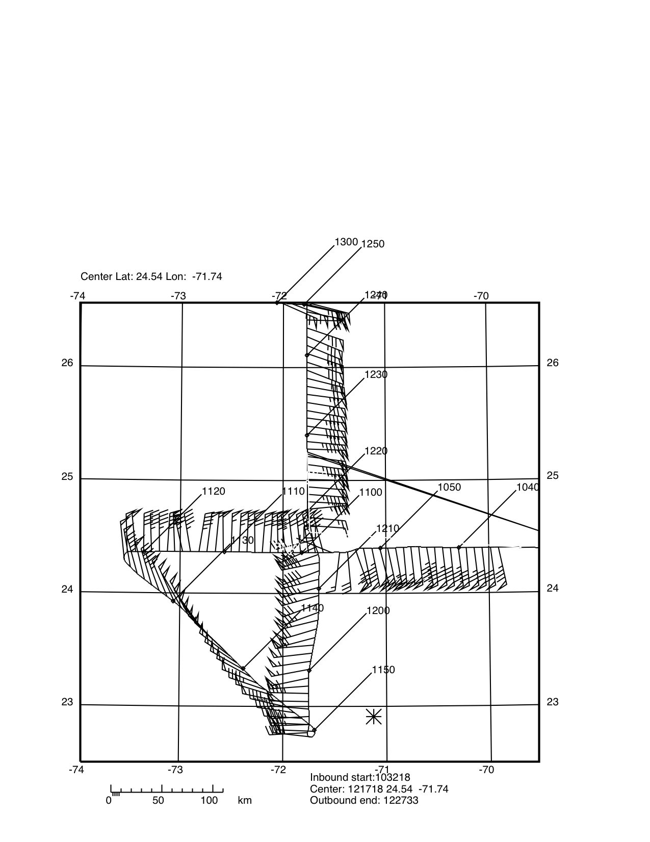
NOAA 42 took off 37 minutes early, at 0723 UTC, to begin the projected 8-h flight from Barbados to MacDill via the center of Hurricane Earl. This was the first 12-hourly P3 flight in a series of 6. We arrived at their IP three hours later at 1030 UTC, and remained in pattern until 1250 UTC, landing at MacDill AFB at 1459 UTC. In the first east-west pass through Earl, the highest wind speeds on the east side were found in an outer maximum with FL winds of 110 kt in the outer, and 90 kt in the inner. Unfortunately we dropped the eyewall sonde in the inner eyewall. The SFMR showed only 80 kt on the outer max, and about the same on inner max. On the west the maximum FL wind was 90 kt, and max SFMR was 82 kt. Maximum FL winds on the south side were 92 kt, and 78 kt from the SFMR, while on the north side maximum FL winds were 113 kt, and max SFMR was 97 kt. Interestingly, the maximum surface winds were found several minutes closer to the center than the FL winds at 12000 ft.
a |
b |
c |
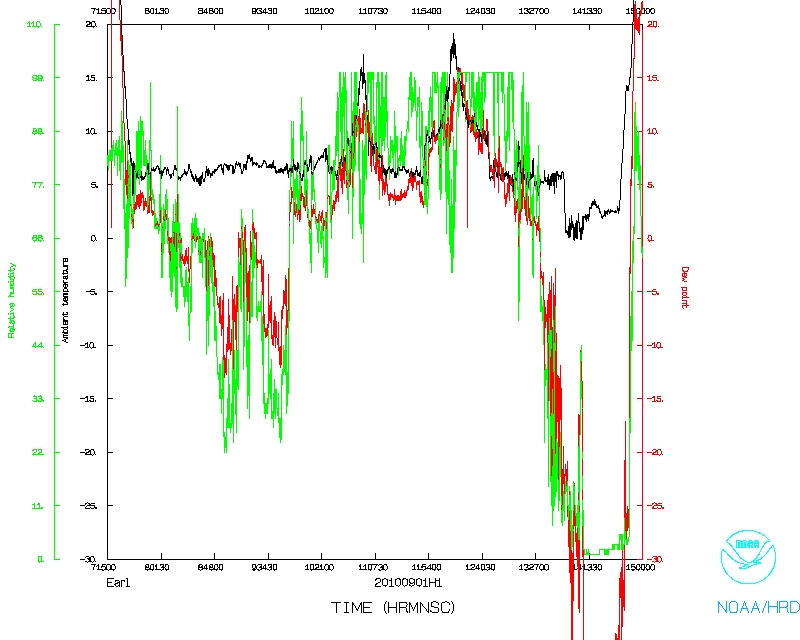
Sondes launched during this flight indicated saturated conditions below flight level on the north side at 105 nm radius, while all other 3 cardinal direction showed about 3-5 Celsius degrees dewpoint depression. A similar dewpoint depression was found in the southern eyewall sounding.
a |
b |
Problems :
This flight went fairly well, with a few problems with sondes. Otherwise quite well, as the steady-state Earl was documented.
John Gamache
Sept. 20, 2010
serial | NetCDF | 1 second data | |
 Flight track |
 Temperature and Moisture |
 Wind and Atlitude |
 Flight track |
Page last updated September 21, 2010
Return to Mission page.