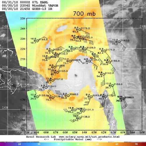
Figure 1. Total precipitable water from WindSat valid at 2204 UTC 30 August, with 700 hPa dropwindsonde data.
| Aircraft Commander |
| Co-pilot |
| Flight Director |
| Flight Director |
| Electronics Technician |
| AVAPS Operator |
| Dropsonde Operator |
| Sim Aberson | Dropsonde scientist |
|
|
Mission Plan :
A Rapid Intensification Experiment mission around Hurricane Earl north of Barbados. A six-sided star pattern was to be executed to sample the storm and environment with dropwindsondes.
Mission Summary :
The mission was fully successful with 32 dropwindsondes released, only one a fast fall. Earl was nearing the end of a period of rapid intensification at the time, with initial intensity of 115 kt during the mission. Figure 1 shows the flight pattern flown, with 700 hPa station plots overlain on total precipitable water satellite retrieval during the time of the mission. The data do not correspond exactly since the mission occurred over 8 h, whereas the satellite retrieval is an instantaneous snapshot.
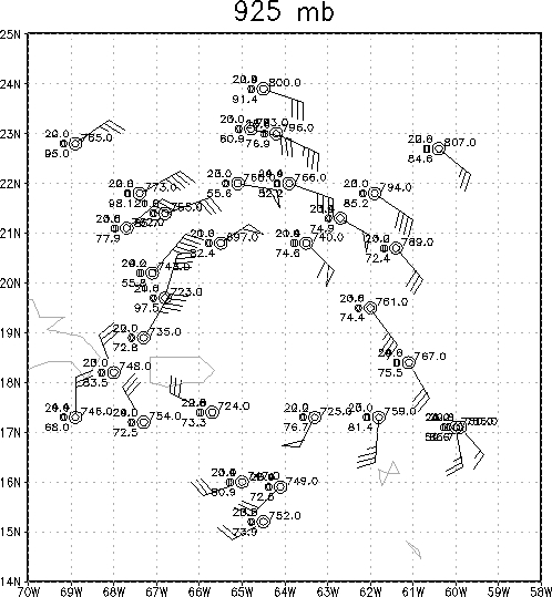
The relative humidity data from the dropwindsondes compares fairly well with the precipitable water retrievals, with very dry air seen in the environment in the green shades. The lowest relative humidity is to the northwest of the center with 15.7% relative humidity. The green area directly north of the center does not show sell in the dropwindsonde data at 700 hPa, but a thin layer of dry air is seen in that location at 925 hPa (Fig. 2).
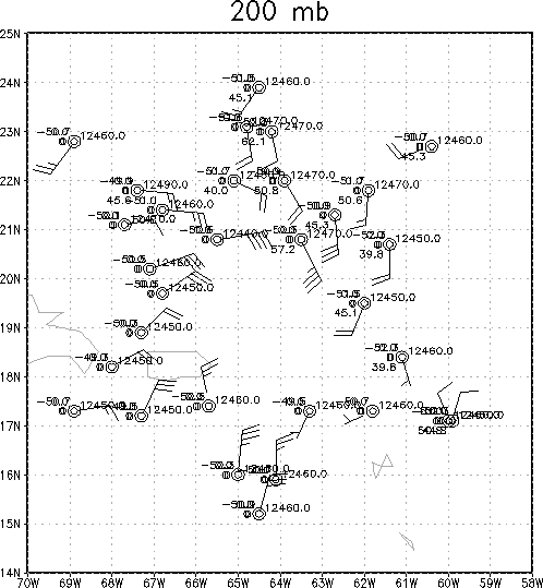
Because of the large circulation of Earl, all the data show the cyclonic circulation of the cyclone until 200 hPa (Fig. 3) when outflow to the north is seen in the distant sondes. The G-IV has essentially sampled a well-developed mature hurricane in a relatively quiescent environment.
Problems :
No major problems were encountered during this flight.
Sim Aberson
Sept. 15, 2010