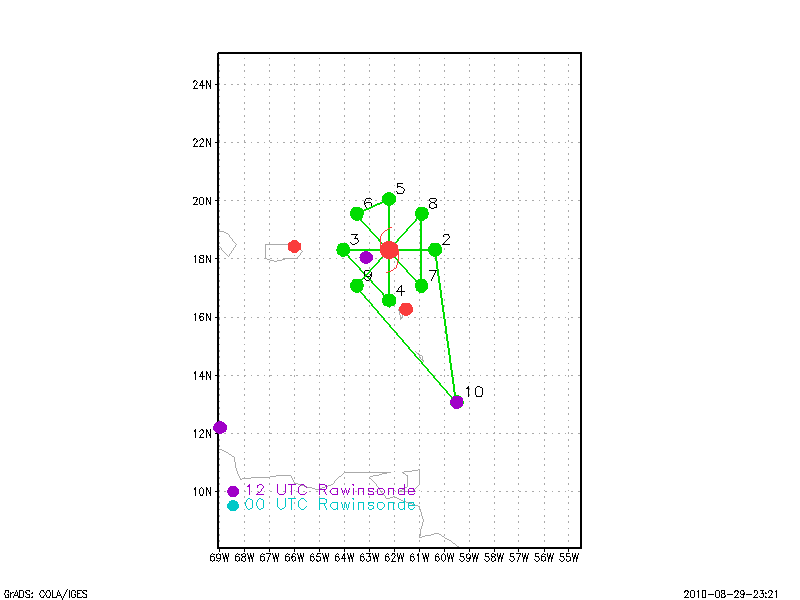
Figure 1. Proposed flight plan
| Aircraft Commander | Carl Newman |
| Co-pilot | Cathy Martin |
| Co-pilot | Mark Sweeney |
| Flight Engineer | Joe Klippel |
| Flight Engineer | Paul Darby |
| Navigator | Devin Brakob |
| Flight Director | Jess Williams |
| Flight Director | Barry Damiano |
| Data Technician | Joe Bosko |
| Avionics | Bill Olney |
| Dropsonde Operator | Terry Lynch |
| Dropsonde Operator | Todd Richards |
| Dropsonde Operator | James Warnecke |
| Lead Scientist | John Gamache |
| Radar Scientist | Sylvie Lorsolo |
| Dropsonde Scientist | Eric Uhlhorn |
Mission Plan :

Rapid intensification monitoring. The plan was to fly a rotating figure four, starting with an east-west pass and ending with a northeast-southwest pass, resulting in 4 passes. Radial legs were to extend 105 nm from the storm center, and drops were to be made at all 8 exterior points, and at wind maxima, particularly if co-located with convection. Two drops were also to be made in the eye on the first and last passes. With sondes and Doppler observations, among others, this would ensure good monitoring of structure and intensity changes as Earl appeared to be intensifying rapidly. Flight was to last approximately 7.5 hours.
Mission Summary :
| Take off | Landing
| Barbados | 30/09:40 UTC
| Barbados | 30/15:27 UTC
| | ||
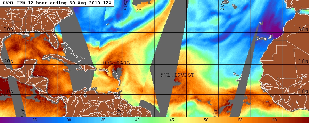
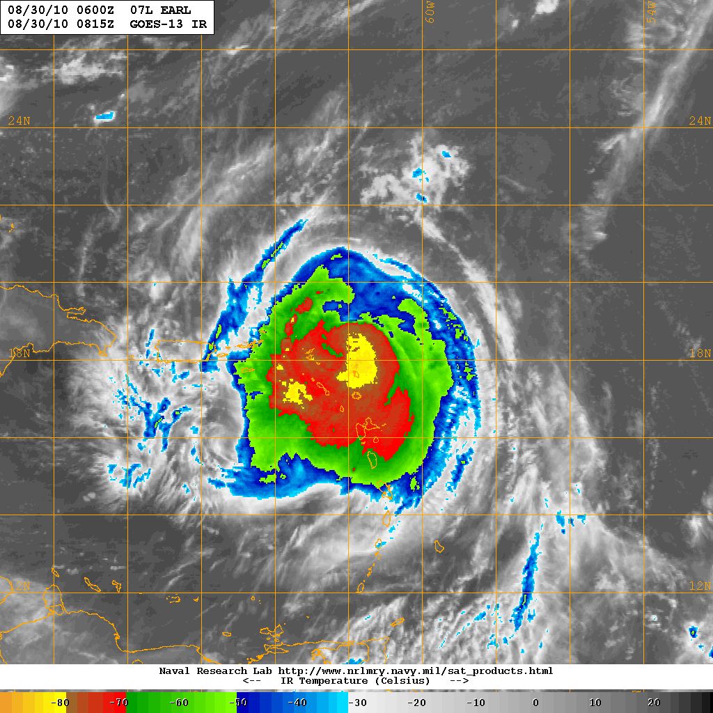
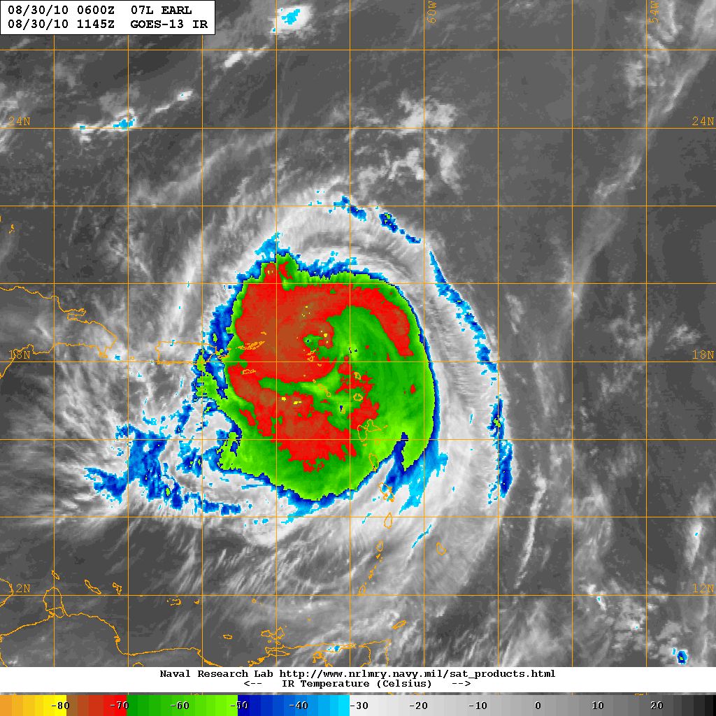
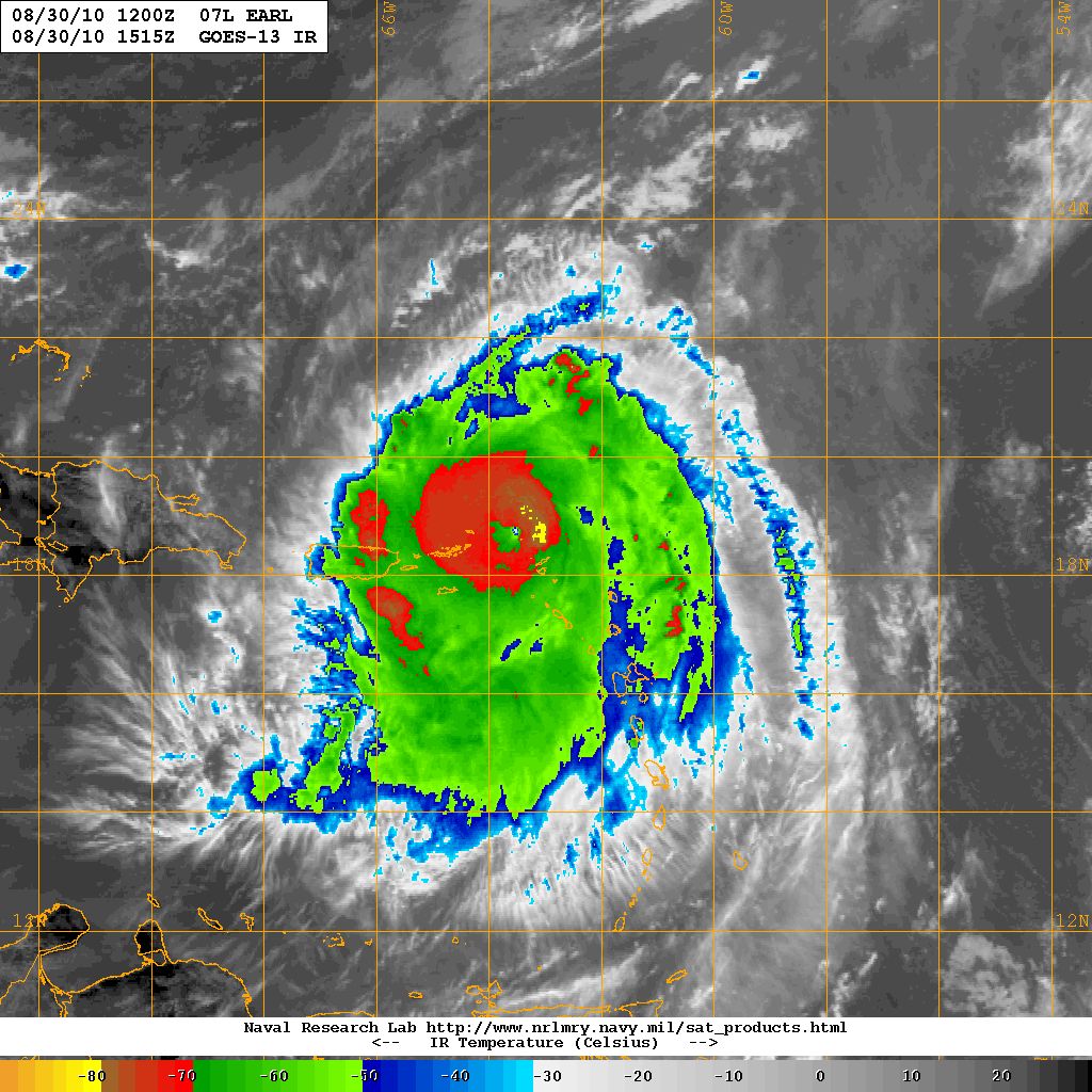
At the time of takeoff (0940 UTC), Hurricane Earl was officially a 90 kt (~45 m/s) hurricane, moving toward 285 at 13 kts (7 m/s). The CIMMS imagery (Fig.3)
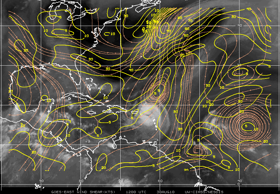
indicated that the deep shear was still northeasterly at about 10 kts, and no very dry air appeared to be close to the center, at least based upon the TPW showed in Figure 4. The infrared satellite showed a circular area of 500 km diameter with cloud tops above the -50°C level, and a circular area of 350 km diameter with cloud tops above the -70°C level. Smaller areas of cloud tops colder than -80°C of diameter 100 km or so were seen.
a |
b |
c |
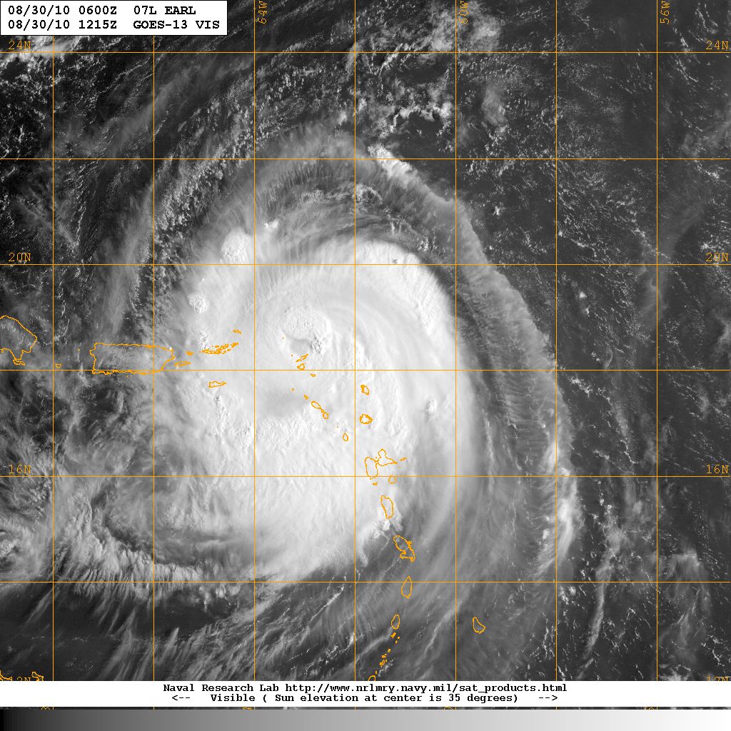
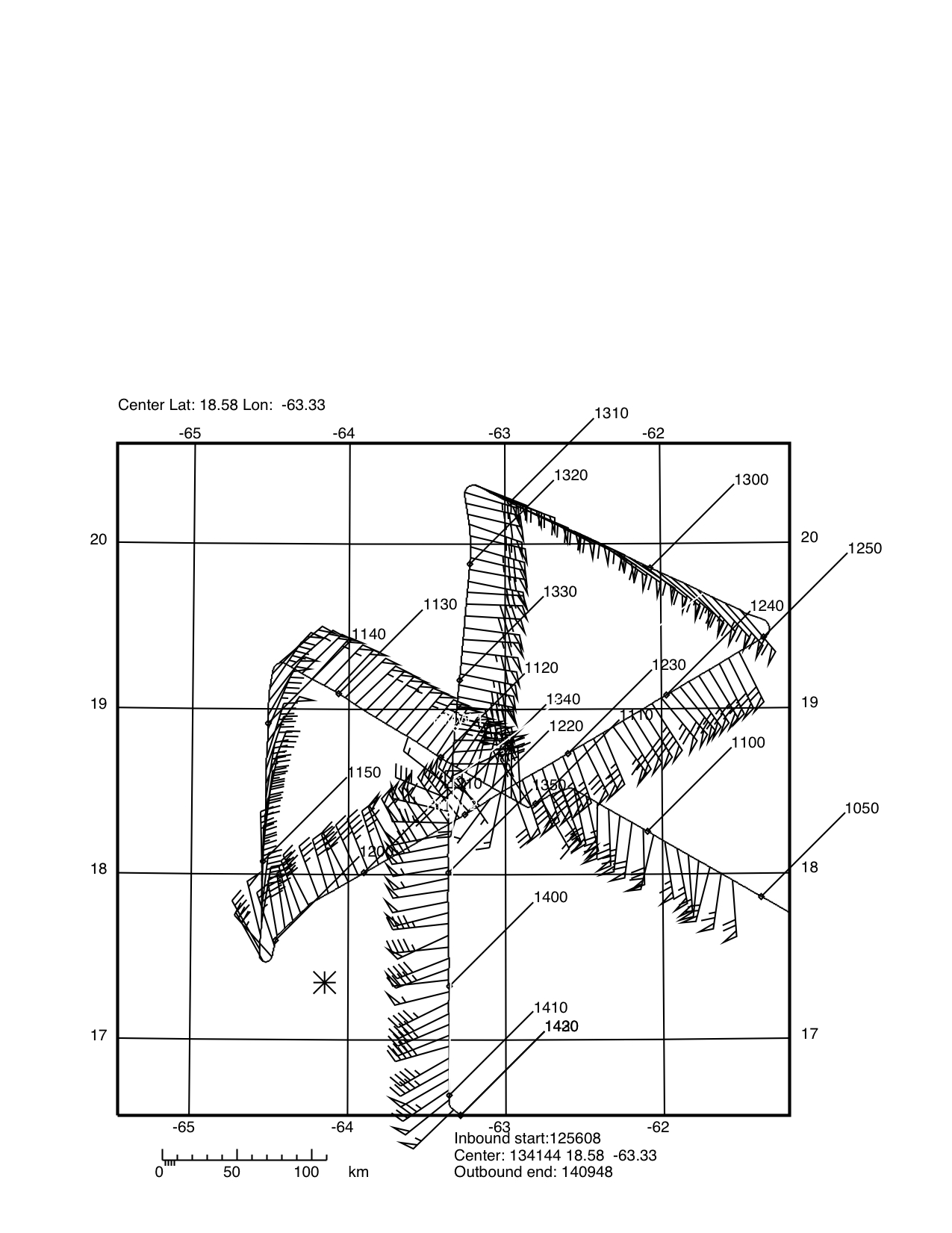
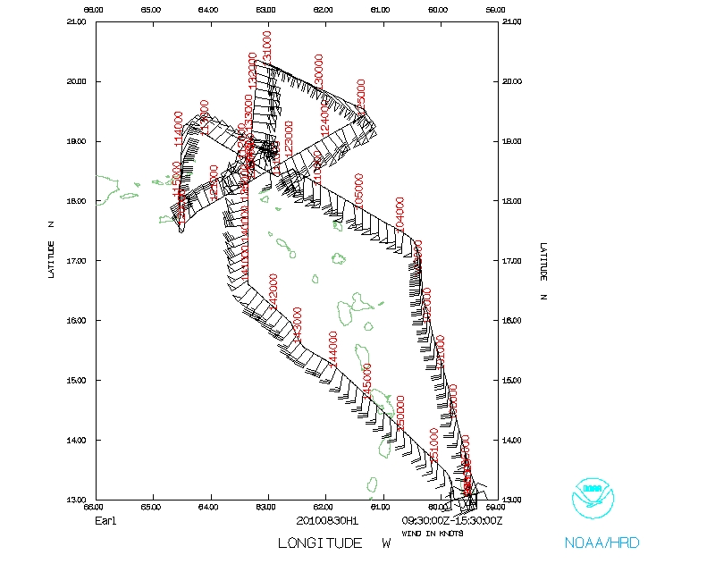
This flight was the fourth of five 12-hourly P3 flights in a row into Earl to document the intensity change, and in this case, the rapid intensification of Earl. Takeoff occurred at 0940 UTC, one hour forty minutes after scheduled time. Because of the desire to maintain a 24-h schedule for 42 takeoffs, so that observations corresponded to the 12 UTC model ingests, and because of crew rest requirements, the mission was shortened to a butterfly pattern, with an ESE-WNW, WSW-ENE, and N-S pass through the center. Drops were to be made on the first and last passes. This plan was followed in the actual flight, which is shown in Figure 2.
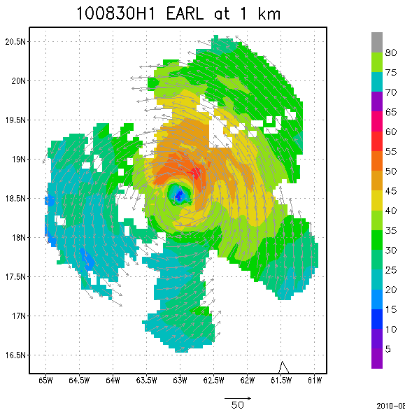
a |
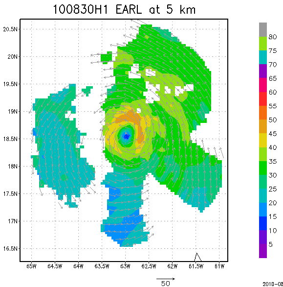
b |
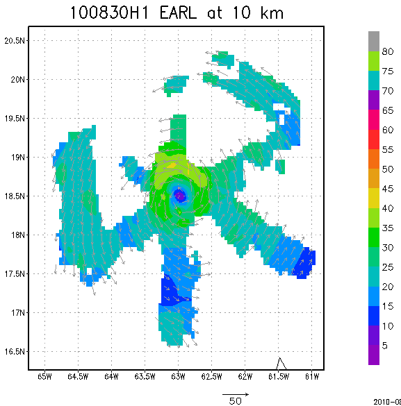
c |
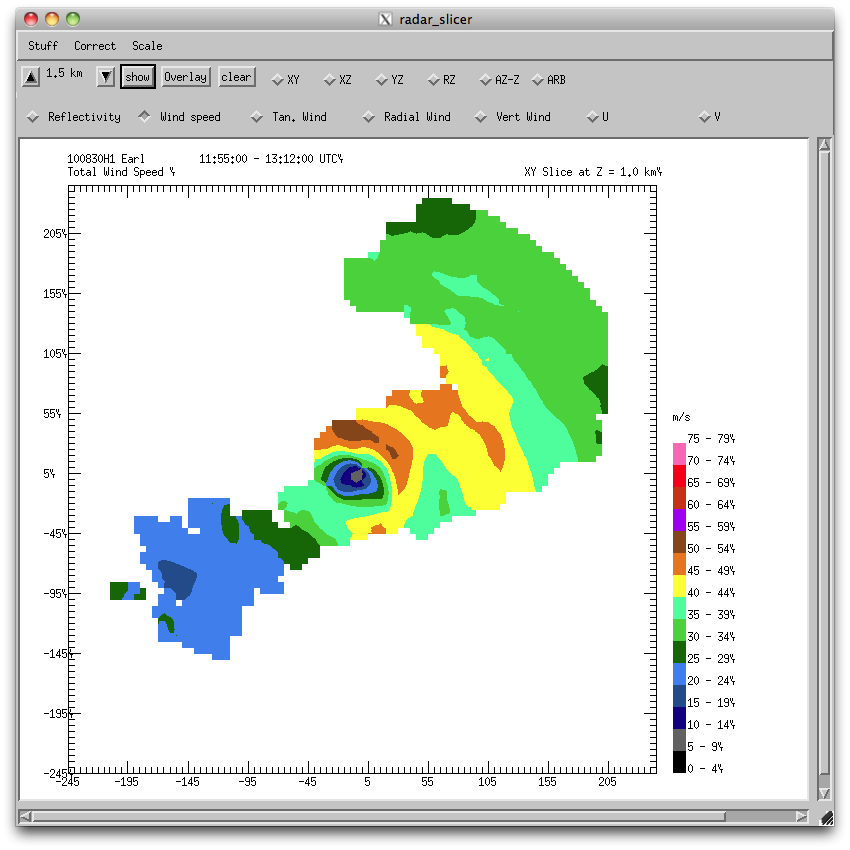
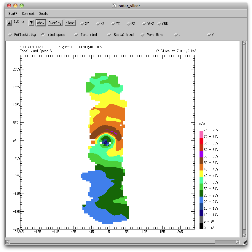
The Doppler composite analysis for this flight (Fig. 7) showed a fairly symmetric wind field, if the 7 m/s storm motion were subtracted from the winds on the NNE side, and added to the winds on the SSW side. During the flight the official maximum surface wind estimate increased from 90 kt (45 m/s) to 105 kt (52 m/s). Individual Doppler analyses at 1 km suggested little change in wind speed or structure during the flight, but the flight definitely was occurring as Earl was in a several-flight period of intensification.
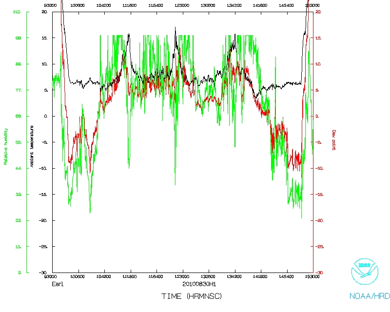
Sondes launched at 105 nm from storm center during the flight showed dewpoint depressions at 850 mb as much as 10 Celsius degrees on the S side, to saturated on the NW side. Any dry air on the south side was not able to prevent intensification during this flight.
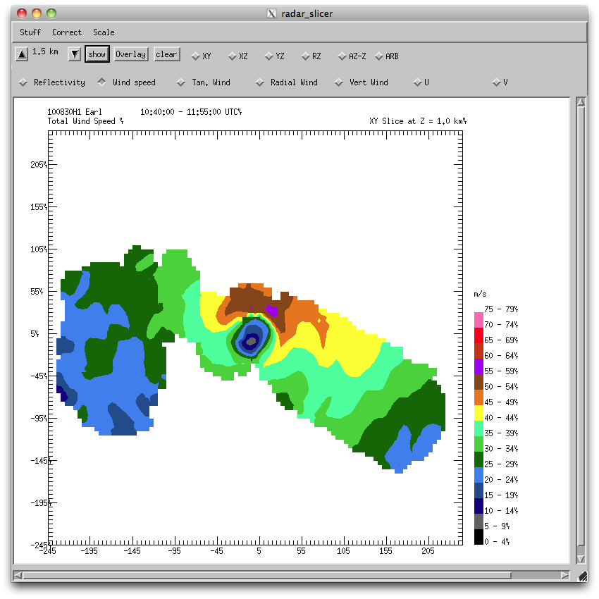
a |
b |
 c |
Problems :
Problems with hydraulics on 42, apparently in the circuitry somewhere. I asked that if we could continue, I would like to, doing a butterfly pattern instead of a rotating figure 4, to keep the mission short enough to stay in our 4 AM takeoff rotation. AOC crew fired up APU and systems on 43 just in case it would be needed to accomplish the flight, but Bill Olney was able to jiggle some of the circuitry and the hydraulic pump was good to go for that flight. Although only one hydraulic pump is needed to operate control surfaces of P3, all three must be up and running before P3 is permitted to take off.
John Gamache
Sept. 20, 2010
serial | NetCDF | 1 second data | |
 Flight track |
 Temperature and Moisture |
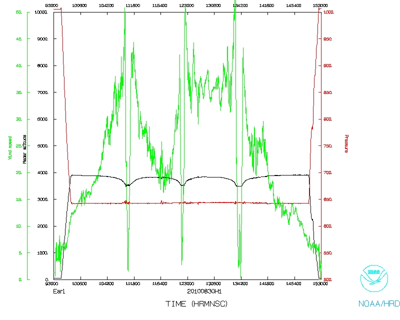 Wind and Atlitude |
Page last updated Sept. 21, 2010
Return to Mission page.