| Aircraft Commander | Pat Didier |
| Co-pilot | Kevin Doremus |
| Co-pilot | Robert Mitchell |
| Flight Engineer | Mike Sanchez |
| Flight Engineer | Ken Heystek |
| Navigator | Pete Freeman |
| Flight Director | Mike Holmes |
| Flight Director | Lundry |
| System Engineer | Terry Lynch |
| Data Technician | Dana Naeher |
| AVAPS | Joe Greene |
| LPS | Rob Rogers | HRD |
| Dropsonde | Jason Dunion | HRD |
| Radar | Brittany Dahl | HRD |
| LPS | Paul Chang | NESDIS |
| Observer | Wayn Pullen | AOC |
| Observer | Jim Brewer | AOC |
| Observer | Alex Hudson | NatGeo |
| Radar | John Gamache | HRD |
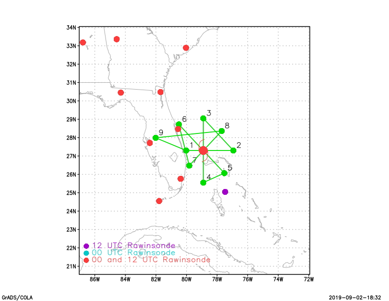
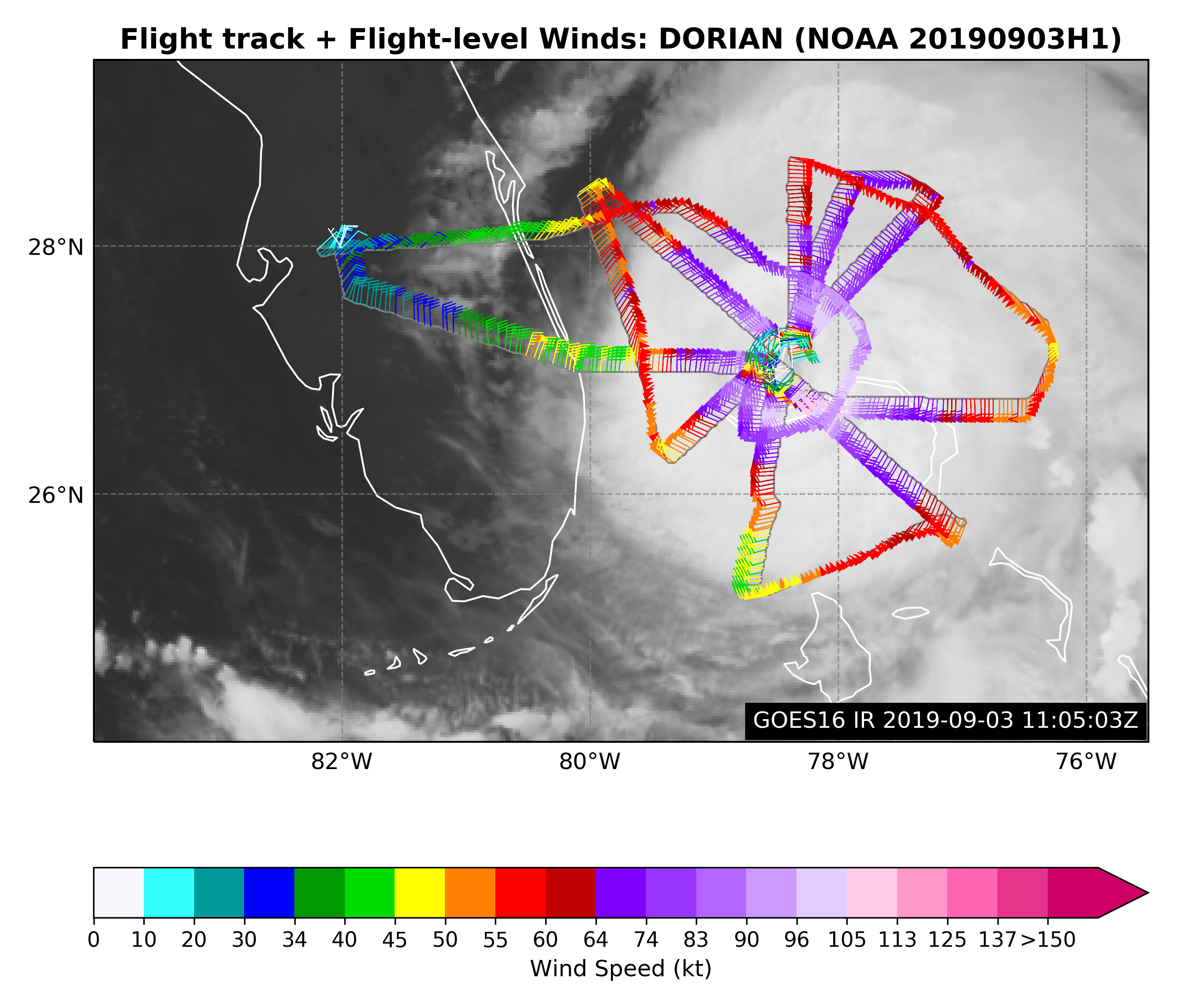
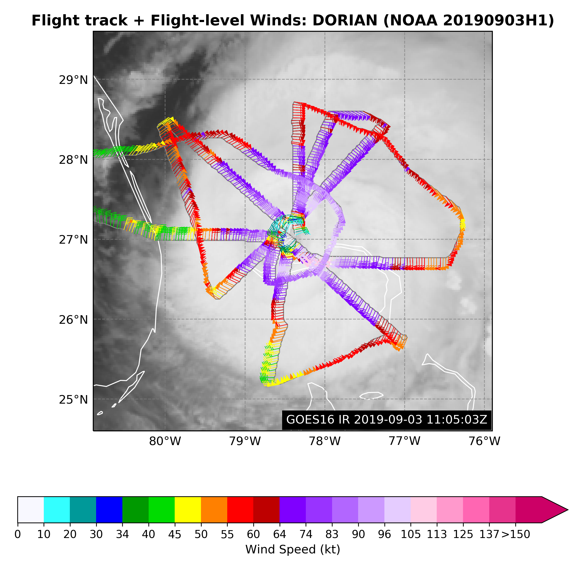
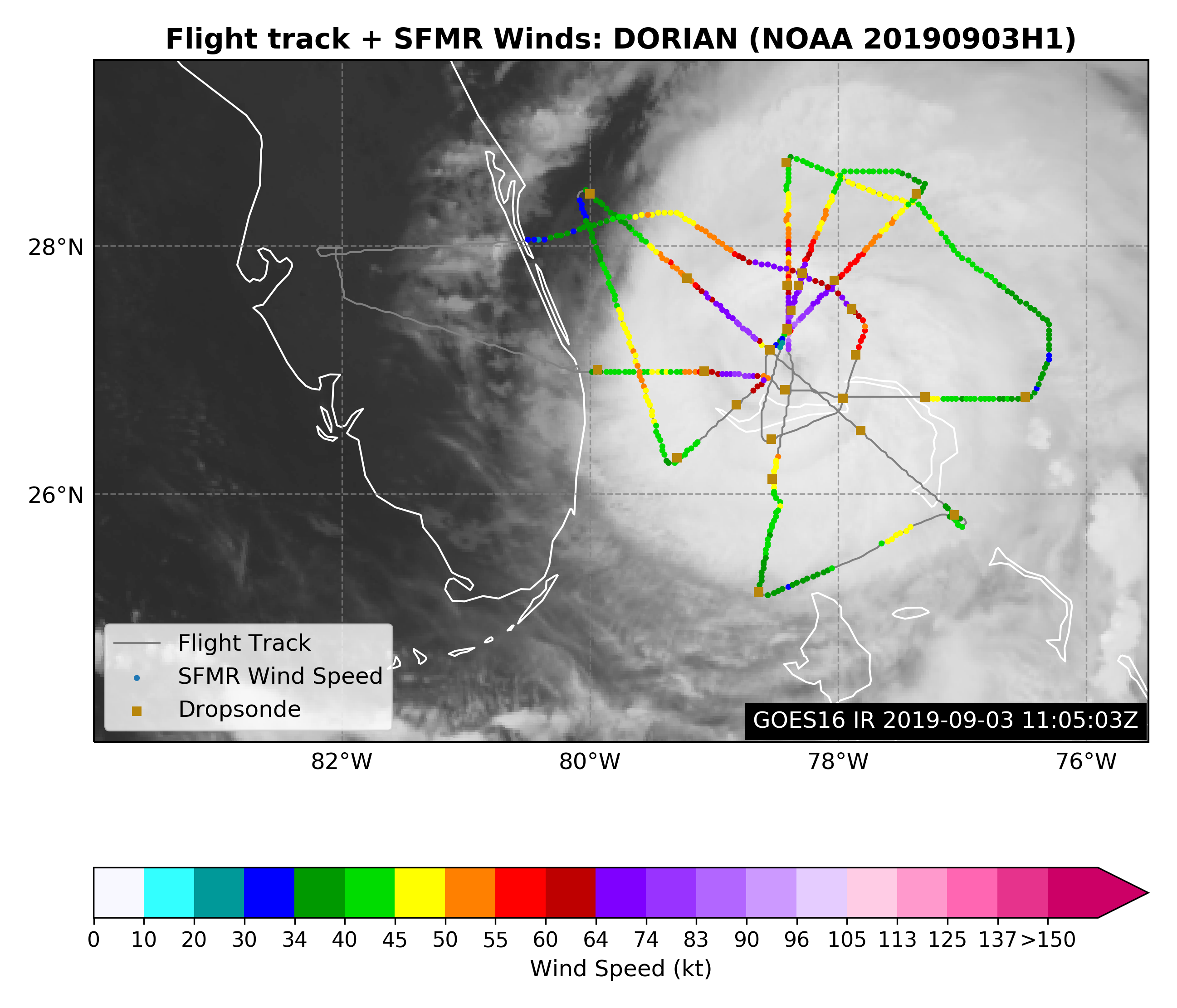
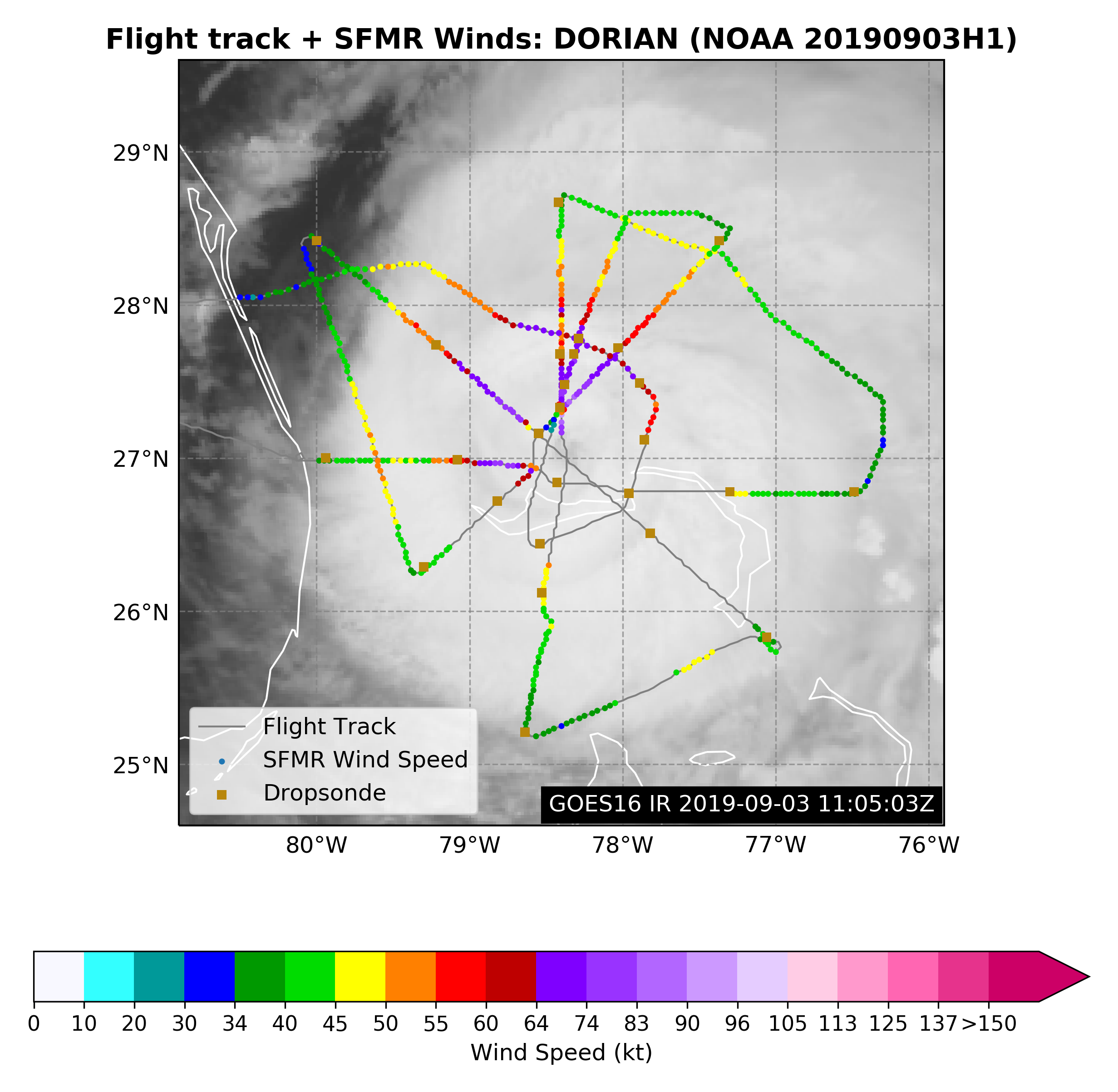
Figure 1. Flight plan for 20190903H1 mission for Dorian |
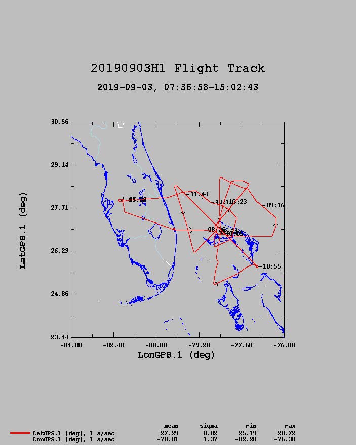
Figure 2. Actual Flight track for 20190903H1 mission for Dorian |
Mission Plan :
NOAA42 will conduct a TDR mission into Hurricane Dorian.
Mission Summary :
| Take off | Landing
| Linder_Lakeland, FL
| 07:40 UTC
| Linder_Lakeland, FL
| 14:59 UTC
| Penetrations
| 5
| Expendables
| 27 GPS sondes
| | ||||||
|
Prepared by the Hurricane Research Division Aug. 30, 2019 12:15 PM EDT Aircraft: N42RF Proposed takeoff: 03/0400Z | |||||||
| DROP LOCATION TABLE | |||||||
| # | LAT | LON | RAD/AZMON | Time | |||
| deg min | deg min | deg nm | hr:min | ||||
| 1S | 27 18 | 80 01 | 60/270 | 0:23 | |||
| 2S | 27 18 | 76 56 | 105/090 | 1:05 | |||
| 3S | 29 03 | 78 54 | 105/000 | 1:42 | |||
| 4S | 25 33 | 78 54 | 105/180 | 2:35 | |||
| 5S | 26 04 | 77 31 | 105/135 | 2:56 | |||
| 6S | 28 43 | 80 30 | 120/315 | 3:53 | |||
| 7S | 26 29 | 79 49 | 70/225 | 4:29 | |||
| 8S | 28 22 | 77 42 | 90/045 | 5:09 | |||
Mission Evaluation / Problems :
![]() Flight level wind along track |
![]() Flight level wind along track in storm |
![]() SFMR wind along flight track |
![]() SFMR wind along flight track in storm |
![]() Altitude, Pressure, Rain Rate, and Wind |
|
LPS log |
Radar log |
Drop log
Flight Director's log |
Flight Director's manifest |
AVAPS log |
NetCDF data