| Aircraft Commander | Pat Didier |
| Co-pilot | Robert Mitchell |
| Flight Engineer | Chris Lelonde |
| Flight Engineer | Ken Heystek |
| Navigator | Pete Freeman |
| Flight Director | Ian Sears |
| System Engineer | Terry Lynch |
| Data Technician | Dana Naeher |
| AVAPS | Joe Greene |
| Observer | Joe Klippel |
| Observer | Bill Olney |
| LPS | Jon Zawislak | HRD |
| Dropsonde | Brittany Dahl | HRD |
| Radar | Jason Dunion | HRD |
| Observer | Jason Sippel | HRD |
| LPS | Paul Chang | NESDIS |
| Observer | Gerard Ricciotti | unk |
| Radar | John Gamache | HRD |
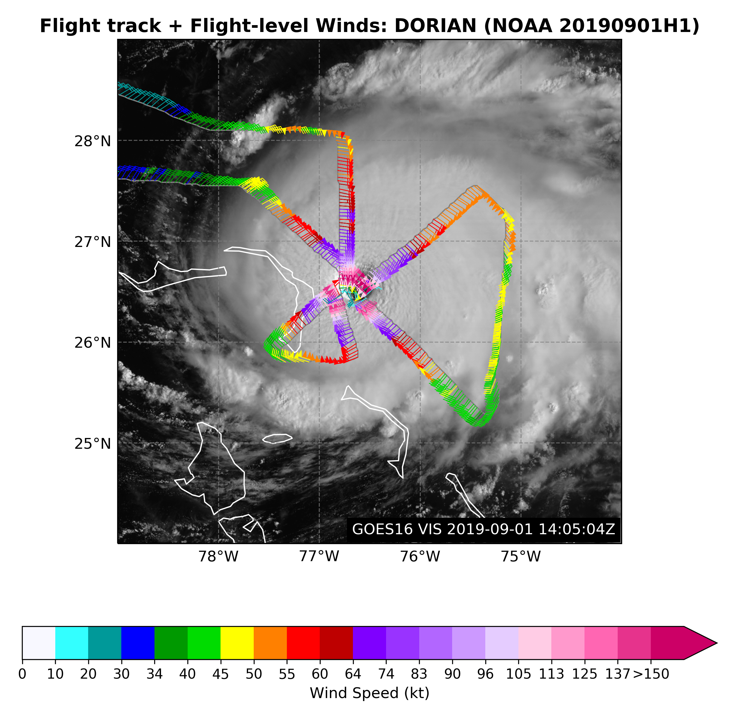
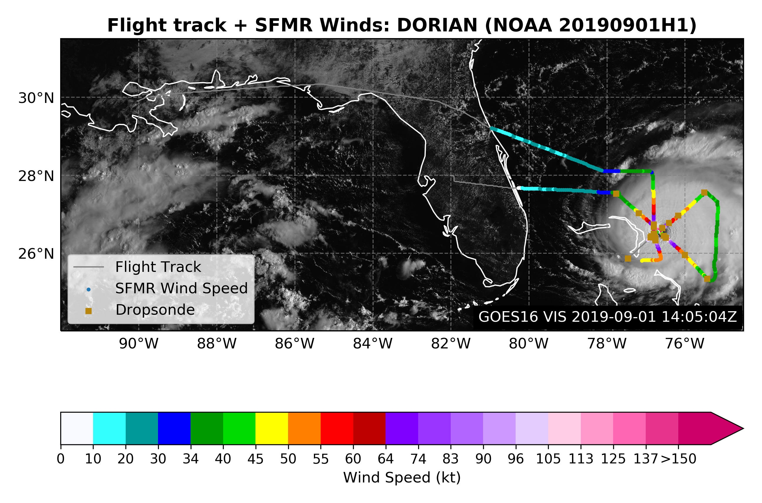
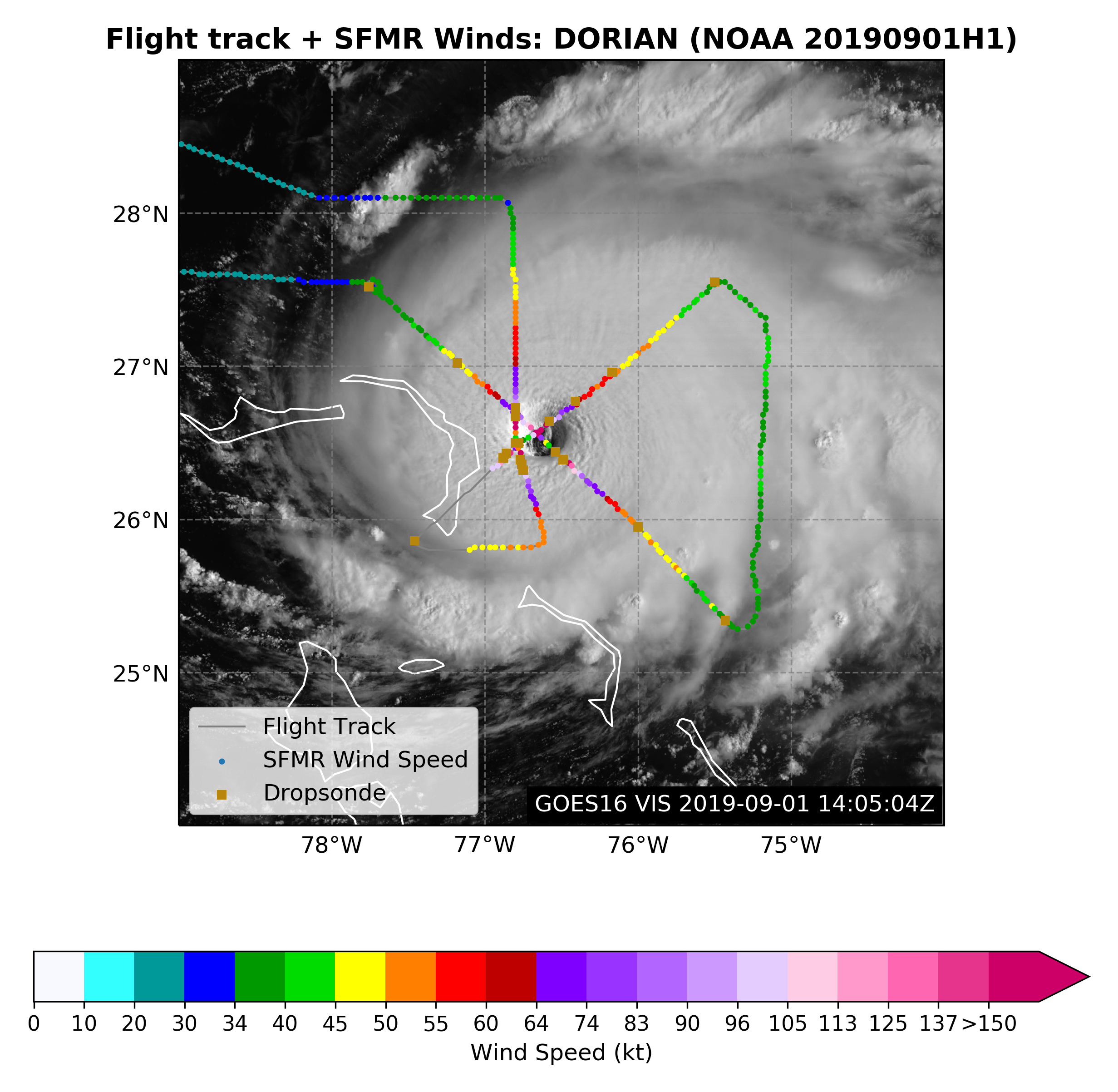
Figure 1. Flight plan for 20190901H1 mission for Dorian |
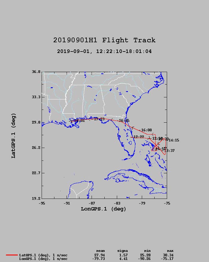
Figure 2. Actual Flight track for 20190901H1 mission for Dorian |
Mission Plan :
NOAA42 will conduct a TDR mission into Hurricane Dorian.
Mission Summary :
| Take off | Landing
| Linder_Lakeland, FL
| 12:04 UTC
| New Orleans, LA
| 18:00 UTC
| Penetrations
| 3
| Expendables
| 27 sondes, 25 good
| | ||||||
|
Prepared by the Hurricane Research Division Aug. 30, 2019 12:15 PM EDT Aircraft: N42RF Proposed takeoff: 01/0930Z | |||||||
| DROP LOCATION TABLE | |||||||
| # | LAT | LON | RAD/AZMON | Time | |||
| deg min | deg min | deg nm | hr:min | ||||
| 1S | 27 21 | 77 39 | 90/300 | 0:45 | |||
| 2S | 25 51 | 74 46 | 90/120 | 1:30 | |||
| 3S | 27 21 | 74 45 | 90/060 | 1:54 | |||
| 4S | 25 51 | 77 38 | 90/240 | 2:39 | |||
| 5S | 25 06 | 76 12 | 90/180 | 3:03 | |||
| 6S | 28 06 | 76 12 | 90/360 | 3:48 | |||
Mission Evaluation / Problems :
![]() Flight level wind along track |
![]() Flight level wind along track in storm |
![]() SFMR wind along flight track |
![]() SFMR wind along flight track in storm |
![]() Altitude, Pressure, Rain Rate, and Wind |
|
LPS log |
Radar log |
Drop log
Flight Director's manifest |
NetCDF data |