| Aircraft Commander | Pat Didier |
| Co-pilot | Kevin Doremus |
| Co-pilot | Robert Mitchell |
| Flight Engineer | Chris Lelonde |
| Flight Engineer | Ken Heystek |
| Navigator | Pete Freeman |
| Flight Director | Mike Holmes |
| Data Technician | Dana Naeher |
| AVAPS | Joe Greene |
| LPS | Gus Alaka | HRD |
| Dropsonde | Jason Sippel | HRD |
| Radar | Brittany Dahl | HRD |
| LPS | Paul Chang | NESDIS |
| Observer | Mike Gonsalves | NESDIS |
| Observer | Joe Newcomb | unk |
| Observer | Chad Meckley | unk |
| Observer | Christine Sur | unk |
| Radar | John Gamache | HRD |
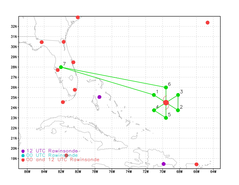
Figure 1. Flight plan for 20190830H1 mission for Dorian |
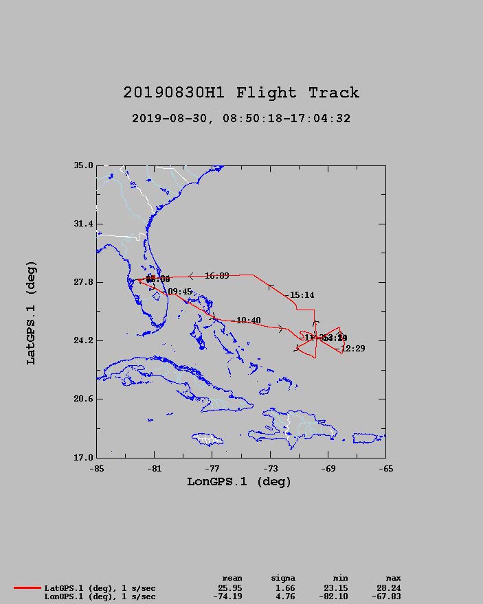
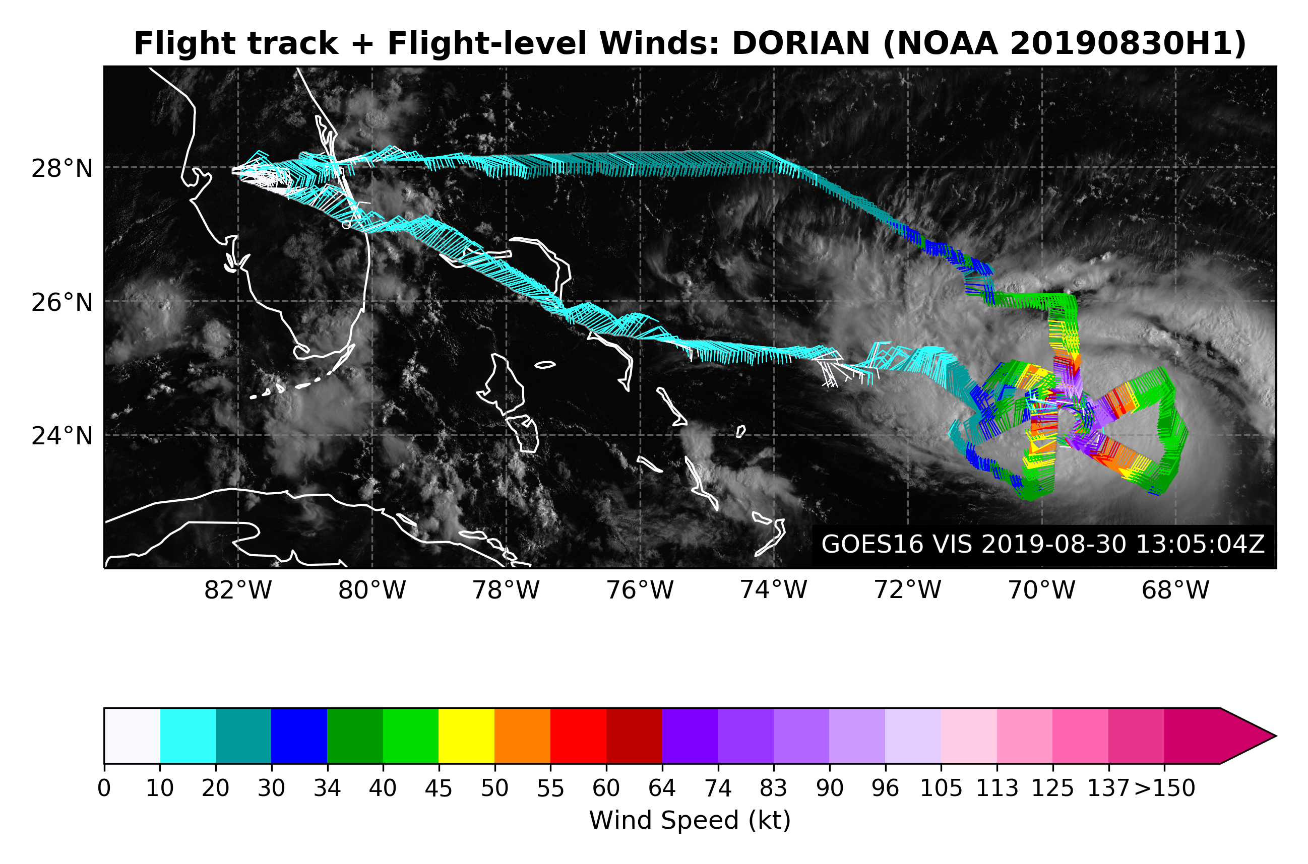
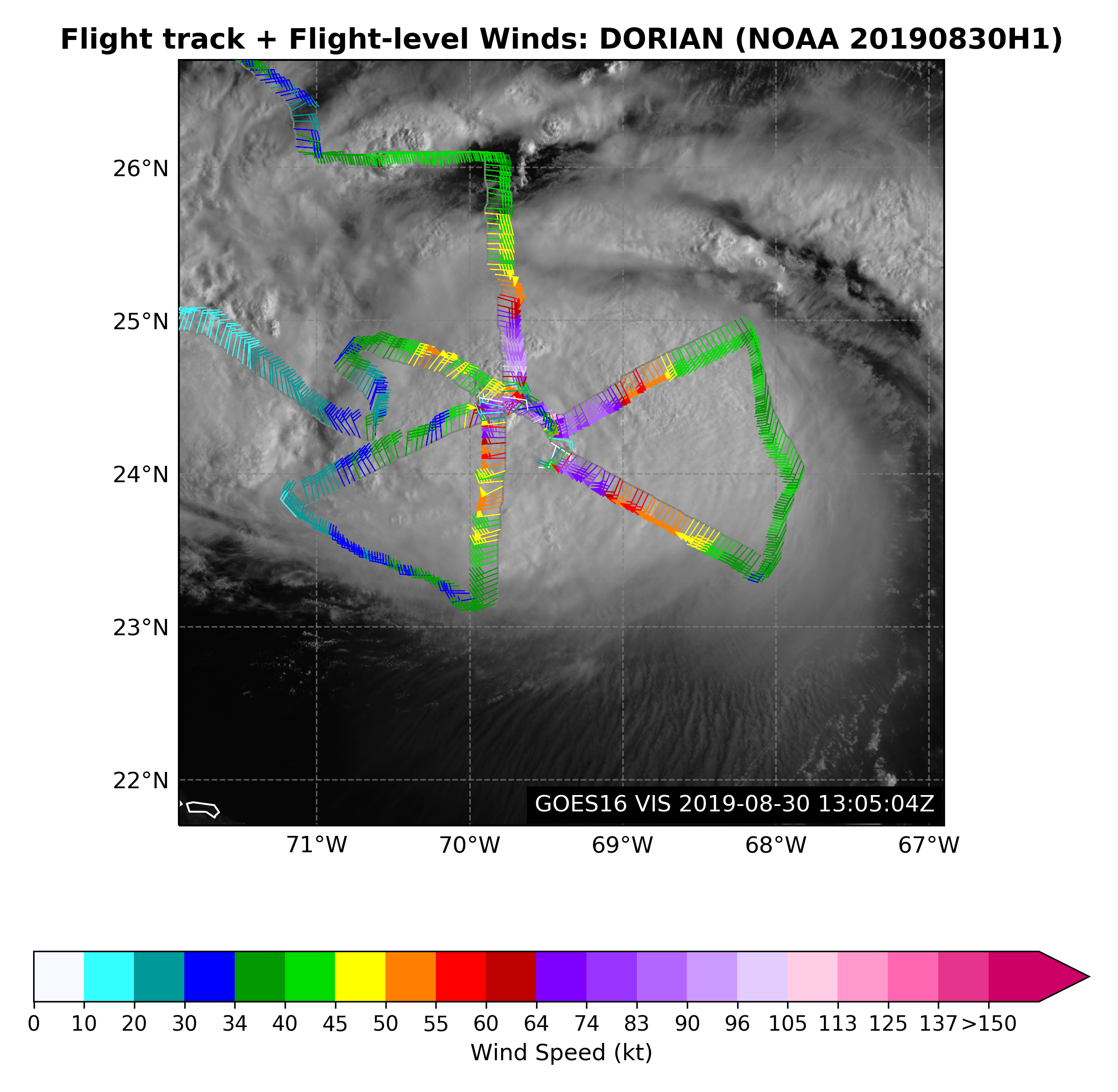
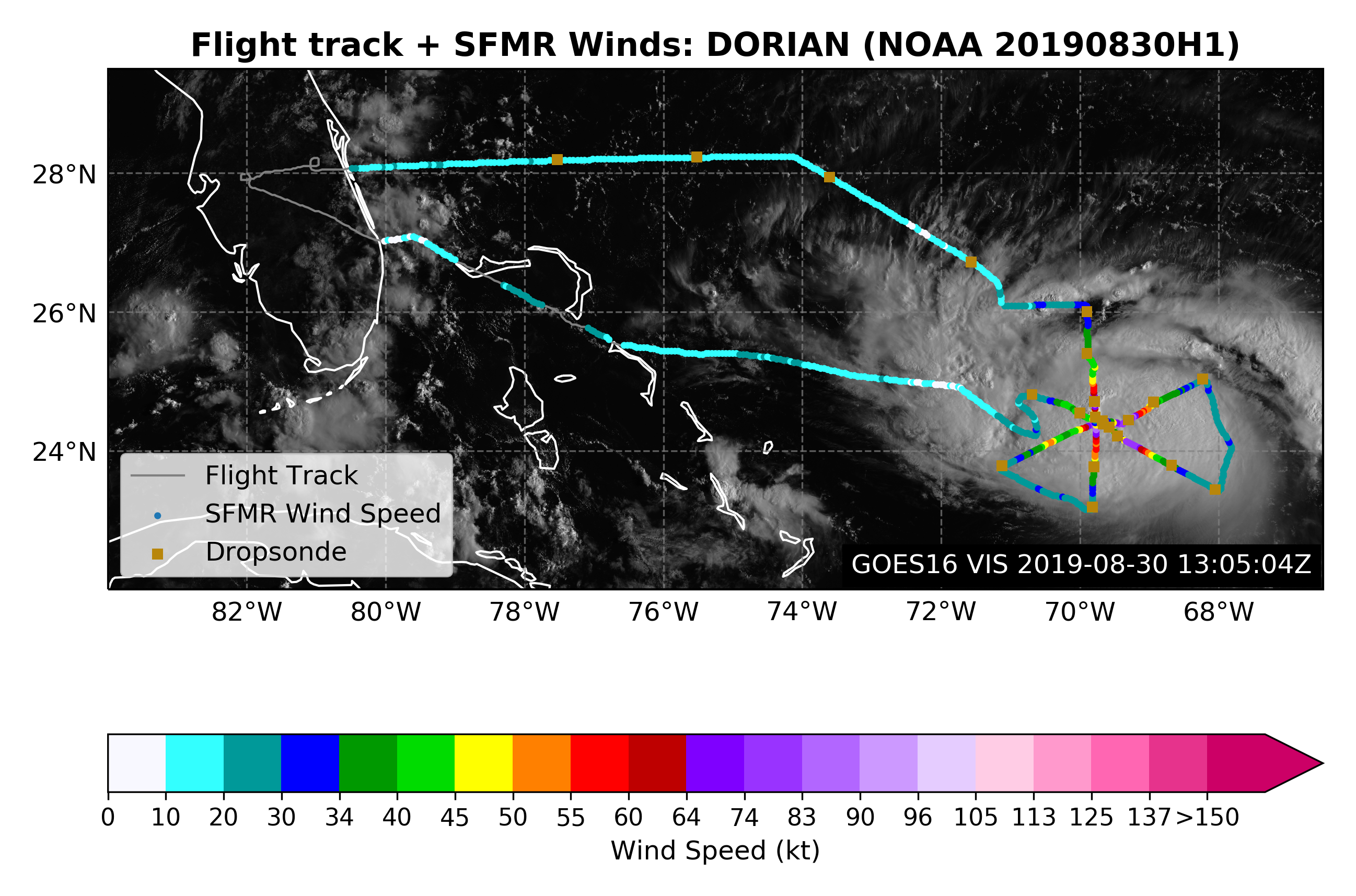
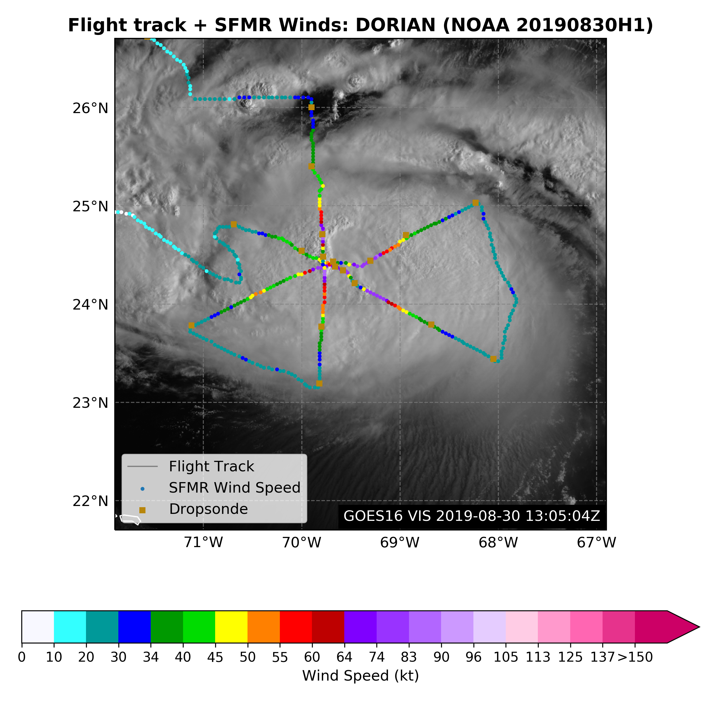
Figure 2. Actual flight track for 20190830H1 mission for Dorian |
Mission Plan :
NOAA42 will conduct a TDR mission into Hurricane Dorian.
Mission Summary :
| Take off | Landing
| Linder_Lakeland, FL
| 09:22 UTC
| Linder_Lakeland, FL
| 17:02 UTC
| Penetrations
| 3
| Expendables
| 23 sondes | 5 AXBTs | ||||||
|
Prepared by the Hurricane Research Division Aug. 30, 2019 12:15 PM EDT Aircraft: N42RF Proposed takeoff: 30/0930Z | |||||||
| DROP LOCATION TABLE | |||||||
| # | LAT | LON | RAD/AZMON | Time | |||
| deg min | deg min | deg nm | hr:min | ||||
| 1S | 25 15 | 71 02 | 90/300 | 1:53 | |||
| 2S | 23 45 | 68 11 | 90/120 | 2:39 | |||
| 3S | 25 15 | 68 10 | 90/060 | 3:03 | |||
| 4S | 23 45 | 71 01 | 90/240 | 3:48 | |||
| 5S | 23 00 | 69 36 | 90/180 | 4:11 | |||
| 6S | 26 00 | 69 36 | 90/360 | 4:57 | |||
Mission Evaluation / Problems :
![]() Flight level wind along track |
![]() Flight level wind along track in storm |
![]() SFMR wind along flight track |
![]() SFMR wind along flight track in storm |
![]() Altitude, Pressure, Rain Rate, and Wind |
|
LPS log | Radar log | Drop log