| Mike Black | LPS |
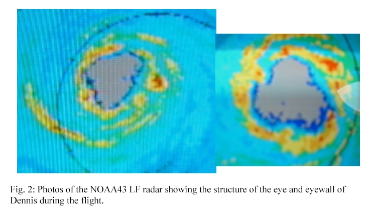
| Peter Dodge | Radar |
| Paul Willis | Cloud Physics |
| Eric Uhlhorn | AXBT |
| Krystal Valde | Radar |
| Ed Zipser | Observer |
| LCDR Rany TeBeest LCDR Mark Nelson | Pilots |
| Marty Mayeaux Tom Shepherd | Flight Directors |
| LT Devin Brakob | Navigator |
| Dewie Floyd | Flight Engineer |
| Jim Barr | Electrical Engineer |
| Terry Lynch | Data Tech |
Mission Summary :
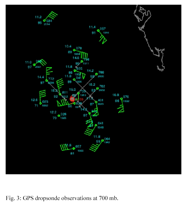

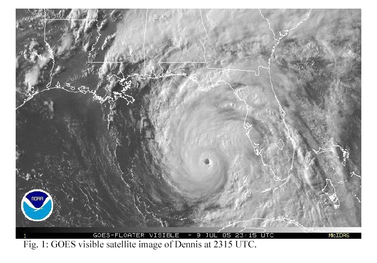
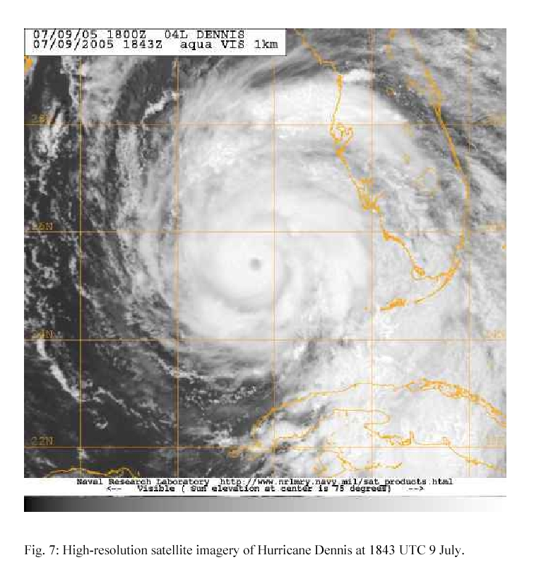
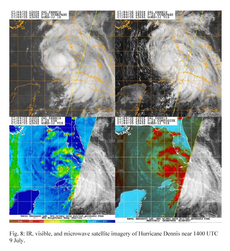
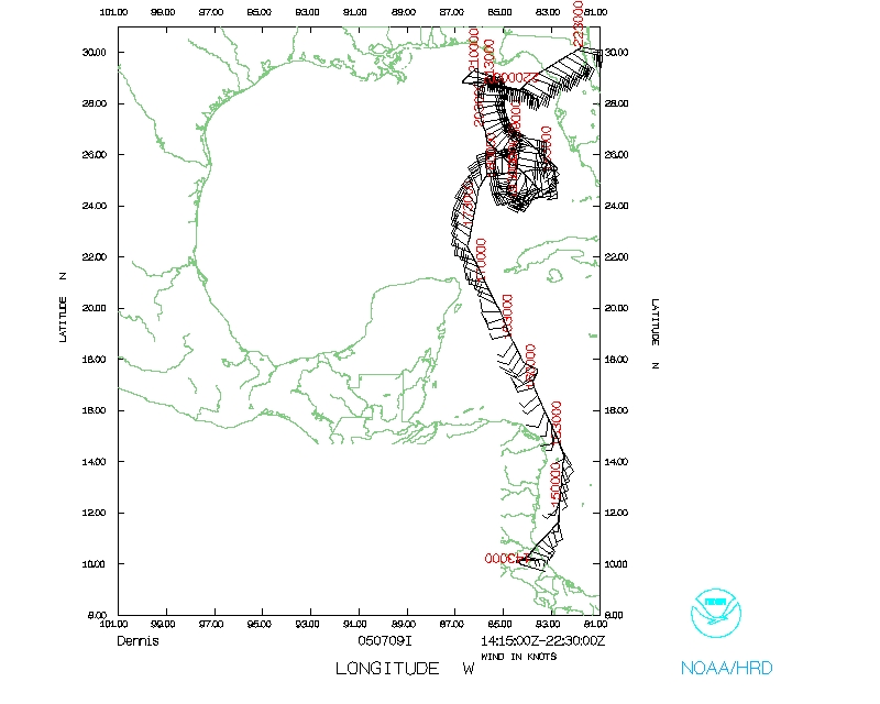
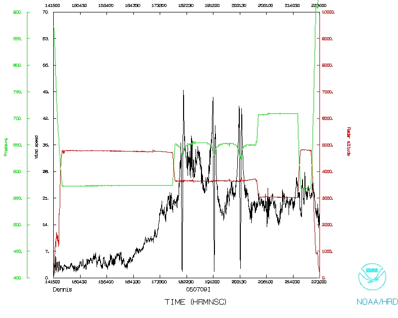
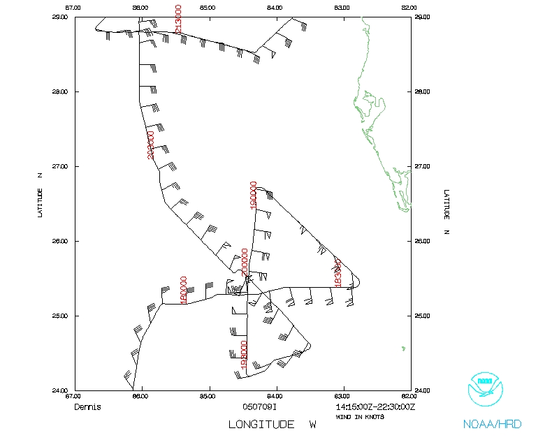
The NOAA P3 headed NW downwind to a point 75 nmi north of the eye at 1857 UTC where the aircraft proceeded south through the eye. The eye was reached at 1914 UTC and 43 reached its southern point 75 miles away at 1930 UTC. The winds appeared to be strongest on the northern side of Dennis with flight-level winds at about 100 kt and SFMR winds of about 90 kt. A GPS sonde reported winds of about 120 kt below flight level but well above the surface. The winds were generally about 20 kt weaker on the south side.
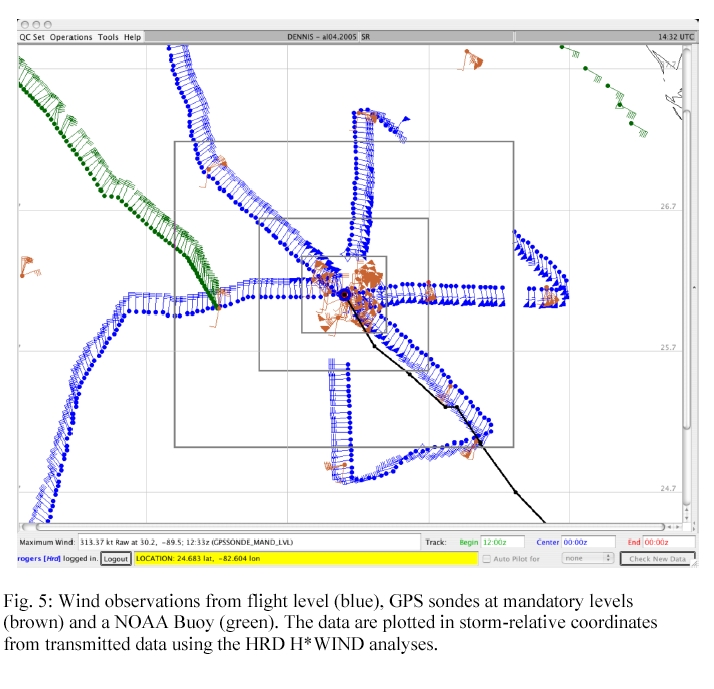
The final leg through Dennis was from the SE to the NW. We reached our SE point, 75 nmi from the eye at 1943, the eye at 2002 an were 75 nmi NW of the center at 2021 UTC. Winds on the SE side were a maximum of about 90 kts

at flight level and 75 kt at the sfc while winds at flight level and the surface in the NW quadrant were 85 and 70 kt, respectively. The GPS sonde released in the eye had a failed launch detect but the P3 measured 950 mb extrapolated from 12,000 ft, which equates to about 955 mb considering extrapolation errors. An AXBT released in the NW quadrant measured 28°C SST but with a shallow, 20 m mixed-layer depth. The final part of the mission was to perform the short figure 4 centered around buoy 42039, releasing AXBTs at the end points and at the buoy. A GPS sonde was
also released at the buoy location. We descended to 10,000 ft and depressurized before reaching a point 30 nmi south of the buoy at 2042 UTC. The AXBTs measured uniform SST of about 28°C within 60 nmi of the buoy and relatively shallow mixed-layer depths of 20-30 m. Flight-level winds were about 40 kt and surface winds were between 250 and 30 kt near the buoy.
At 2148 UTC NOAA climbed out of the pattern and headed for Jacksonville NAS and we landed at the base at about 2230 UTC.
Problems :
Three of the 25 sondes did not have launch detects (no data) and several more had intermittent winds. Otherwise, the radars, main data system, and AXBTS worked well. NOAA43 did not have an opportunity to coordinate any of the pattern with the NASA ER2.
Michael Black
7/8/05
Mission Data :
Flight Data | ||
 Flight track |
 Temperature and Moisture |
 Wind and Atlitude |
 Flight track detail |
||
| Start | End |
| 14:38:20 Z | 22:01:46 Z |