Mission Summary
20090827I1 Aircraft 43RF
TDR monitoring flight into Tropical Storm Danny 2009
Aircraft Crew (43RF)
| Aircraft Commander | Barry Choy |
| Co-pilots | Carl Newman
Al Girimonte |
| Flight Engineers | Dewey Floyd
Paul Darby |
| Navigators | Chris Sloan
Ryan Kidder |
| Flight Director | Ian Sears
Barry Damiano |
| Data Technician | Bobby Peek |
| Dropsonde Operator | Jeff Smith |
| Electrical Engineer | Bill Olney |
Scientific Crew (43RF)
| Lead Project Scientist | Paul Leighton |
| Dropsonde Scientist | Jun Zhang |
| iWRAP Scientist | Joe Sapp (UMASS) |
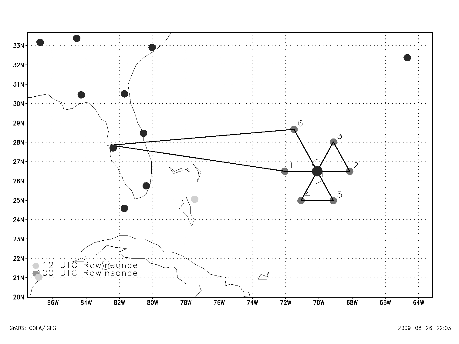
20090827I1 proposed track
|
Mission Plan :
Perform TDR/lifecycle monitoring into T. S. Danny (See proposed track above),
butterfly pattern at 12000 ft. with IP approx. 120 nm west of low level
circulation. Fly standard 105 nm legs (See Turns table below) with possibly
extended legs to the north and northeast to oversample convection in this
area and possibly shorten legs to the south where dry tongue and shear are
inhibiting convection. Roughly same as previous flight with dropsondes at
endpoints and midpoints of legs and a center drop, also 7 BT's on way to
storm 6 at endpoints and 7 returning from storm.
Planned turns
Danny
Prepared by the Hurricane Research Division
Aircraft: N43RF
Altitude: FL120
Proposed takeoff: 27/08:00 Z
|
TURN
#
| LAT
(deg) (min)
| LON
(deg) (min)
| RAD/AZM
(nm/deg)
| LEG
(nm)
| TOTAL
(nm)
| TIME
(h:mm)
|
| 0 | MACDILL | | 0. | 0. | 0:00
|
| 1S | 26 30 | 72 03 | 105/270 | 565. | 565. | 2:04
|
| 2S | 26 30 | 68 09 | 105/090 | 210. | 775. | 2:55
|
| 3S | 28 01 | 69 08 | 105/030 | 105. | 881. | 3:21
|
| 4S | 24 59 | 71 04 | 105/210 | 210. | 1090. | 4:12
|
| 5S | 24 59 | 69 08 | 105/150 | 106. | 1196. | 4:38
|
| 6S | 28 40 | 71 29 | 150/330 | 255. | 1451. | 5:40
|
| 7 | MACDILL | | 586. | 2037. | 7:39
|
Mission Summary :
| Take off
| Landing
| MacDill AFB, FL | 07:54 UTC
| MacDill AFB, FL | 15:10 UTC
| |
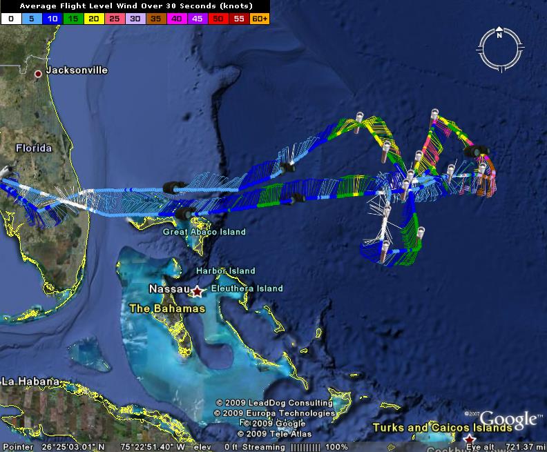
Takeoff was at 075450 UTC. A modified version of the butterfly pattern was
flown to try to account for the asymmetric precipitation and changing
structure of Danny (See actual track). Satellite imagery showed the LLCC
displaced to the SW of the convection. We overflew the estimated LLCC on the
inbound leg searched briefly for the mid or flight-level circulation,
returning to the LLCC before continuing west to continue the pattern. Legs
were extended on the east and northeast side of the pattern both to avoid
turning in heavy convection and to sample the more convective cells to the NE
of the centers with the doppler radar. On the inbound NE/SW leg we jogged
right (West) from the estimated mid-level to the estimated LLCC. There were
limited scatterers in the pattern on the southwest and southeast quadrants
from a dry tongue extending into the center so the westbound downwind leg was
shortened. We dropped sondes at the endpoints and midpoints with a total of
14 with 2 not being sent. Also, the first four were sent with an incorrect
date, these were not re-transmitted per the flight director's request. We
dropped 19 AXBTs at 1° longitude spacings on the ferries to and from
the storm avoiding land masses. Sea-surface temperatures were about 28°C.
The aircraft returned to Tampa at 151000 UTC.
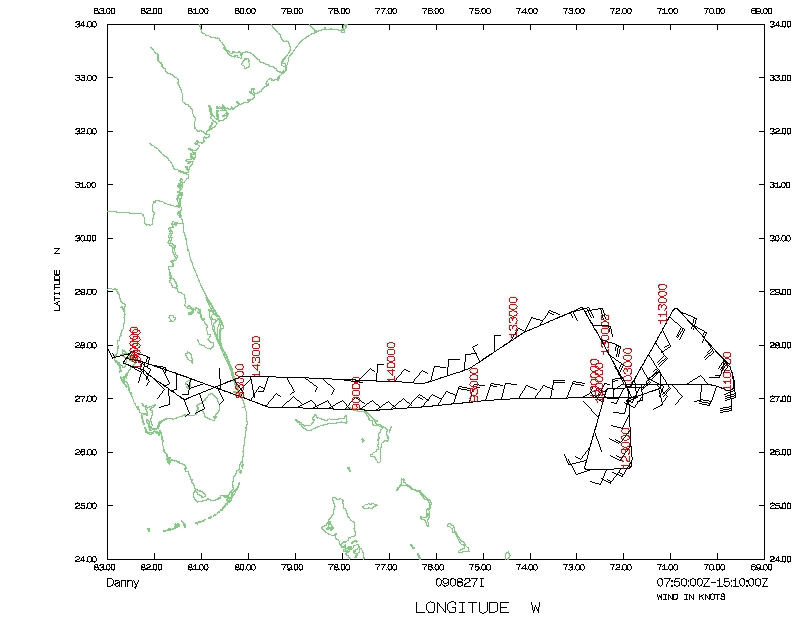
20090827I1 actual track
|
Mission Evaluation:
Three doppler wind analysis legs were completed and sent in real-time. They
show an asymmetric storm pattern with limited reflectors to the south of
centers(LLCC west/SW of MLCC).
Paul Leighton
10/19/2009
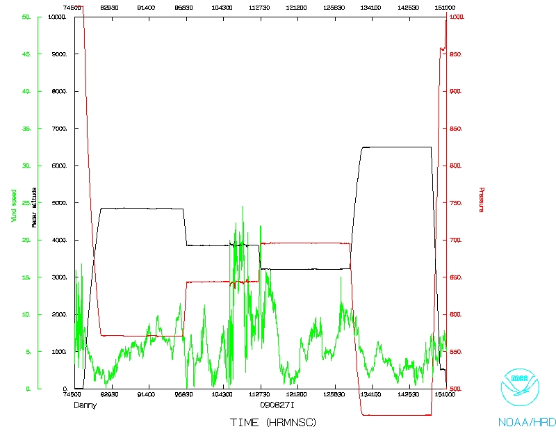
Mission Data :
Error log |
g'zipped Fast data |
NetCDF|
1 second
LPS log |
Radar log |
Sonde log |
AXBT log |
Miscellaneous
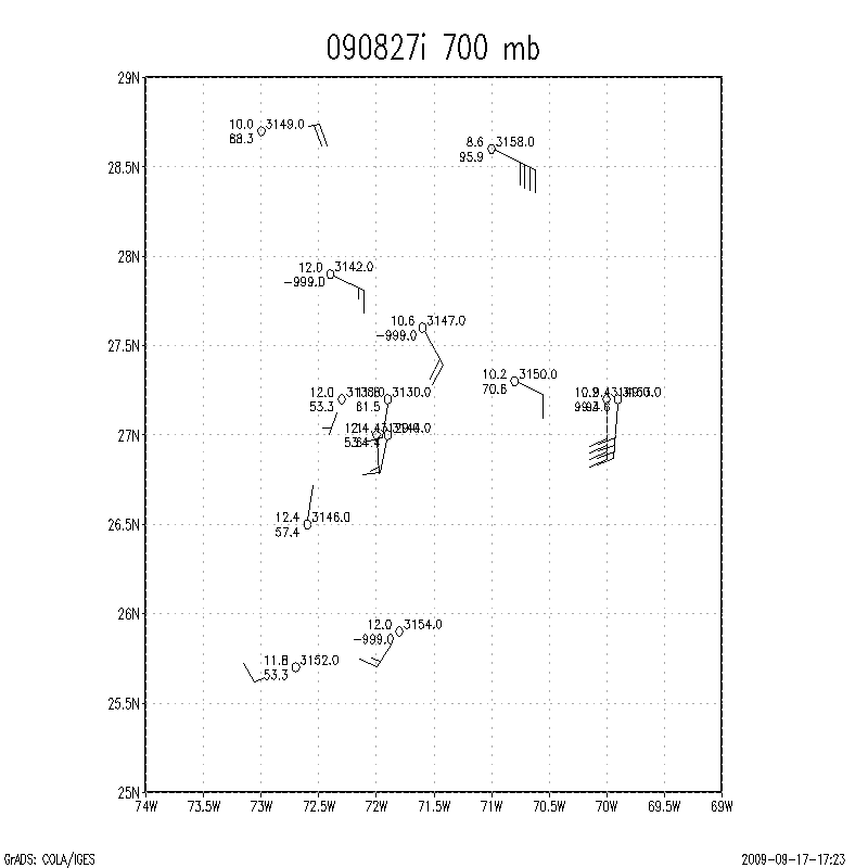
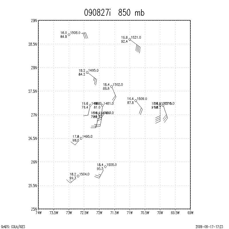
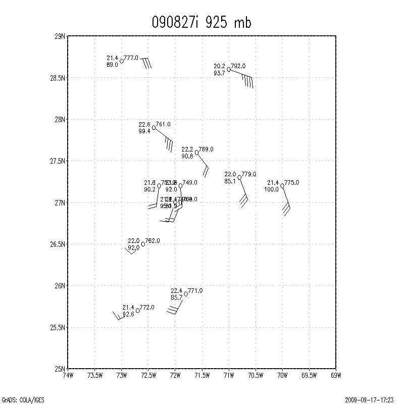
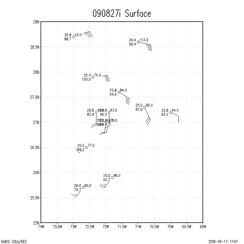
Pressure height maps of dropsonde data
700mb map
850mb map
925mb map
1000mb map
surface map
Page last updated Oct. 19, 2009
Return to Mission page.
