Mission Summary
20090820I1 Aircraft 43RF
TDR flight into Hurricane Bill 2009
Aircraft Crew (43RF)
| Aircraft Commander | Carl Newman |
| Co-pilot | Al Girimonte |
| Co-pilot | Amelia Ebhardt |
| Flight Engineer | Dewie Floyd |
| Flight Engineer | Paul Darby |
| Navigator | Joe Bishop |
| Navigator | Chris Sloan |
| Flight Director | Barry Damiano |
| Flight Director | Ian Sears |
| Data Tech | Terry Lynch |
| Electrical Engineer | Jeff Smith |
| El Tech | Bobby Peek
Damon San Souci |
Scientific Crew (43RF)
| Lead Project Scientist | Rob Rogers |
| Dropsonde Scientist | Kathryn Sellwood |
| Radar Scientist | Shirley Murillo |
| IWRAP Scientist | Joe Sapp (UMass) |
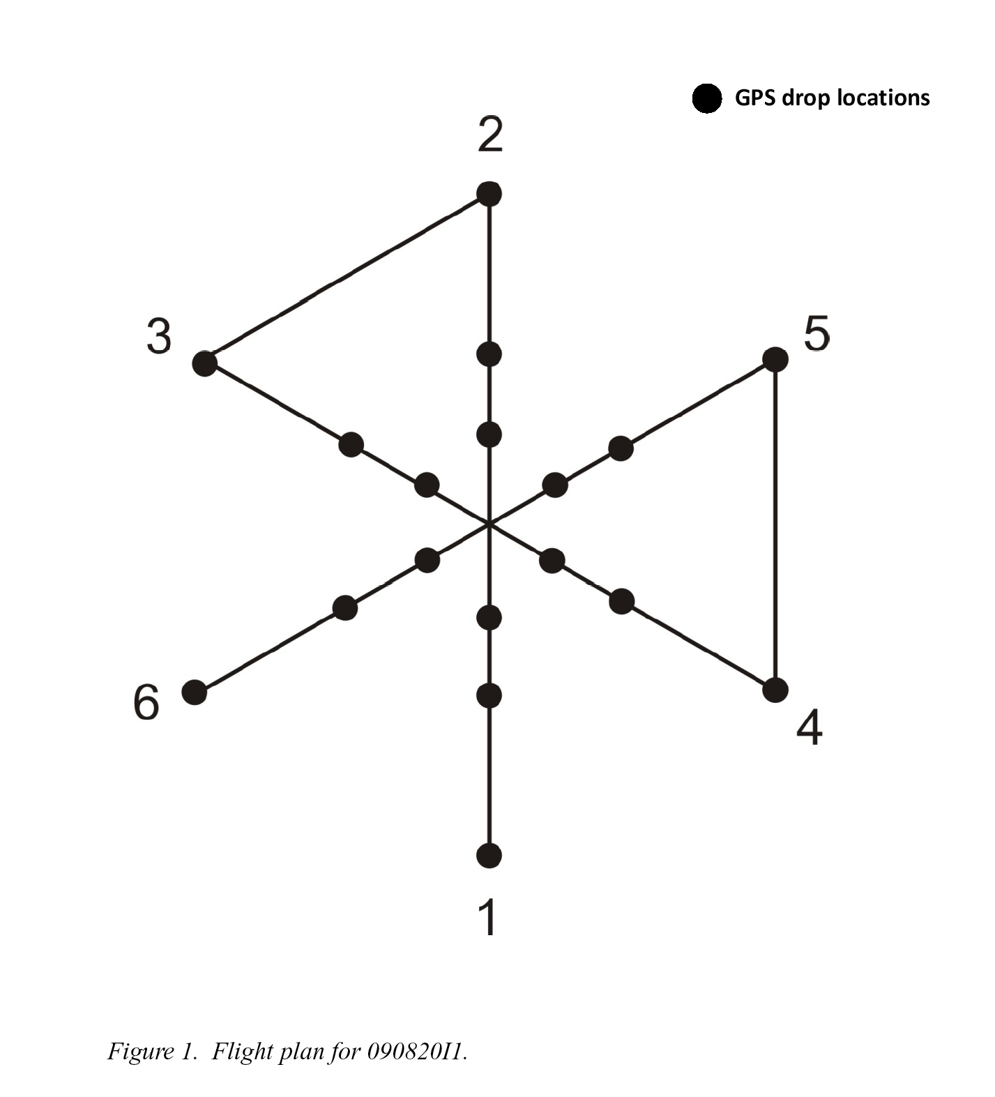
Mission Plan :
Fly TDR mission into Hurricane Bill, which remains a Category 4 according to
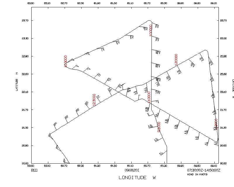
NHC, despite showing significant azimuthal asymmetries. Fly butterfly pattern,
120 nm leg lengths, IP on S side, end up on SW side (Fig. 1). Drop sondes at
end points, midpoints, and at RMW for each leg, plus first and last center
passes. Possible arc cloud dropson NW leg if it shows up on visible imagery.
Fly pattern at 12,000 ft.
Mission Summary :
| Take off
| Landing
| Barbados | 07:41 UTC
| Barbados | 14:47 UTC
| |
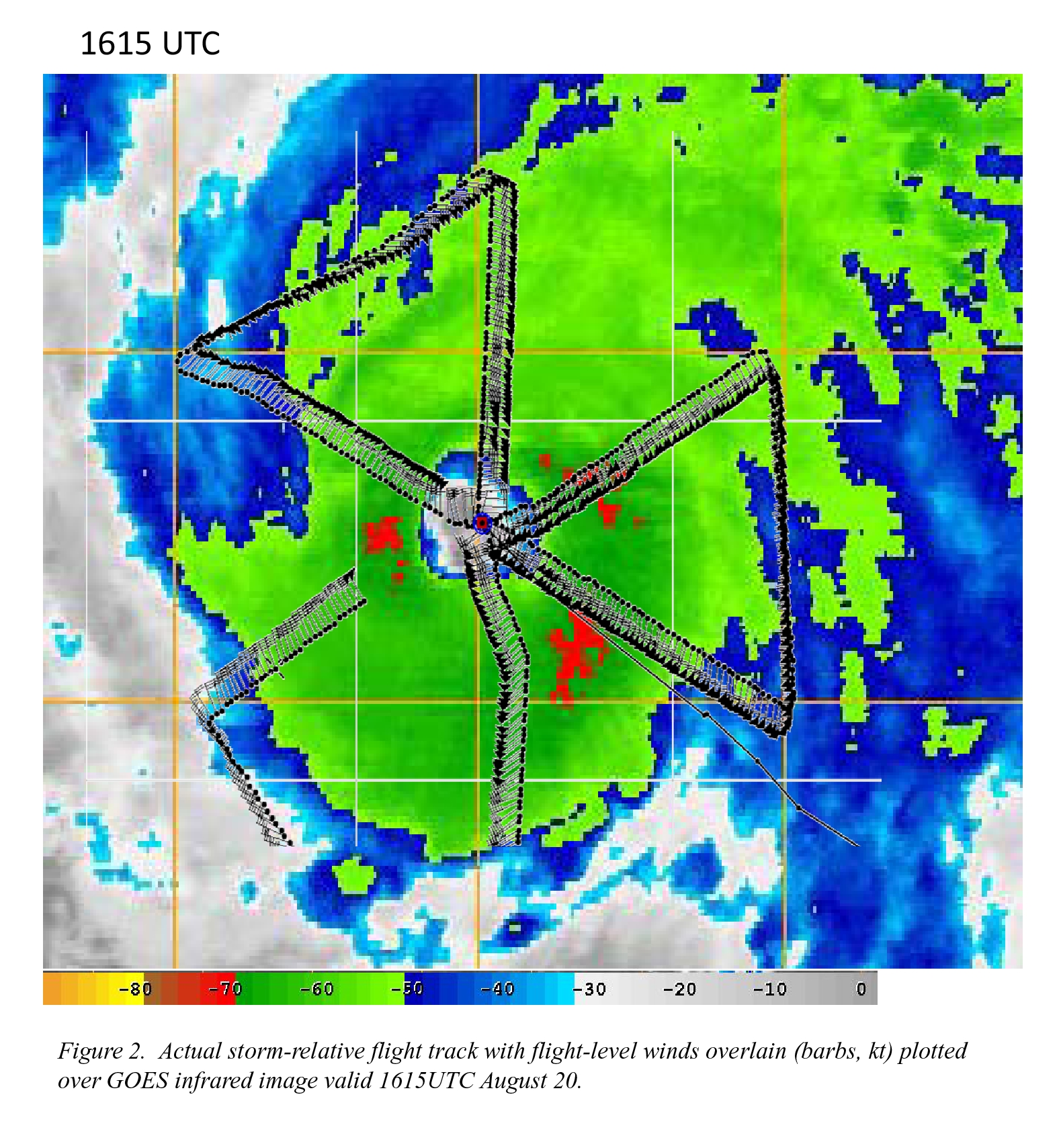
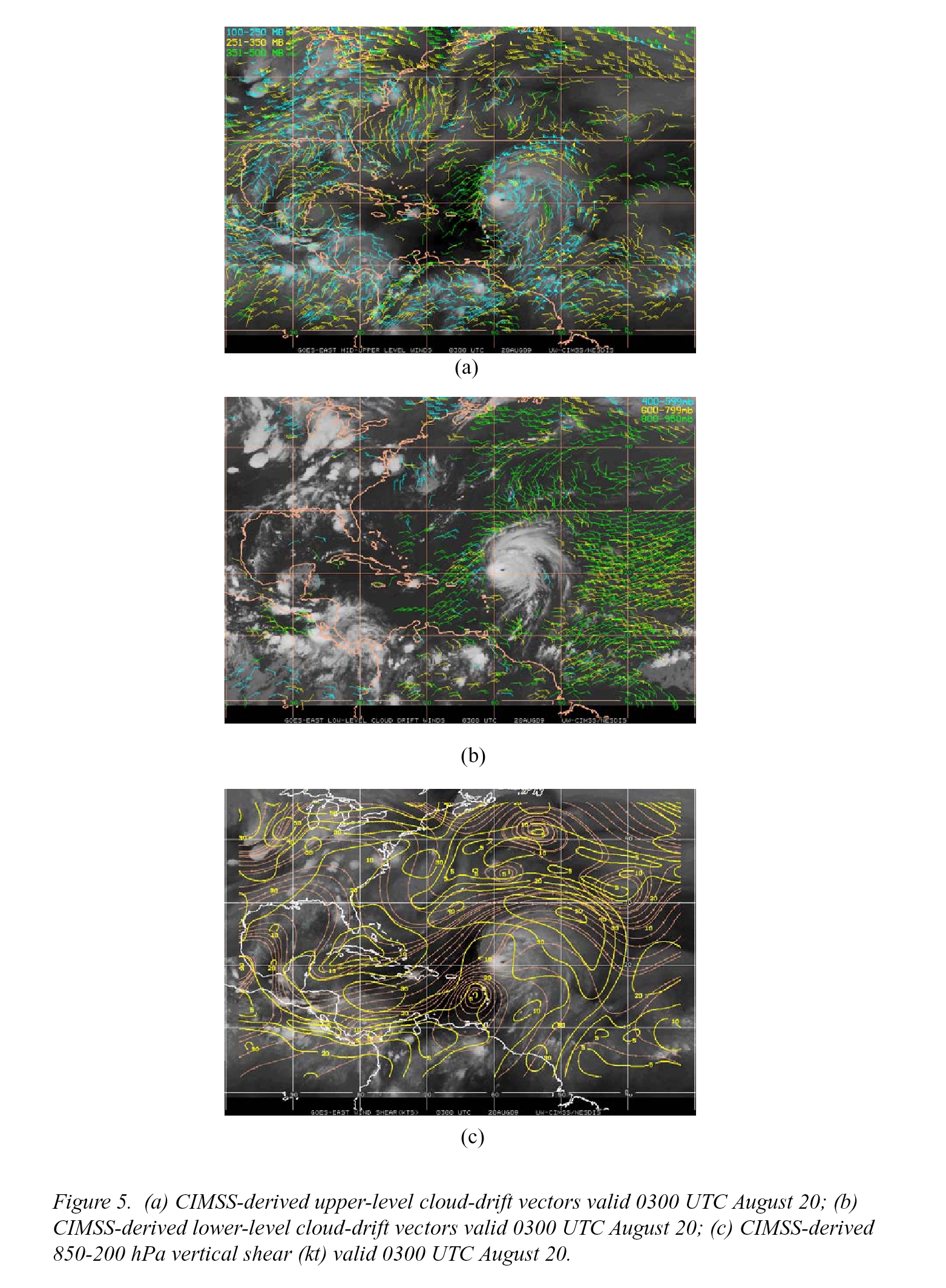
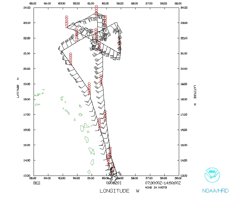
Takeoff was at 0741 UTC. Flew pattern as planned (Fig. 2). Storm continues
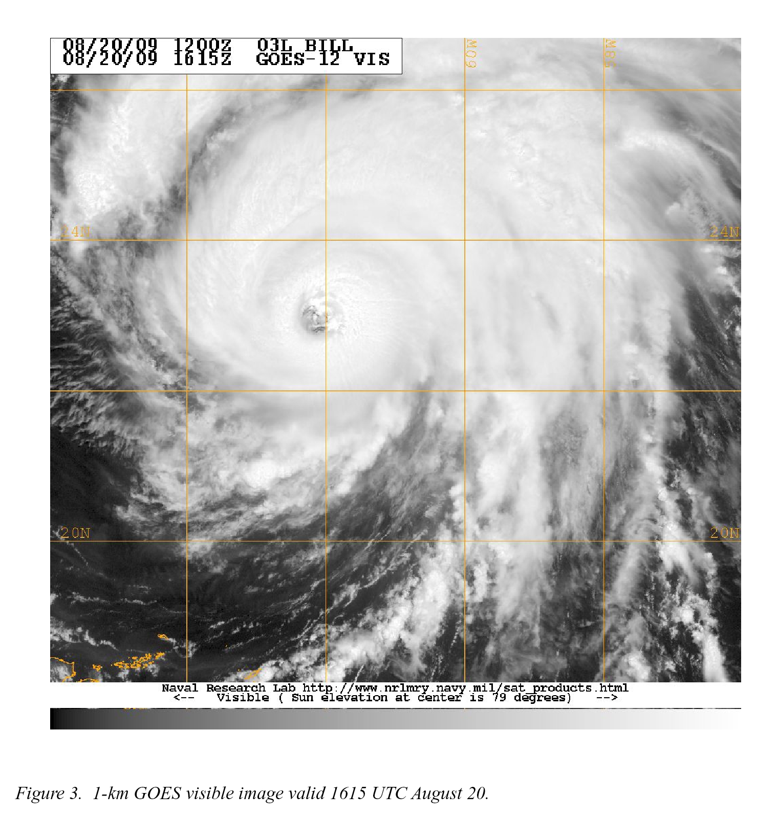
to appear well-organized on visible satellite imagery (Fig. 3) despite warmer
cloud tops on infrared (cf. Fig. 2) and limited cloud cover on the west and
southwest sides evident on the visible.
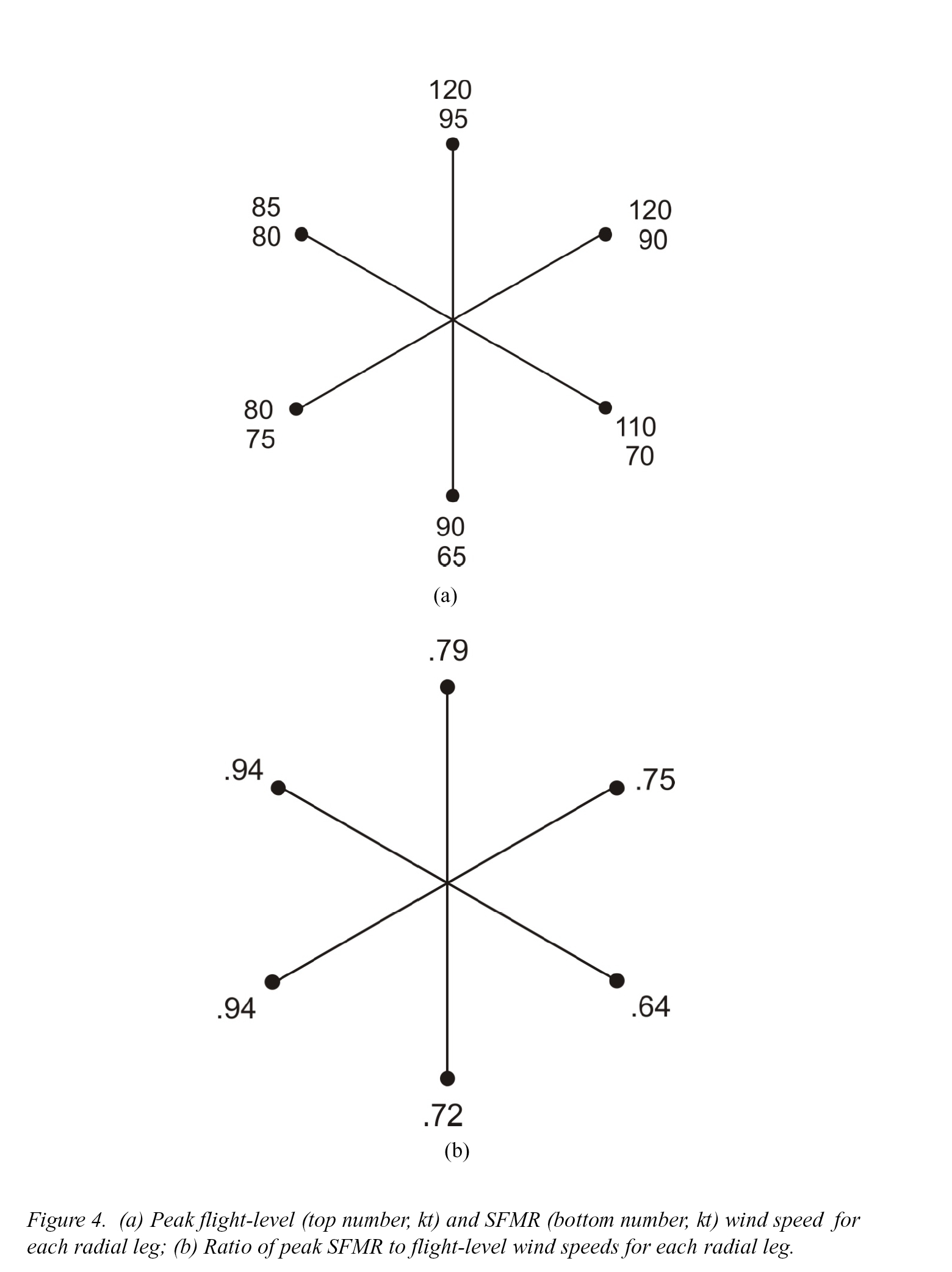
No SFMR winds of 100+ kt were observed. There were very few scatterers on
W and SW sides, just thin cirrus anvil.
The NE and N eyewall was still active, and a rainband was seen on E side that
had turbulence. Storm again was highly asymmetric -- winds were strongest on
NE side and the azimuthal variation of SFMR/FL reduction was highly asymmetric
-- winds were strongest on NE side and the azimuthal variation of SFMR/FL
reduction (Fig. 4) suggests WSW shear between surface and flight level (Fig. 5)
. Peak SFMR winds of 95 kt seen on N side, peak FL winds of 120 kt seen on N
and NE side. Minimum SFMR winds of 65 kt seen on S side, minimum FL winds of
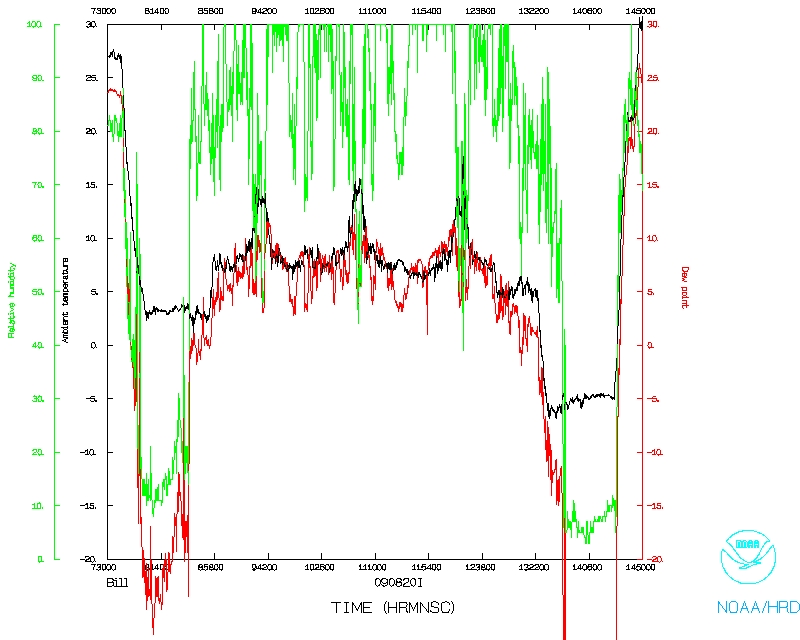
80 kt seen on SW side. Minimum sonde pressure of 950.8 hPa. Sonde humidities
show an interesting pattern of dry air in the lowest 100 mb on N side of storm,
perhaps indicating subsidence associated with the band on the north side. That
data, combined with G-IV data, should provide interesting study of low-level
thermodynamic structure in outer bands and possibly the inner core. The
aircraft returned at 1447 UTC.
Mission Evaluation:
There were radar problems the entire flight. The radar was down for the
entire inbound part of the first leg, and then it was down for the whole third
leg. Doppler analyses were marginal at best. FL and SFMR data plus drop data
provided some interesting data for future research, but Doppler problems
seriously degraded the success of this mission.
Problems :
There were major problems with the tail Doppler. One dropsonde had no launch
detect. Fifteen GPS dropsondes were released.
Rob Rogers
Mission Data :
LPS log |
Radar log |
Drop log
NetCDF file |
1 second data
Page last updated October 06, 2009
Return to Mission page.